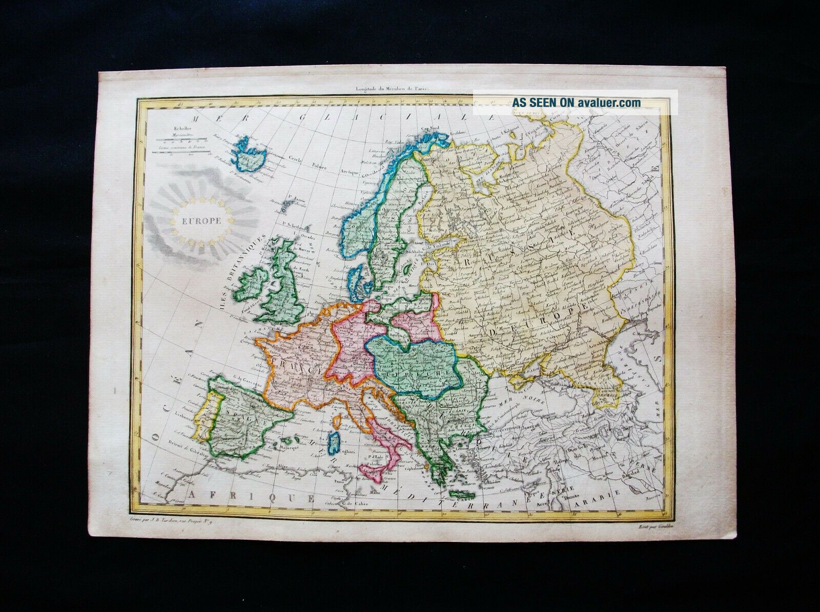
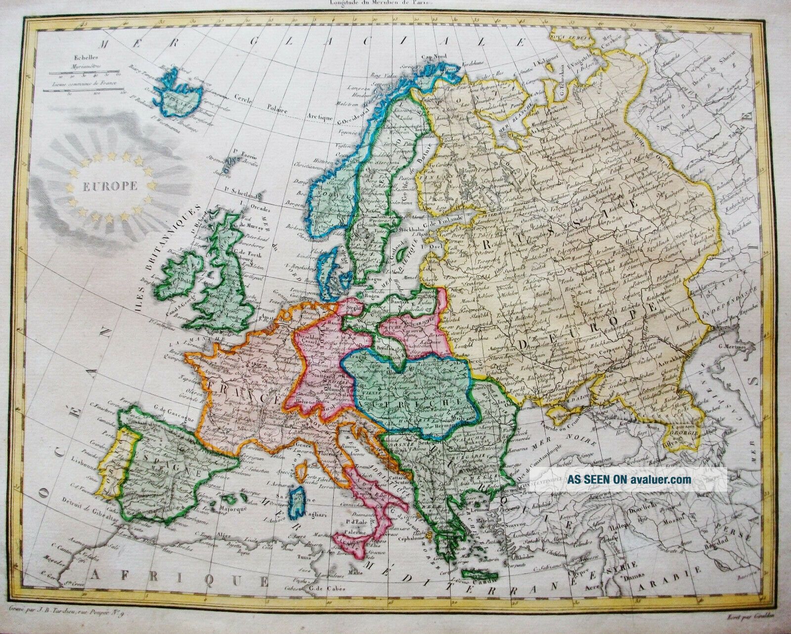
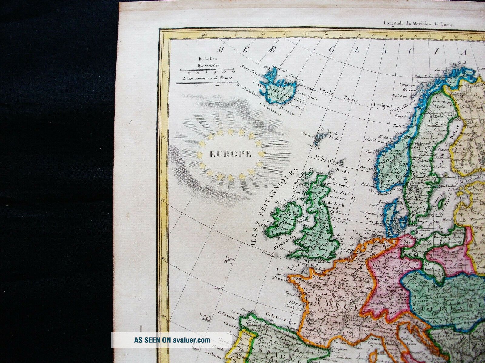
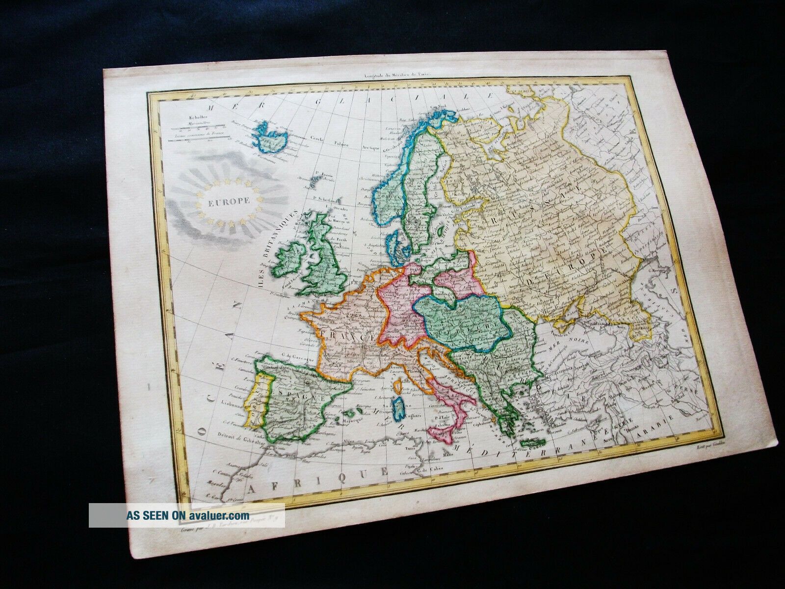
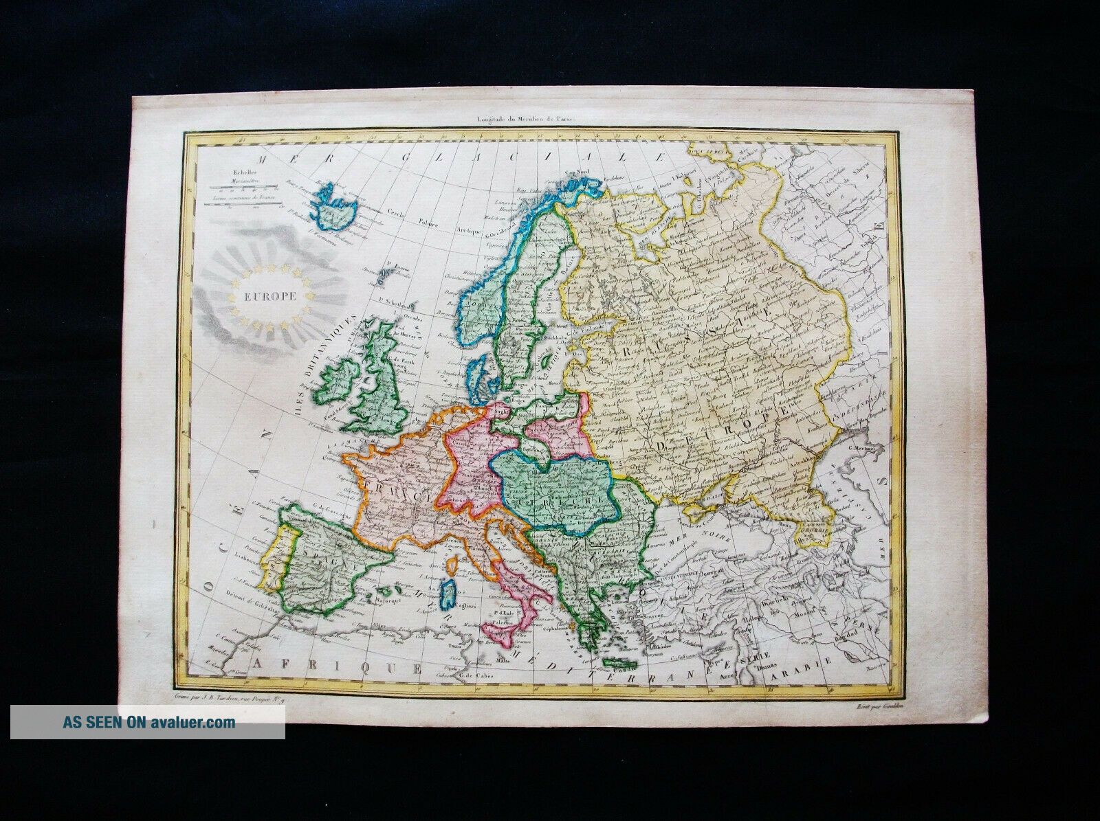
1810 LAPIE - Rare Map Of EUROPE MODERNE, EUROPEAN EMPIRE, MEDITERRANEAN, ITALY.
Item History & Price

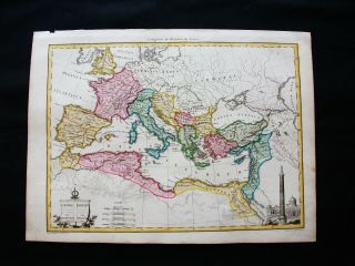
1810 Lapie - Rare Map Of Europe, Mediterranean Sea, Italy, Roman Empire, Turkey
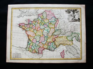
1810 Lapie - Rare Map Of France & North Italy, Liguria, Turin, Milan Corse
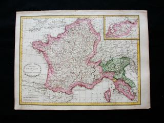
1810 Lapie - Rare Map Of France & North Italy, Genoa, Aosta, Tuscany Venice
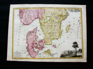
1810 Lapie - Rare Map Of Scandinavia, Denmark, Sweden, Norway, Copenhagen, Skagen
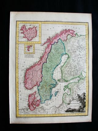
1810 Lapie - Rare Map Of Scandinavia, Norway, Oslo, Sweden, Denmark, Iceland.
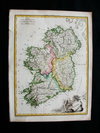
1810 Lapie - Rare Map Of British Isles, Ireland, Dublin, Uk, Cork, Belfast Derry
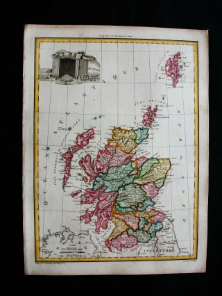
1810 Lapie - Rare Map Of British Isles, Scotland, Uk, Glasgow, Edinburgh, Perth
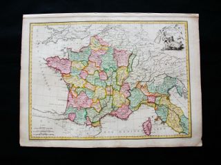
1810 Lapie - Rare Map Of France & North Italy, Cote D ' Or, Turin, Piedmont, Milan

Hungary & Romania 1579 (1584) Ortelius Unusual Antique Copper Engraved Map

Brussels Bruxelles Belfium 1777 De Ferraris & Dupuis Large Antique Map Sheet Xxi

1616 Atlas Map Of Iceland.

Kazan Russia 1767 Le Clerc/lespinasse Antique Copper Engraved City View

1899 Stanford, Folding Map Of Norwich, Norfolk, Arthur Collins, Jarrold & Sons,

1948 Vintage Linen Colour Map Geological Survey Ten Mile Of Great Britain

1944 Map Flying Bombs Sussex Ww2 Newspaper Military Kent Courier German V1 V2

Dated 1638 Vellum Map Of Icklesham Sussex Showing Land Uses Owners Etc