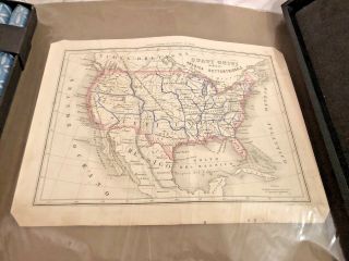
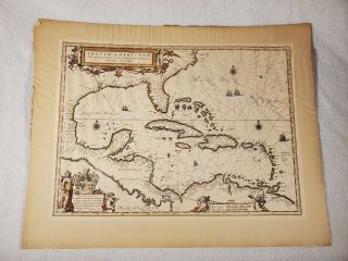
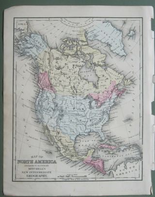
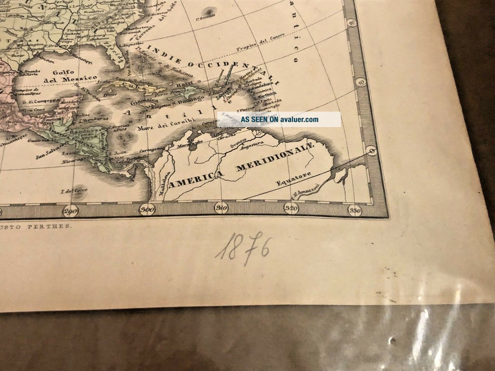
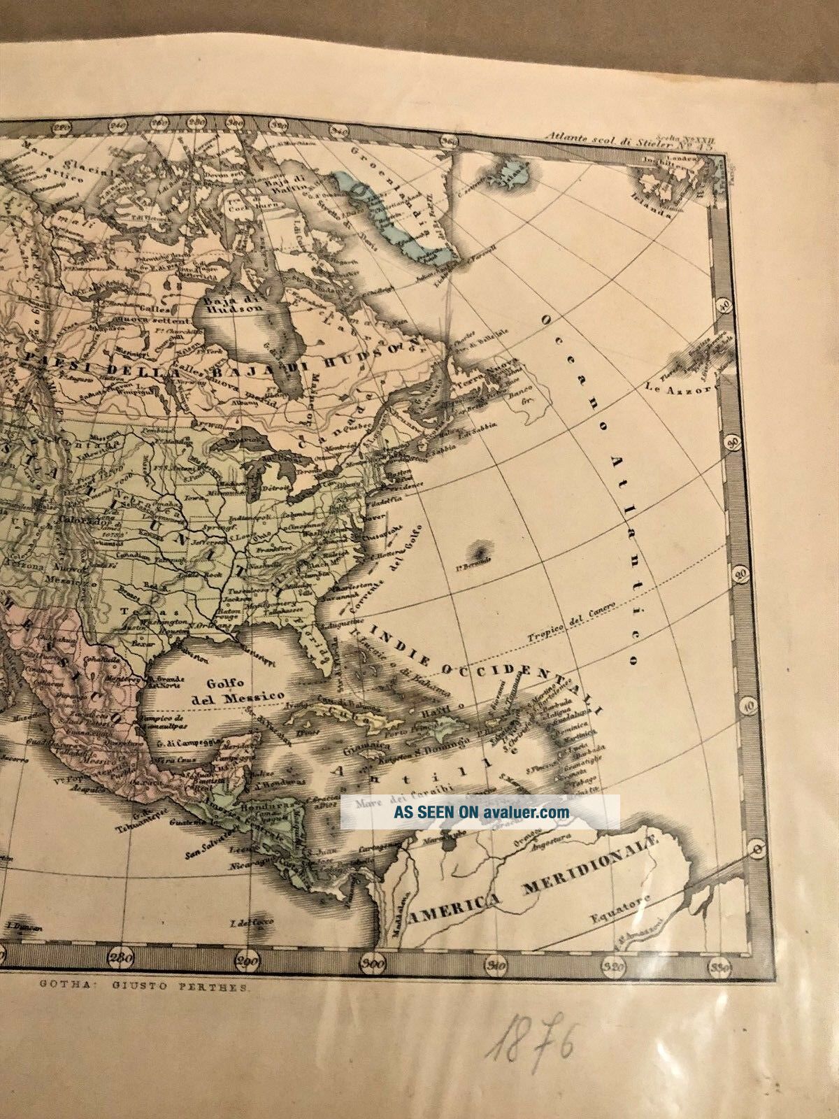
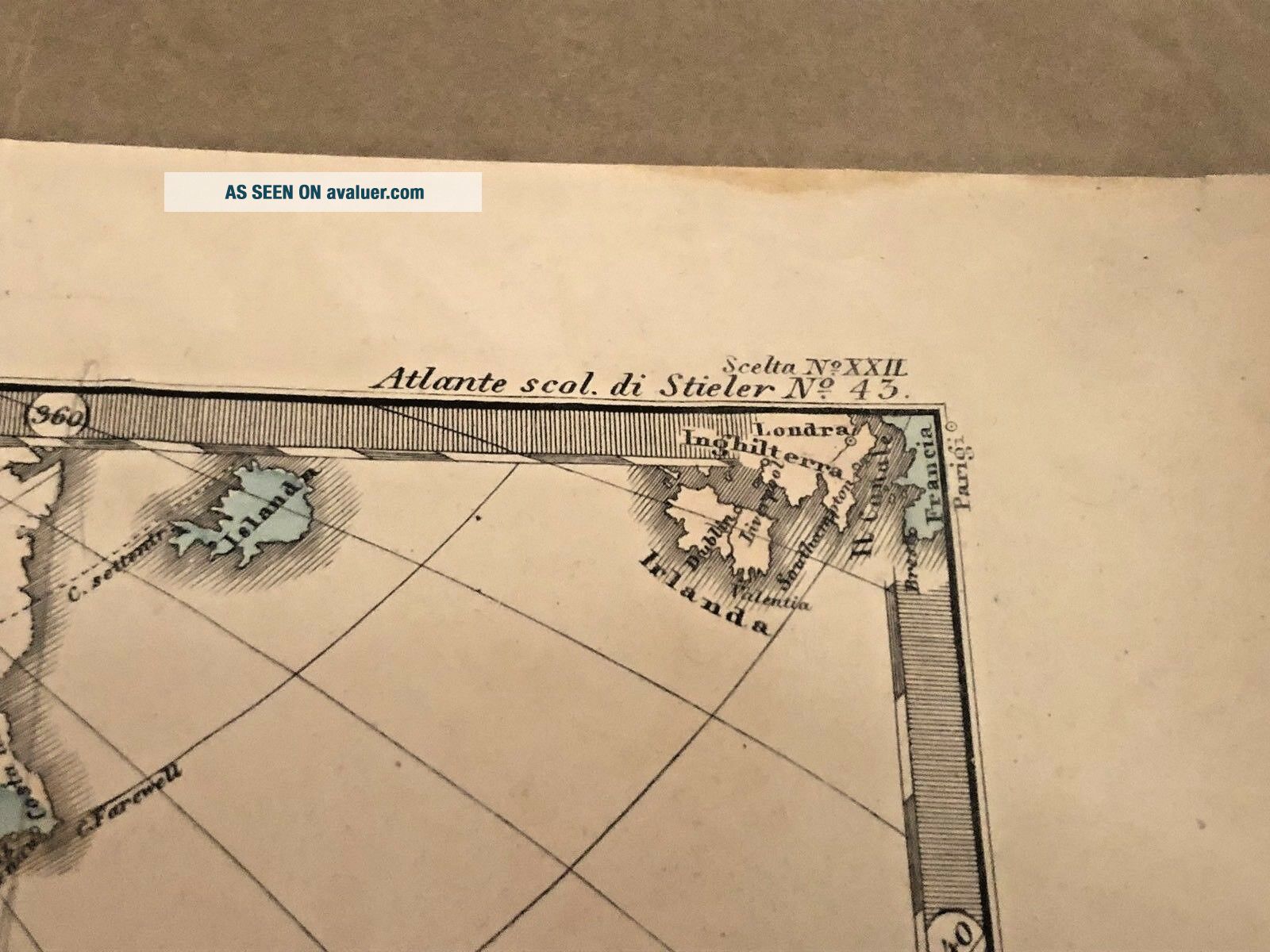
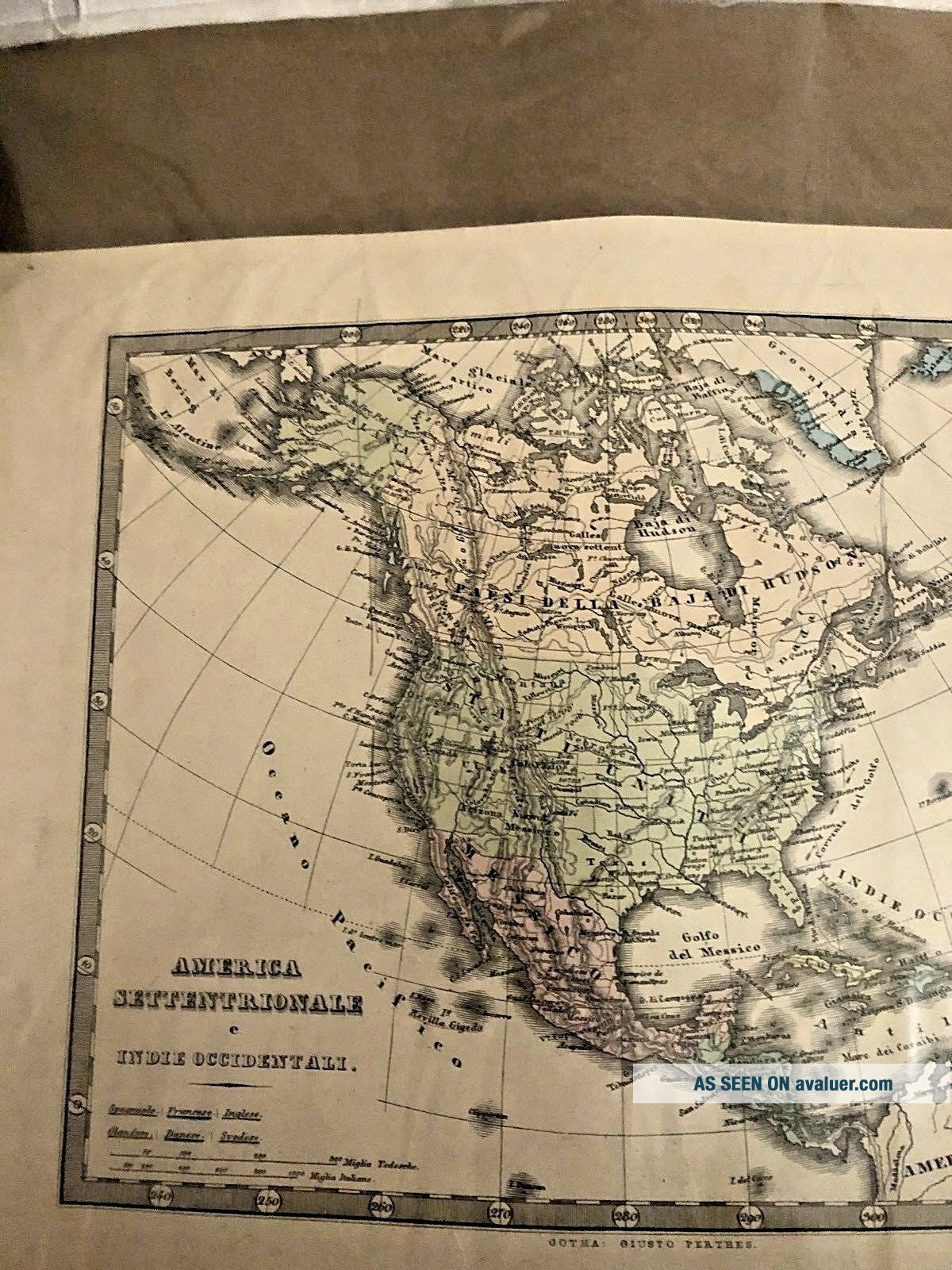
Antique 1876 Italian Map America Settentrionale E Indie Occidentali Rare Find


Item History & Price

Information:
Reference Number: Avaluer:1240429Year: 1876
Original/Reproduction: Antique OriginalSubgenre: Indie
Language: ItalianCartographer/Publisher: Parigi
Date Range: 1800-1899Topic: Antiques
Country/Region: North AmericaPublication Year: 1876
Features: Antique
Original Description:
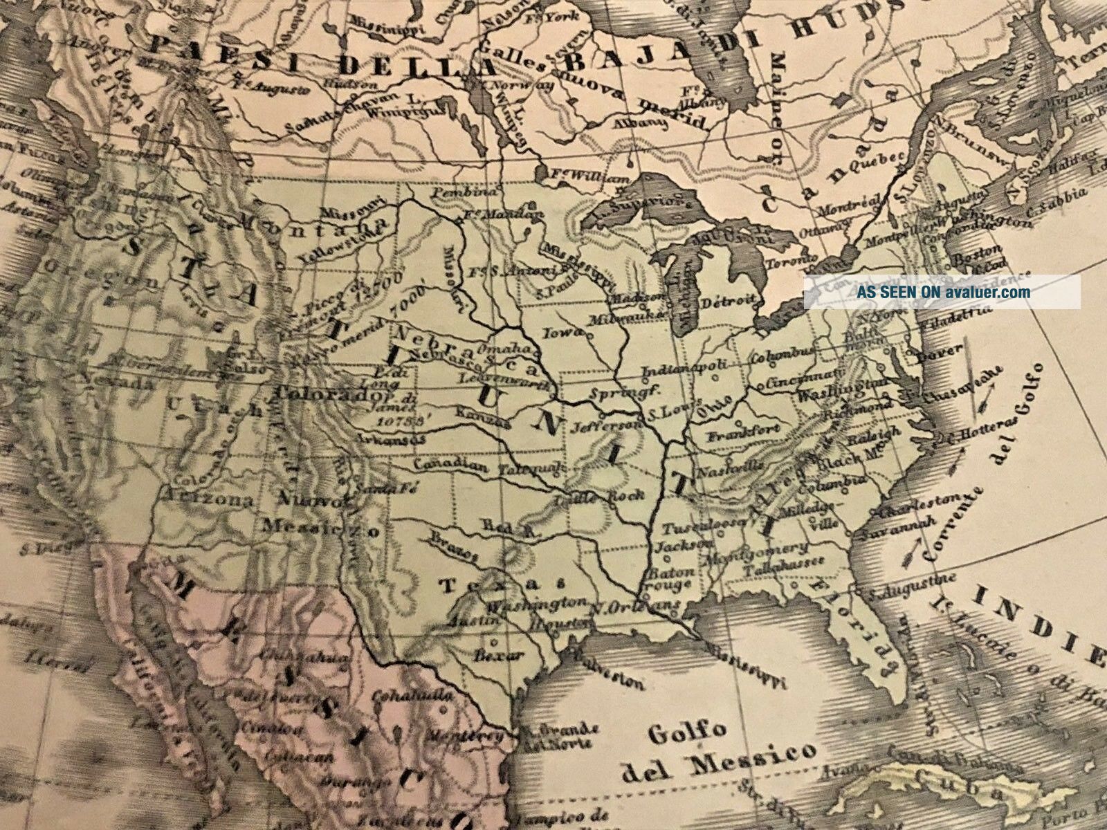
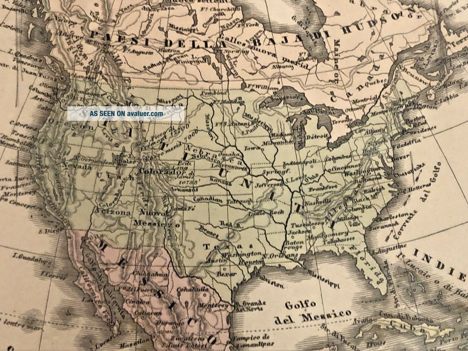
Estate find, antique map in Italian, marked 1876 in pencil at bottom - measures 12" x about 9-1/2" - Good antique condition with some slight yellowing - has been stored on large paper with loose plastic over and rolled loosely - looks like top of map has been glued to back paper - didn't take out to photograph.  Reads "America Settentrionale e Indie Occidentali - Atlante Scali di Steiler No. 43, Scelta No. XXIL - Parigi - Gotha Giusto Perthes at bottom.  Please see photo...graphs and please let us know if you have questions.  Thanks so much!
*We have another map listed as well - see our eBay Store*


    Similar items


  • Antique 1860 Italian Map Of United States - Estate Find - Rare

    Antique 1860 Italian Map Of United States - Estate Find - Rare

  • Antique 1876 Mitchell Map Of Illinois,  Minnesota,  Wisconsin,  Missouri,  Iowa

    Antique 1876 Mitchell Map Of Illinois, Minnesota, Wisconsin, Missouri, Iowa

  • Antique 1635 Blaeu Map Florida Cuba West Indies Central America Virginia Mexico

    Antique 1635 Blaeu Map Florida Cuba West Indies Central America Virginia Mexico

  • Antique 1876 Atlas Map Jasper - Clay County,  Illinois Old Authentic

    Antique 1876 Atlas Map Jasper - Clay County, Illinois Old Authentic

  • Antique 1876 Atlas Map Of Tippecanoe Benton County Illustrated Baskin & Foster

    Antique 1876 Atlas Map Of Tippecanoe Benton County Illustrated Baskin & Foster

  • Antique 1876 Atlas Map Cass County Logansport Indiana Illustrated Baskin Foster

    Antique 1876 Atlas Map Cass County Logansport Indiana Illustrated Baskin Foster

  • Antique 1876 Mitchell Map:alabama,  Mississippi,  Tennessee,  Georgia,  Florida

    Antique 1876 Mitchell Map:alabama, Mississippi, Tennessee, Georgia, Florida

  • Antique 1876 Mitchell Map Of North America Showing Territory Of Alaska

    Antique 1876 Mitchell Map Of North America Showing Territory Of Alaska


    • You might also like


    • 1860 Mitchell Hand Colored Map Colorado,  Nebraska & Kansas - Civil War Era

      1860 Mitchell Hand Colored Map Colorado, Nebraska & Kansas - Civil War Era

    • 18th Century French Map Of North America

      18th Century French Map Of North America

    • Las Vegas Nevada Vintage 1967 Us Geological Survey Quadrangle Map 4 Panels

      Las Vegas Nevada Vintage 1967 Us Geological Survey Quadrangle Map 4 Panels

    • Rare Antique 1845 Maps United States Exploring Expedition Book Antartica Hawaii

      Rare Antique 1845 Maps United States Exploring Expedition Book Antartica Hawaii

    • Vintage 1926 Map Hollywood From The Best Surveys Of The Time

      Vintage 1926 Map Hollywood From The Best Surveys Of The Time

    • American Continent (western Hemisphere) 1747 Bowen Antique Copper Engraved Map

      American Continent (western Hemisphere) 1747 Bowen Antique Copper Engraved Map

    • Gulf Coast Florida Texas United States 1705 De Fer Unusual Antique Engraved Map

      Gulf Coast Florida Texas United States 1705 De Fer Unusual Antique Engraved Map

    • California As Island United States 1700 De Fer Unusual First Edition Antique Map

      California As Island United States 1700 De Fer Unusual First Edition Antique Map

Avaluer          About Us          Privacy Policy          Contact Us          UP
© 2022, avaluer.net, Inc. or its affiliates