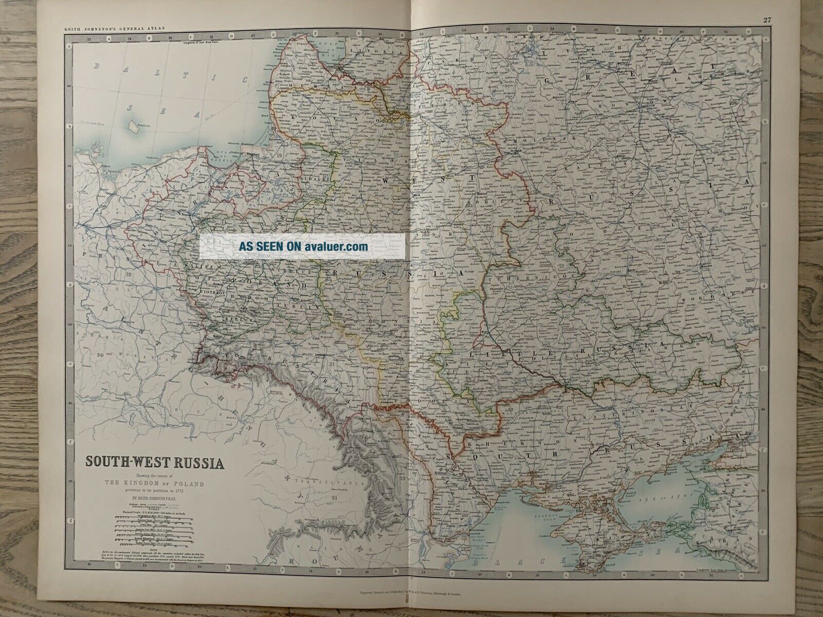
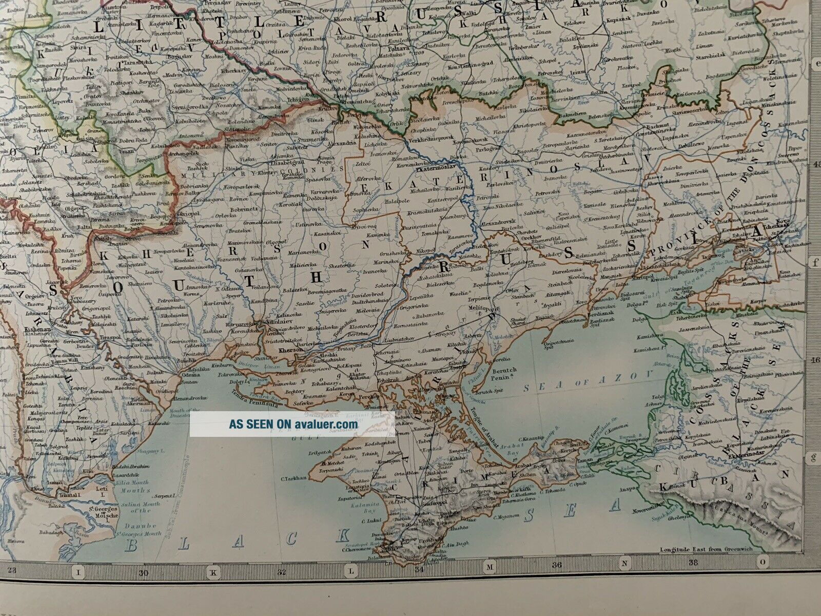
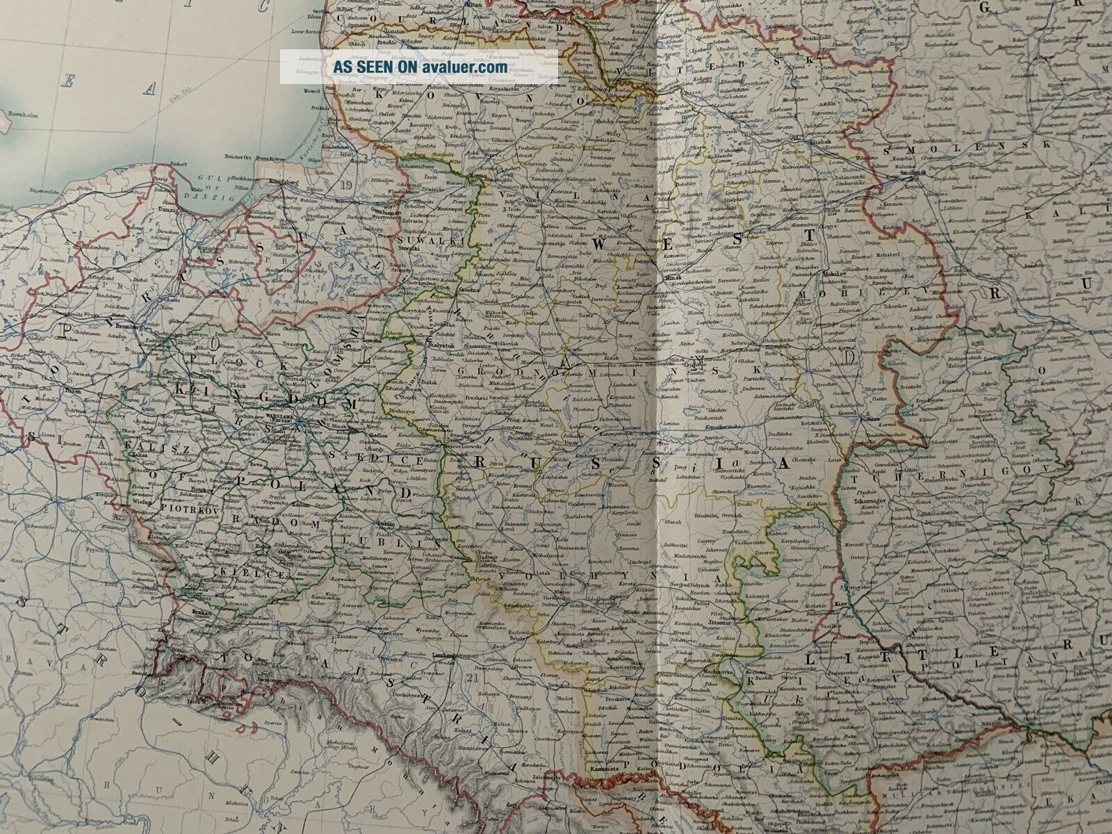
1893 SOUTH WEST RUSSIA POLAND UKRAINE ANTIQUE MAP BY JOHNSTON 126 YEARS OLD


Item History & Price

Information:
Reference Number: Avaluer:1240816Year: 1893
Original/Reproduction: Antique OriginalFormat: Atlas Map
Date Range: 1800-1899Cartographer/Publisher: Alexander K. Johnston
Country/Region: GreeceType: Political Map
Original Description:
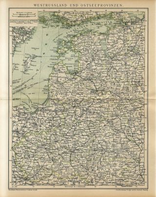
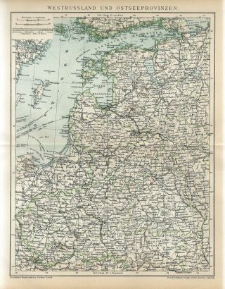
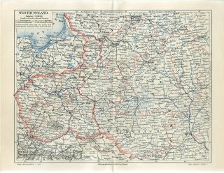
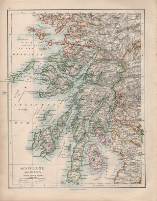
This large colour map is from Royal Atlas of Modern Geography exhibiting in a series of entirely original and authentic maps the present condition of geographical discovery and research in the several countries, empires and states of the World by the late Alexander Keith Johnston, updated by T.B. Johnston, published by W. & A.K. Johnston, Edinburgh & London, 1893.
This map is printed on one side only and measures 62 cm x 49 cm or 24" x 19".
If you have any questions or wo...uld like to see more photographs then please do not hesitate to ask. This interesting map is an original antique which is 126 years old. 
Please check my other auctions for more antique, books, maps and engravings which are added every week.


    Similar items


  • 1900 West Russia Poland Ukraine Belarus Estonia Latvia Lithuania Antiq.  Map Dated

    1900 West Russia Poland Ukraine Belarus Estonia Latvia Lithuania Antiq. Map Dated

  • 1895 West Russia Poland Ukraine Belarus Lithuania Latvia Estonia Antique Map

    1895 West Russia Poland Ukraine Belarus Lithuania Latvia Estonia Antique Map

  • 1896 West Russia Poland Ukraine Kiev Belarus Minsk Lithuania Antique Map Dated

    1896 West Russia Poland Ukraine Kiev Belarus Minsk Lithuania Antique Map Dated

  • 1730 Seutter Map Of Southern Russia And Ukraine

    1730 Seutter Map Of Southern Russia And Ukraine

  • 1914 Map Scotland South - West Argyll Perth Mull

    1914 Map Scotland South - West Argyll Perth Mull

  • Shell Road Map Of The South West Africa - Now Namibia

    Shell Road Map Of The South West Africa - Now Namibia

  • Antique Map South West Africa Harmsworth 1920

    Antique Map South West Africa Harmsworth 1920

  • E.  J.  Larby 1 " :4 Miles Linen Backed Map Of South West England - C.  1933

    E. J. Larby 1 " :4 Miles Linen Backed Map Of South West England - C. 1933


    • You might also like


    • Hungary & Romania 1579 (1584) Ortelius Unusual Antique Copper Engraved Map

      Hungary & Romania 1579 (1584) Ortelius Unusual Antique Copper Engraved Map

    • Brussels Bruxelles Belfium 1777 De Ferraris & Dupuis Large Antique Map Sheet Xxi

      Brussels Bruxelles Belfium 1777 De Ferraris & Dupuis Large Antique Map Sheet Xxi

    • 1616 Atlas Map Of Iceland.

      1616 Atlas Map Of Iceland.

    • Kazan Russia 1767 Le Clerc/lespinasse Antique Copper Engraved City View

      Kazan Russia 1767 Le Clerc/lespinasse Antique Copper Engraved City View

    • 1899 Stanford,  Folding Map Of Norwich,  Norfolk,  Arthur Collins,  Jarrold & Sons,

      1899 Stanford, Folding Map Of Norwich, Norfolk, Arthur Collins, Jarrold & Sons,

    • 1948 Vintage Linen Colour Map Geological Survey Ten Mile Of Great Britain

      1948 Vintage Linen Colour Map Geological Survey Ten Mile Of Great Britain

    • 1944 Map Flying Bombs Sussex Ww2 Newspaper Military Kent Courier German V1 V2

      1944 Map Flying Bombs Sussex Ww2 Newspaper Military Kent Courier German V1 V2

    • Dated 1638 Vellum Map Of Icklesham Sussex Showing Land Uses Owners Etc

      Dated 1638 Vellum Map Of Icklesham Sussex Showing Land Uses Owners Etc

Avaluer          About Us          Privacy Policy          Contact Us          UP
© 2022, avaluer.net, Inc. or its affiliates