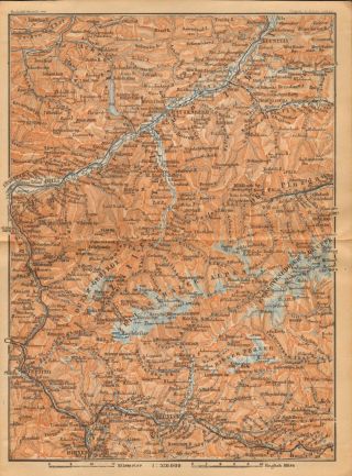
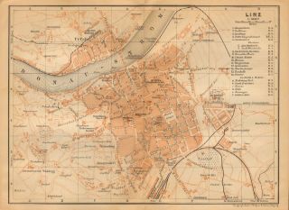
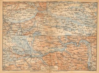
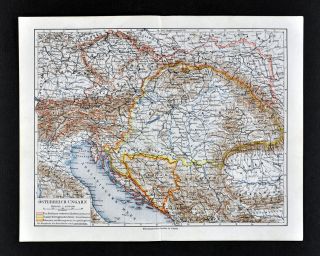
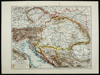
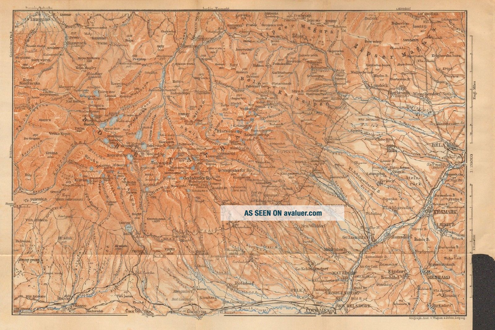
1900 ANTIQUE MAP - AUSTRIA - SLOVAKIA - BELA, KESMARK, VAZSEC, ZAKOPANE


Item History & Price

Information:
Reference Number: Avaluer:1243188Type: City Map
Cartographer/Publisher: Karl BaedekerDate Range: 1900-1909
Country: AustriaYear: 1900
Original Description:
Guaranteed original Victorian map 110 Years old Description: Small plan,  single page with folds as issued. Blank verso. Eccentric margin right sidePage Size: Small plan, approx 290 x 200 mm (11.5 x 8 Inches)Condition: Please look at the picture provided. Generally  very goodProvenance: Austria including Hungary, Transylvania, Dalmatia and Bosnia, by Karl Baedeker,   Leipzig... and London.  Ninth revised and augmented edition 1900The picture included here is of the actual print for sale, not a stock or library print.  We endeavour to describe any faults but please look at the picture.  Virtually all antiquarian maps and prints have been recovered from disbound atlases or other books and are subject to some normal aging due to use and time which is not obtrusive unless otherwise stated. We offer a no questions asked return policy. GUARANTEED ORIGINAL ANTIQUE MAPThis is an authentic print, published at the date stated above. It is not a modern copy.FREE DOMESTIC POSTAGE 


    Similar items


  • 1900 Antique Map - Austria - Rattenberg,  Bruneck,  Brixen,  Rufstein

    1900 Antique Map - Austria - Rattenberg, Bruneck, Brixen, Rufstein

  • 1900 Antique Map - Austria - Plan Of Linz

    1900 Antique Map - Austria - Plan Of Linz

  • 1900 Antique Map - Austria - The Danube - Vienna To Budapest

    1900 Antique Map - Austria - The Danube - Vienna To Budapest

  • 1900 Meyers Map Austria Hungary Croatia Bohemia Slovenia Italy Serbia Bosnc

    1900 Meyers Map Austria Hungary Croatia Bohemia Slovenia Italy Serbia Bosnc

  • 1900 Antique Map Of Austria Hungary Austro Hungarian Empire.  120 Years Old Chart

    1900 Antique Map Of Austria Hungary Austro Hungarian Empire. 120 Years Old Chart

  • Antique Map.  Italy.  Naples.  Mount Vesuvius In 1631 Year.  Hans Kraemer.  C 1900

    Antique Map. Italy. Naples. Mount Vesuvius In 1631 Year. Hans Kraemer. C 1900

  • Xl 1892,  1906 Dated Japan Wall Map Art Print Decor.  Japanese Empire 1800s,  1900s

    Xl 1892, 1906 Dated Japan Wall Map Art Print Decor. Japanese Empire 1800s, 1900s

  • Dovedale,  Kingsley,  Brassington: Staffs - Derby Meet: Antique Bespoke Map 1871 - 1900:

    Dovedale, Kingsley, Brassington: Staffs - Derby Meet: Antique Bespoke Map 1871 - 1900:


    • You might also like


    • Hungary & Romania 1579 (1584) Ortelius Unusual Antique Copper Engraved Map

      Hungary & Romania 1579 (1584) Ortelius Unusual Antique Copper Engraved Map

    • Brussels Bruxelles Belfium 1777 De Ferraris & Dupuis Large Antique Map Sheet Xxi

      Brussels Bruxelles Belfium 1777 De Ferraris & Dupuis Large Antique Map Sheet Xxi

    • 1616 Atlas Map Of Iceland.

      1616 Atlas Map Of Iceland.

    • Kazan Russia 1767 Le Clerc/lespinasse Antique Copper Engraved City View

      Kazan Russia 1767 Le Clerc/lespinasse Antique Copper Engraved City View

    • 1899 Stanford,  Folding Map Of Norwich,  Norfolk,  Arthur Collins,  Jarrold & Sons,

      1899 Stanford, Folding Map Of Norwich, Norfolk, Arthur Collins, Jarrold & Sons,

    • 1948 Vintage Linen Colour Map Geological Survey Ten Mile Of Great Britain

      1948 Vintage Linen Colour Map Geological Survey Ten Mile Of Great Britain

    • 1944 Map Flying Bombs Sussex Ww2 Newspaper Military Kent Courier German V1 V2

      1944 Map Flying Bombs Sussex Ww2 Newspaper Military Kent Courier German V1 V2

    • Dated 1638 Vellum Map Of Icklesham Sussex Showing Land Uses Owners Etc

      Dated 1638 Vellum Map Of Icklesham Sussex Showing Land Uses Owners Etc

Avaluer          About Us          Privacy Policy          Contact Us          UP
© 2022, avaluer.net, Inc. or its affiliates