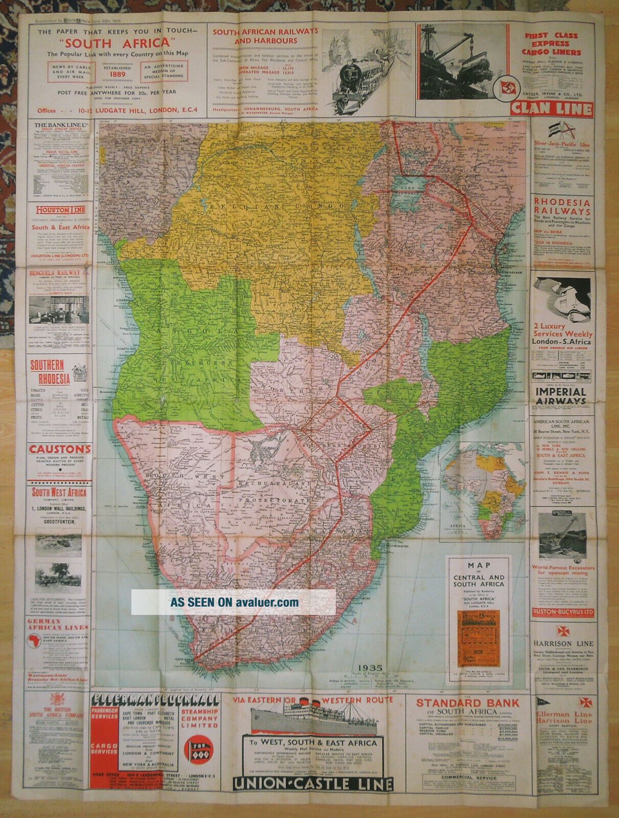
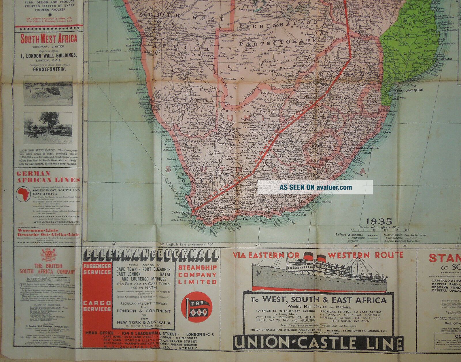
THE ' SOUTH AFRICA ' PAPER MAP OF CENTRAL & SOUTH AFRICA - 1935
Item History & Price
| Reference Number: Avaluer:1243677 | Language: English |
| Country/Region of Manufacture: United Kingdom | Cartographer/Publisher: Ordnance Survey |
| Place of Publication: UK | Format: Sheet Map |
| Antique/ Modern: Old |
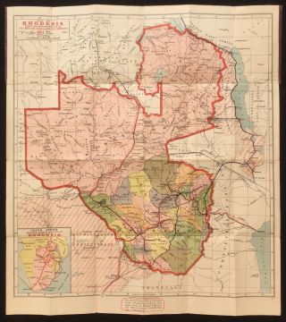
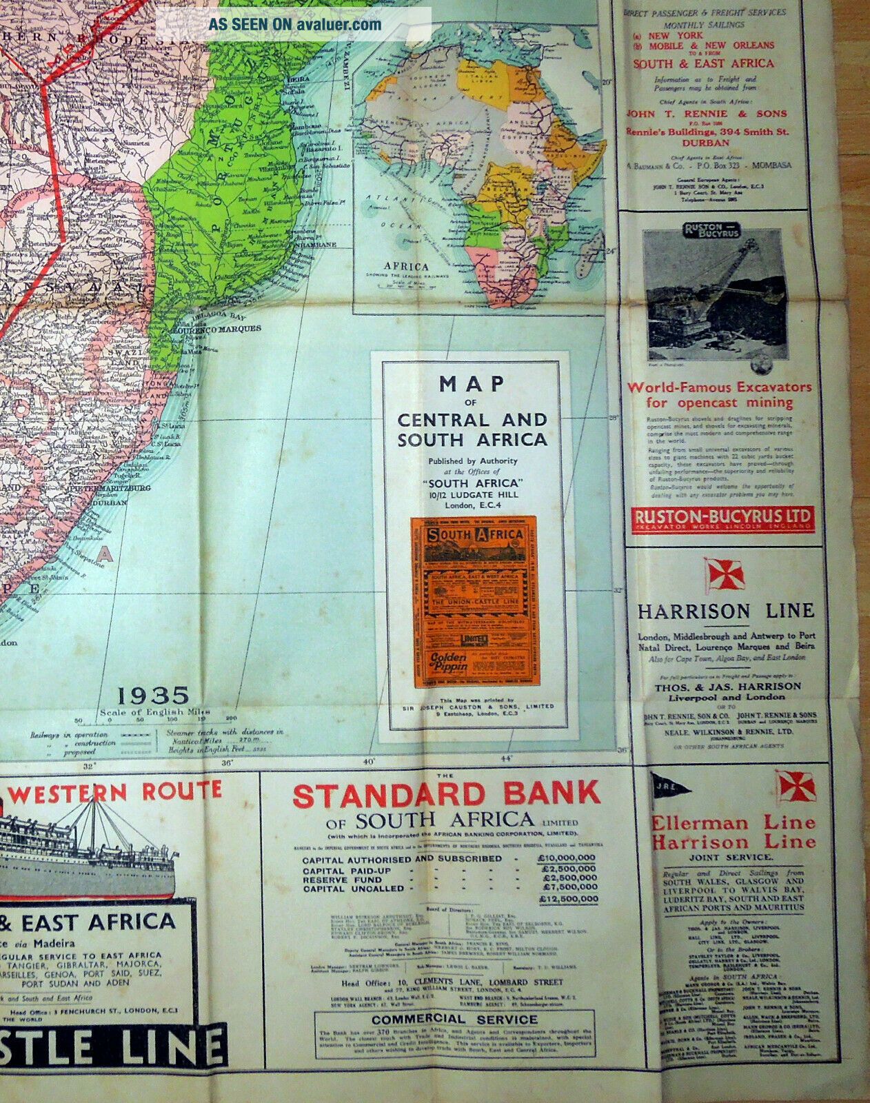
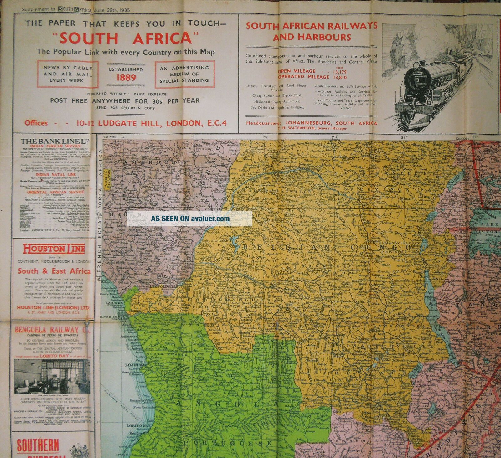
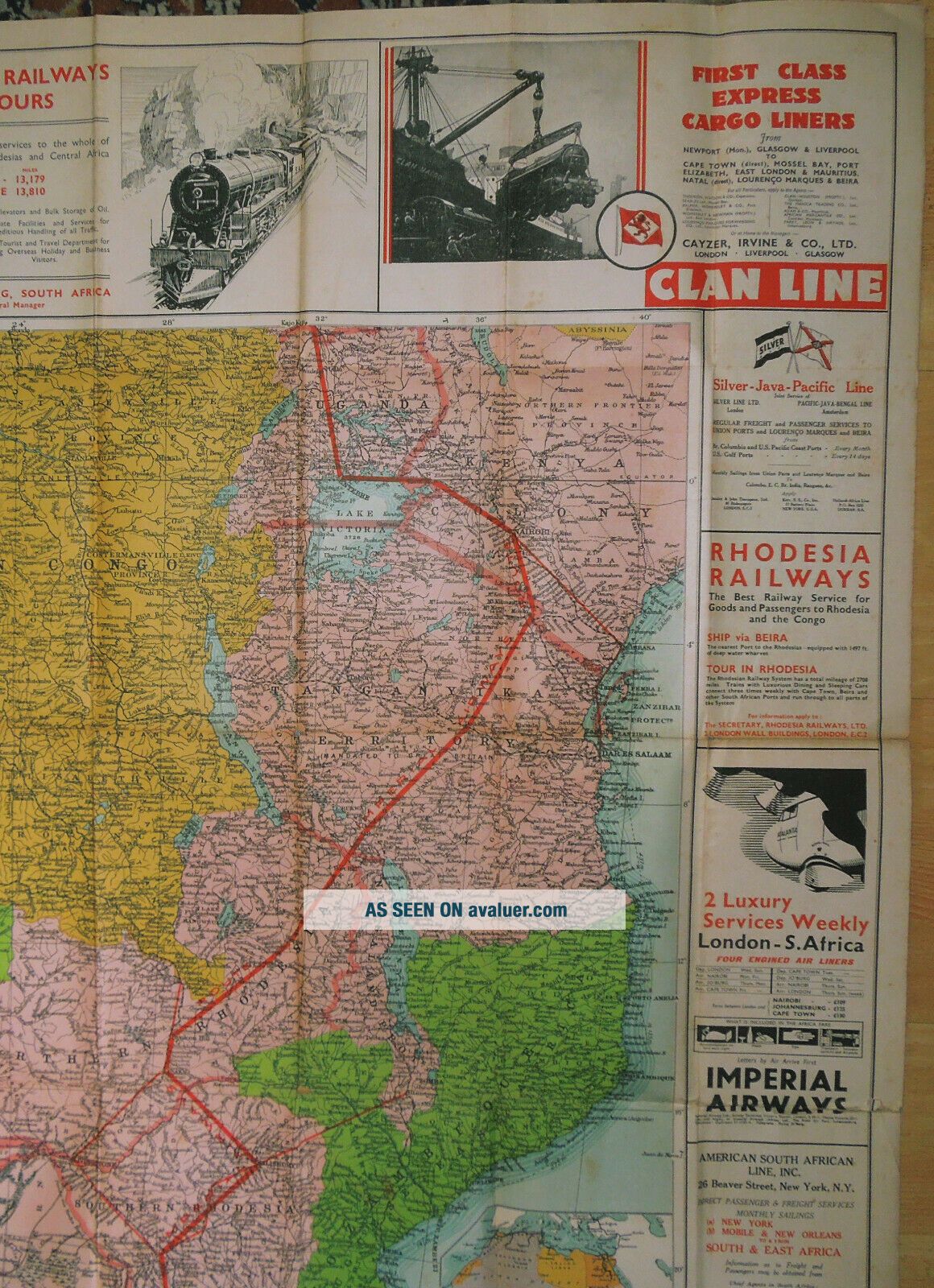
The ‘South Africa’ paper map of Central and South Africa, produced as a supplement to ‘South Africa’ magazine, 29th June 1935.
The map is folded, measures 1320mm x 995mm, within integral light card panels, the map with some xfold holes, a little marking, browning to the folds, some edgefolds torn with some repair and the covers with some marking. 250TPurchasing Information Overseas Buyers - Please note that all pricesare in UK Pounds Sterling, unless shown as converted tolo...cal currencyI try to accurately describe each item, and photographs/scans form partof the description. Please contact me, preferably at least 24 hours before theend of the listing if you require any further information, before purchasing.
All Items are pre-owned Originals, unless otherwise stated, and may also haveminor imperfections not mentioned, commensurate with their age/use.
Postage and packing is shown separately for the U.K., Europe &Worldwide, but if not, please contact me for an estimate of the likely cost toyour address. Inclusive Postage Offers apply within the UK only, as shown on thelisting. Postage prices shown separately also include the e bay & Paypalpostage fees. All Payments must be through Paypal (NO e Cheques, please) If buying multiple items, please use the basket system, click Request Total from Seller and await combinedinvoice, before checking out & making paymentAll items are normally sent assoon as possible, and within 4 working days, following receipt of clearedfunds, packed suitably to withstand the normal rigours of the postal system.Items up to 2kg are sent through the Post Office, unless otherwisestated and a Certificate of Posting is always obtained, which offerscompensation up to £20, within the U.K., in the unlikely event of an item goingastray. Insured & tracked p & p will be quoted at cost. Items, individually or together, weighing over 2kg are sent through a Courier, unlessotherwise stated, automatically tracked and insured. Please contact me first if an item is not received within the stipulatedtime, so that the matter can be addressed and taken up with the Carrier.Overseas buyers are responsible for any Customs matters and importchargesThank you for reading this