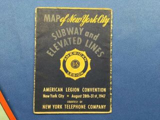
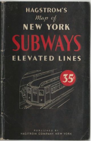
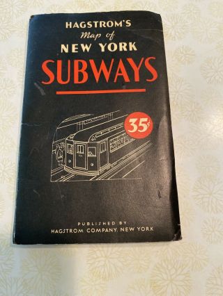
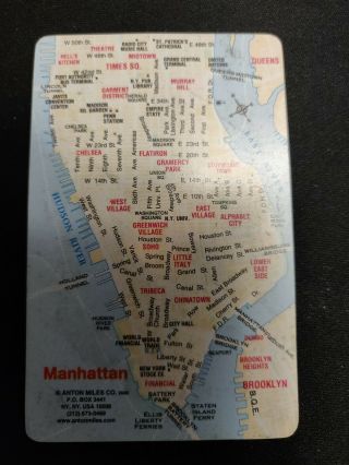
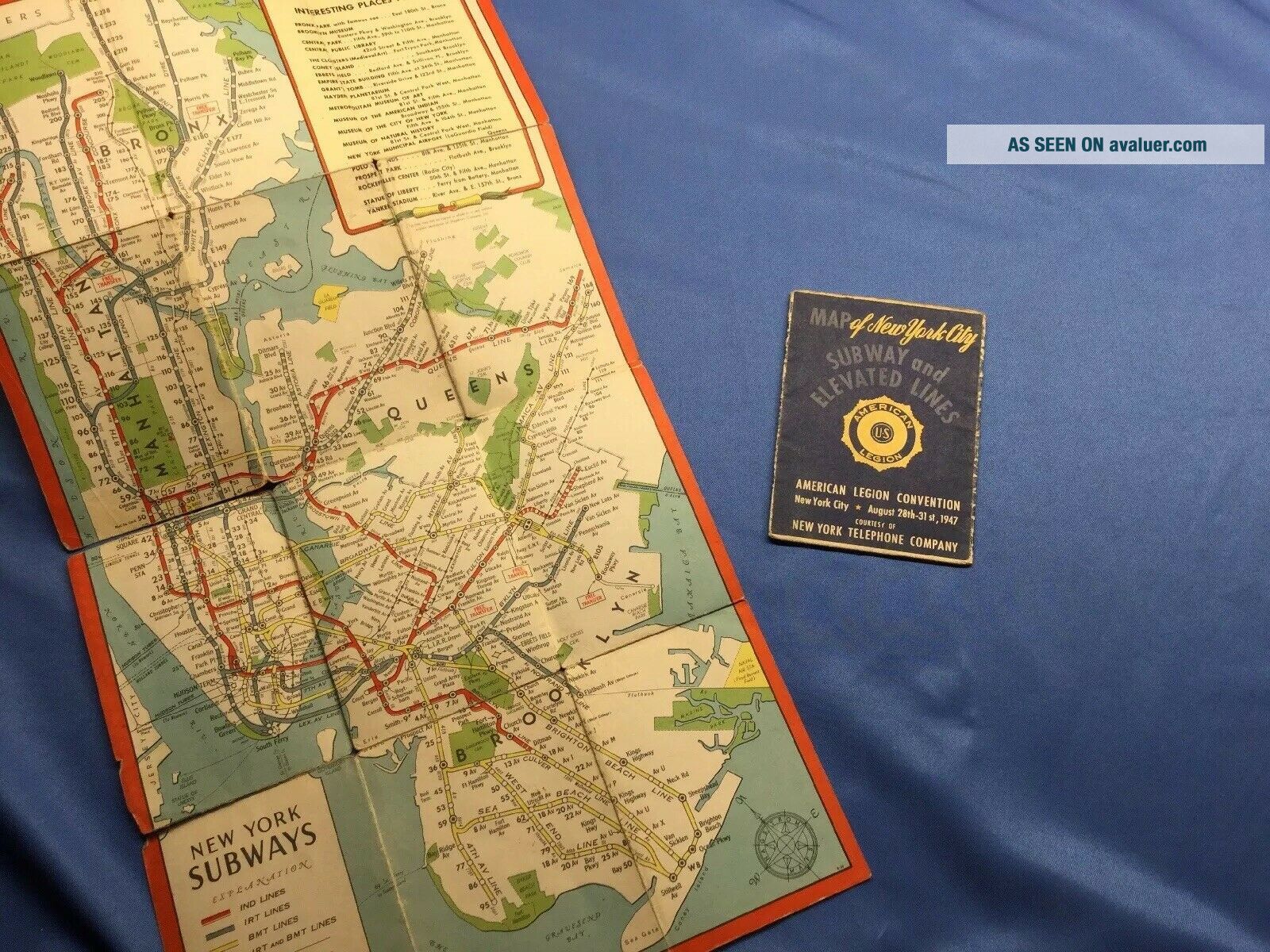
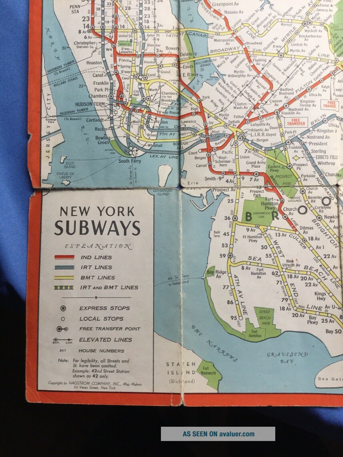
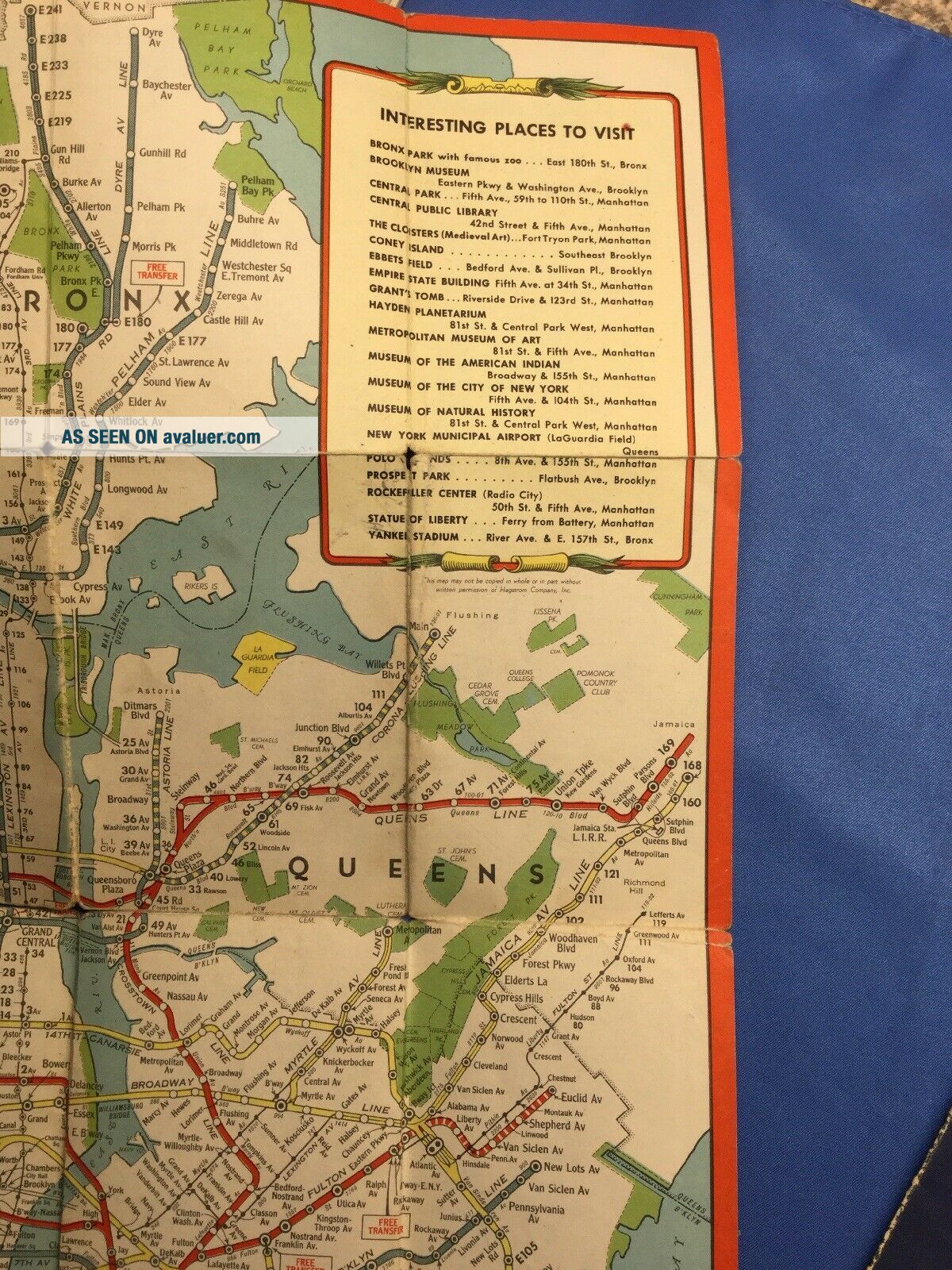
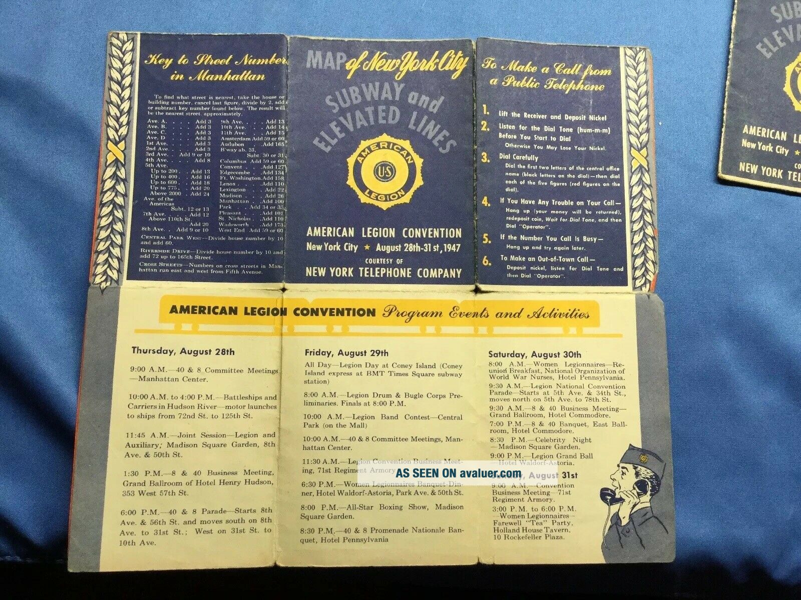
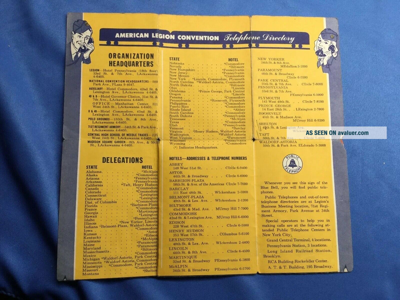
1947 Vest Pocket Map Of York City Subway Map Antique COLOR American Legion


Item History & Price

Information:
Reference Number: Avaluer:1243746Type: Pocket
US State: New YorkTopic: Maps
City: New York
Original Description:
1947 Vest Pocket Map of New York City Subway and Elevated Lines Map Antique COLOR..some folding separation but still in tact. Shipped with USPS First Class Package. Free Shipping


    Similar items


  • 1947 Vest Pocket Map Of York City Subway Map Antique Color American Legion

    1947 Vest Pocket Map Of York City Subway Map Antique Color American Legion

  • Vintage Rand - Mcnally Vest Pocket Map Of York City Borough Manhattan Brooklyn

    Vintage Rand - Mcnally Vest Pocket Map Of York City Borough Manhattan Brooklyn

  • Vintage Nyc Hagstrom

    Vintage Nyc Hagstrom ' S Folding Map Of York City Subways Lines As Of Aug 1947

  • Vintage Hagstroms 1954 Map Of York City Subway Auto Routes House Numbers,

    Vintage Hagstroms 1954 Map Of York City Subway Auto Routes House Numbers,

  • Antique Pocket Map Of York City - 1903

    Antique Pocket Map Of York City - 1903

  • Hagstrom’s Map Of York City Subways Elevated Lines March 1952 Folding Map

    Hagstrom’s Map Of York City Subways Elevated Lines March 1952 Folding Map

  • Old Vintage Nyc Hagstrom

    Old Vintage Nyc Hagstrom ' S Folding Map Of York City Subways Elev Lines 50 ' S

  • Pocket Wallet Sized Card Maps Of York City Streets & Subways & Bus Transit

    Pocket Wallet Sized Card Maps Of York City Streets & Subways & Bus Transit


    • You might also like


    • 1860 Mitchell Hand Colored Map Colorado,  Nebraska & Kansas - Civil War Era

      1860 Mitchell Hand Colored Map Colorado, Nebraska & Kansas - Civil War Era

    • 18th Century French Map Of North America

      18th Century French Map Of North America

    • Las Vegas Nevada Vintage 1967 Us Geological Survey Quadrangle Map 4 Panels

      Las Vegas Nevada Vintage 1967 Us Geological Survey Quadrangle Map 4 Panels

    • Rare Antique 1845 Maps United States Exploring Expedition Book Antartica Hawaii

      Rare Antique 1845 Maps United States Exploring Expedition Book Antartica Hawaii

    • Vintage 1926 Map Hollywood From The Best Surveys Of The Time

      Vintage 1926 Map Hollywood From The Best Surveys Of The Time

    • American Continent (western Hemisphere) 1747 Bowen Antique Copper Engraved Map

      American Continent (western Hemisphere) 1747 Bowen Antique Copper Engraved Map

    • Gulf Coast Florida Texas United States 1705 De Fer Unusual Antique Engraved Map

      Gulf Coast Florida Texas United States 1705 De Fer Unusual Antique Engraved Map

    • California As Island United States 1700 De Fer Unusual First Edition Antique Map

      California As Island United States 1700 De Fer Unusual First Edition Antique Map

Avaluer          About Us          Privacy Policy          Contact Us          UP
© 2022, avaluer.net, Inc. or its affiliates