1942 Antique ARGENTINA And CHILE Map Vintage Map Of Argentina & Chile 5035


Item History & Price

Information:
Reference Number: Avaluer:1244267Type: Map
Publication Year: 1942Format: Atlas Map
Country/Region: ArgentinaYear: 1942
Original/Reproduction: Vintage OriginalEra: 1940s
Features: Antique,VintageTopic: Art
Original Description:
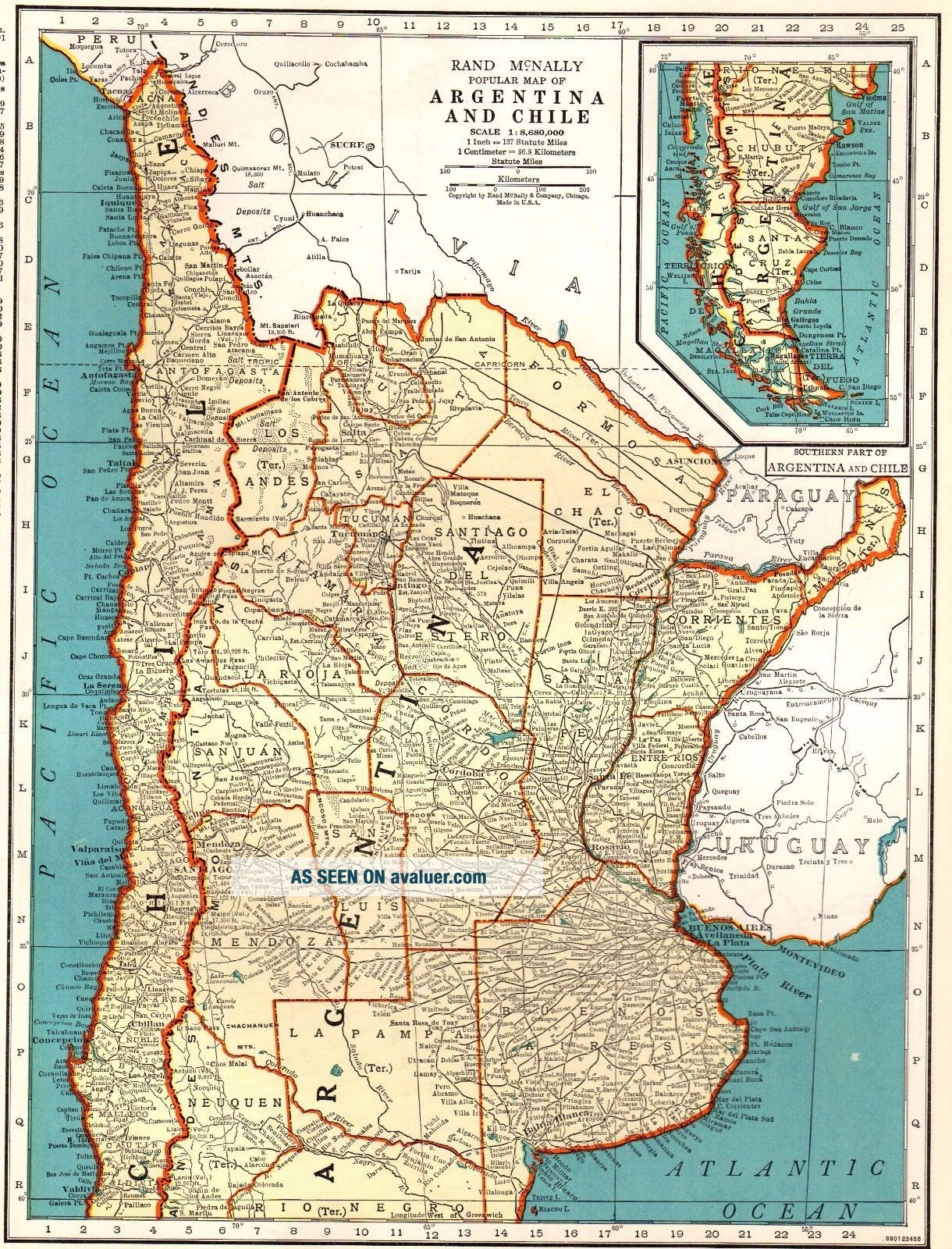
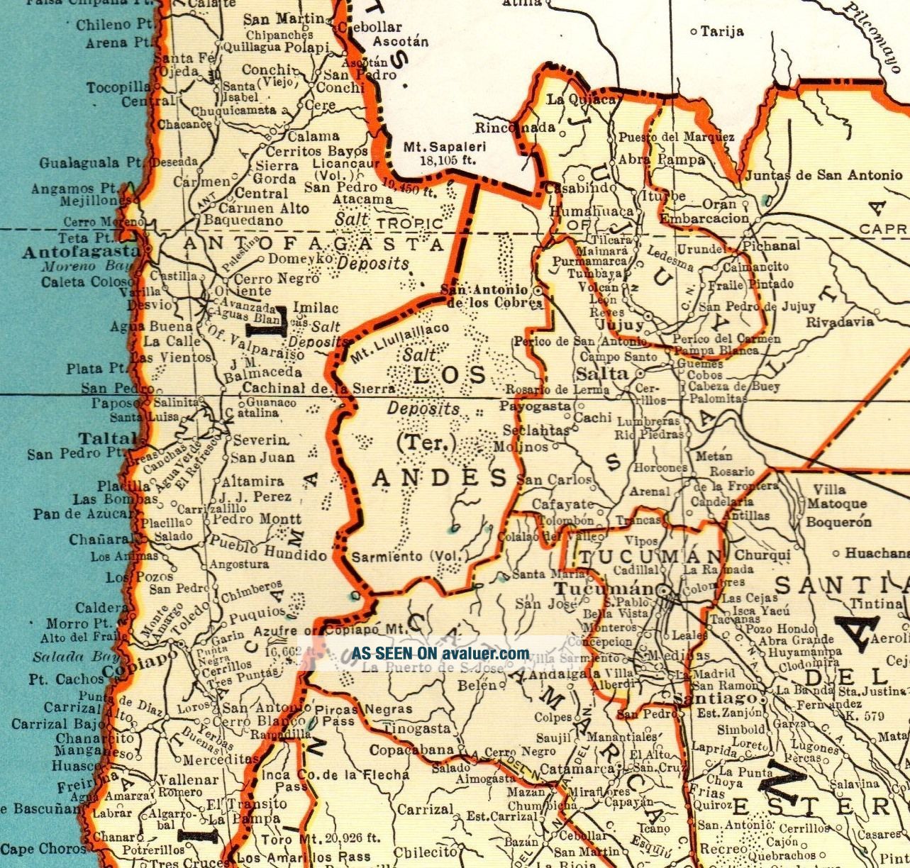
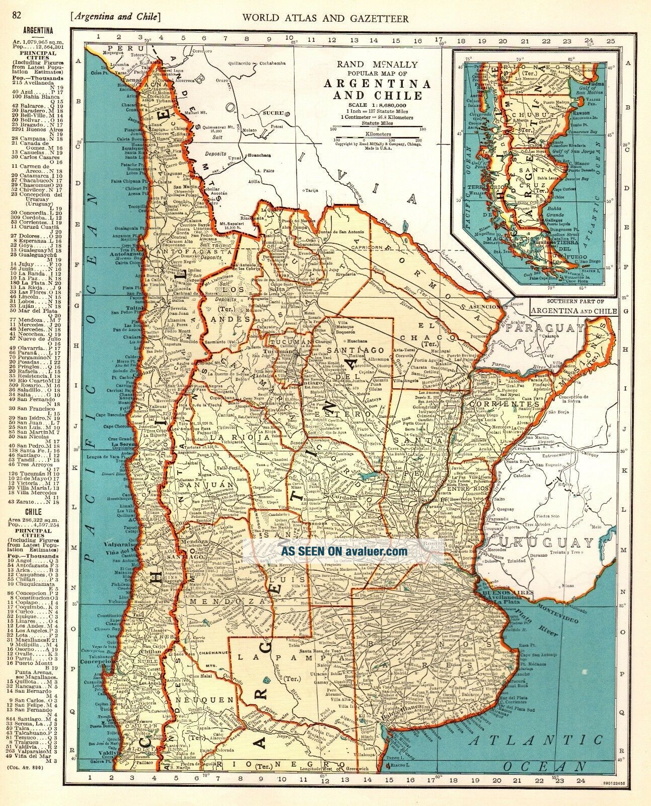
ANTIQUE MAP OF ARGENTINA AND CHILEThis is an original, not reproduction, vintage map of Argentina and Chile which was carefully removed from an atlas. Map measures approximately 9 x 12 inches - not including the index - and is in very good condition.  Your item will be packaged in a plastic sleeve, within a cardboard mailing tube. We happily combine purchases to save on shipping fees.Please email with questions, we will answer your email promptly!Please visit our ebay st...ore, Plaindealing Vintage Paper.  
Powered by eBay Turbo Lister
The free listing tool. List your items fast and easy and manage your active items.


    Similar items


  • Rare Antique Kentucky And Tennessee Map 1888 Rare Miniature Vintage Map 6393

    Rare Antique Kentucky And Tennessee Map 1888 Rare Miniature Vintage Map 6393

  • Denoyer - Geppert Co.  1942 J121rp Political And Geographic Map Michigan

    Denoyer - Geppert Co. 1942 J121rp Political And Geographic Map Michigan

  • Antique Usa And Mexico Map W/ Ak & Hi Vintage Pull Down School Map Wall Hanging

    Antique Usa And Mexico Map W/ Ak & Hi Vintage Pull Down School Map Wall Hanging

  • 1942 Esso North And South Carolina Vintage Road Map

    1942 Esso North And South Carolina Vintage Road Map

  • Antique Road And Business Map Of Visalia California 16 " X 23 "

    Antique Road And Business Map Of Visalia California 16 " X 23 "

  • Antique A And Correct Map Of North Wales Framed Rob Morden?

    Antique A And Correct Map Of North Wales Framed Rob Morden?

  • Wwii - 1942 - Antique Colored - Europe Road Map (le Mans) (british/us)

    Wwii - 1942 - Antique Colored - Europe Road Map (le Mans) (british/us)

  • 1888 Antique Map Michigan Antique Railroad And County Map

    1888 Antique Map Michigan Antique Railroad And County Map


    • You might also like


    • 1860 Mitchell Hand Colored Map Colorado,  Nebraska & Kansas - Civil War Era

      1860 Mitchell Hand Colored Map Colorado, Nebraska & Kansas - Civil War Era

    • 18th Century French Map Of North America

      18th Century French Map Of North America

    • Las Vegas Nevada Vintage 1967 Us Geological Survey Quadrangle Map 4 Panels

      Las Vegas Nevada Vintage 1967 Us Geological Survey Quadrangle Map 4 Panels

    • Rare Antique 1845 Maps United States Exploring Expedition Book Antartica Hawaii

      Rare Antique 1845 Maps United States Exploring Expedition Book Antartica Hawaii

    • Vintage 1926 Map Hollywood From The Best Surveys Of The Time

      Vintage 1926 Map Hollywood From The Best Surveys Of The Time

    • American Continent (western Hemisphere) 1747 Bowen Antique Copper Engraved Map

      American Continent (western Hemisphere) 1747 Bowen Antique Copper Engraved Map

    • Gulf Coast Florida Texas United States 1705 De Fer Unusual Antique Engraved Map

      Gulf Coast Florida Texas United States 1705 De Fer Unusual Antique Engraved Map

    • California As Island United States 1700 De Fer Unusual First Edition Antique Map

      California As Island United States 1700 De Fer Unusual First Edition Antique Map

Avaluer          About Us          Privacy Policy          Contact Us          UP
© 2022, avaluer.net, Inc. or its affiliates