Antique1914 World Atlas Map Florida FL & Connecticut CT Conn World War WW L@@K

Item History & Price
Vintage 1914 World Atlas Map of Florida & Connecticut
Vintage 1914 World Atlas Map of Florida And Connecticut A Wonderful Gift!
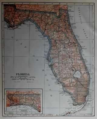
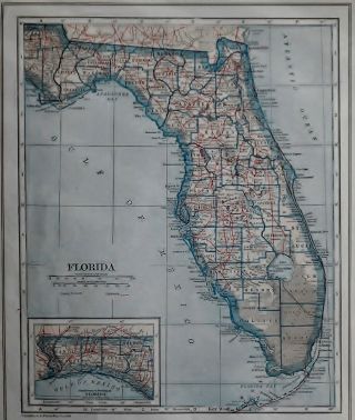
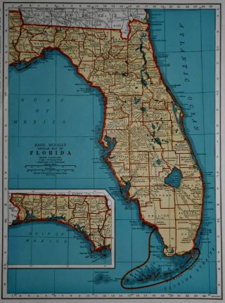
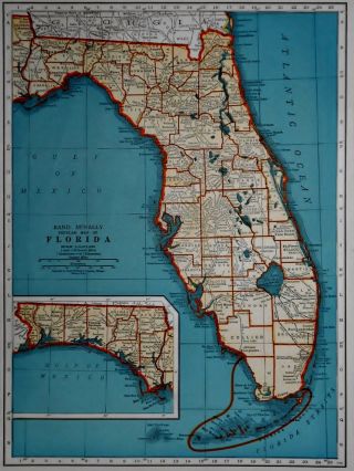
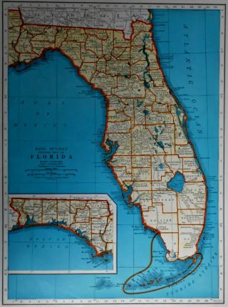
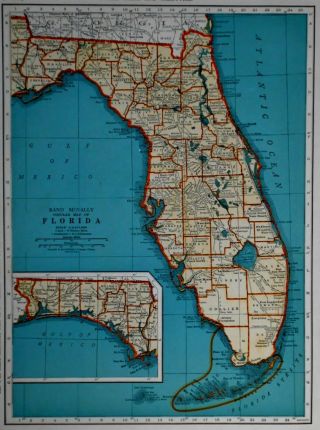
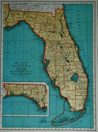
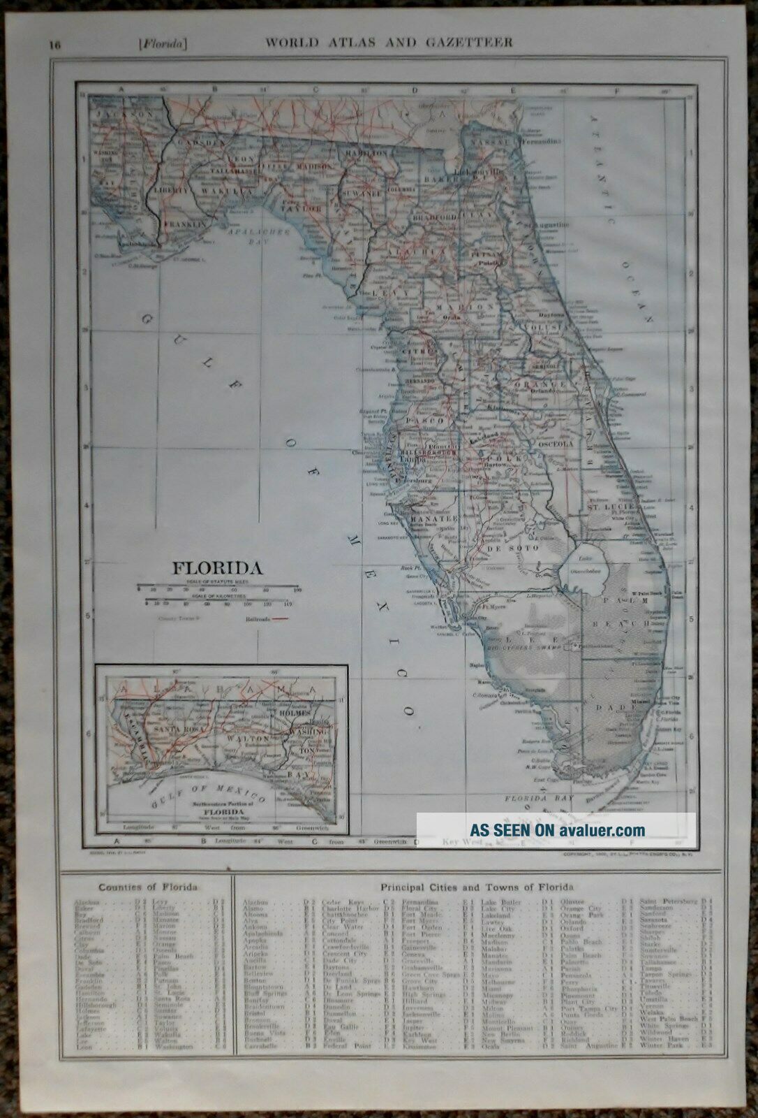
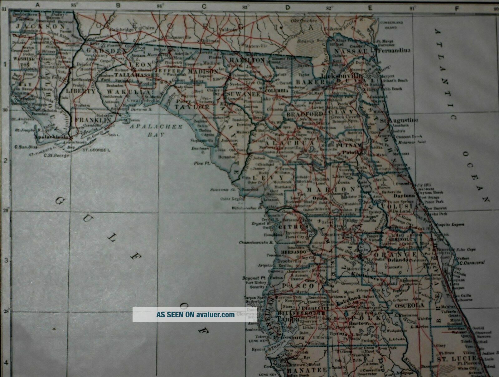
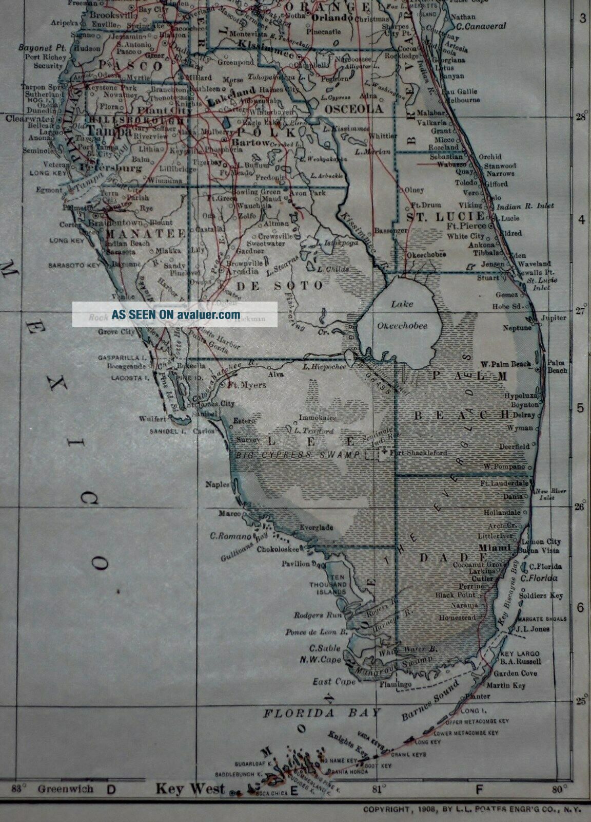
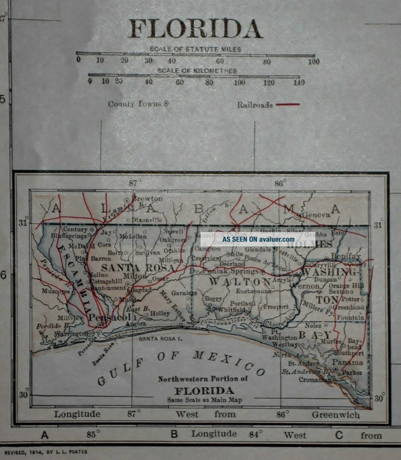
Great OLD Map from the COLLIER'S "THE NEW ENCYCLOPEDIC ATLAS & GAZETTEER OF THE WORLD"The Book Is Copyright 1914105 Years Old!Both Maps Are Copyright 1908 by L.L. Poates Eng. Co., 111 Years OldBoth Were Revised In 1914Florida On One Side (Contact Us For More Photo...s)A Map of Connecticut On The Other SideThe Page Measures About 10 1/4 x 15 1/8"There Is Also An Index of Counties, Principal Cities & Towns of Each!Very Historic!Very Educational. See What These States used to look like!Wonderful Colors!It Is In Great ConditionThere Is Some Light Yellowing, As Expected, From Age. There Are Some Very Light Wrinkles In The PaperSee All Photos!It Will Look Great Matted & Framed!A Really Nice Gift!A GREAT House Warming Gift!Buy It Now!Awesome Décor For Your Home, Business, Studio, Library, Restaurant, Club Or Bar!Teachers, Students, Authors, Historians, Artists, Real Estate Agents, Interior Decorators, Travel Agents, Prop Companies & Politicians LOVE Them!A "Must" For Your Genealogy Research Project!Super For a Local Business or Office!An Awesome Gift For A Special Client!Shipping by USPS 1st Class or Priority MailWe Will Combine Shipping On Up To 6 Maps For The Same Shipping Fee As One!Check Out All Of Our Art, Maps, Prints, Books And Other Great Items!Email Us With Any Questions or For an International Shipping QuoteBe sure to add me to your favorites list!Thanks For Looking!International Buyers – Please Note:
Import duties, taxes, and charges are not included in the item price or shipping cost. These charges are the buyer's responsibility
Please check with your country's customs office to determine what these additional costs will be prior to bidding or buying
00009
Vintage 1914 World Atlas Map of Florida And Connecticut A Wonderful Gift!
Great OLD Map from the COLLIER'S "THE NEW ENCYCLOPEDIC ATLAS & GAZETTEER OF THE WORLD"The Book Is Copyright 1914105 Years Old!Both Maps Are Copyright 1908 by L.L. Poates Eng. Co., 111 Years OldBoth Were Revised In 1914Florida On One Side (Contact Us For More Photo...s)A Map of Connecticut On The Other SideThe Page Measures About 10 1/4 x 15 1/8"There Is Also An Index of Counties, Principal Cities & Towns of Each!Very Historic!Very Educational. See What These States used to look like!Wonderful Colors!It Is In Great ConditionThere Is Some Light Yellowing, As Expected, From Age. There Are Some Very Light Wrinkles In The PaperSee All Photos!It Will Look Great Matted & Framed!A Really Nice Gift!A GREAT House Warming Gift!Buy It Now!Awesome Décor For Your Home, Business, Studio, Library, Restaurant, Club Or Bar!Teachers, Students, Authors, Historians, Artists, Real Estate Agents, Interior Decorators, Travel Agents, Prop Companies & Politicians LOVE Them!A "Must" For Your Genealogy Research Project!Super For a Local Business or Office!An Awesome Gift For A Special Client!Shipping by USPS 1st Class or Priority MailWe Will Combine Shipping On Up To 6 Maps For The Same Shipping Fee As One!Check Out All Of Our Art, Maps, Prints, Books And Other Great Items!Email Us With Any Questions or For an International Shipping QuoteBe sure to add me to your favorites list!Thanks For Looking!International Buyers – Please Note:
Import duties, taxes, and charges are not included in the item price or shipping cost. These charges are the buyer's responsibility
Please check with your country's customs office to determine what these additional costs will be prior to bidding or buying
00009