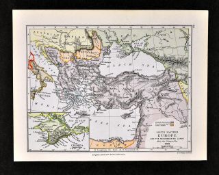
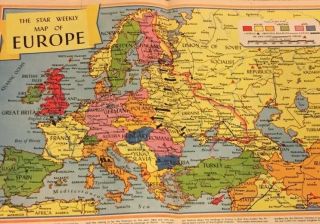
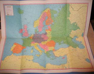
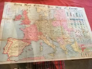
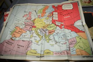
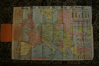
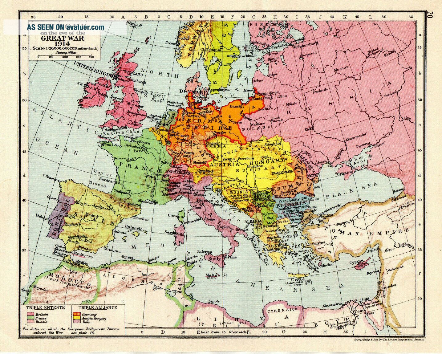
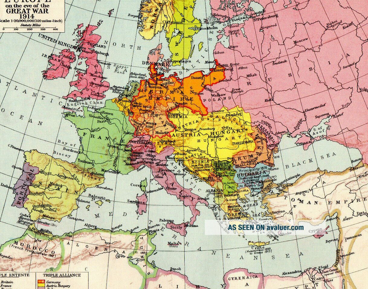
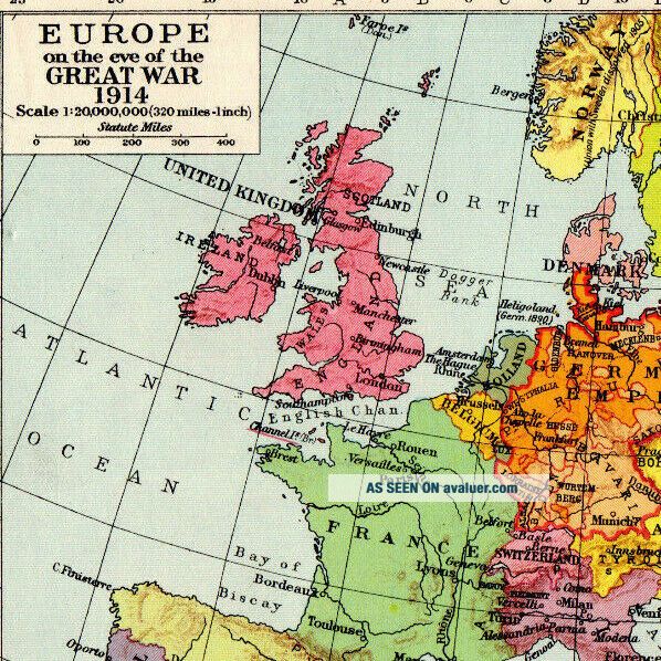
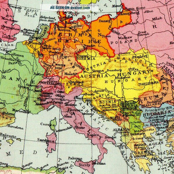
Map Of Europe 1924 WW1 Great War George Philip & Son Vintage 1929


Item History & Price

Information:
Reference Number: Avaluer:1247353Format: Atlas Map
size: 10 x 8 inchesYear: 1929
Original Description:
MAP: Europe Great War C18
DATE PRINTED: 1929
IMAGE SIZE: Approx 25.0 x 20.0cm, 10 x 8 inches
PROVENANCE: New School Atlas Of Universal History
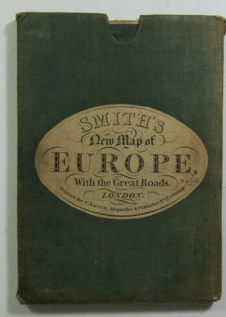
VERSO: The Reverse Has a Map
FOLD: None
CONDITION: Good Please Check Images Before Purchase
POSTAGE: First Class Or Air Mail Within 24 Hours In Card Backed Envelope Or Postal Tube


    Similar items


  • Map Of Europe In 1856 Crimean War Russia Ukraine Crimea Greece Turkey Balkans

    Map Of Europe In 1856 Crimean War Russia Ukraine Crimea Greece Turkey Balkans

  • 1830 Old Antique Smith

    1830 Old Antique Smith ' S Map Of Europe With The Great Roads By C S Smith

  • 1944 Map Of Europe Star Weekly Ww2,  War How Germany Was Encircled By Un Pr8

    1944 Map Of Europe Star Weekly Ww2, War How Germany Was Encircled By Un Pr8

  • Set Of 7 Vintage Maps Of Europe Early 1940s Some War Office

    Set Of 7 Vintage Maps Of Europe Early 1940s Some War Office

  • C.  S.  Hammond

    C. S. Hammond ' S War Map Of Europe Wwii Ww2 Vital Statistics -

  • 1916 Ww1 Daily Mail War Map Of Europe,  Large Colourful Antique Ww1 Folding Map.

    1916 Ww1 Daily Mail War Map Of Europe, Large Colourful Antique Ww1 Folding Map.

  • Antique Map Of Europe War Time Map Germany Ww1

    Antique Map Of Europe War Time Map Germany Ww1

  • Daily Mail General War Map Of Europe Foldout World War I George Philip & Son

    Daily Mail General War Map Of Europe Foldout World War I George Philip & Son


    • You might also like


    • Hungary & Romania 1579 (1584) Ortelius Unusual Antique Copper Engraved Map

      Hungary & Romania 1579 (1584) Ortelius Unusual Antique Copper Engraved Map

    • Brussels Bruxelles Belfium 1777 De Ferraris & Dupuis Large Antique Map Sheet Xxi

      Brussels Bruxelles Belfium 1777 De Ferraris & Dupuis Large Antique Map Sheet Xxi

    • 1616 Atlas Map Of Iceland.

      1616 Atlas Map Of Iceland.

    • Kazan Russia 1767 Le Clerc/lespinasse Antique Copper Engraved City View

      Kazan Russia 1767 Le Clerc/lespinasse Antique Copper Engraved City View

    • 1899 Stanford,  Folding Map Of Norwich,  Norfolk,  Arthur Collins,  Jarrold & Sons,

      1899 Stanford, Folding Map Of Norwich, Norfolk, Arthur Collins, Jarrold & Sons,

    • 1948 Vintage Linen Colour Map Geological Survey Ten Mile Of Great Britain

      1948 Vintage Linen Colour Map Geological Survey Ten Mile Of Great Britain

    • 1944 Map Flying Bombs Sussex Ww2 Newspaper Military Kent Courier German V1 V2

      1944 Map Flying Bombs Sussex Ww2 Newspaper Military Kent Courier German V1 V2

    • Dated 1638 Vellum Map Of Icklesham Sussex Showing Land Uses Owners Etc

      Dated 1638 Vellum Map Of Icklesham Sussex Showing Land Uses Owners Etc

Avaluer          About Us          Privacy Policy          Contact Us          UP
© 2022, avaluer.net, Inc. or its affiliates