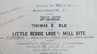
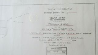
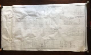
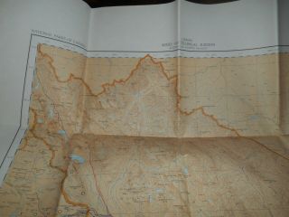
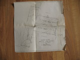
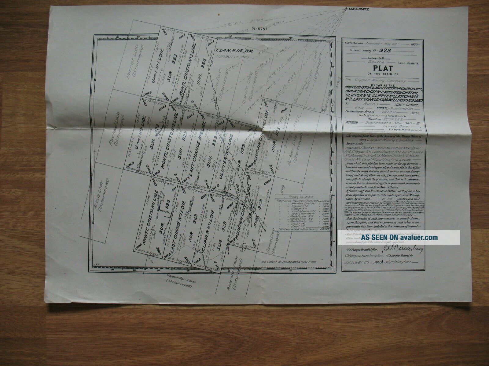
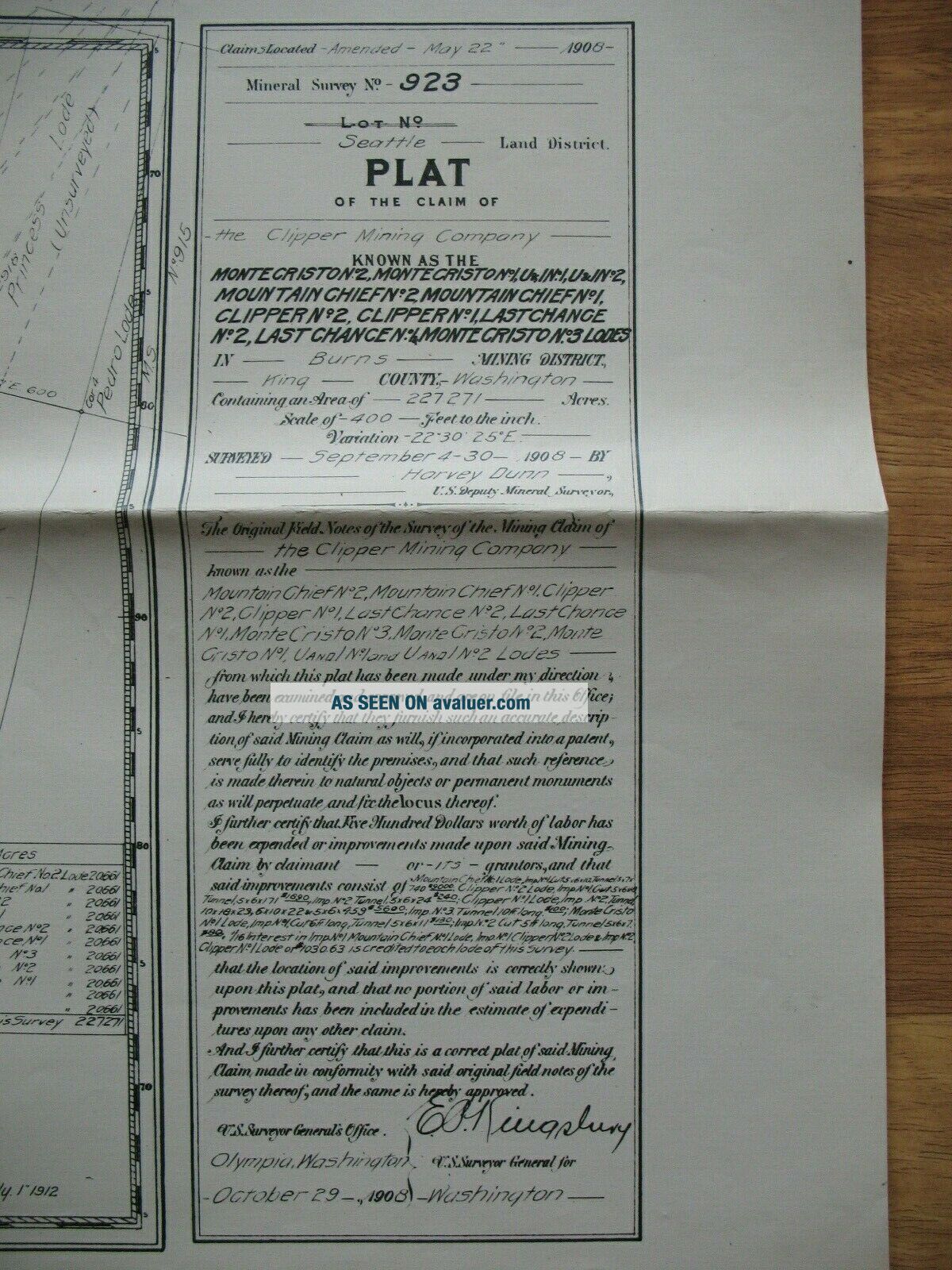
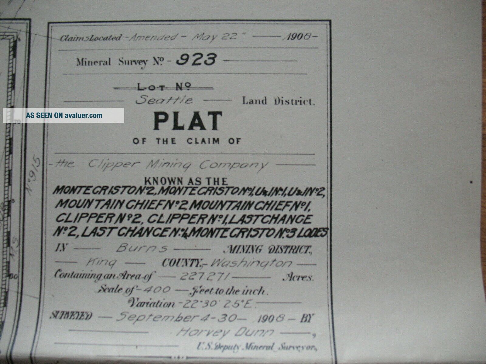
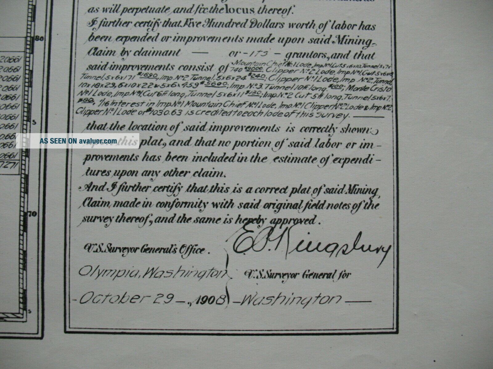
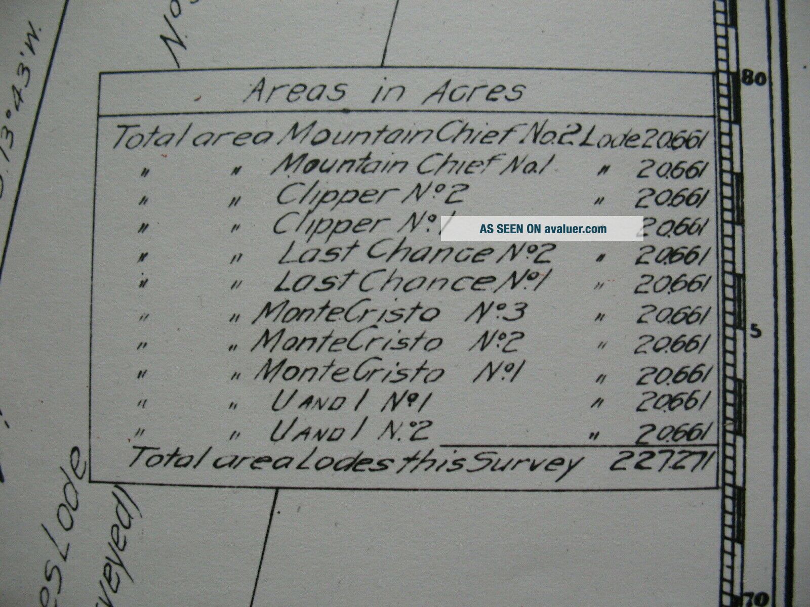
Mineral Mining Survey Plat Map Seattle Monte Criston 1908


Item History & Price

Information:
Reference Number: Avaluer:1248204Topic: Maps
Year: 1908Cartographer/Publisher: Unknown
US State: WashingtonOriginal/Reproduction: Antique Original
Date Range: 1900-1909Format: Sheet Map
City: SeattleType: Mineral Survey Map
Country/Region: United States of America
Original Description:
The sheet measures approximately 21.5 inches by 15 inches. See photos for more detail. 
If payment is not received before those 2 days shipping will be the following week.
Wisconsin state and local sales tax apply to Wisconsin buyers.
State tax will be added and collected by eBay for states that have a mandatory collection of such tax.


    Similar items


  • Vtg

    Vtg ' 60s ' 70s Survey Plat Maps Charts Lake Vermillion Minnesota Minntac Mining

  • 1880 Clear Creek County Colorado Little Bessie Lode & Mill Site Survey Plat Map -

    1880 Clear Creek County Colorado Little Bessie Lode & Mill Site Survey Plat Map -

  • 1890 Clear Creek County Colorado Victory Lode & Mill Site Mining Claim Plat Map

    1890 Clear Creek County Colorado Victory Lode & Mill Site Mining Claim Plat Map

  • Rare Pacific Railroad Exploration & Survey Plat Map 1855 Hr Ex Doc 56 Washington

    Rare Pacific Railroad Exploration & Survey Plat Map 1855 Hr Ex Doc 56 Washington

  • Banff Park Alberta Canada Topographical Map National Parks Mine Survey

    Banff Park Alberta Canada Topographical Map National Parks Mine Survey

  • Map Seattle Land District Mining Survey N.  915 Sept 1908

    Map Seattle Land District Mining Survey N. 915 Sept 1908

  • Freegold Mountain Yukon Geology Mineral Deposits Lac Seul 1937 Survey Book Maps

    Freegold Mountain Yukon Geology Mineral Deposits Lac Seul 1937 Survey Book Maps

  • 1897 Silver Plume Colorado Smuggler Tunnel Mine & Survey Cost - Underground Miners

    1897 Silver Plume Colorado Smuggler Tunnel Mine & Survey Cost - Underground Miners


    • You might also like


    • 1860 Mitchell Hand Colored Map Colorado,  Nebraska & Kansas - Civil War Era

      1860 Mitchell Hand Colored Map Colorado, Nebraska & Kansas - Civil War Era

    • 18th Century French Map Of North America

      18th Century French Map Of North America

    • Las Vegas Nevada Vintage 1967 Us Geological Survey Quadrangle Map 4 Panels

      Las Vegas Nevada Vintage 1967 Us Geological Survey Quadrangle Map 4 Panels

    • Rare Antique 1845 Maps United States Exploring Expedition Book Antartica Hawaii

      Rare Antique 1845 Maps United States Exploring Expedition Book Antartica Hawaii

    • Vintage 1926 Map Hollywood From The Best Surveys Of The Time

      Vintage 1926 Map Hollywood From The Best Surveys Of The Time

    • American Continent (western Hemisphere) 1747 Bowen Antique Copper Engraved Map

      American Continent (western Hemisphere) 1747 Bowen Antique Copper Engraved Map

    • Gulf Coast Florida Texas United States 1705 De Fer Unusual Antique Engraved Map

      Gulf Coast Florida Texas United States 1705 De Fer Unusual Antique Engraved Map

    • California As Island United States 1700 De Fer Unusual First Edition Antique Map

      California As Island United States 1700 De Fer Unusual First Edition Antique Map

Avaluer          About Us          Privacy Policy          Contact Us          UP
© 2022, avaluer.net, Inc. or its affiliates