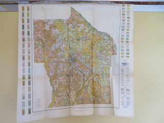
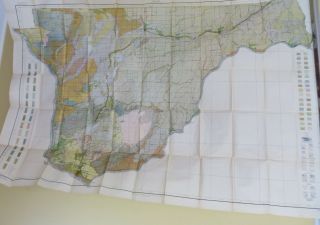
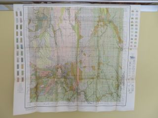
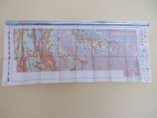
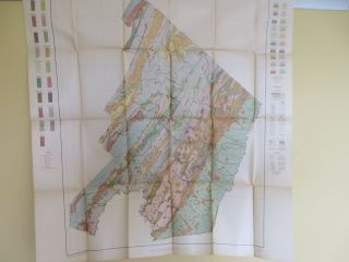
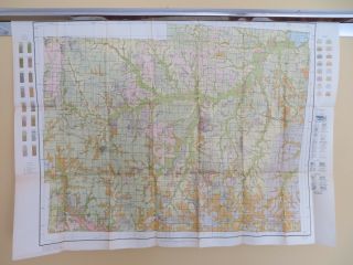
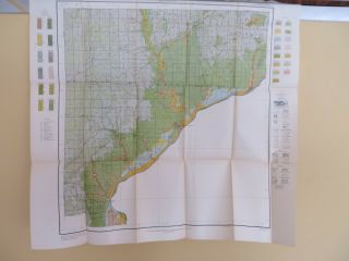
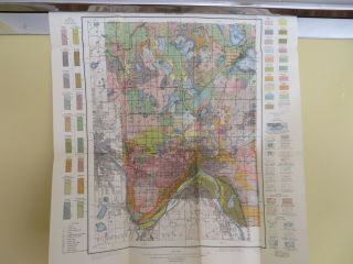
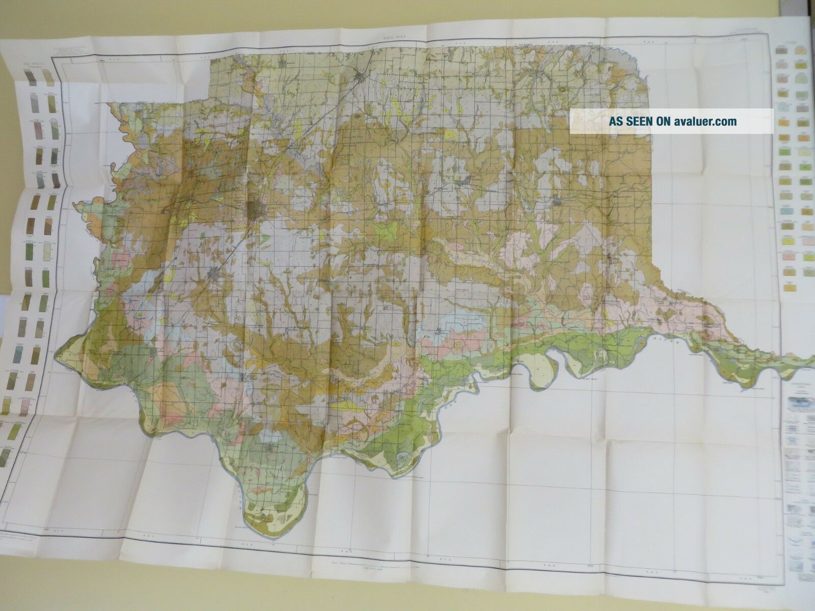
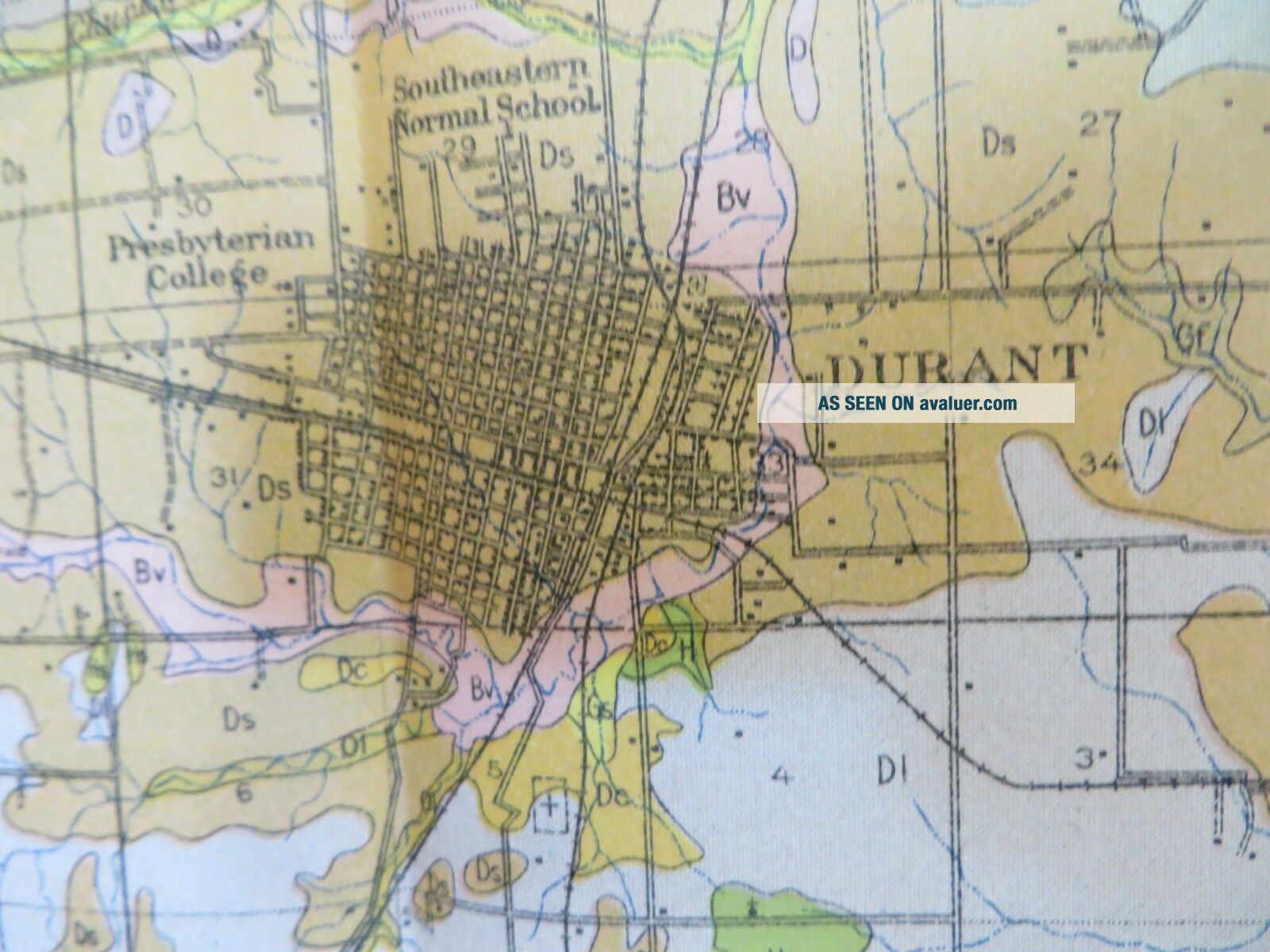
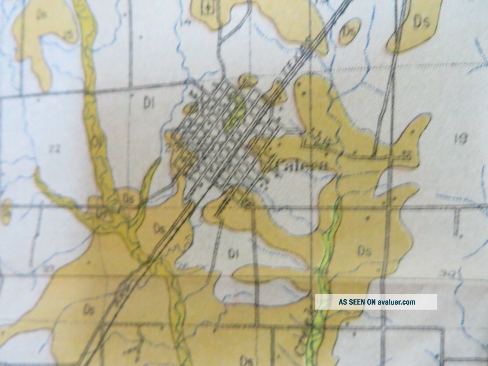
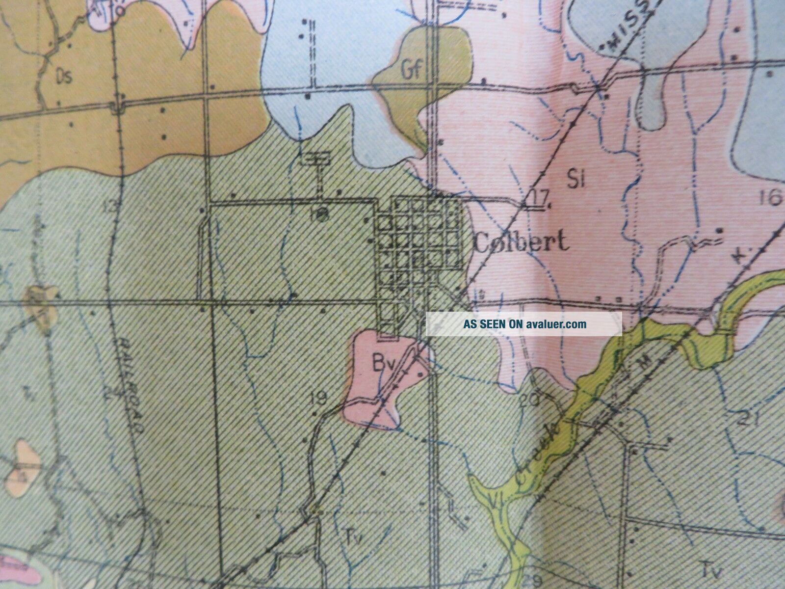
1914 Antique Map Oklahoma Bryan County Durant Kenefic Bokchito 53 X 35 " 8874


Item History & Price

Information:
Reference Number: Avaluer:1248400Topic: Antiques
Format: Sheet MapPublication Year: 1914
Type: Soil MapMaker: US Dept of Agriculture
Year: 1914Features: Antique
US State: OklahomaOriginal/Reproduction: Original
Country/Region: United States of America
Original Description:
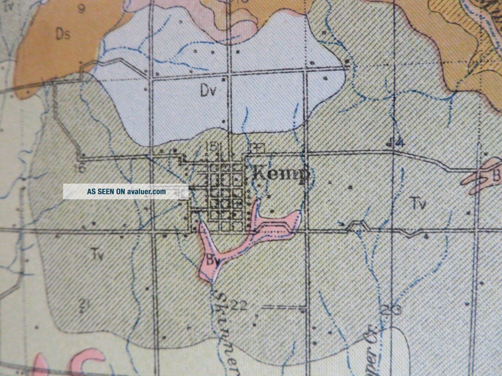
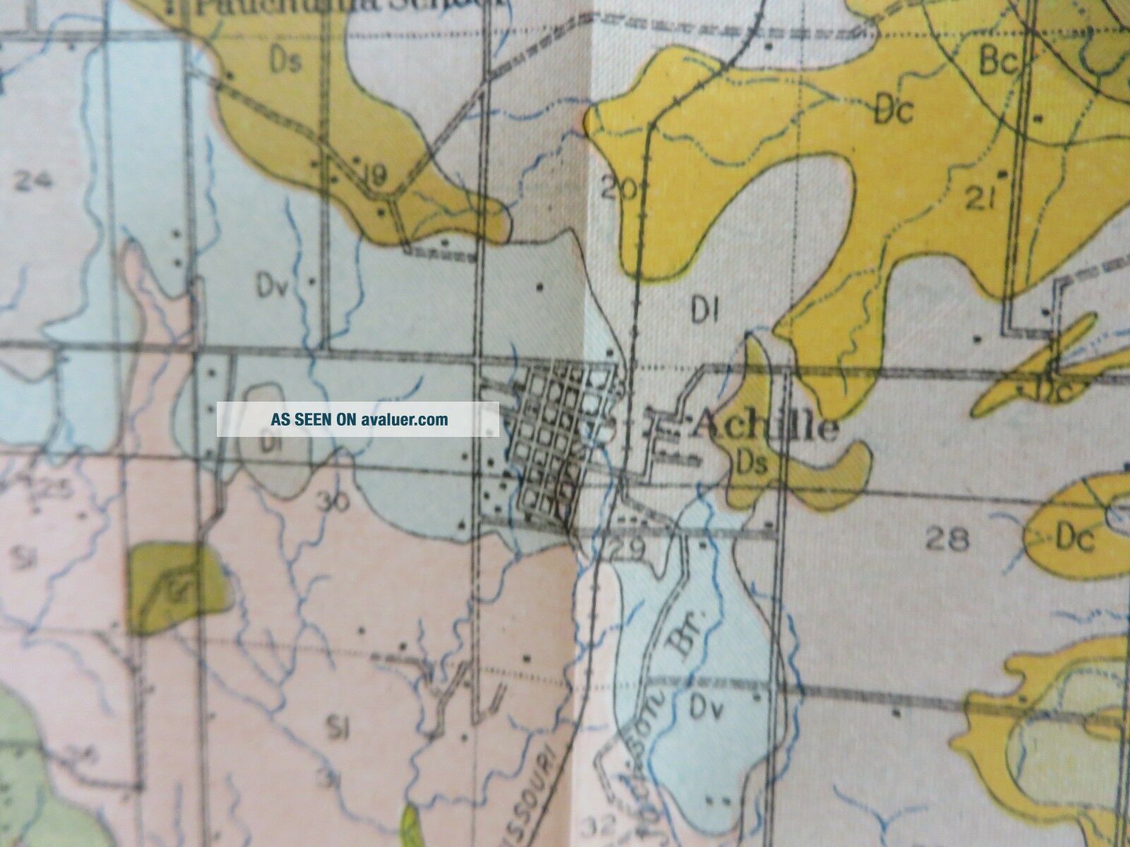
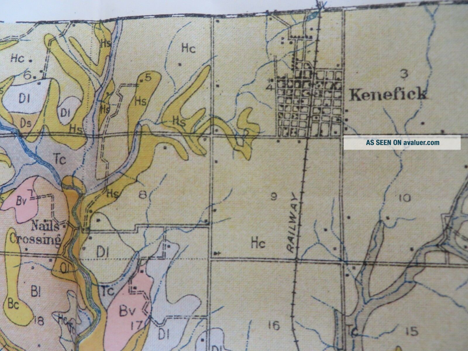
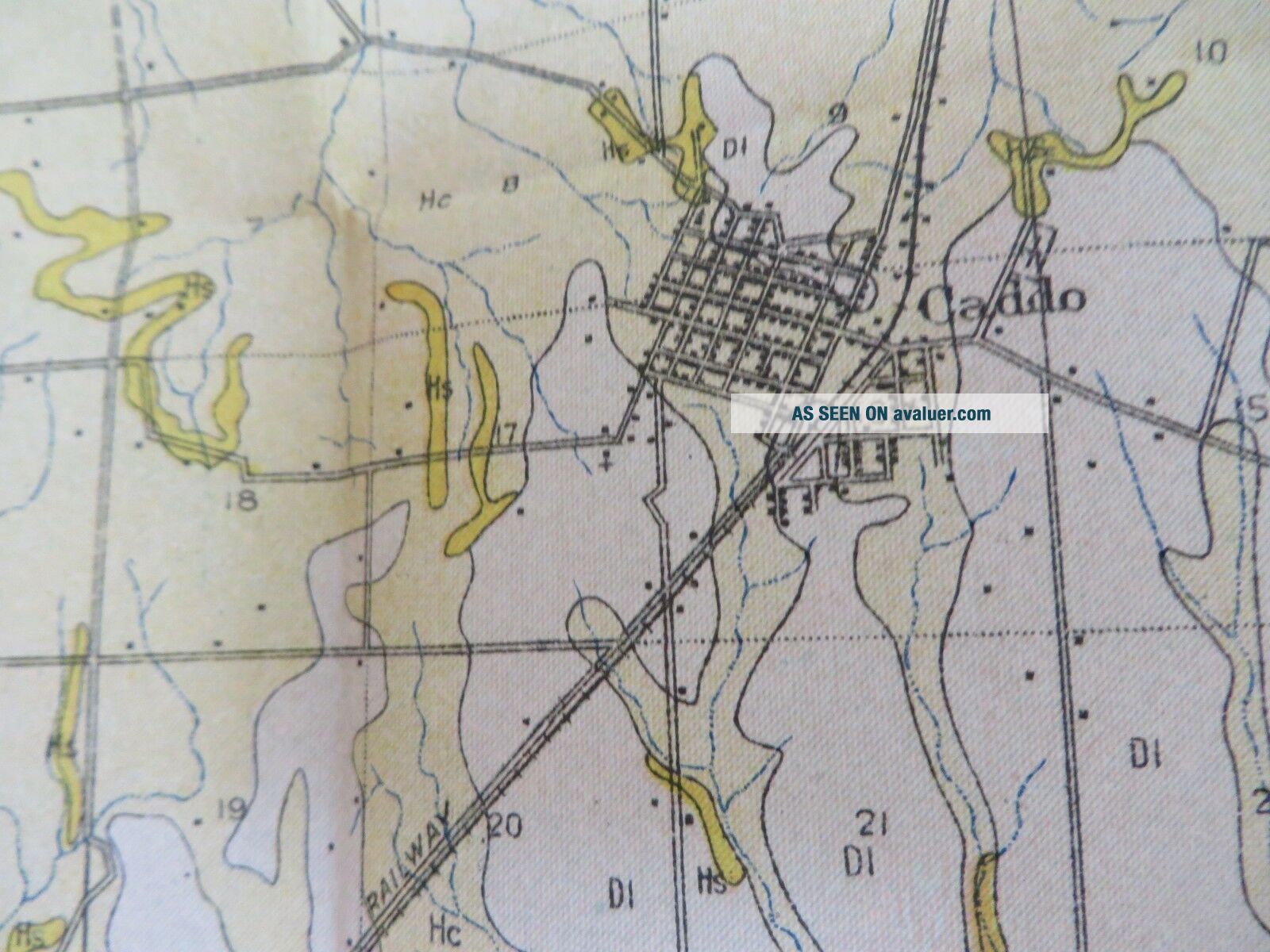
ANTIQUE MAPUS Department of Agriculture Bureau of SoilsOriginal Soil Map dated 1914Suitable for framingMeasures approximately 53.5" wide 35.5" height including marginsFolded measures approx 9" X 5 3/4"Oklahoma - Bryan County  Includes:DurantColbertKempAchilleKeneficCaddoBokchitoBennington+ MoreShips in a rigid photo mailerSoil Survey Map is over 100 years old - Paper shows yellowing/foxing consistent with age, may have some minor crease/fold line pin holes or tears, some... edge or margin tears possible.  Please review pictures.


    Similar items


  • 1914 Antique Map Georgia Terrell County Dawson Herod Parrott 26 X 27 " 8839

    1914 Antique Map Georgia Terrell County Dawson Herod Parrott 26 X 27 " 8839

  • 1914 Antique Map Washington Franklin County Connell Pasco Mesa 60 X 40 " 8882

    1914 Antique Map Washington Franklin County Connell Pasco Mesa 60 X 40 " 8882

  • 1914 Antique Map Ohio Trumbull County Warren Newton Falls Hubbard 33 X 30 " 8854

    1914 Antique Map Ohio Trumbull County Warren Newton Falls Hubbard 33 X 30 " 8854

  • 1914 Antique Map Minnesota Pennington County Thief River Falls 47 X 20 " 8861

    1914 Antique Map Minnesota Pennington County Thief River Falls 47 X 20 " 8861

  • 1914 Antique Map Virginia Frederick County Winchester Middletown 32 X 34 " 8827

    1914 Antique Map Virginia Frederick County Winchester Middletown 32 X 34 " 8827

  • 1914 Antique Map Missouri Johnson County Warrensburg Knob Noster 40 X 29 " 8870

    1914 Antique Map Missouri Johnson County Warrensburg Knob Noster 40 X 29 " 8870

  • 1914 Antique Map Indiana Warren County Carbondale Marshfield 29 X 28 " 8858

    1914 Antique Map Indiana Warren County Carbondale Marshfield 29 X 28 " 8858

  • 1914 Antique Map Minnesota Ramsey County Minneapolis Saint Paul 19 X 21 " 8862

    1914 Antique Map Minnesota Ramsey County Minneapolis Saint Paul 19 X 21 " 8862


    • You might also like


    • 1860 Mitchell Hand Colored Map Colorado,  Nebraska & Kansas - Civil War Era

      1860 Mitchell Hand Colored Map Colorado, Nebraska & Kansas - Civil War Era

    • 18th Century French Map Of North America

      18th Century French Map Of North America

    • Las Vegas Nevada Vintage 1967 Us Geological Survey Quadrangle Map 4 Panels

      Las Vegas Nevada Vintage 1967 Us Geological Survey Quadrangle Map 4 Panels

    • Rare Antique 1845 Maps United States Exploring Expedition Book Antartica Hawaii

      Rare Antique 1845 Maps United States Exploring Expedition Book Antartica Hawaii

    • Vintage 1926 Map Hollywood From The Best Surveys Of The Time

      Vintage 1926 Map Hollywood From The Best Surveys Of The Time

    • American Continent (western Hemisphere) 1747 Bowen Antique Copper Engraved Map

      American Continent (western Hemisphere) 1747 Bowen Antique Copper Engraved Map

    • Gulf Coast Florida Texas United States 1705 De Fer Unusual Antique Engraved Map

      Gulf Coast Florida Texas United States 1705 De Fer Unusual Antique Engraved Map

    • California As Island United States 1700 De Fer Unusual First Edition Antique Map

      California As Island United States 1700 De Fer Unusual First Edition Antique Map

Avaluer          About Us          Privacy Policy          Contact Us          UP
© 2022, avaluer.net, Inc. or its affiliates