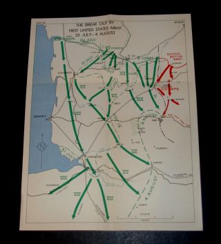
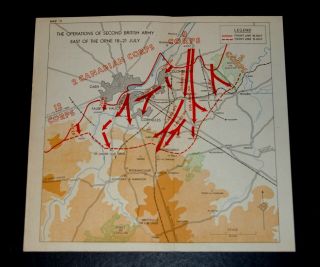
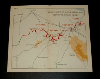
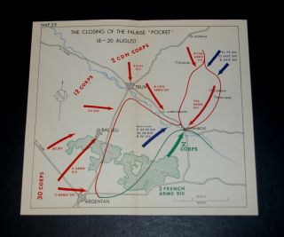
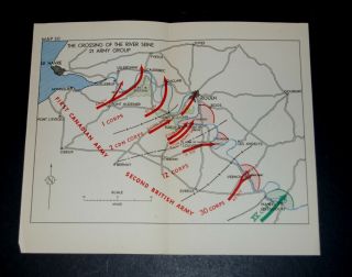
WW2 D - Day Invasion Map Of BRITISH & CANADIAN OPERATIONS 28 July - 4 Aug. 1944


Item History & Price

Information:
Reference Number: Avaluer:1249290Cartographer/Publisher: War Office
Year: 1943Original/Reproduction: Vintage Original
City: CaenFormat: Military Map
Country/Region: FranceType: Nautical Map
Era: 1940s
Original Description:
WW2 D-Day Invasion Map of BRITISH AND CANADIAN OPERATIONS 28 JULY-4 AUGUST 1944Second Army regrouped with creditable speed, and it was found possible to commence the thrust southwards from the Caumont area on 30 July 1944.Map in good condition, folded.  Scale: 1 cm for 1.25 miles.  Overall size 26.0(w) x 21.0(h) cms. Ref: M21Thisis a genuine map and not a copy, facsimile or computer generated image.Please see my other auctions/sales for similar.   PAYPAL only.&...nbsp; UK P&P £1.30.  Combined postage available.
    

00022


    Similar items


  • Ww2 D - Day Invasion Map Of Break Out By First United States Army 25/7 - 4/8 1944

    Ww2 D - Day Invasion Map Of Break Out By First United States Army 25/7 - 4/8 1944

  • Ww2 D - Day Invasion Map Of The Battle Of The Rhine 9 March 1945

    Ww2 D - Day Invasion Map Of The Battle Of The Rhine 9 March 1945

  • Ww2 D - Day Invasion Map Of Operations To Clear Scheldt Estuary & Sw Holland 1944

    Ww2 D - Day Invasion Map Of Operations To Clear Scheldt Estuary & Sw Holland 1944

  • Ww2 D - Day Invasion Map Of Advance To Meuse & Rhine,  Battle Of Arnhem 14/9/1944

    Ww2 D - Day Invasion Map Of Advance To Meuse & Rhine, Battle Of Arnhem 14/9/1944

  • Ww2 D - Day Invasion Map Operations Of 2nd British Army W.  Of Orne 18 - 21 July 1944

    Ww2 D - Day Invasion Map Operations Of 2nd British Army W. Of Orne 18 - 21 July 1944

  • Ww2 D - Day Invasion Map Operations Of 2nd British Army W.  Of Orne 10 - 18 July 1944

    Ww2 D - Day Invasion Map Operations Of 2nd British Army W. Of Orne 10 - 18 July 1944

  • Ww2 D - Day Overlord Map Of Closing Of The Falaise " Pocket " 18 - 20 Aug 1944 France

    Ww2 D - Day Overlord Map Of Closing Of The Falaise " Pocket " 18 - 20 Aug 1944 France

  • Ww2 D - Day Overlord Map Of The Crossing Of River Seine 21 Army Group 25 Aug 1944

    Ww2 D - Day Overlord Map Of The Crossing Of River Seine 21 Army Group 25 Aug 1944


    • You might also like


    • Hungary & Romania 1579 (1584) Ortelius Unusual Antique Copper Engraved Map

      Hungary & Romania 1579 (1584) Ortelius Unusual Antique Copper Engraved Map

    • Brussels Bruxelles Belfium 1777 De Ferraris & Dupuis Large Antique Map Sheet Xxi

      Brussels Bruxelles Belfium 1777 De Ferraris & Dupuis Large Antique Map Sheet Xxi

    • 1616 Atlas Map Of Iceland.

      1616 Atlas Map Of Iceland.

    • Kazan Russia 1767 Le Clerc/lespinasse Antique Copper Engraved City View

      Kazan Russia 1767 Le Clerc/lespinasse Antique Copper Engraved City View

    • 1899 Stanford,  Folding Map Of Norwich,  Norfolk,  Arthur Collins,  Jarrold & Sons,

      1899 Stanford, Folding Map Of Norwich, Norfolk, Arthur Collins, Jarrold & Sons,

    • 1948 Vintage Linen Colour Map Geological Survey Ten Mile Of Great Britain

      1948 Vintage Linen Colour Map Geological Survey Ten Mile Of Great Britain

    • 1944 Map Flying Bombs Sussex Ww2 Newspaper Military Kent Courier German V1 V2

      1944 Map Flying Bombs Sussex Ww2 Newspaper Military Kent Courier German V1 V2

    • Dated 1638 Vellum Map Of Icklesham Sussex Showing Land Uses Owners Etc

      Dated 1638 Vellum Map Of Icklesham Sussex Showing Land Uses Owners Etc

Avaluer          About Us          Privacy Policy          Contact Us          UP
© 2022, avaluer.net, Inc. or its affiliates