SOLENT - SOUTHAMPTON - PORTSMOUTH:ISLE OF WIGHT - HANTS - WAR DECADE ORDNANCE MAP 1945 - 7
Item History & Price
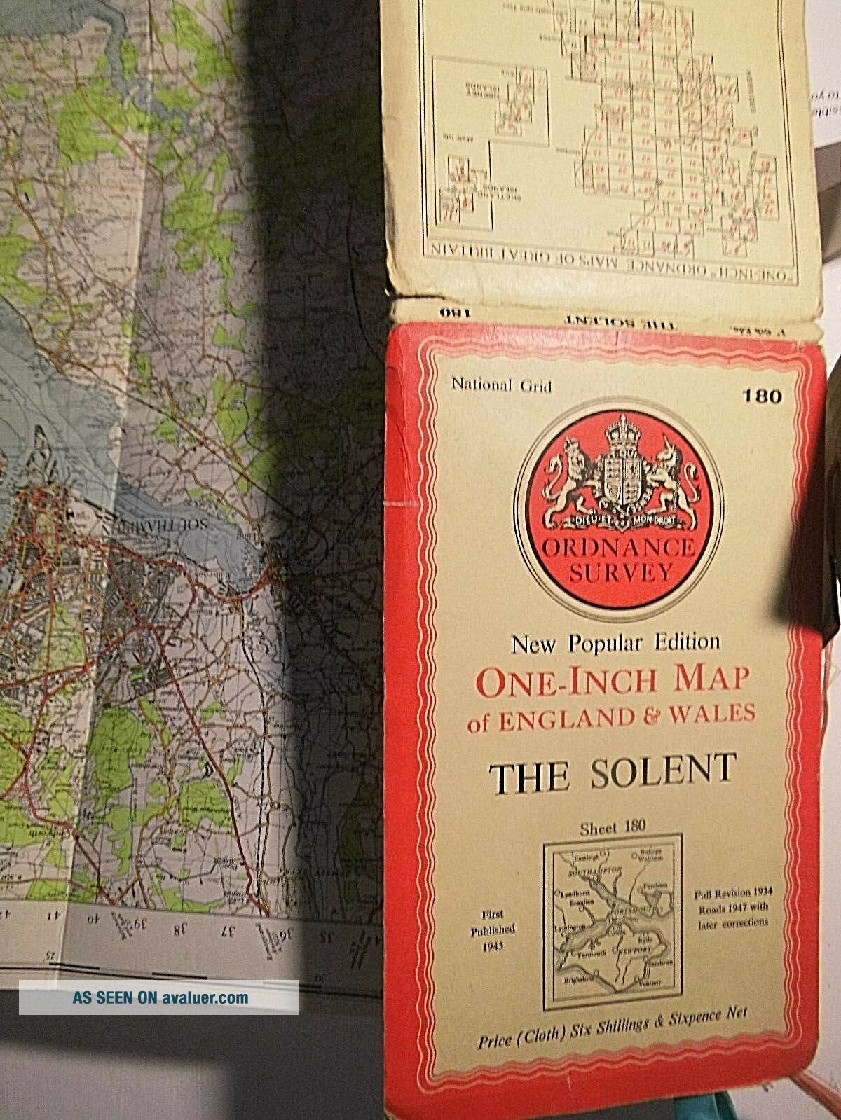
VINTAGEMAP- SOLD FOR £11 ONLY- NO AUCTION- NO POSTAGE FEE FOR 2ND CLASS UK.seller’scode:071220183Hereis the Series Six (1920's-1940's series ) 1 inch surveyTitle:THESOLENT 180
Showing
Surveyrevision and publication:1934-1945- 1947(Theprint code is “H”, I am not sure that I have seen a Code “H”Ordnance map before)
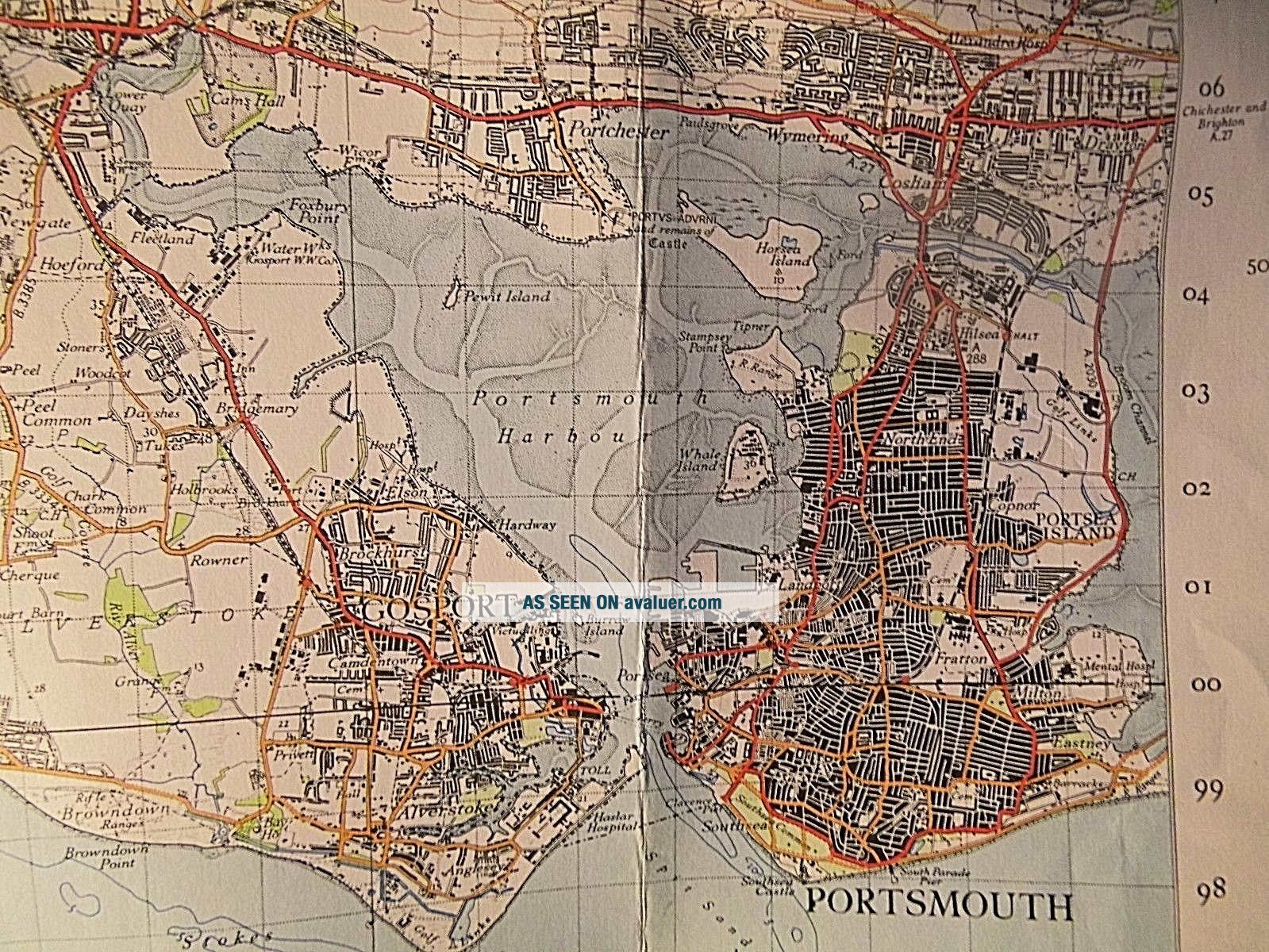
DESCRIPTIONOF THIS MAP:Hereis the War decade map of the Solent, Southampton. Portsmouth and theIsle of Wight. It is a redacted map and ...airfields and Royal Navalstations are hidden.Thereis one aspect of this map which is of particular interest and perhapsunique. In Portsmouth, near the Royal navy Docks which is called HMSVictory there are a number of terraced streets marked as black: theseare old streets and cut a swathe across South West Portsea from theDocks towards Southsea Common. I think it likely that this shows bombdamage: lost streets. Perhaps 21 streets are so marked.Asto the redacted HMS Victory: I don’t really understand why this wasdone. The dockyard is marked as a bright white block: so if you are aLuftwaffe navigator: here, like a beacon, is the target. Also thatdockyard which is centuries old, was marked on any pre 1939 Ordnancemap and I am sure German authorities had access to those. TheAirfields of the RAF and RNAS are also not marked but an exception isEastleigh (Southampton) airport: perhaps because it was alwayscivilian.Onthe other hand Army barracks and camps are not redacted generally.Coweson the Isle of Wight was also a navy Port in this 2nd Warand was the home base of the Free French Navy. Warships were alsobuilt at East Cowes and the chain ferry is seen crossing the Medinabetween the two halves of the town.Gosportwas a submarine base and training station and the Hospital there isnamed as Haslar Hospital, so the only change here is that the letters“RN” have been dropped from it name. Two ferries serve Gosport onthis map and the Bridge across the Harbour seaward of Alverstoke istolled. Bombdamage is rare on an OS map because Series 6 was surveyed in the1930s (too early), and Series 7 was surveyed 1946-1954 (too late).
THEISLE OF WIGHT IN THE WARItwill be noticed that no ferry routes are marked on this redacted map. The island was a secure zone and travel on and off it was not freeduring the war years. Generally the island was served from Portsmouthto Ryde, Lymington serves Yarmouth and Southampton served Fishbourneor Wootton Creek.Onolder maps a paddle steamer route is seen from one seaside town tothe next round the Isle of Wight: Sandown, Shanklin and Ventnor havepaddle steamer piers. I don’t know when paddle steamers ended here.At Southend-Margate it was 1954, in the Bristol Channel it was asimilar date.
Onold Bartholomew maps of circa 1890-1900, a railway tunnel is seenfrom Lymington to Yarmouth: this project by a local rail company andthe LSWR did not come to anything and the Ordnance Survey did notspeculate about future infrastructure.
SEALEVELS AND THE ISLANDTheMilitary Road is important seen here 1934-1947. Since this map partsof it have fallen onto the beach and that coast retreats quitequickly. Very severe erosion is also seen near Bonchurch and CulverCliff. Chale Bay erodes quickly and the tourist facilities atBlackgang chine retreat yearly.Thecauses were two fold. One is land sinkage, which is the corollary ofIsostatic Rebound in the north of Britain. That rebound is caused bythe land adjusting following the disappearance of the Ice Sheets. Theloss to sea level rise is better seen in the Western Solent and theCoast about Lymington retreats. Ancient forests and ancient sites canbe seen on neap tides in this waterway.Theother cause of erosion is geological. The Upper Cretaceous chalk andthe Greensand of the south of the Island sits on a clay bed. Thisclay is locally called Blue Slipper. It is unstable and crumbles incontact with seawater. I think it is probably synonymous with GaultClay, that Lower Cretaceous stratum which always is found parallel tothe edge of a chalk ridge. Gault is old and was laid down as a deepsea floor. It is almost devoid of life or fossils.Avery good example of Gault and Greensand coastal erosion is also seenat Equihen Plage on the other side of the Channel. Sealevel rise might now be being caused by Global warming: so there arethree drivers of coastal erosion here: Gault, Isostatic Rebound andgeneral sea level rise. Today general sea level rise is 3.2mm peryear which is roughly 1 ft every 90 years if the rate does not change.It is interesting that predictive sea level maps put Culver Cliff and Foreland with Bembridge as an island remote from the main body of the Isle of Wight, following the flooding of the Eastern Yar valley from Brading Harbour to Sandown.
SALTMARSH.Itis an interesting aspect of this geology that sea level rise does notnecessarily mean land loss. In some places, such as Barnstaple Bay, ahigher tide allows gyr material or drift to be deposited at higherlevels: so burrows systems can grow with sea level rise. On this mapsalt marsh is a phenomenon which is sedimentary and organic and thatadjusts to the high tide level. There is a possibility that it wouldlargely cope with sea level rise by simply establishing a new level.There are, therefore, two examples on this map, where land lost wouldbe an automatic corollary of sea-level rise.
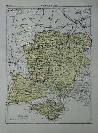
THESOLENTThehills of the Isle of Wight are essentially an arm of the PurbeckHills which have been severed at the west end: Submarine contoursshow that the West Solent is not a long established river bed.TheSolent was a river and is now a ria (sunken river inundated by sea). Spithead was the mouth of thatriver. Beaulieu Creek and the Medina must have been tributaries of theSolent River before the Western Solent came into being.Ptolemythe Greek Egyptian who drew the first map of Britain, called thisisland Vectis Nessos and “Wight” is a Saxon version of Vectis:much loser to that original that it might seem for Latin pronounced“V” as “W”.Onthis map of 1945-47 the Flying Boat Base at Calshot is marked: Iwonder why that was not redacted?
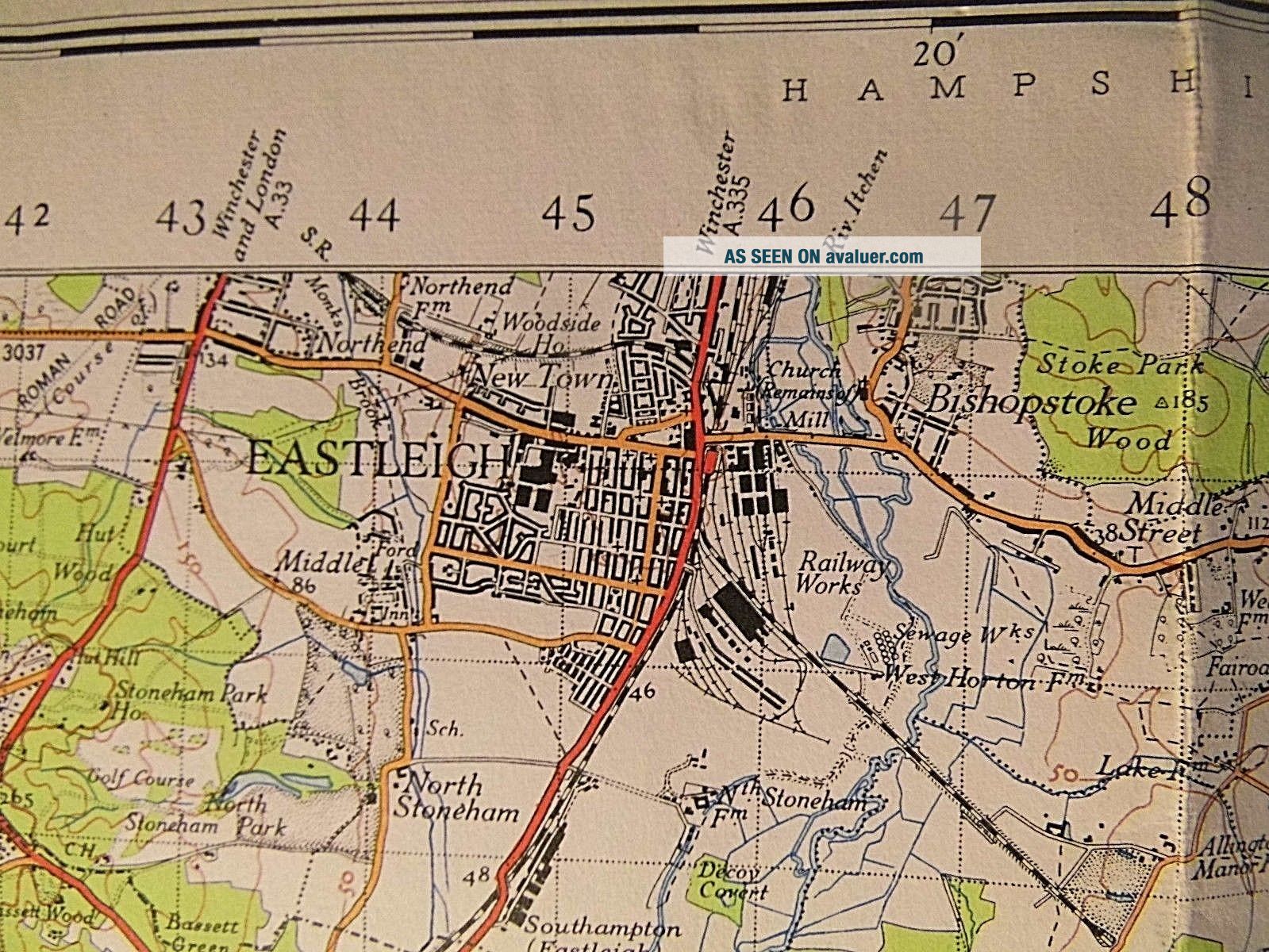
WARPERIOD RAILWAYSWestCowes is served from Newport. The station at Cowes opened in 1869 andclosed partly in 1962 and completely in 1966.Newportto Freshwater via Yarmouth is also lost.Freshwater station openedin stages 1888-1889 and closed early in 1954- so that is only sixyears after the print date here.Rydeto Newport is also lost, as is the Bembridge Branch, but trains stillrun on the line from Ryde Pier to Shanklin. Part of a closed lineis now operated by the Isle of Wight Steam Railway.Onthis map of 1934-45 the railway to Steephill at West Ventnor fromMerstone is already closed. Old stations are still shown on it atGodshill, Whitwell, St Lawrence and West Ventnor. Thus, railways wereclosing before the Beeching era and, in the case of this map, beforethe network became British Railways and a nationalised system in1948.TheSouthern Railway, seen here, came into being in 1923 mainly as anamalgamation of the LSWR, LB&SCR and SE&CR. The major railwayworks seen on this map at Eastleight were inherited in 1923 from theLSWR
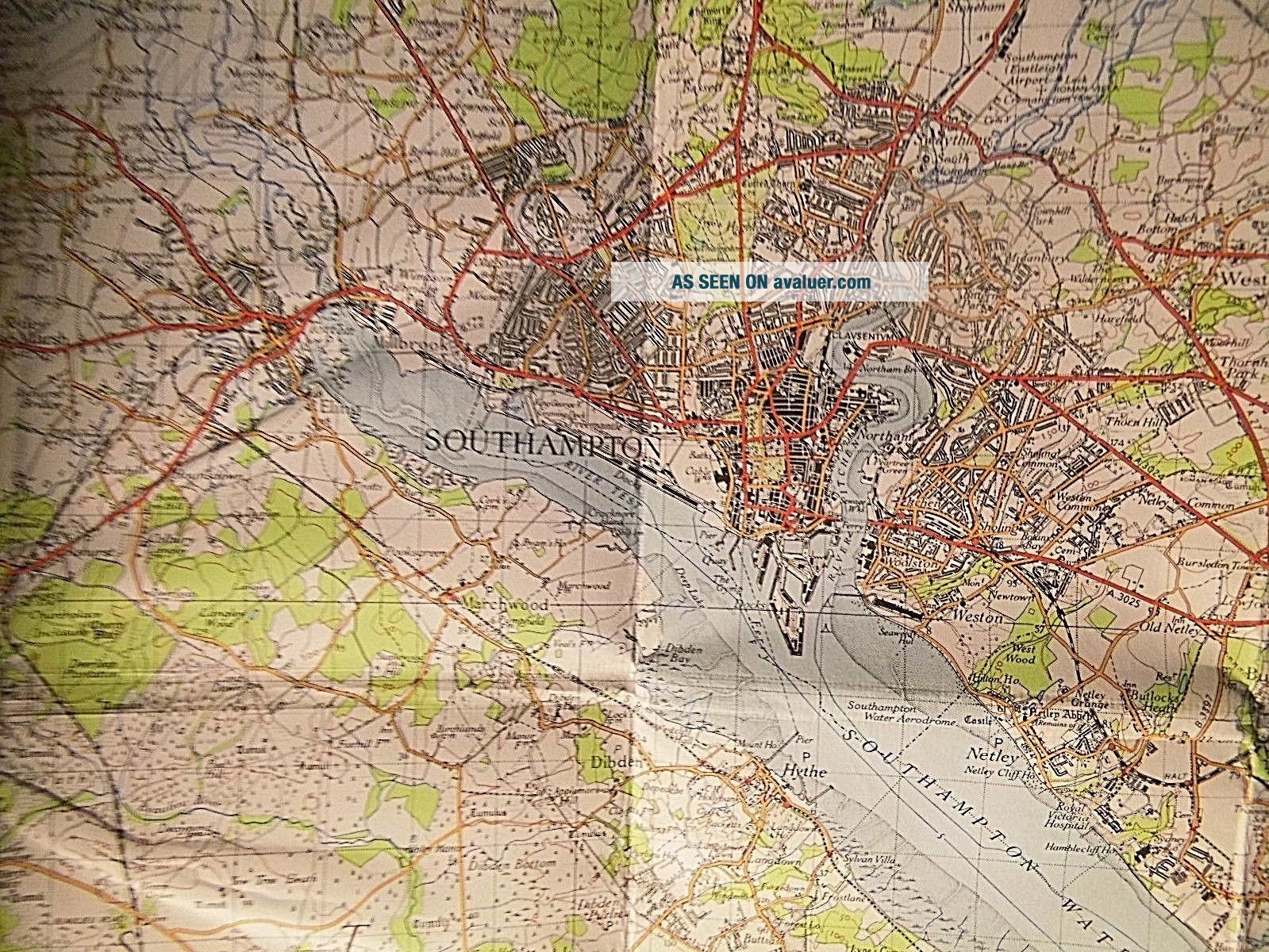
SOUTHAMPTONAND THE WAR57air-raids were made by the Luftwaffe on Southampton.110people were killed by the raids of the Supermarine Factory. There wasa factory at Woolston just east of the Itchen and another was on theFawley line across Southampton Water.Theworst raid on Southampton was December 1940.Airraids were over by 1942 but some V1 flying bomb attacks were laterthan hat in the war. 44 thousand buildings were damaged in the city.Amongst those were the offices of the Ordnance Survey, and in thatraid the OS lost its masters for this Series 6. They also lost themasters for all the tourist maps with the exception of “The LakeDistrict”.Theconsequence of the loss of the preparation for Series 6 was that whenthis series did appear 1940-1945 it fell back on the survey work ofSeries 5: that is the blue covered Ellis Martin illustrated maps ofthe 1930’s. There was a fault with those maps which is still seenhere: the urban areas, the conurbations, are mapped in opaquelithographic black. And the consequence of that is that importantbuildings such as town halls, hospitals and cathedrals cannot easilybe seen. When Series 7 maps appeared in c.1950+ the urban areas weregrey and the major building again emerged clearly in black. Itis possible that that Series 7 Ordnance Survey was the lost butintended Series 6. British cartography lost a whole generation due tothe Luftwaffe rails of Southampton.
MAPSTATS:OLDMAPSHOP.CO.UK IS MY SOURCE ON-LINE FOR MAP & CARTOGRAPHIC HISTORY
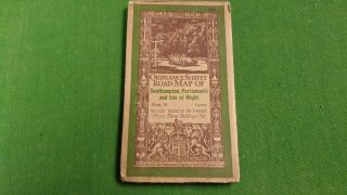
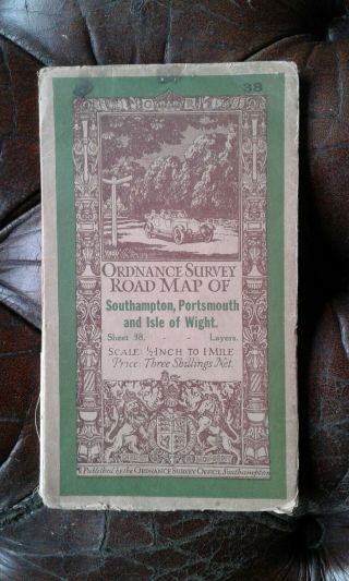
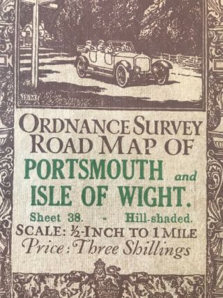
TITLE: THESOLENT 180DATES: 1934-1945-1947PUBLISHER:Ordnance Survey of England and WalesEDITION: 1inch Series 6PRINTER: OrdnanceSurvey, SouthamptonPRINTINGCODE: HPRINTINGPROCESS: HelioZincograph SCALE:1 inch to the mile GRID:1 and 10 km grid from the 00 datum of South East Cornwall OVERALLDIMENSIONS:Roughly 7 inches by 32 inches. COVERDIMENSIONS:8 ½ inches by 5 inches COVERDETAIL:hinged : card, buff, red with black lettering cartouche map and RoyalArms – back cover shows index map of the series COVERCONDITION: edgenicks and some wear MAPPAPER OR LINEN BACKED: bestlinenFOLDWEAR: minimal PINHOLES AT FOLD JUNCTIONS: minor VERSO:Plain linenFOXING: no REINFORCING:no , SURFACEMARKING:minimal FOLDEDINTO:24 sections ANNOTATION: notseen INTEREST:considerable: Old Railways of Isleof Wight andHampshire:particularlyold railways of Isle of Wight. Geology of Solent and Isle of Wight.War time Portsmouth and Southampton. Eastleigh Railway Works. TheSouthern Railway just before the establishment of BR.
GENERALCONDITION: Good , COVERHAS SOME WEARTHENORTH WEST CORNER OF THIS MAP IS AT: WestwellowTHENORTH EAST CORNER OF THIS MAP IS AT: Leydenea House near HambledonTHESOUTH EAST CORNER OF THIS MAP IS AT: Seaoff Dunose Head, Bonchurch or VentnorTHESOUTH WEST OF THIS MAP IS AT: Seadue south of the NeedlesTHECENTRE OF THIS MAP IS AT: GurnardBay, West Cowes
THESOUTH WEST CORNER OF THIS MAP IS: 75 km NORTHOF NG 00 DATUM AND: 428 km EASTOF NG 00 DATUM (which is off South West Cornwall)
GENERALNOTES ON SERIES 6 MAPSTheSixth Edition was essentially the War Survey, from a revised surveyprior to the War and published in the war or the first year of thePeace- earlier than any Post War survey would have been possible.Thestandard dates were 1930 revision -1946 editionTheearliest and latest dates were about1928revision- 1948 publication.Somewere published in the War : 1940+. These must have been restrictedInthis series, RAF and RNAS airfield from the 2nd World War wereredacted.PROJECTIONSeries6 maps used an adapted Mercator projection- probably the Transversemodel or Secant model which defined two true latitudes roughly at thetropics rather than the equatorial base latitude of the standardMercator. This had the effect of minimising the distortion which-at this latitude, would have been significant on a Standard MercatorProjectionRAILWAYSThiswas the last survey to show the full Pre-British Railways' network, with the Old Company named written by the lines. The country wascovered by the Southern Railway, London & North Eastern Railway, Great Western Railway, and London Midland and Scottish Railways. Somesmaller railways remained, notably “Lancashire and Cheshire Lines”, “Midland and Great Northern Joint Railway”, “Norfolk andSuffolk Joint Committee Railway”.Herewas the last survey to definitely show all the branch railways of thedistrict open, prior to the mass closures of the 1950's- 1960's.Series6 maps named roads with their MOT numbers for the first time on 1inch maps.Thiswas the last survey to always show Britain before any motorways werebuilt.CARTOGRAPHYSeries6 maps tended to be about 27 inches by 31 inches.Coverswere 8 ¼ inches by 5 inches. Some early ones are shorter and foldthe bottom margin in-to accommodate the same sized sheet.Themaps were lithographed sometimes from engraved masters. It is saidthat South of Birmingham the masters were already Lithographic, butnorth of that latitude the masters were still electrotypedTherewere 190 maps in the Series, numbered north to south. No 1 wasShetland; No 190 was Truro.InSeries 6 Scottish Maps were still separate from English and Welsh andhas different covers- Both were called “1 Inch New Popular Edition”GRIDSAND DATUMSeries6 introduced the National Grid of 1 and 10 kilometre square- Point“00” onthegrid was located off South West of Cornwall.Thescale is expressed as 1 inch or 1:63, 360Thedatum for measurements of altitude is not stated except as “MeanSea Level” but since 1915 this was LWMMT at the Tidal Observatory, Newlyn, Cornwall.There-levelling to the new datum at Newlyn LWMMT from the old datum atLiverpool LWMMT was slow, often c 1932 so it is possible this seriesmight use the old Liverpool datum. I have noticed that in some places(Mid Kent for example) the re-levelling to Newlyn added about 4 ft tothe old figures. In other places this seems not to be the case and ina few- the old Liverpool datum heights are greater- thesediscrepancies are unexplained. There is an interesting not on some OSseries 6 maps stating that the the 100 ft contours are surveyed- sopresumably the 50 ft interim contours are interpolated or guessed.Series6 did not revise using Aerial Photography, but the War heralded thisform of cartography for Series 7.COVERSOriginalSeries 6 covers were vermilion and off-white with red and blacklettering, the Royal Arms marked GR, the edition number was at topright and on the front cover was a cartouche map.Thecover aesthetic was almost Edwardian and quite unlike that of Series7 maps. OS did not use gloss covers then.Alleditions cited revision and publication dates on the cover.Thecovers of Series 6 maps hinged in the English and Welsh series;Scottish maps had floating covers.RAILWAYSTheRailways of Series 6 maps are the Company Railways following theamalgamations of the 1920's. These created the G.W.R., L.&N.E.R., L.M. & S.R. And the Southern Railway. Some smallersystems survived- notable Cheshire Lines near Merseyside, the Midland& Great Northern Joint Railway in East Anglia and the Norfolk andSuffolk Joint Committee Railway in those counties.HYDROGRAPHYSeriesSix maps do not show Admiralty soundings , as earlier terrestrialOrdnance 1” maps did. But the shallows and tidal flats are shown ingreat detail in a grey stipple- and the major tidal flats are named.The marine contours of a Series 6 map are 5 and 10 fathoms. Note thatinland waters are measured in feet not fathoms (if measured at all).Bathymetric surveys can be quite old- 1870's-1900's and are not oftenrepeated. Some inland waters are cited with a height above sea levelat the water surface. I assume fathoms are measured from the samedatum as land altitude: LWMMT Liverpool or Newlyn, but that is aguess. A fathom is 6 ft so the two contours on a Series 6 OS mapequate to 30 ft and 60 ft sea depth. A shallow water which can bemeasured by plumb line is “sounding”. “Beyond Sounding” isdeeper than 100 fathoms. Interestingly, burial at sea has to be atleast 6 fathoms: called “Deep Six”. Technically a fathom is1/1000 of an Imperial Nautical or Sea Mile, which is a little morethan 6 ft.TOWNS1”OS maps do not show bomb or war damage- there was no new survey workbetween the Pre war revision date and the publication date. Theremight be a couple of exceptions to the above rule, one might bePortsmouth. One has to fine 25” or 50” surveys- used by the LandRegistry and Planners before the word “ruin” is seen onbuildings, plots and parcels of land. Notice how the blocks ofbuildings are now represented with an opaque black blocking- This isthe first full lithographic series – Previous editions of the 1”survey used hatching on urban areas, as is necessary withelectrotype. The aesthetic result is that this Series 6 seems bolder, darker and broader lined. The electrotypes were light, high key andthin lined. This use of black for urban areas was short lived andsomewhat problematic. By the 1950's it had been replaced withlithographic grey in which individual buildings such as town hallsand churches could again be differentiated, in black, from thegeneral urban shading.................