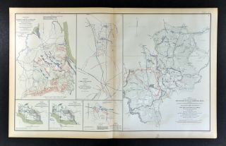
Civil War Map Battle Of Gettysburg July 2, 3:30 PM Pickett ' S Charge Pennsylvania

Item History & Price

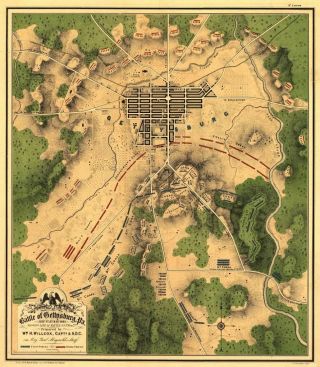
24x36 Vintage Civil War Map Battle Of Gettysburg Pennsylvania 1863
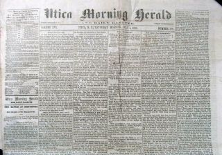
1863 Civil War Newspaper – Battle Of Gettysburg – July 4, 1863 Utica Ny
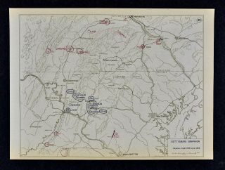
West Point Civil War Map - Battle Of Gettysburg Campaign - Meade & Lee - June 28
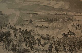
Antique 1880 United States Civil War Print Battle Of Gettysburg W/ Map

Old Army In The Civil War Book Battle Of Gettysburg Chancellorsville Soldier Map
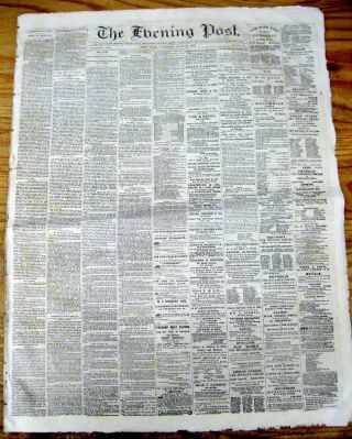
3 1863 Civil War Newspapers Battle Of Gettysburg Begins Confederate Vs Union
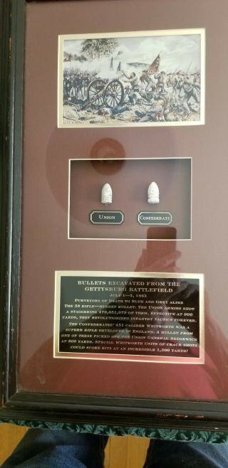
Two Civil War Bullets, Battle Of Gettysburg, Pa
Civil War Map Battle Of Shiloh Harrison ' S Landing Corinth Monterey Tennessee

1860 Mitchell Hand Colored Map Colorado, Nebraska & Kansas - Civil War Era

18th Century French Map Of North America

Las Vegas Nevada Vintage 1967 Us Geological Survey Quadrangle Map 4 Panels

Rare Antique 1845 Maps United States Exploring Expedition Book Antartica Hawaii

Vintage 1926 Map Hollywood From The Best Surveys Of The Time

American Continent (western Hemisphere) 1747 Bowen Antique Copper Engraved Map

Gulf Coast Florida Texas United States 1705 De Fer Unusual Antique Engraved Map

California As Island United States 1700 De Fer Unusual First Edition Antique Map