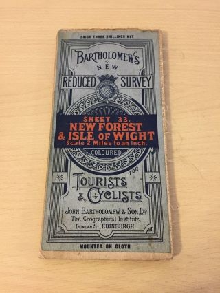
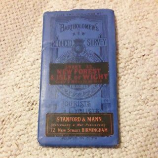
FOREST - ISLE OF WIGHT: BARTHOLOMEW ' S WAR DECADE TOPOGRAPHIC COLOUR MAP 1947
Item History & Price
VINTAGEMAP- SOLD FOR £11 ONLY- NO AUCTION- NO POSTAGE FEE FOR 2ND CLASS UK. SELLER’S CODE: 200220192
“PERSPECTIVESON BRITAIN: TRAVELLING WITH AN ANTIQUE OR VINTAGE MAP”
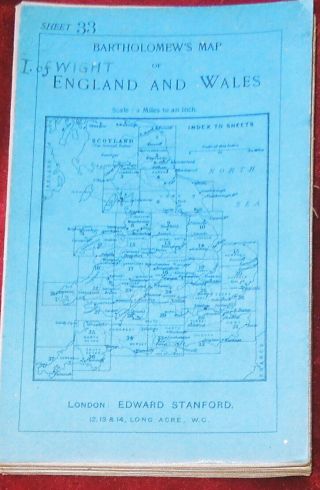
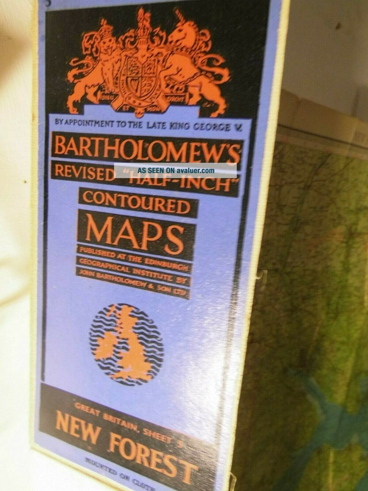
AVINTAGE BARTHOLOMEW’S 1/2” TO THE MILE SHEET MAP IN ATTRACTIVEBOARD COVERS
WARDECADE MAP OF
THENEW FOREST, HAMPSHIRE AND SUSSEX-
THESOUTHERN COAST FROM SWANAGE TO BOGNOR REGIS- AND THE ISLE OF WIGHT
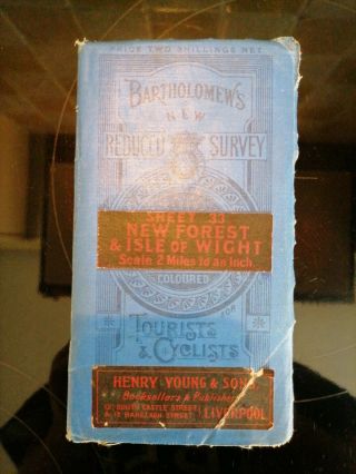
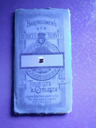
Itdoes not including the RAF and RNAS stations or aerodromes of the 2ndworld war- ...usually marked in bold red and a plane symbol, because itis the War Map and these features are still redacted “BARTHOLOMEWSREVISED HALF INCH CONTOURED MAPS- GREAT BRITAIN NO. 5 - NEW FOREST”
ROYALAPPOINTMENT ARMS AND LEGENDS SAYS: “BYAPPOINTMENT TO THE LATE KING GEORGE V”
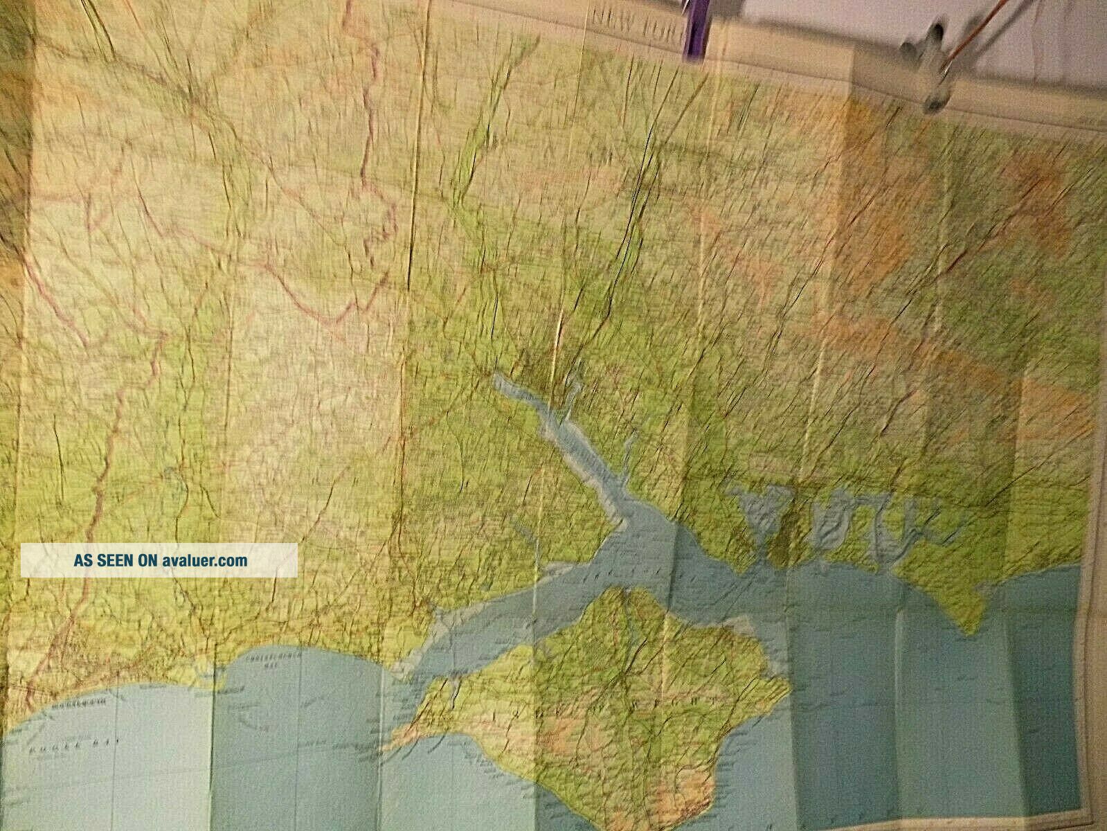
FOLDED SHEET MAP - WITH CARD IN GOODCONDITION, A LINEN BACKED MAPGENERALDESCRIPTION OF THIS MAPInthe War, the Isle of Wight and the New Forest were severelyrestricted sites and travel to and from them was controlled. The Isleof Wight, at Cowes, was the home port of the Free French Navy andsome people suggest that the tradition of onion and garlic growing onthe island was given a boost by the presence of French servicemen.There were several RAF and RNAS stations- both airfields and radar onthe south coast of the the island. The full network of the islandrailways are still in operation including that line west toFreshwater.Onthe mainland a seaplane station is marked at Calshot. The New Forestwas essentially a large army camp but that, with the airfields, isredacted. Redactionis a curious issue on maps: one might ask: How is a facility hidden?Is it just left plain or is false mapping used to hide it? Why aresome barracks and the sea plane station not redacted? Why are otherimportant “targets” such as the railway works of the SR/ LSWR notredacted? In some cases- such as HM dockyards, the large plain whiteareas on OS maps seem to present better bombing targets than themapping would have. Onthis map Bournemouth is still in Hampshire with Canford Cliffs beingin Dorset. Branksome Chine is Dorset. The town was built about 5chines but Boscombe Chine and Branksome Chine are the only two stillnamed here. A chine is a stream running directly to the sea, usuallythrough a wooded gully and often passing over the blue slipper clayof the region which causes massive coastal erosion. It is a work seenon the south coast of the Isle of Wight and also in Eastern Dorsetbut not elsewhere.Herein 1947, ferry routes are again shown and these cross the Yarmouth, Cowes, Fishbourne and Ryde from Portsmouth, Southampton andLymington.Thereis also a coastal route shown which marked the passage of paddlesteamers from Ryde to Cowes andYarmouth. Paddle steamers ran to roughly 1954.Onthe Bartholomew maps of this region, a generation earlier than thismap, a tunnel was marked taking a railway from Lymington to Yarmouth.This project was never built and the LSWR killed it off by pullingout of the project some time in the 1890’s.Itis a difference between Bartholomew and the Ordnance Survey, thatBartholomew, would speculate on future projects, railways etc, whereas the OS did not: so much so that the OS did not mark railways atall until the electrotypes of 1871+.Ferriesare also seen on this map crossing Southampton Water to Hythe andPortsmouth Harbour to Gosport.
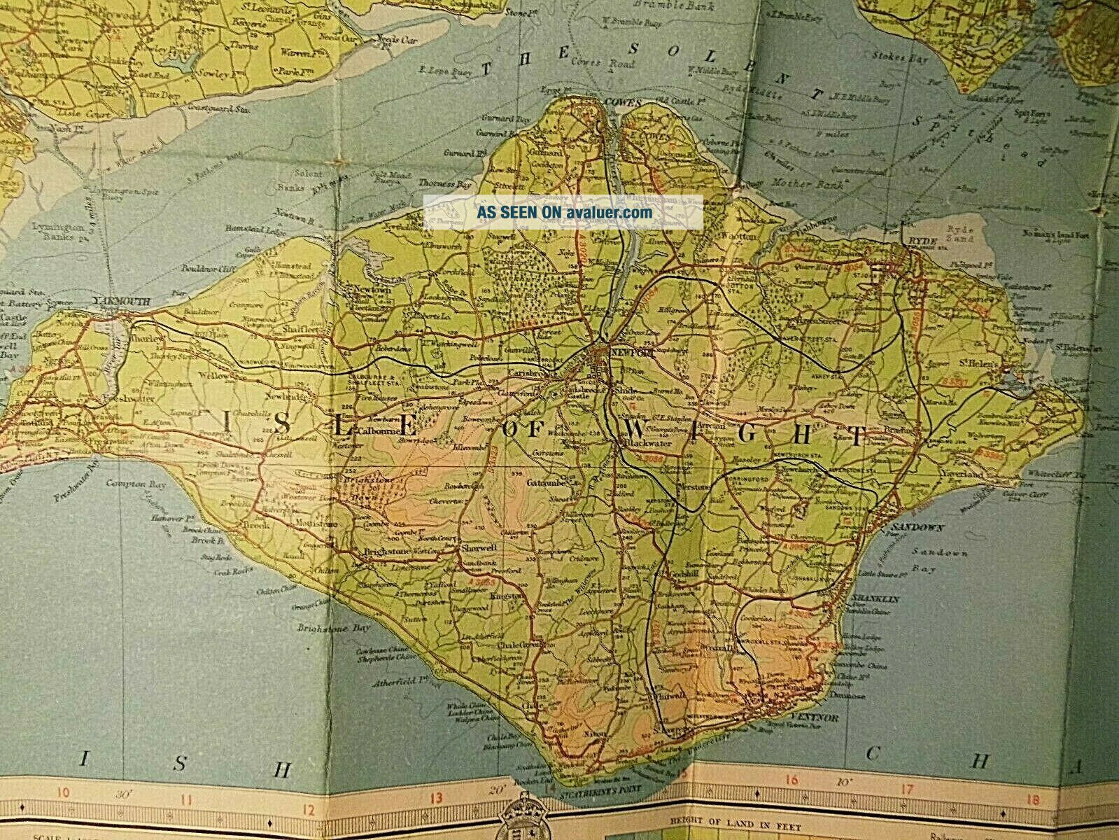
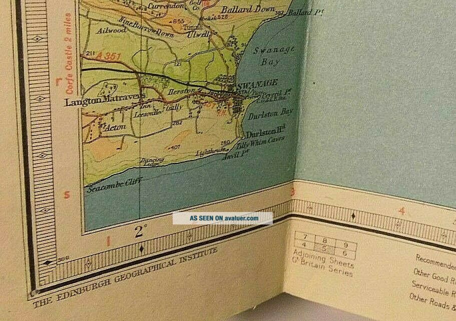
THEISLE OF WIGHT ON THIS MAPThisisland is an eastern range of the Purbeck Hills, which becameisolated when the Western Solent was inundated.TheWestern Solent must once have been just the lower reaches of the Lymington and Beaulieu Rivers. There is a sunken forest in this bodyof tidal water which can be seen on a neep tide. Spithead must havebeen the estuary of the old Solent River.Somewaterways on the map have diminished rather than enlarged: the YarRive once separated Freshwater island from the rest of the Isle ofWight and rises only a few yards from the prom at Freshwater. PaghamHarbour is also a waxing and waning feature in the east of this map.Here it is mapped as a large tidal body of waters, at other timesover the centuries it hardly exists.Anotherinteresting hydrographic feature on this map is the torpedo Range onHorsea island in Portsmouth harbour. It was probably an old featureabandoned by the 2ndwar and so not redacted here.Haylingisland road carries a toll on this map and just west of it extensiveoyster beds are marked.Cowes, the name, refers to two sand banks which used to lie off the Medinaand has Cows on them. They are seen on this map still as submarinecontour shallows. Now this bank has been reconstructed and the townis once again protected by an off-shore bank.EROSIONTheWestern Solent and Isle of Wight erode quickly on their south facingshores. The primary cause is sea level rise and even a map of 1940’sshow considerable differences from that of today: particularly eastof Lymington and along the South Coast Military Road of the Isle ofWight. A secondary cause is the stratum of Blue Slipper Clay whichlies under the more solid geology of the South coast of the Island.This is washed out by tides and the overlying strata collapse. Thenormal geological sequence in Cretaceous landscapes is to have Chalkthen Clunch, the Upper Greensand, then Gault Clay, then LowerGreensand. I assume that the local name “Blue Slipper” issynonymous with Gault Clay- but I am not absolutely sure about that.Chalk is 66 million yearsold at its youngest and the other strata are progressively older –on the normal sequence- after these Cretaceous sequences, one findsJurassic rocks.Theerosion on the Chalk cliffs might be different. Chalk erodes bysaturation and freezing. It then falls away each winter. Thecharacteristic of chalk coast erosion is that a plateau of unerodedchalk is left up to the high tide line, because as soon as the chalkis at sea level, the agent of freezing is no longer present.Thenormal cross section through a chalk hill top to bottom is:aclay and gravel cap which is later and perhaps Quaternary, then flintrich chalk, then pure chalk laid down in deeper seas, then harderchalk: clunch. Of course all these strata of the Cretaceous were laiddown as sea beds. The agent which pushed them up into hills was theAlpine orogeny of 50 million years ago. Itis also interesting that gault is deep ocean deposition not a claylaid down by rivers or estuaries. But a better geologist than I couldsay if Blue Slipper on this map and Gault are actually the samething. The best place to study the erosion of Blue Slipper is justacross the Channel at Equihen Plage cliffs in Pas de Calais.
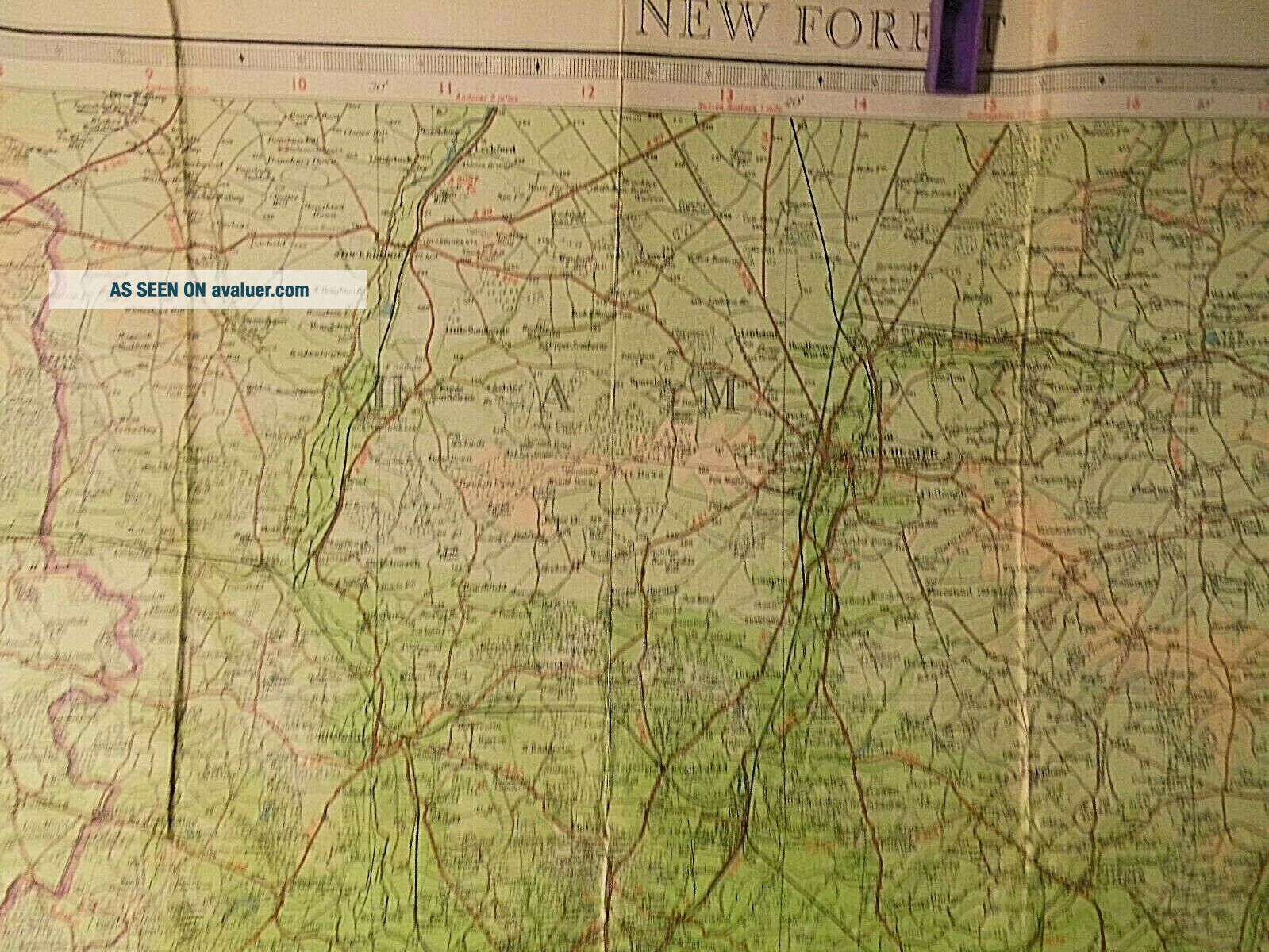
NEWFORESTThisis bordered by Avon River to the west and Southampton Water to theeast. The border to the north is less certain- probably it followedthe old county border between Wiltshire and Hampshire. The map doesnot show the new Forest as a protected area of National park. It iscrossed by a curious railway which contrives to serve neitherBeaulieu nor Lyndhurst but has “Beaulieu Road” and “LyndhurstRoad” stations a considerable distance from either town.TheBeaulieu River is a modern Norman name, and the old name for thismainly tidal “ria” must have been “Exe”- for Exbury stands onits eastern bank.LymingtonRiver seems to do a double loop, etymologically, because presumablyLymington is “Tun of the people of the Limana River” and thenthat town name is reapplied to the stream itself. A similar river tothe east is now called the Rother. The name means “Elm River”Therailwaydown to Fawley was very short lived. It closed post war and is notseen on a map of 1900: It may have served the Supermarine Factory inthat town. This map shows the course of the Schneider Trophy airrace. The Supermarine S5, S6 and SB won it in 1927-1929-and 1931 andthe last two of those races set off from Calshot Spit. The Trophyrace was run from the territory of the previous winner, sothe 1927 race had been held in Venice and the previous English racewas nearby but not the same: having Cowes as its start marker.Onthis map: Potteries are seen in Sloden Inclosure.TheRufus Stone is seen near Upper Canterton, this marks the spot whereWilliam II was shot dead, allegedly a hunting accident.Eaglehurstis near Calshot. Yarmouth and the two yar rivers on the Isle of Wightalso cite eagles: These were probably sea eagles. Iwonder when they died out TheRoman Road near Eaglehurst seems to run to Stone Point, or moreprobably to a Roman port now lost under the waters of the Solent offStone Point.HurstCastle on the Spit and the battery at Cliff End onthe island, essentiallyclose off the Western Solent to enemy shipping: those are Tudordefences.
Ingeneral the 1940’s Forest was wooded in its northern parts andheath land in its southern reaches.Theother, less well known, large forest of this map is the Forest ofBere north of Portsmouth and Emsworth. Part of this region is nowcovered by the Queen Elizabeth Country Park. The nearly Down: ButserHill, at 889 ft is the highest point on the South Downs.
DORSETIN THE WEST OF THIS MAPOnthis map Brownsea Island in Poole Harbour is also called BrankseaIsland. This place was famous for the first camp organised by theScouting Movement. In both cases the real name must be Brownsea orBranksea, because the addition of “Island” is tautological: “ea”means “island”.Itis probable that in this region of the map along, other companies-not the Southern railway- enter this map. Theline down into Poole from the north west was operated by the Somersetand Dorset Joint Railway. Also the GWR had running rights down to thesouth coast- perhaps to Wymouth, Swanage and Southampton.Villageswhich are Hampshire on this map but Dorset today include: Martin, Rockbourne, Breamore, Harbridge, Upper Burgate, St Ives heath, HoldenhurstMuccleshell, Throop. Nearby the map marks “B.O.A.C. Aerodrome”, near Merritown. This wasBritish Overseas Air Corporation and a predecessor of B.A. No doubtthis field is now called Bournemouth Airport. BOACwas formed in 1939 from Imperial Airways and British Airways Ltd.This is not a redacted field because it was not used by the military.
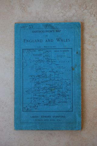
OLDMAPSHOP:IS MY SOURCE ON-LINE FOR MAP & CARTOGRAPHIC HISTORYTITLE: NEWFORESTNO 5 BARTHOLOMEW DATES: 1947PUBLISHER:BARTHOLOMEW AND SONEDINBURGHEDITION:1.2INCH SURVEY OF GREAT BRITAIN- TOPOGRAPHICALLY COLOUREDPRINTER:EDINBURGH GEOGRAPHICALINSTITUDEPRINTINGCODE: 388PRINTINGPROCESS: Lithography SCALE: ½AN INCH TO THE MILEGRID:10 MINUTES OF A DEGREEOVERALLDIMENSIONS:Roughly 34 inchesby 21 inches. COVERDIMENSIONS: 7INCHES BY 31 ½ INCHES COVERDETAIL:BLUEBLACK AND ORANGE, ROYAL ARMS OF GEORGE V- CARTOUCHE OF BRITISH ISLESCOVERCONDITION:GOODMAPPAPER OR LINEN BACKED:on linenFOLDWEAR: someat fold junctionsEDGENICKS: some, securedPINHOLES AT FOLD JUNCTIONS:yes some VERSO:Plain linenFOXING:no REINFORCING: someminor on verso only- edge nicks and fold junctions SURFACEMARKING: fewFOLDEDINTO: 27sections ANNOTATION:notseen INTEREST: considerable:Wardecade, still redacted, curious exception, , Southampton andPortsmouth in their war forms: New Forest before it was a defined andprotected region. Schneider Trophy course, Seaplanes, Old Railwaysof the Southern Railway in Hampshire, Sussex, Dorset and the Isle ofWightGENERALCONDITION: Goodwith some fold wearTHENORTH WEST CORNER OF THIS MAP IS AT: Valeof WyleTHENORTH EAST CORNER OF THIS MAP IS AT: HambledonTHESOUTH EAST CORNER OF THIS MAP IS AT:Sea due south of BognorRegisTHESOUTH WEST OF THIS MAP IS AT: Seajust off Seacombe CliffTHECENTRE OF THIS MAP IS AT: Hamble
xxxxxxxxxxxxxBUYHISTORIC MAPS, BUY MAPS AS PRESENTS, STUDY MAPS; SEARCH OLD MAPS; BUYLOCAL HISTORY MAPS; BUY MAPS OF YOUR REGION; YOUR PAST LANDSCAPE, THEHISTORICAL LANDSCAPE; MAPS OF YOUR REGION IN THE PAST; OLD MAPS;COLLECTABLE MAPS, RARE MAPS; UNIQUE MAP; VICTORIAN MAPS, GEORGIANMAPS, COUNTY MAPS, RAILWAY MAPS, IMPORTANT MAPS; EDWARDIAN MAPS, 1920S MAPS, 1930S MAPS, 1940S MAPS, 1950S, MAPS, 1960S MAPS, ORDNANCESURVEY MAPS, BARTHOLOMEW'S MAPS, CRUCHLEY MAPS, GEORGE BACONMAPS, STANFORD MAPS, GALL AND INGLIS MAPS; MILITARY MAPS, WAR TIMEMAPS, GSGS WAR OFFICE MAPS, ENGLISH MAPS, IRISH MAPS , SCOTTISH MAPS, WELSH MAPS, ANNOTATED MAPS, FOOTPATH MAPS, CYCLING MAPS, GEOLOGICAL MAPS, HYDROGRAPHIC MAPS, TRAVELLERS' MAPS. ANCIENT MAPS, EUROPEAN MAPS, MAPS AS GIFTS.
xxxxxxxxx
“PERSPECTIVESON BRITAIN: TRAVELLING WITH AN ANTIQUE OR VINTAGE MAP”
AVINTAGE BARTHOLOMEW’S 1/2” TO THE MILE SHEET MAP IN ATTRACTIVEBOARD COVERS
WARDECADE MAP OF
THENEW FOREST, HAMPSHIRE AND SUSSEX-
THESOUTHERN COAST FROM SWANAGE TO BOGNOR REGIS- AND THE ISLE OF WIGHT
Itdoes not including the RAF and RNAS stations or aerodromes of the 2ndworld war- ...usually marked in bold red and a plane symbol, because itis the War Map and these features are still redacted “BARTHOLOMEWSREVISED HALF INCH CONTOURED MAPS- GREAT BRITAIN NO. 5 - NEW FOREST”
ROYALAPPOINTMENT ARMS AND LEGENDS SAYS: “BYAPPOINTMENT TO THE LATE KING GEORGE V”
FOLDED SHEET MAP - WITH CARD IN GOODCONDITION, A LINEN BACKED MAPGENERALDESCRIPTION OF THIS MAPInthe War, the Isle of Wight and the New Forest were severelyrestricted sites and travel to and from them was controlled. The Isleof Wight, at Cowes, was the home port of the Free French Navy andsome people suggest that the tradition of onion and garlic growing onthe island was given a boost by the presence of French servicemen.There were several RAF and RNAS stations- both airfields and radar onthe south coast of the the island. The full network of the islandrailways are still in operation including that line west toFreshwater.Onthe mainland a seaplane station is marked at Calshot. The New Forestwas essentially a large army camp but that, with the airfields, isredacted. Redactionis a curious issue on maps: one might ask: How is a facility hidden?Is it just left plain or is false mapping used to hide it? Why aresome barracks and the sea plane station not redacted? Why are otherimportant “targets” such as the railway works of the SR/ LSWR notredacted? In some cases- such as HM dockyards, the large plain whiteareas on OS maps seem to present better bombing targets than themapping would have. Onthis map Bournemouth is still in Hampshire with Canford Cliffs beingin Dorset. Branksome Chine is Dorset. The town was built about 5chines but Boscombe Chine and Branksome Chine are the only two stillnamed here. A chine is a stream running directly to the sea, usuallythrough a wooded gully and often passing over the blue slipper clayof the region which causes massive coastal erosion. It is a work seenon the south coast of the Isle of Wight and also in Eastern Dorsetbut not elsewhere.Herein 1947, ferry routes are again shown and these cross the Yarmouth, Cowes, Fishbourne and Ryde from Portsmouth, Southampton andLymington.Thereis also a coastal route shown which marked the passage of paddlesteamers from Ryde to Cowes andYarmouth. Paddle steamers ran to roughly 1954.Onthe Bartholomew maps of this region, a generation earlier than thismap, a tunnel was marked taking a railway from Lymington to Yarmouth.This project was never built and the LSWR killed it off by pullingout of the project some time in the 1890’s.Itis a difference between Bartholomew and the Ordnance Survey, thatBartholomew, would speculate on future projects, railways etc, whereas the OS did not: so much so that the OS did not mark railways atall until the electrotypes of 1871+.Ferriesare also seen on this map crossing Southampton Water to Hythe andPortsmouth Harbour to Gosport.
THEISLE OF WIGHT ON THIS MAPThisisland is an eastern range of the Purbeck Hills, which becameisolated when the Western Solent was inundated.TheWestern Solent must once have been just the lower reaches of the Lymington and Beaulieu Rivers. There is a sunken forest in this bodyof tidal water which can be seen on a neep tide. Spithead must havebeen the estuary of the old Solent River.Somewaterways on the map have diminished rather than enlarged: the YarRive once separated Freshwater island from the rest of the Isle ofWight and rises only a few yards from the prom at Freshwater. PaghamHarbour is also a waxing and waning feature in the east of this map.Here it is mapped as a large tidal body of waters, at other timesover the centuries it hardly exists.Anotherinteresting hydrographic feature on this map is the torpedo Range onHorsea island in Portsmouth harbour. It was probably an old featureabandoned by the 2ndwar and so not redacted here.Haylingisland road carries a toll on this map and just west of it extensiveoyster beds are marked.Cowes, the name, refers to two sand banks which used to lie off the Medinaand has Cows on them. They are seen on this map still as submarinecontour shallows. Now this bank has been reconstructed and the townis once again protected by an off-shore bank.EROSIONTheWestern Solent and Isle of Wight erode quickly on their south facingshores. The primary cause is sea level rise and even a map of 1940’sshow considerable differences from that of today: particularly eastof Lymington and along the South Coast Military Road of the Isle ofWight. A secondary cause is the stratum of Blue Slipper Clay whichlies under the more solid geology of the South coast of the Island.This is washed out by tides and the overlying strata collapse. Thenormal geological sequence in Cretaceous landscapes is to have Chalkthen Clunch, the Upper Greensand, then Gault Clay, then LowerGreensand. I assume that the local name “Blue Slipper” issynonymous with Gault Clay- but I am not absolutely sure about that.Chalk is 66 million yearsold at its youngest and the other strata are progressively older –on the normal sequence- after these Cretaceous sequences, one findsJurassic rocks.Theerosion on the Chalk cliffs might be different. Chalk erodes bysaturation and freezing. It then falls away each winter. Thecharacteristic of chalk coast erosion is that a plateau of unerodedchalk is left up to the high tide line, because as soon as the chalkis at sea level, the agent of freezing is no longer present.Thenormal cross section through a chalk hill top to bottom is:aclay and gravel cap which is later and perhaps Quaternary, then flintrich chalk, then pure chalk laid down in deeper seas, then harderchalk: clunch. Of course all these strata of the Cretaceous were laiddown as sea beds. The agent which pushed them up into hills was theAlpine orogeny of 50 million years ago. Itis also interesting that gault is deep ocean deposition not a claylaid down by rivers or estuaries. But a better geologist than I couldsay if Blue Slipper on this map and Gault are actually the samething. The best place to study the erosion of Blue Slipper is justacross the Channel at Equihen Plage cliffs in Pas de Calais.
NEWFORESTThisis bordered by Avon River to the west and Southampton Water to theeast. The border to the north is less certain- probably it followedthe old county border between Wiltshire and Hampshire. The map doesnot show the new Forest as a protected area of National park. It iscrossed by a curious railway which contrives to serve neitherBeaulieu nor Lyndhurst but has “Beaulieu Road” and “LyndhurstRoad” stations a considerable distance from either town.TheBeaulieu River is a modern Norman name, and the old name for thismainly tidal “ria” must have been “Exe”- for Exbury stands onits eastern bank.LymingtonRiver seems to do a double loop, etymologically, because presumablyLymington is “Tun of the people of the Limana River” and thenthat town name is reapplied to the stream itself. A similar river tothe east is now called the Rother. The name means “Elm River”Therailwaydown to Fawley was very short lived. It closed post war and is notseen on a map of 1900: It may have served the Supermarine Factory inthat town. This map shows the course of the Schneider Trophy airrace. The Supermarine S5, S6 and SB won it in 1927-1929-and 1931 andthe last two of those races set off from Calshot Spit. The Trophyrace was run from the territory of the previous winner, sothe 1927 race had been held in Venice and the previous English racewas nearby but not the same: having Cowes as its start marker.Onthis map: Potteries are seen in Sloden Inclosure.TheRufus Stone is seen near Upper Canterton, this marks the spot whereWilliam II was shot dead, allegedly a hunting accident.Eaglehurstis near Calshot. Yarmouth and the two yar rivers on the Isle of Wightalso cite eagles: These were probably sea eagles. Iwonder when they died out TheRoman Road near Eaglehurst seems to run to Stone Point, or moreprobably to a Roman port now lost under the waters of the Solent offStone Point.HurstCastle on the Spit and the battery at Cliff End onthe island, essentiallyclose off the Western Solent to enemy shipping: those are Tudordefences.
Ingeneral the 1940’s Forest was wooded in its northern parts andheath land in its southern reaches.Theother, less well known, large forest of this map is the Forest ofBere north of Portsmouth and Emsworth. Part of this region is nowcovered by the Queen Elizabeth Country Park. The nearly Down: ButserHill, at 889 ft is the highest point on the South Downs.
DORSETIN THE WEST OF THIS MAPOnthis map Brownsea Island in Poole Harbour is also called BrankseaIsland. This place was famous for the first camp organised by theScouting Movement. In both cases the real name must be Brownsea orBranksea, because the addition of “Island” is tautological: “ea”means “island”.Itis probable that in this region of the map along, other companies-not the Southern railway- enter this map. Theline down into Poole from the north west was operated by the Somersetand Dorset Joint Railway. Also the GWR had running rights down to thesouth coast- perhaps to Wymouth, Swanage and Southampton.Villageswhich are Hampshire on this map but Dorset today include: Martin, Rockbourne, Breamore, Harbridge, Upper Burgate, St Ives heath, HoldenhurstMuccleshell, Throop. Nearby the map marks “B.O.A.C. Aerodrome”, near Merritown. This wasBritish Overseas Air Corporation and a predecessor of B.A. No doubtthis field is now called Bournemouth Airport. BOACwas formed in 1939 from Imperial Airways and British Airways Ltd.This is not a redacted field because it was not used by the military.
OLDMAPSHOP:IS MY SOURCE ON-LINE FOR MAP & CARTOGRAPHIC HISTORYTITLE: NEWFORESTNO 5 BARTHOLOMEW DATES: 1947PUBLISHER:BARTHOLOMEW AND SONEDINBURGHEDITION:1.2INCH SURVEY OF GREAT BRITAIN- TOPOGRAPHICALLY COLOUREDPRINTER:EDINBURGH GEOGRAPHICALINSTITUDEPRINTINGCODE: 388PRINTINGPROCESS: Lithography SCALE: ½AN INCH TO THE MILEGRID:10 MINUTES OF A DEGREEOVERALLDIMENSIONS:Roughly 34 inchesby 21 inches. COVERDIMENSIONS: 7INCHES BY 31 ½ INCHES COVERDETAIL:BLUEBLACK AND ORANGE, ROYAL ARMS OF GEORGE V- CARTOUCHE OF BRITISH ISLESCOVERCONDITION:GOODMAPPAPER OR LINEN BACKED:on linenFOLDWEAR: someat fold junctionsEDGENICKS: some, securedPINHOLES AT FOLD JUNCTIONS:yes some VERSO:Plain linenFOXING:no REINFORCING: someminor on verso only- edge nicks and fold junctions SURFACEMARKING: fewFOLDEDINTO: 27sections ANNOTATION:notseen INTEREST: considerable:Wardecade, still redacted, curious exception, , Southampton andPortsmouth in their war forms: New Forest before it was a defined andprotected region. Schneider Trophy course, Seaplanes, Old Railwaysof the Southern Railway in Hampshire, Sussex, Dorset and the Isle ofWightGENERALCONDITION: Goodwith some fold wearTHENORTH WEST CORNER OF THIS MAP IS AT: Valeof WyleTHENORTH EAST CORNER OF THIS MAP IS AT: HambledonTHESOUTH EAST CORNER OF THIS MAP IS AT:Sea due south of BognorRegisTHESOUTH WEST OF THIS MAP IS AT: Seajust off Seacombe CliffTHECENTRE OF THIS MAP IS AT: Hamble
xxxxxxxxxxxxxBUYHISTORIC MAPS, BUY MAPS AS PRESENTS, STUDY MAPS; SEARCH OLD MAPS; BUYLOCAL HISTORY MAPS; BUY MAPS OF YOUR REGION; YOUR PAST LANDSCAPE, THEHISTORICAL LANDSCAPE; MAPS OF YOUR REGION IN THE PAST; OLD MAPS;COLLECTABLE MAPS, RARE MAPS; UNIQUE MAP; VICTORIAN MAPS, GEORGIANMAPS, COUNTY MAPS, RAILWAY MAPS, IMPORTANT MAPS; EDWARDIAN MAPS, 1920S MAPS, 1930S MAPS, 1940S MAPS, 1950S, MAPS, 1960S MAPS, ORDNANCESURVEY MAPS, BARTHOLOMEW'S MAPS, CRUCHLEY MAPS, GEORGE BACONMAPS, STANFORD MAPS, GALL AND INGLIS MAPS; MILITARY MAPS, WAR TIMEMAPS, GSGS WAR OFFICE MAPS, ENGLISH MAPS, IRISH MAPS , SCOTTISH MAPS, WELSH MAPS, ANNOTATED MAPS, FOOTPATH MAPS, CYCLING MAPS, GEOLOGICAL MAPS, HYDROGRAPHIC MAPS, TRAVELLERS' MAPS. ANCIENT MAPS, EUROPEAN MAPS, MAPS AS GIFTS.
xxxxxxxxx