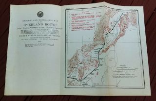
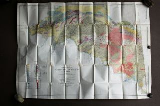
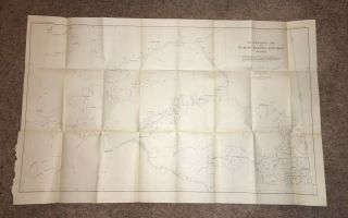
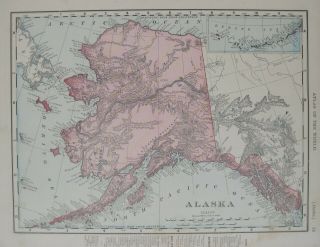
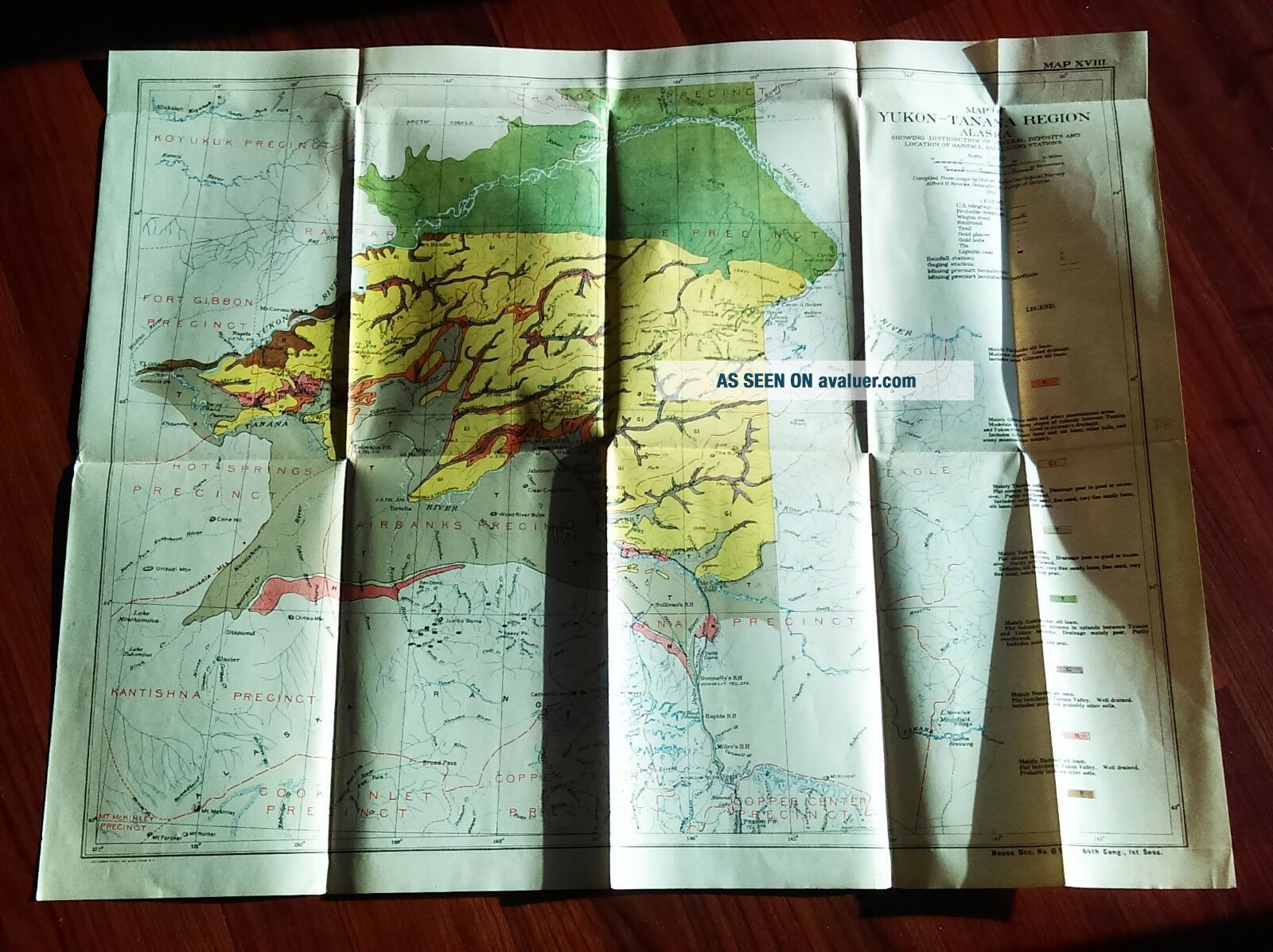
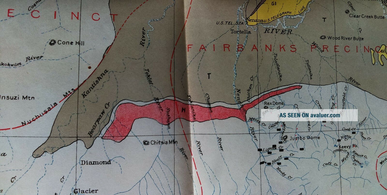
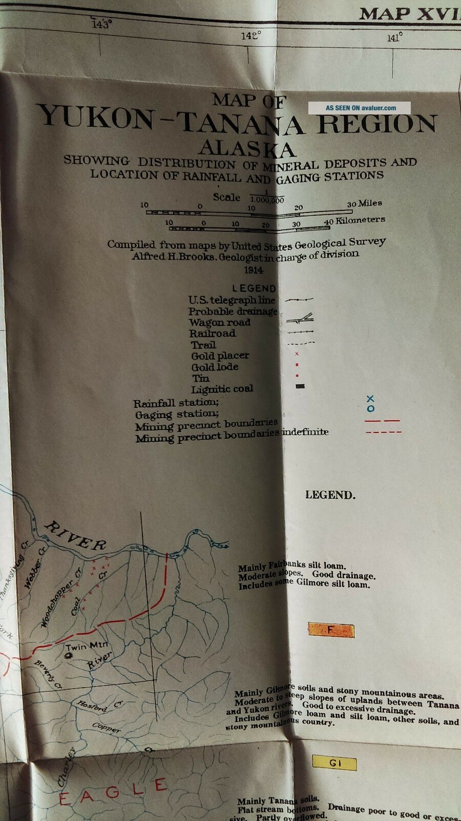
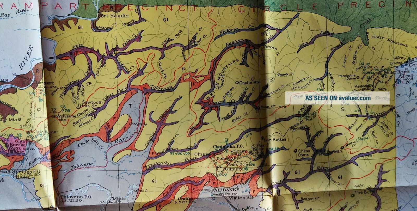
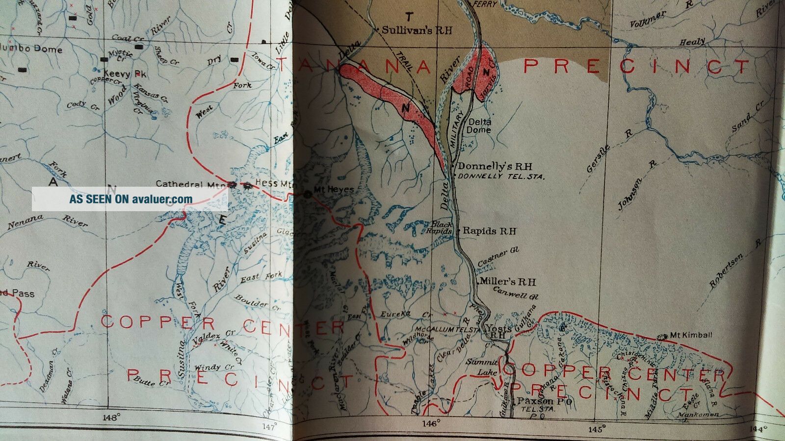
1915 Alaska Survey Map Yukon - Tanana Region, Mineral Deposit, Telegraph Station


Item History & Price

Information:
Reference Number: Avaluer:1250411Original/Reproduction: Original
Date Range: 1910-1919Type: Survey Map
Country/Region: United States of AmericaTopic: Maps
Printing Technique: LithographyUS State: Alaska, Tennessee
Format: Folding Map
Original Description:
Army Engineering  Map. Diagram is in delicate condition with some aging, seam wear.  Since our maps can vary greatly in condition (i.e. some maps MAY have edge tears and/or separating seams), please view images carefully. Was removed from a historical bound book of maps and documents printed by the U.S. Government Printing Office.  GPO

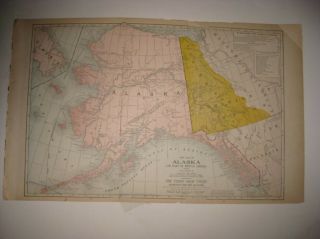
Map comes folded on current seams (if any exist) when we ship it.

Measures about 22in x 18in.
(map #2250)

All ori...ginal maps and diagrams are crisp and sharp. Some of our low resolution photos come across as blurry.
We offer FREE Shipping for Purchases of 3 items or more. Please E-mail with any Questions.

Please check out our EBay store MEMAPS for thousands of Antique Original Foldout Maps, Diagrams, and Plates including, Canals  -  Dikes  -  Rivers  -  Lakes  -  Harbors  -  Dredging  -  Flood Control  -  Concrete Piers  - Dams Levees  - Forests  -  National Parks  - Railroads  - Military Ordnance  -  Naval  - Nautical  -  Topographical  - Geographical  - Mining  -  Tunnels  -  Bridges  -  Architectural  Engineering  - Reservations  U.S. Territories  - Wharfs – U.S  Army Corps of Engineers Surveys. We offer a 100% satisfaction guarantee on all purchases.


    Similar items


  • 1915 Geographical Survey Map Nevada Carson Sink Humboldt Range Lake Lahontan

    1915 Geographical Survey Map Nevada Carson Sink Humboldt Range Lake Lahontan

  • Alaskan Multi - Colored U S Geological Map (yukon - Tenana Region) 1937 J.  B.  Mertie

    Alaskan Multi - Colored U S Geological Map (yukon - Tenana Region) 1937 J. B. Mertie

  • Alaska Surveying & Mapping Conference Anchorage January 1982 Cast Survey Marker

    Alaska Surveying & Mapping Conference Anchorage January 1982 Cast Survey Marker

  • 1904 Sketch Map Reconnaissance Of Yukon - Tanana Alaska Fairbanks Goodpaster River

    1904 Sketch Map Reconnaissance Of Yukon - Tanana Alaska Fairbanks Goodpaster River

  • 1895 Map Alaska Sitka Capital Yukon River Klondike Region Weare Indians

    1895 Map Alaska Sitka Capital Yukon River Klondike Region Weare Indians

  • Larg Antique 1904 Alaska British Canada Yukon Gold Mining Region Philippines Map

    Larg Antique 1904 Alaska British Canada Yukon Gold Mining Region Philippines Map

  • Vintage Alaska Far North Frontier Wall Map Yukon Gold Rush Kleng Rude 1959 40x48

    Vintage Alaska Far North Frontier Wall Map Yukon Gold Rush Kleng Rude 1959 40x48

  • Old Ordnance Survey Maps Leytonstone & Leyton London 1915 Godfrey Edition

    Old Ordnance Survey Maps Leytonstone & Leyton London 1915 Godfrey Edition


    • You might also like


    • 1860 Mitchell Hand Colored Map Colorado,  Nebraska & Kansas - Civil War Era

      1860 Mitchell Hand Colored Map Colorado, Nebraska & Kansas - Civil War Era

    • 18th Century French Map Of North America

      18th Century French Map Of North America

    • Las Vegas Nevada Vintage 1967 Us Geological Survey Quadrangle Map 4 Panels

      Las Vegas Nevada Vintage 1967 Us Geological Survey Quadrangle Map 4 Panels

    • Rare Antique 1845 Maps United States Exploring Expedition Book Antartica Hawaii

      Rare Antique 1845 Maps United States Exploring Expedition Book Antartica Hawaii

    • Vintage 1926 Map Hollywood From The Best Surveys Of The Time

      Vintage 1926 Map Hollywood From The Best Surveys Of The Time

    • American Continent (western Hemisphere) 1747 Bowen Antique Copper Engraved Map

      American Continent (western Hemisphere) 1747 Bowen Antique Copper Engraved Map

    • Gulf Coast Florida Texas United States 1705 De Fer Unusual Antique Engraved Map

      Gulf Coast Florida Texas United States 1705 De Fer Unusual Antique Engraved Map

    • California As Island United States 1700 De Fer Unusual First Edition Antique Map

      California As Island United States 1700 De Fer Unusual First Edition Antique Map

Avaluer          About Us          Privacy Policy          Contact Us          UP
© 2022, avaluer.net, Inc. or its affiliates