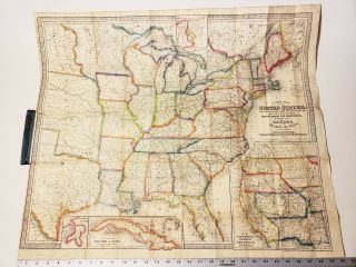
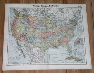
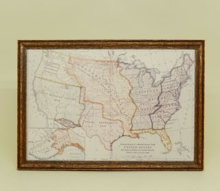
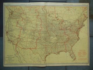
1935 VINTAGE MAP OF UNITED STATES CANADA NORTH AMERICA ONTARIO FLORIDA


Item History & Price

Information:
Reference Number: Avaluer:1251321Original/Reproduction: Original
Country/Region: CanadaCanadian Province: Ontario
Topic: United StatesType: Map
Publication Year: 1935Year: 1935
Maker: Deutsche Buch-GemeinschaftUS State: Florida
SHEET SIZE: 21" x 17 3/4" (53 x 45 cm)
Original Description:
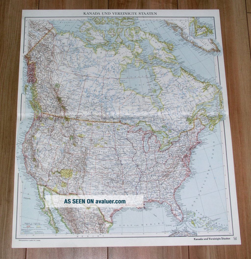
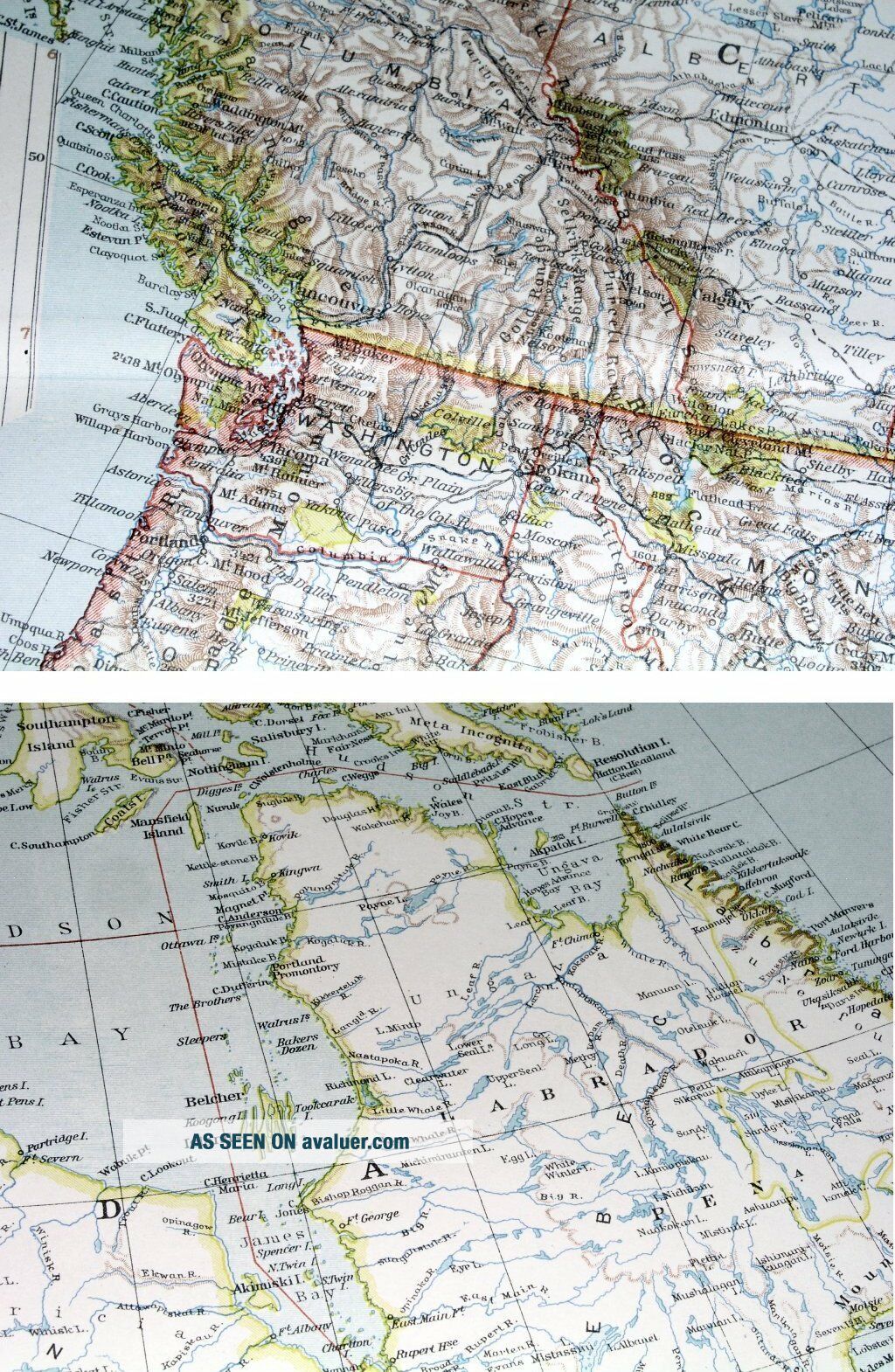
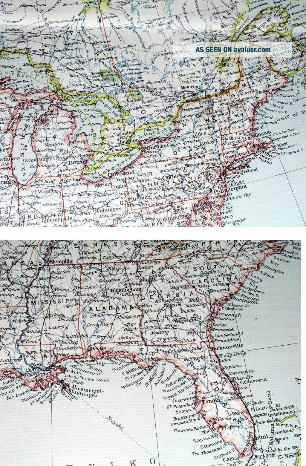
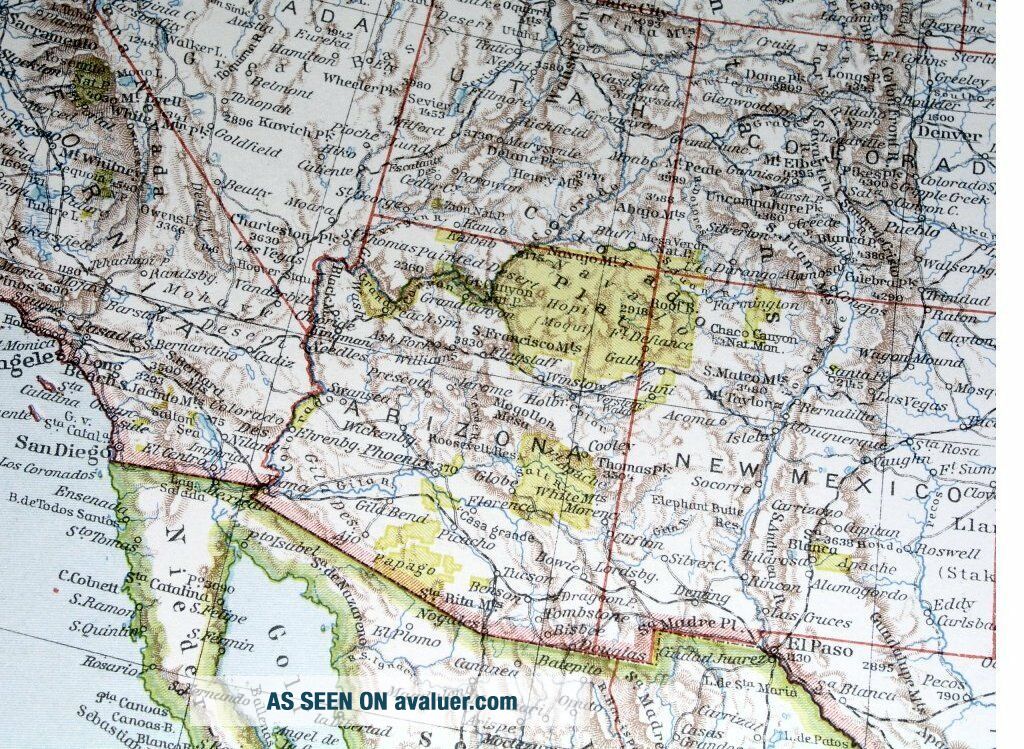
ORIGIN OF THE MAP: "Der Grosse Weltatlas", published in Berlin, Germany by Deutsche Buch-Gemeinschaft G.m.b.H.

DATE OF ISSUE: 1935.

SIZE: The sheet measures: 21" x 17 3/4" (53 x 45 cm).

Most of maps we sell come from ancient atlases that were damaged and beyond repair. The maps have often a canvas or paper binding tape mounted on back along the centerfold. If you have ANY PROBLEM with the purchase, it is essential you CONTACT US BEFORE LEAVING FEEDBACK TO GIVE US... THE CHANCE TO RESOLVE IT.

SHIPPED FROM CANADA in secure tubes or bubble mailers. PLEASE NOTE, THAT THE SHIPPING FROM QUEBEC TO THE U.S. TAKES 10 DAYS / WORLD 18 DAYS.

We combine shipping costs for multiple items. The HIGHEST VALUE SHIPPING FEE WILL APPLY FIRST and each subsequent item will be shipped FOR FREE.

00036


    Similar items


  • 1854 Map Of United States & Canada Pocket Map 25 X 30 Pre Civil War Pre Railroad

    1854 Map Of United States & Canada Pocket Map 25 X 30 Pre Civil War Pre Railroad

  • 1905 Antique Map Of United States / Canada

    1905 Antique Map Of United States / Canada

  • Vintage Map Of United States Artisan Dollhouse Miniature 1:12

    Vintage Map Of United States Artisan Dollhouse Miniature 1:12

  • Vintage Map Of United States & State Flowers Stamped For Embroidery Black Satin

    Vintage Map Of United States & State Flowers Stamped For Embroidery Black Satin

  • Large 1942 Vintage Map Of United States Airlines / 20 1/2 " X 27 5/8 "

    Large 1942 Vintage Map Of United States Airlines / 20 1/2 " X 27 5/8 "

  • Vintage 1993 Future Map Of United States Michael Scallions For 1998 To 2001

    Vintage 1993 Future Map Of United States Michael Scallions For 1998 To 2001

  • 1850 Map Of United States Texas California Florida York Canada

    1850 Map Of United States Texas California Florida York Canada

  • Rare Vintage Rand Mcnally Pull Down School Map Of United States Of America

    Rare Vintage Rand Mcnally Pull Down School Map Of United States Of America


    • You might also like


    • 1860 Mitchell Hand Colored Map Colorado,  Nebraska & Kansas - Civil War Era

      1860 Mitchell Hand Colored Map Colorado, Nebraska & Kansas - Civil War Era

    • 18th Century French Map Of North America

      18th Century French Map Of North America

    • Las Vegas Nevada Vintage 1967 Us Geological Survey Quadrangle Map 4 Panels

      Las Vegas Nevada Vintage 1967 Us Geological Survey Quadrangle Map 4 Panels

    • Rare Antique 1845 Maps United States Exploring Expedition Book Antartica Hawaii

      Rare Antique 1845 Maps United States Exploring Expedition Book Antartica Hawaii

    • Vintage 1926 Map Hollywood From The Best Surveys Of The Time

      Vintage 1926 Map Hollywood From The Best Surveys Of The Time

    • American Continent (western Hemisphere) 1747 Bowen Antique Copper Engraved Map

      American Continent (western Hemisphere) 1747 Bowen Antique Copper Engraved Map

    • Gulf Coast Florida Texas United States 1705 De Fer Unusual Antique Engraved Map

      Gulf Coast Florida Texas United States 1705 De Fer Unusual Antique Engraved Map

    • California As Island United States 1700 De Fer Unusual First Edition Antique Map

      California As Island United States 1700 De Fer Unusual First Edition Antique Map

Avaluer          About Us          Privacy Policy          Contact Us          UP
© 2022, avaluer.net, Inc. or its affiliates