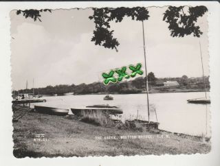
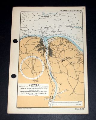
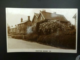
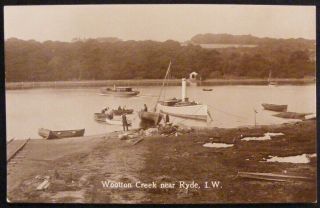
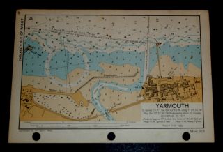
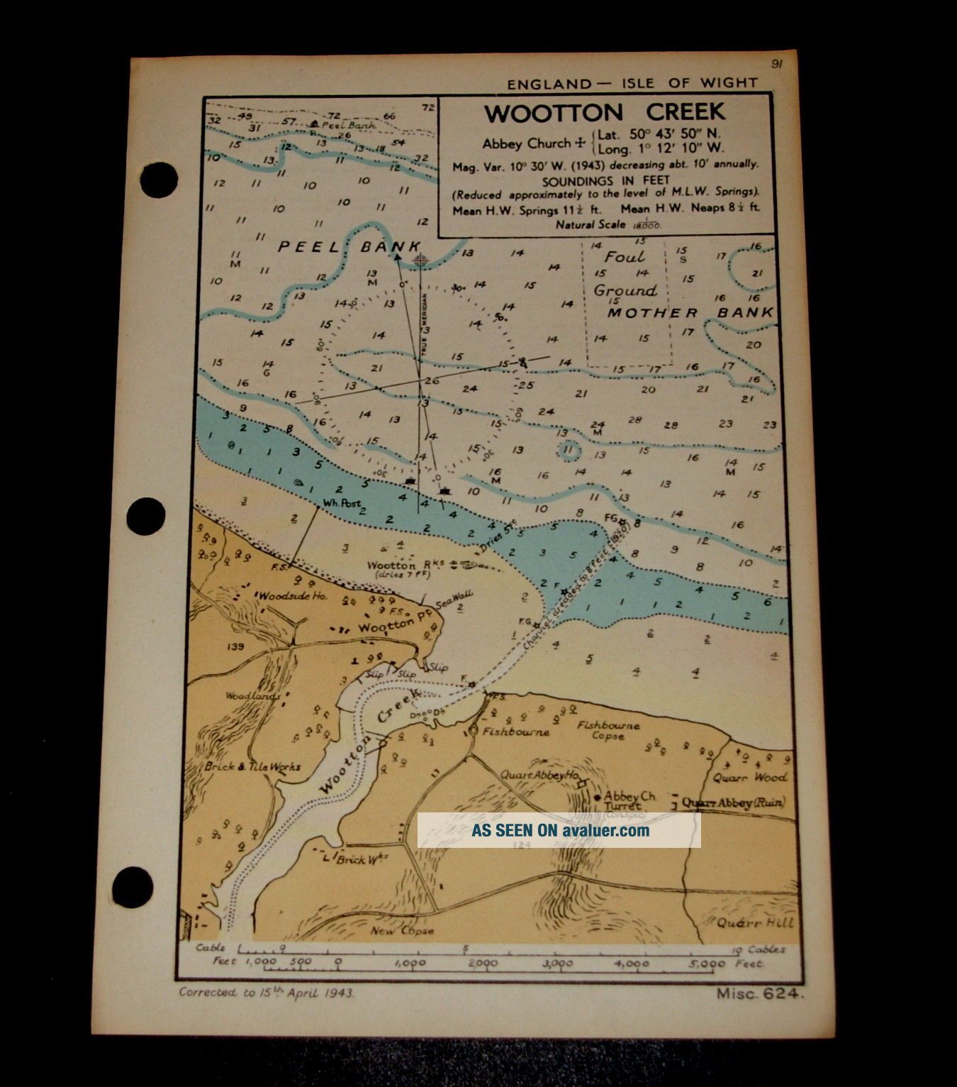
WOOTTON CREEK, Isle Of Wight - WW2 Naval Map 1943


Item History & Price

Information:
Reference Number: Avaluer:1251584County: Aberdeenshire, Isle of Wight
Type: Nautical MapCartographer/Publisher: Admiralty
Year: 1943Original/Reproduction: Vintage Original
City: WOOTTON CREEKFormat: Sheet Map
Country/Region: England
Original Description:
Vintage Naval WW2 Map of WOOTTON CREEK, Isle of Wight - 1943Published by the Hydrographic Department of the Admiralty, for a Naval Handbook. OriginallyRESTRICTED but now declassified.In good condition showing fine detail.  Used for Coastal Defence.  Delightful example of fine cartography.Corrected to 15th April 1943.  Natural Scale 1: 18, 000.  Soundings in Feet.Overall size: 6.5(w) x 9.5(h) ins.  Printed on fine card.  S...uitable for framing.Thisis a genuine map and not a copy, facsimile or computer generated image.Please see my other auctions/sale for similar.   PAYPAL only.  UK P&P £1.30.  Combined postage available  

00050


    Similar items


  • Photo? Postcard - The Creek,  Wootton Bridge,  Isle Of Wight

    Photo? Postcard - The Creek, Wootton Bridge, Isle Of Wight

  • Cowes,  Isle Of Wight - Ww2 Naval Map 1943

    Cowes, Isle Of Wight - Ww2 Naval Map 1943

  • Vintage Wootton Bridge Isle Of Wight Iow Rp Postcard

    Vintage Wootton Bridge Isle Of Wight Iow Rp Postcard

  • Vintage Wootton Creek Near Ryde Isle Of Wight Rp Postcard Pub By Nigh Ventnor

    Vintage Wootton Creek Near Ryde Isle Of Wight Rp Postcard Pub By Nigh Ventnor

  • Man In Rowing Boat By Tug,  Wootton Creek Nr Fishbourne: 1910 Vintage Collotype

    Man In Rowing Boat By Tug, Wootton Creek Nr Fishbourne: 1910 Vintage Collotype

  • 1906 Wootton Creek Regatta Wootton Bridge Nr Ryde & Newport F N Broderick Photo

    1906 Wootton Creek Regatta Wootton Bridge Nr Ryde & Newport F N Broderick Photo

  • Ea Sweetman Post Card The Creek Wootton I W 37438

    Ea Sweetman Post Card The Creek Wootton I W 37438

  • Yarmouth,  Isle Of Wight - Detailed Vintage Ww2 Map 1943

    Yarmouth, Isle Of Wight - Detailed Vintage Ww2 Map 1943


    • You might also like


    • Hungary & Romania 1579 (1584) Ortelius Unusual Antique Copper Engraved Map

      Hungary & Romania 1579 (1584) Ortelius Unusual Antique Copper Engraved Map

    • Brussels Bruxelles Belfium 1777 De Ferraris & Dupuis Large Antique Map Sheet Xxi

      Brussels Bruxelles Belfium 1777 De Ferraris & Dupuis Large Antique Map Sheet Xxi

    • 1616 Atlas Map Of Iceland.

      1616 Atlas Map Of Iceland.

    • Kazan Russia 1767 Le Clerc/lespinasse Antique Copper Engraved City View

      Kazan Russia 1767 Le Clerc/lespinasse Antique Copper Engraved City View

    • 1899 Stanford,  Folding Map Of Norwich,  Norfolk,  Arthur Collins,  Jarrold & Sons,

      1899 Stanford, Folding Map Of Norwich, Norfolk, Arthur Collins, Jarrold & Sons,

    • 1948 Vintage Linen Colour Map Geological Survey Ten Mile Of Great Britain

      1948 Vintage Linen Colour Map Geological Survey Ten Mile Of Great Britain

    • 1944 Map Flying Bombs Sussex Ww2 Newspaper Military Kent Courier German V1 V2

      1944 Map Flying Bombs Sussex Ww2 Newspaper Military Kent Courier German V1 V2

    • Dated 1638 Vellum Map Of Icklesham Sussex Showing Land Uses Owners Etc

      Dated 1638 Vellum Map Of Icklesham Sussex Showing Land Uses Owners Etc

Avaluer          About Us          Privacy Policy          Contact Us          UP
© 2022, avaluer.net, Inc. or its affiliates