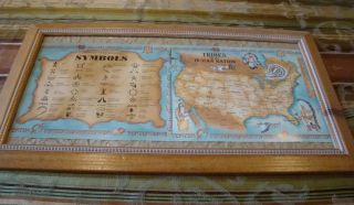
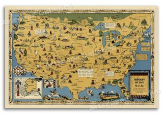
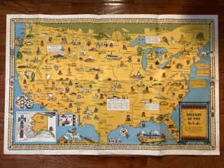
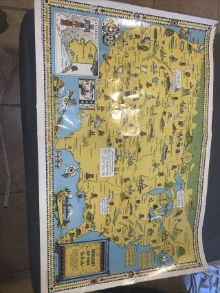
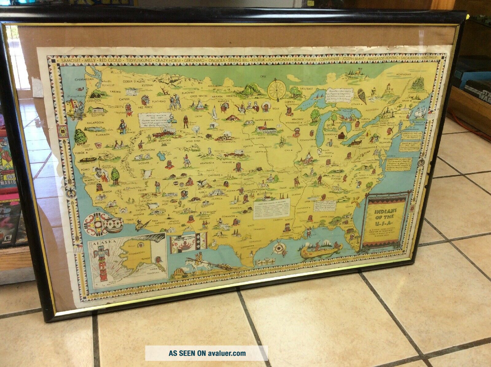
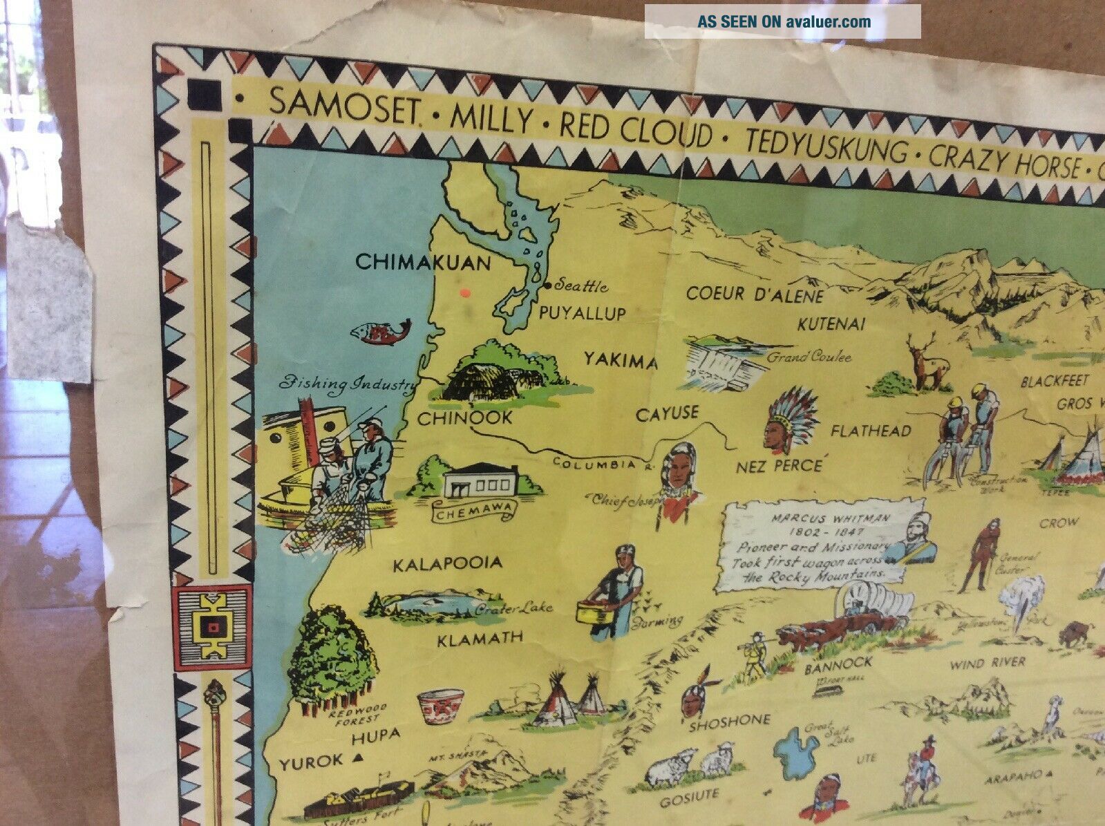
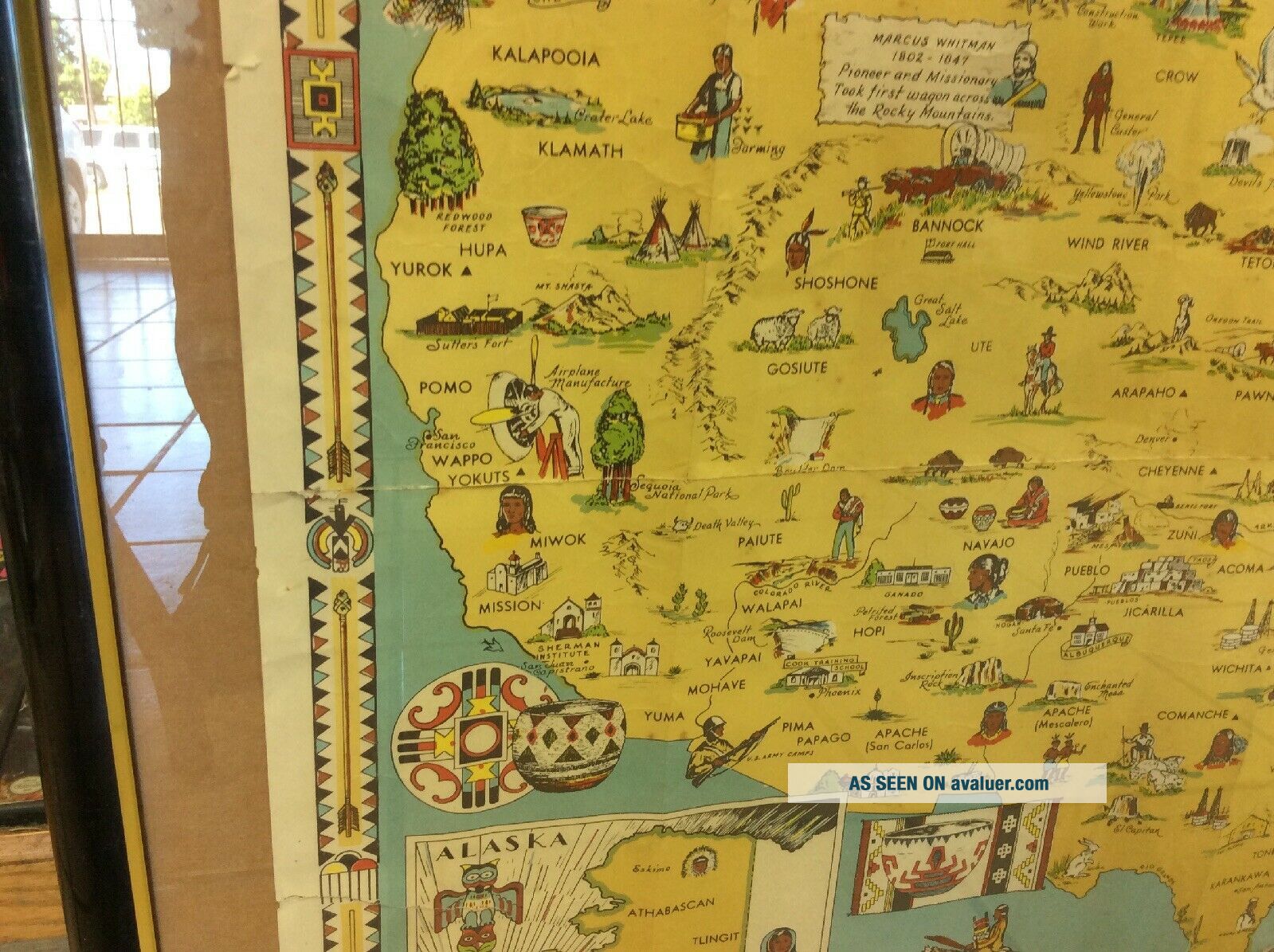
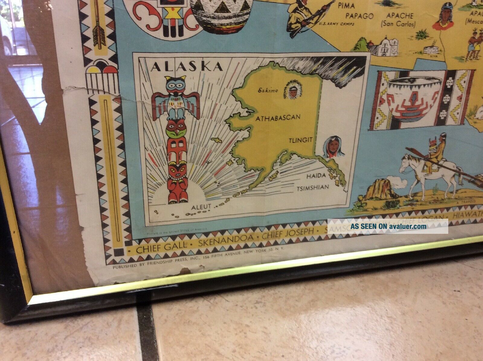
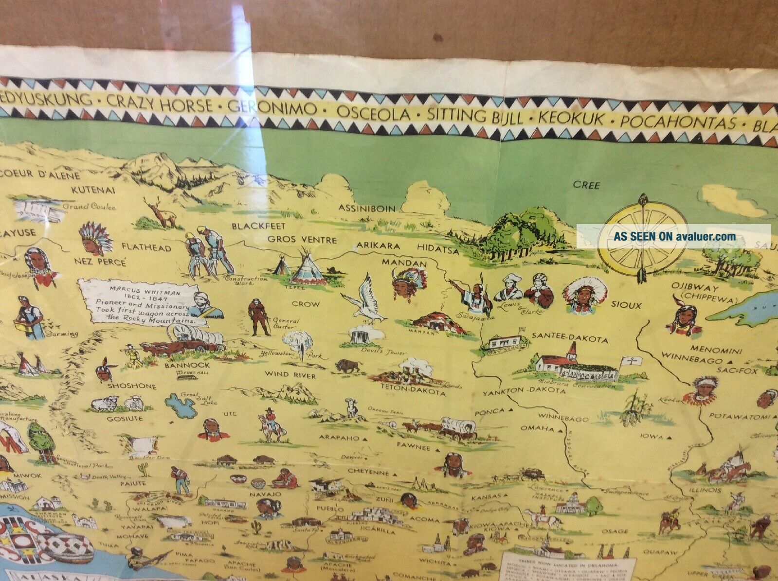
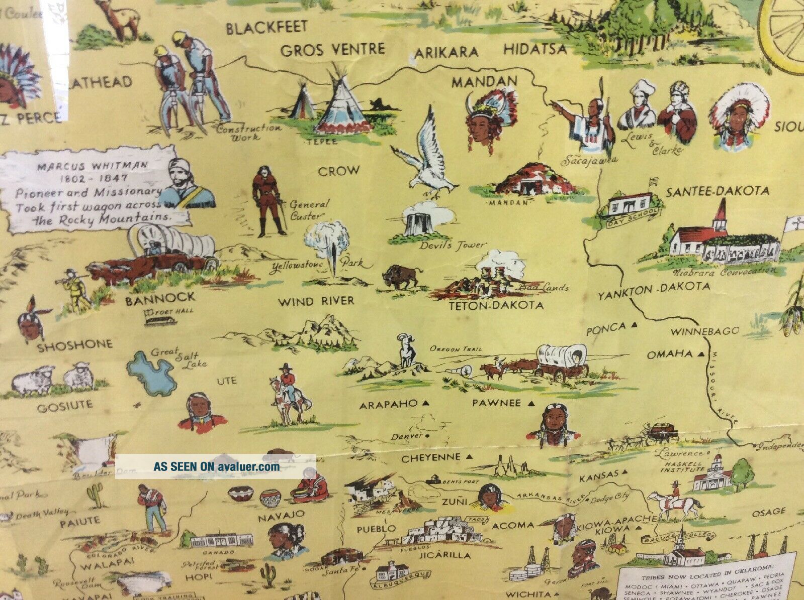
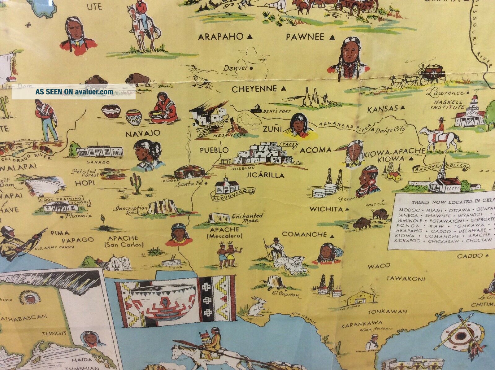
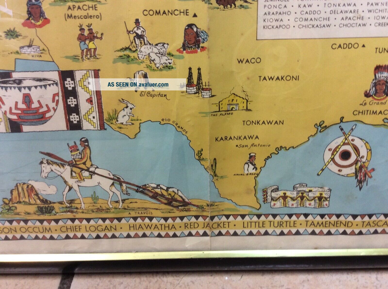
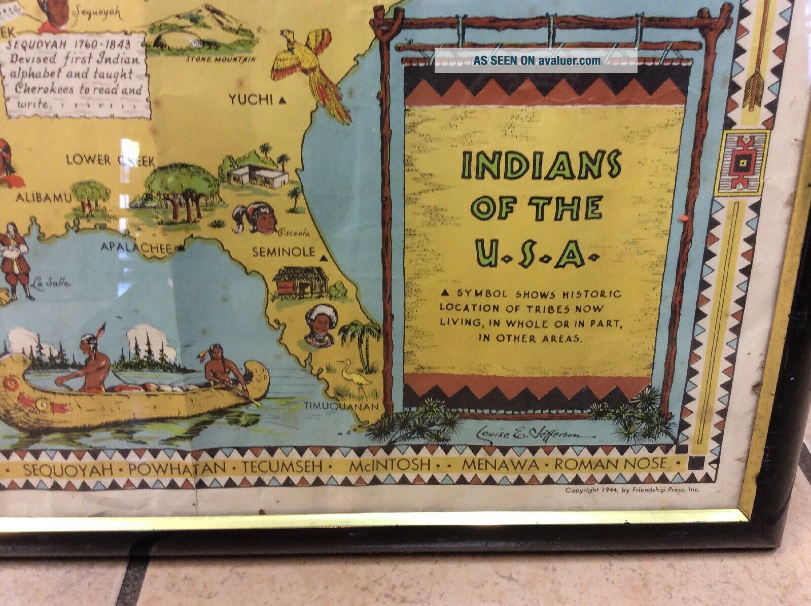
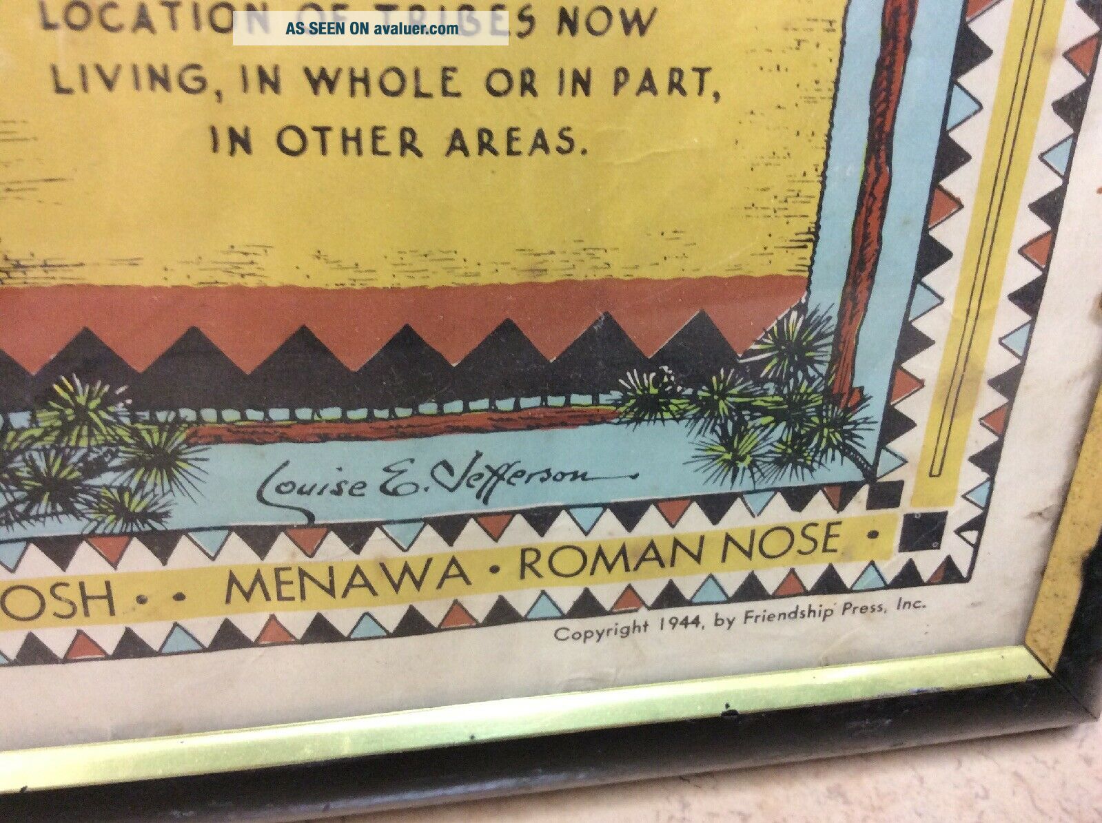
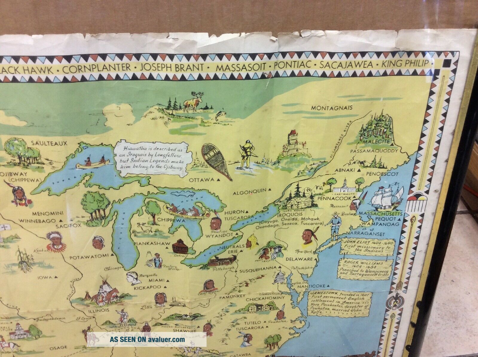
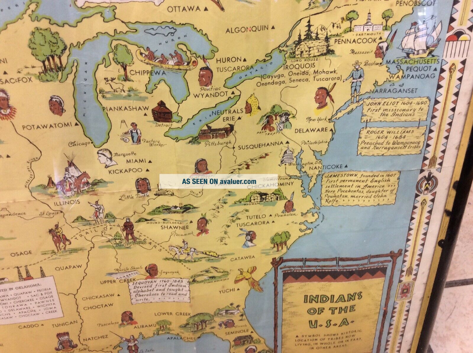
Friendship Press 1944 Indians Of The USA 34 X 22 Map North America Rare


Item History & Price

Information:
Reference Number: Avaluer:12625Year: 1944
Original/Reproduction: Vintage OriginalPublication Year: 1944
US State: Texas
Original Description:
Friendship Press Original 1944 Indians Of The USA 34 X 22 Map North America Rare. Shipped with USPS 8.00 priority tube—has edge wear, some soiling, some tears and folds—colors still vibrant —cannot ship in frame due to the size and it being glass—too expensive to ship —will send in tube gently rolled—any other questions let me know thank youAll sales final as is auction thanks again


    Similar items


  • Indians Of The Usa Native American Tribes Pictorial Map & Symbols Framed 23 " @7

    Indians Of The Usa Native American Tribes Pictorial Map & Symbols Framed 23 " @7

  • Indians Of The Usa Native American Tribes Historical Vintage Map Poster - 16x24

    Indians Of The Usa Native American Tribes Historical Vintage Map Poster - 16x24

  • Vintage 1960’s “authentic Indians Of The Usa” Fold Out Postcard Pack 13 Views

    Vintage 1960’s “authentic Indians Of The Usa” Fold Out Postcard Pack 13 Views

  • Rare Historic Map - Indians Of The U.  S.  A.  1944 Friendship Press Louise Jefferson

    Rare Historic Map - Indians Of The U. S. A. 1944 Friendship Press Louise Jefferson

  • Vintage Cartoon Map Indian Tribes Of The Usa By Jefferson 1944 34 1/2”x 22 3/8”

    Vintage Cartoon Map Indian Tribes Of The Usa By Jefferson 1944 34 1/2”x 22 3/8”

  • The Indian In American Life - G.  E.  E.  Lindquist - Friendship Press 1944 Book

    The Indian In American Life - G. E. E. Lindquist - Friendship Press 1944 Book

  • " The Indian In American Life " By: Lindquist,  Friendship Press 1944,  1st.  Edn.

    " The Indian In American Life " By: Lindquist, Friendship Press 1944, 1st. Edn.

  • 1944 Wwii Associated Press Wire Photo Of The Ruins Santa Maria Italy Dsp47

    1944 Wwii Associated Press Wire Photo Of The Ruins Santa Maria Italy Dsp47


    • You might also like


    • 1860 Mitchell Hand Colored Map Colorado,  Nebraska & Kansas - Civil War Era

      1860 Mitchell Hand Colored Map Colorado, Nebraska & Kansas - Civil War Era

    • 18th Century French Map Of North America

      18th Century French Map Of North America

    • Las Vegas Nevada Vintage 1967 Us Geological Survey Quadrangle Map 4 Panels

      Las Vegas Nevada Vintage 1967 Us Geological Survey Quadrangle Map 4 Panels

    • Rare Antique 1845 Maps United States Exploring Expedition Book Antartica Hawaii

      Rare Antique 1845 Maps United States Exploring Expedition Book Antartica Hawaii

    • Vintage 1926 Map Hollywood From The Best Surveys Of The Time

      Vintage 1926 Map Hollywood From The Best Surveys Of The Time

    • American Continent (western Hemisphere) 1747 Bowen Antique Copper Engraved Map

      American Continent (western Hemisphere) 1747 Bowen Antique Copper Engraved Map

    • Gulf Coast Florida Texas United States 1705 De Fer Unusual Antique Engraved Map

      Gulf Coast Florida Texas United States 1705 De Fer Unusual Antique Engraved Map

    • California As Island United States 1700 De Fer Unusual First Edition Antique Map

      California As Island United States 1700 De Fer Unusual First Edition Antique Map

Avaluer          About Us          Privacy Policy          Contact Us          UP
© 2022, avaluer.net, Inc. or its affiliates