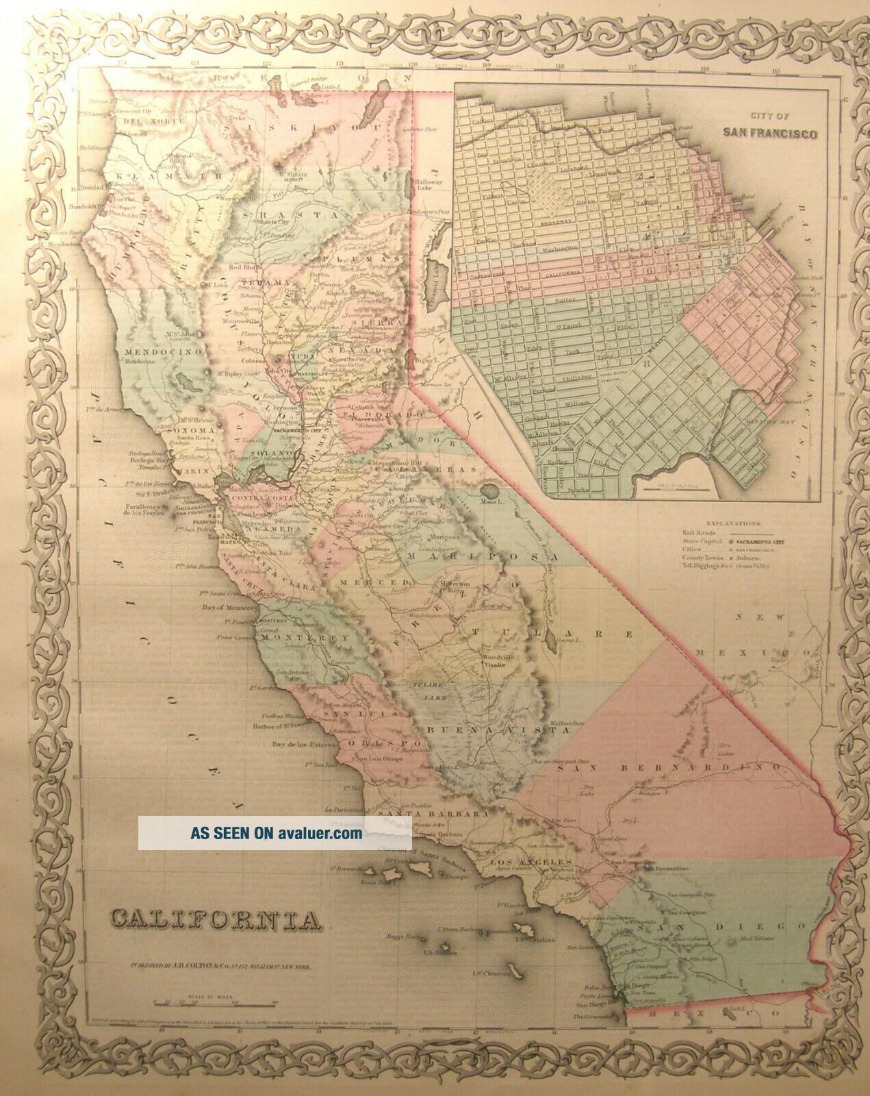
ANTIQUE COLOR ENGRAVING MAP CALIFORNIA 1859 COLTON ' S GENERAL ATLAS SAN FRANCISCO


Item History & Price

Information:
Reference Number: Avaluer:12726Cartographer/Publisher: J H COLTON & CO
Year: 1859Printing Technique: STEEL PLATE
US State: CaliforniaOriginal/Reproduction: Antique Original
Date Range: 1800-1899Format: Sheet Map
Country/Region: United States of AmericaType: STATE MAP
Original Description:

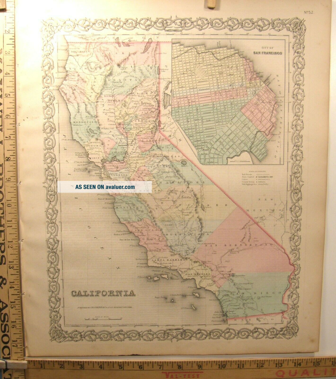
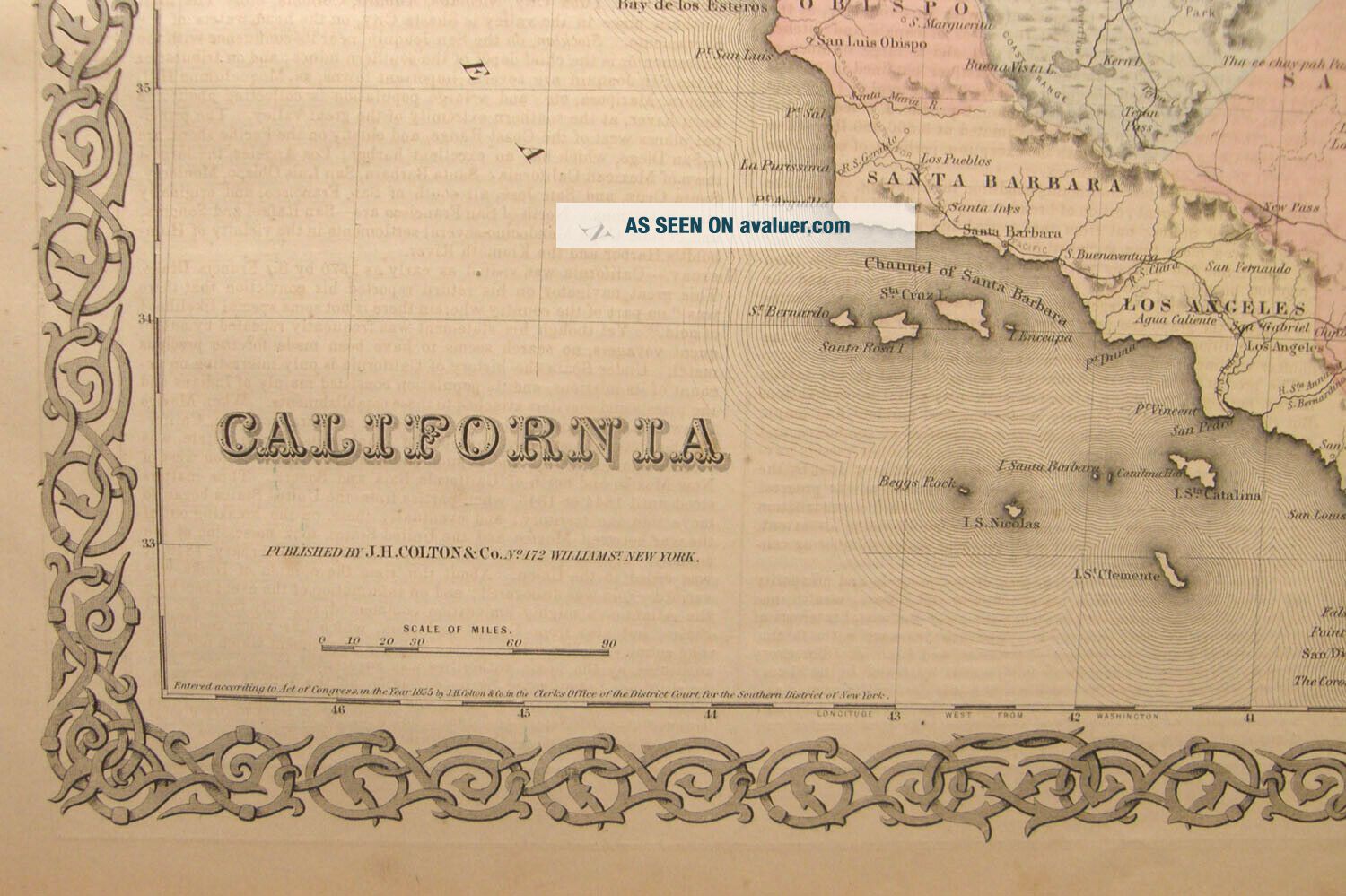
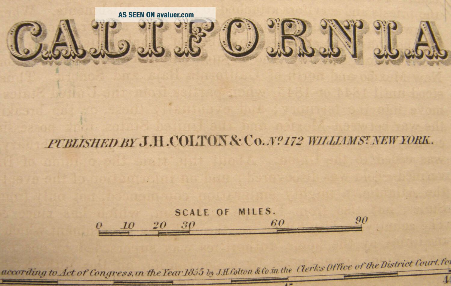
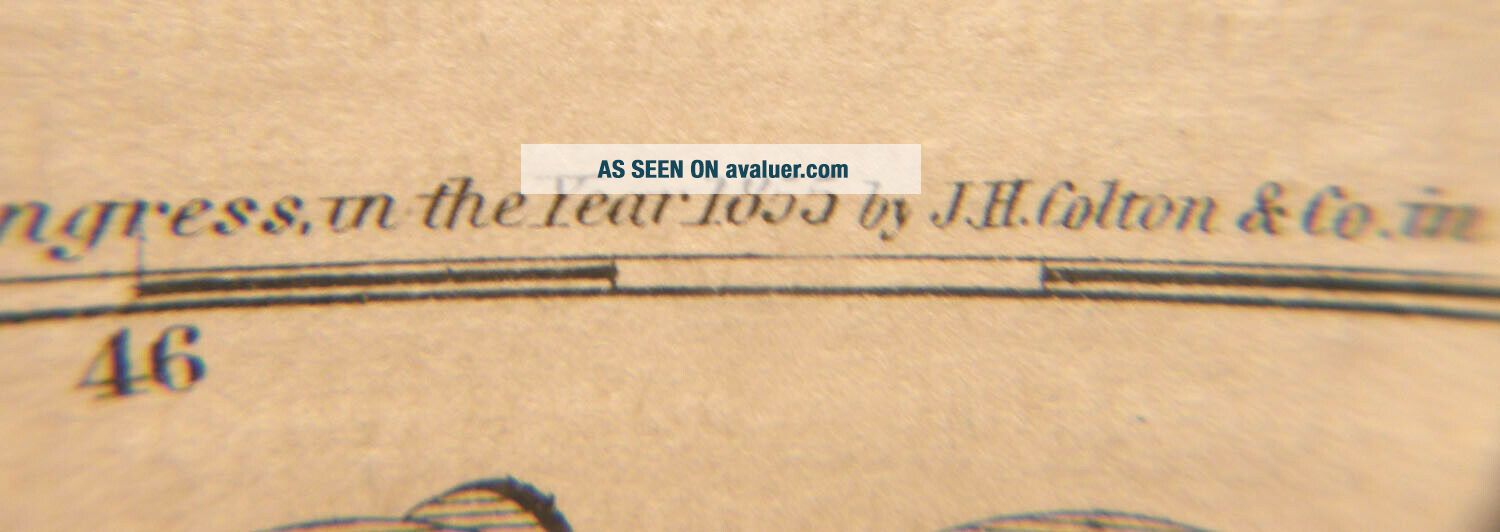
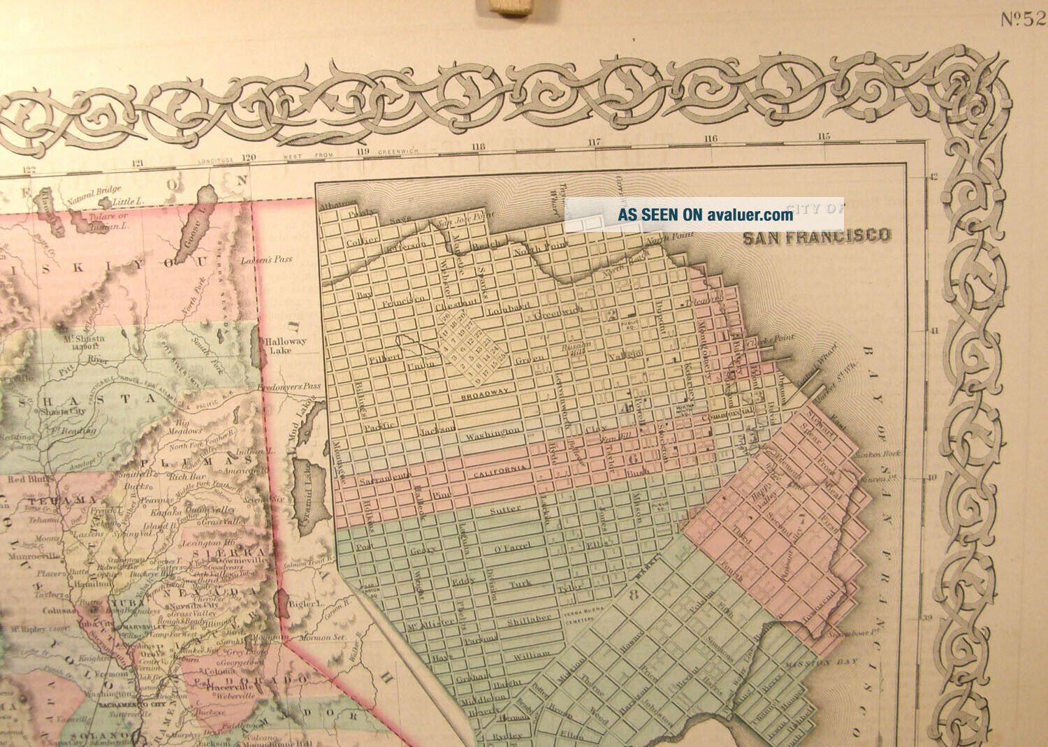
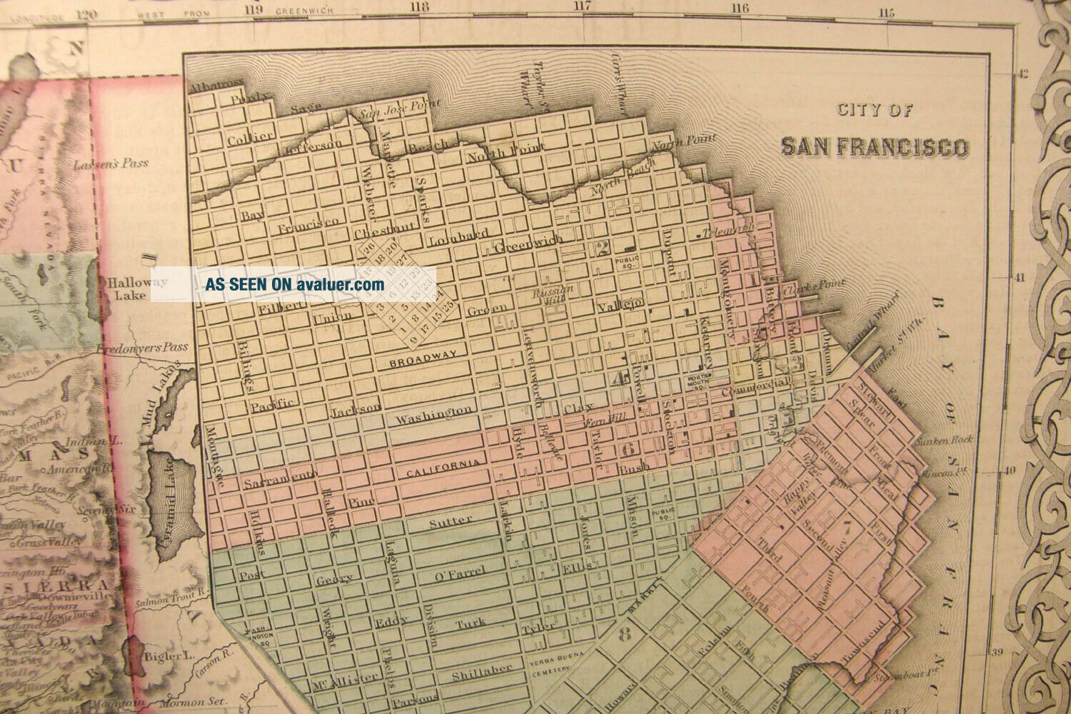
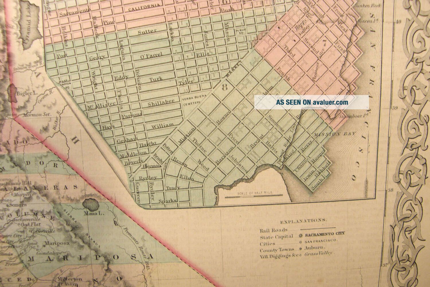
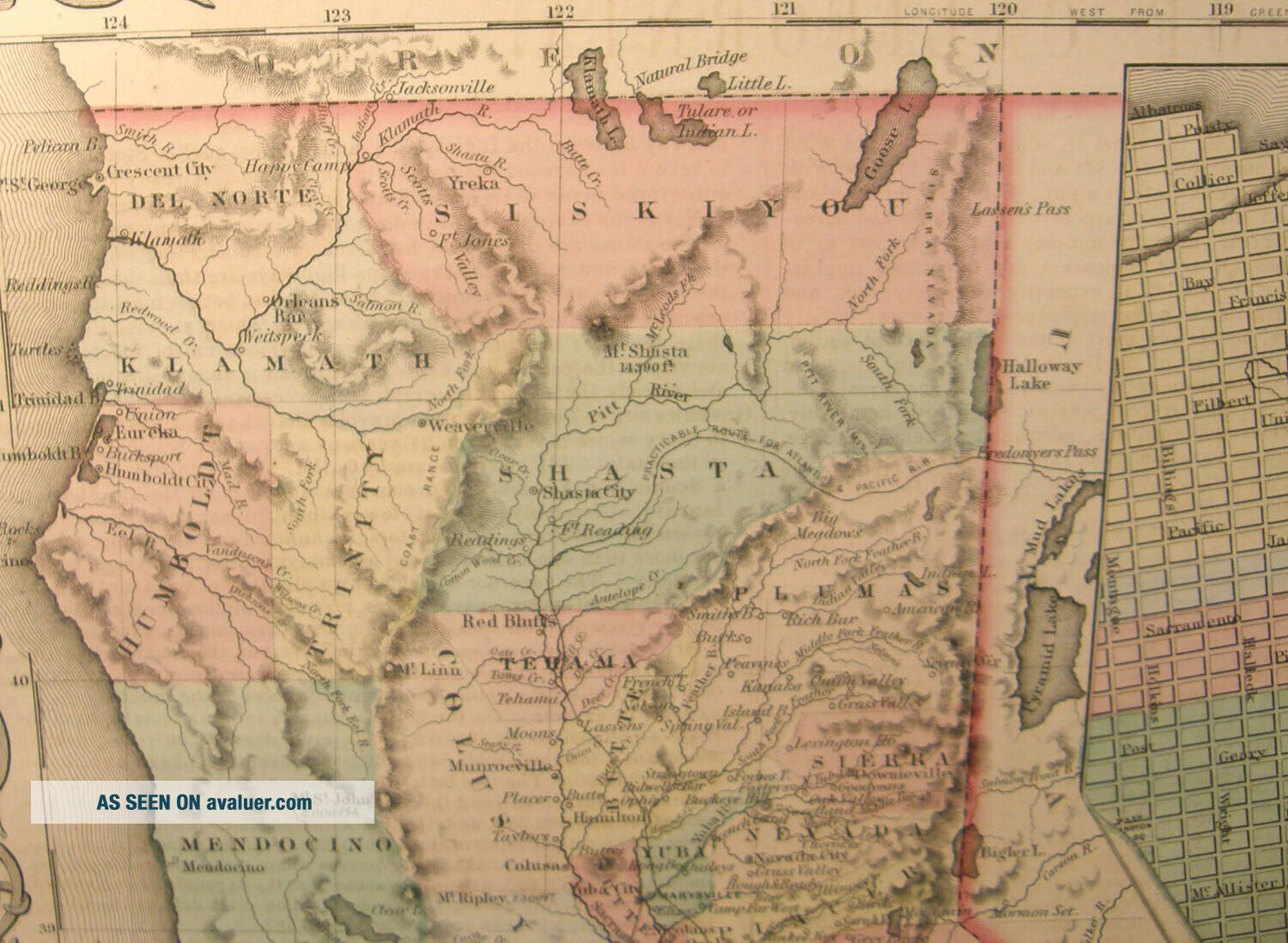
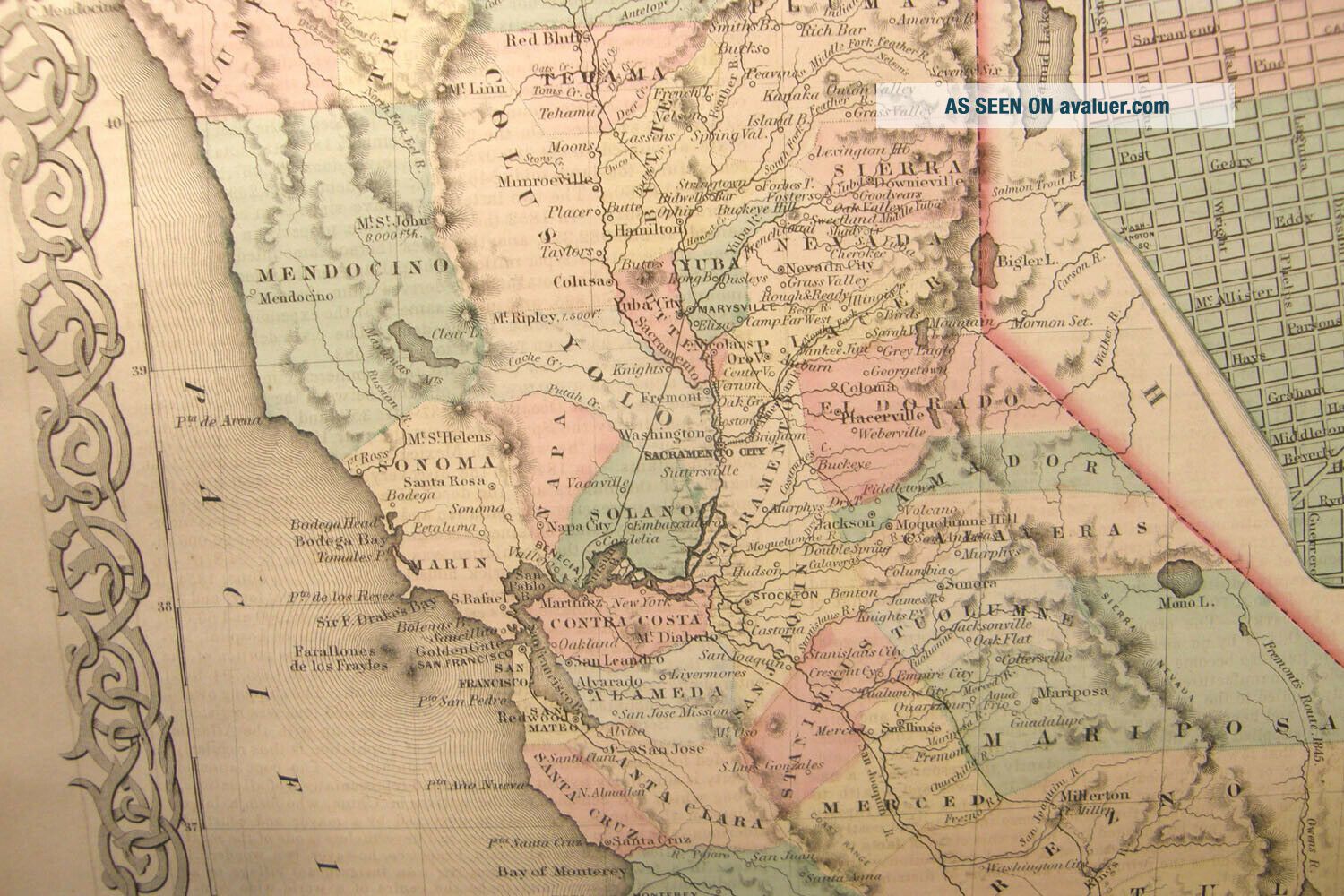
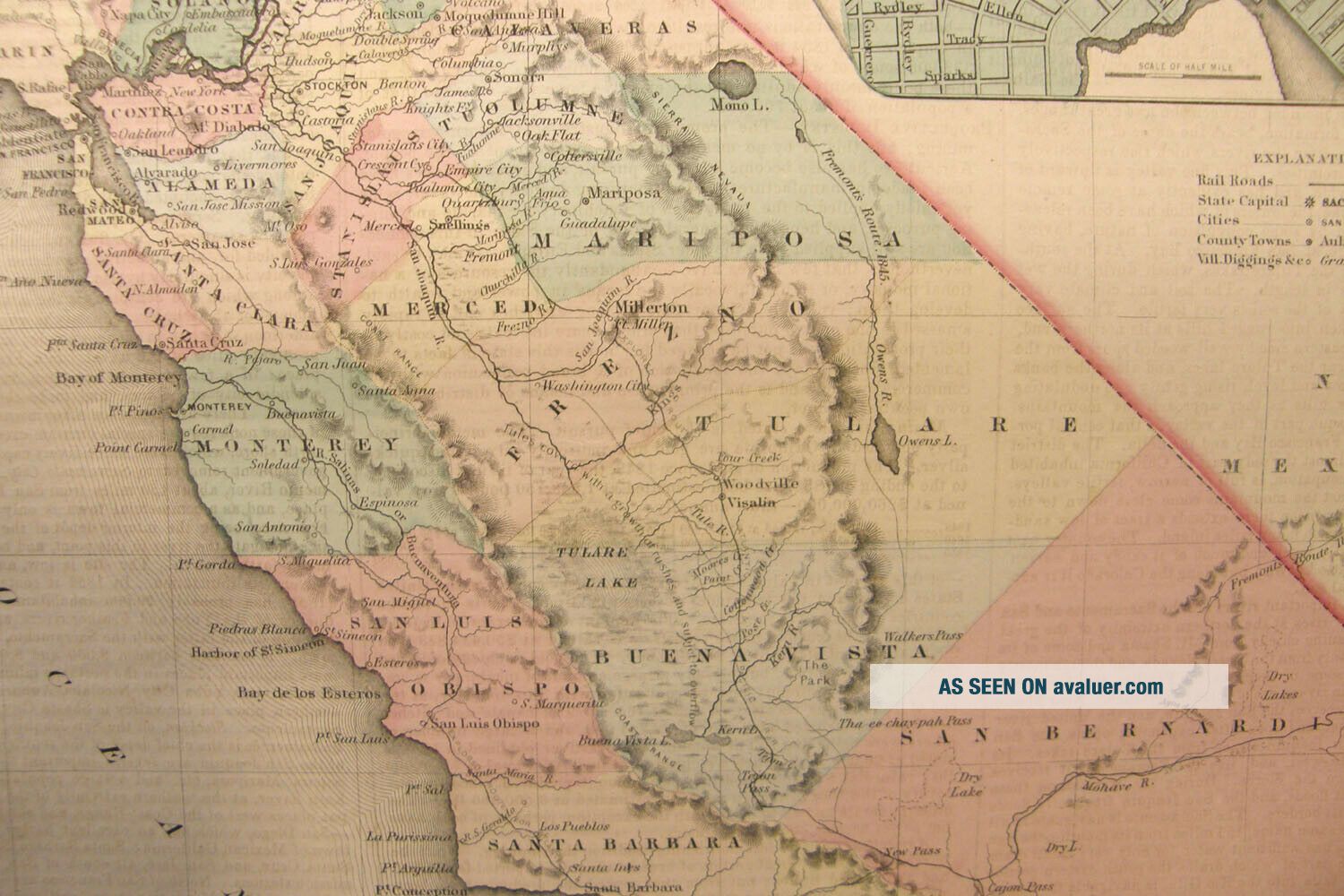
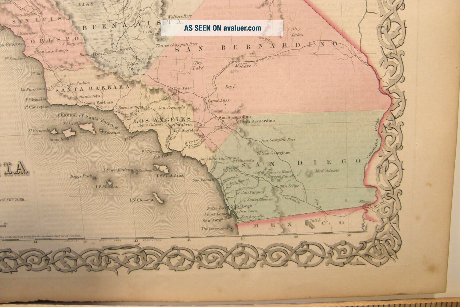
Please email with any questions. Map of California with inset map of San Francisco, hand colored steel plate engraving on paper 17 1/2" by 15". Map taken from Colton's General Atlas published in 1859. Gorgeous, suitable for framing map showing cities and towns, counties, railroads and bodies of water. The bound atlas that this map came from was in unusable, poor condition without a cover and with staining on the first few pages- otherwise we would not have broken apart a good b...ook. The reverse of the map has unrelated text. Paper a little toned with some minor foxing - a mat will hide any edge flaws.


    Similar items


  • Large Antique Hand Color Engraving Map Texas 1859 Colton

    Large Antique Hand Color Engraving Map Texas 1859 Colton ' S General Atlas

  • Antique Hand Colored Engraving Map Wisconsin 1859 Colton

    Antique Hand Colored Engraving Map Wisconsin 1859 Colton ' S General Atlas Rr

  • Antique Hand Colored Engraving Map Michigan 1859 Colton

    Antique Hand Colored Engraving Map Michigan 1859 Colton ' S Atlas Railroad

  • Antique Hand Colored Engraving Map Minnesota 1859 Colton

    Antique Hand Colored Engraving Map Minnesota 1859 Colton ' S General Atlas

  • Antique Hand Color Engraving Map Indiana 1859 Colton

    Antique Hand Color Engraving Map Indiana 1859 Colton ' S General Atlas Railroads

  • Antique Hand Colored Engraving Map Georgia 1859 Colton

    Antique Hand Colored Engraving Map Georgia 1859 Colton ' S General Atlas Rr

  • Big Antique Color Engraving Map Kansas & Nebraska 1859 Colton

    Big Antique Color Engraving Map Kansas & Nebraska 1859 Colton ' S General Atlas

  • Antique 1859 Hand Colored Engraving Map North Carolina Colton

    Antique 1859 Hand Colored Engraving Map North Carolina Colton ' S General Atlas


    • You might also like


    • 1860 Mitchell Hand Colored Map Colorado,  Nebraska & Kansas - Civil War Era

      1860 Mitchell Hand Colored Map Colorado, Nebraska & Kansas - Civil War Era

    • 18th Century French Map Of North America

      18th Century French Map Of North America

    • Las Vegas Nevada Vintage 1967 Us Geological Survey Quadrangle Map 4 Panels

      Las Vegas Nevada Vintage 1967 Us Geological Survey Quadrangle Map 4 Panels

    • Rare Antique 1845 Maps United States Exploring Expedition Book Antartica Hawaii

      Rare Antique 1845 Maps United States Exploring Expedition Book Antartica Hawaii

    • Vintage 1926 Map Hollywood From The Best Surveys Of The Time

      Vintage 1926 Map Hollywood From The Best Surveys Of The Time

    • American Continent (western Hemisphere) 1747 Bowen Antique Copper Engraved Map

      American Continent (western Hemisphere) 1747 Bowen Antique Copper Engraved Map

    • Gulf Coast Florida Texas United States 1705 De Fer Unusual Antique Engraved Map

      Gulf Coast Florida Texas United States 1705 De Fer Unusual Antique Engraved Map

    • California As Island United States 1700 De Fer Unusual First Edition Antique Map

      California As Island United States 1700 De Fer Unusual First Edition Antique Map

Avaluer          About Us          Privacy Policy          Contact Us          UP
© 2022, avaluer.net, Inc. or its affiliates