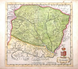
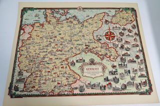
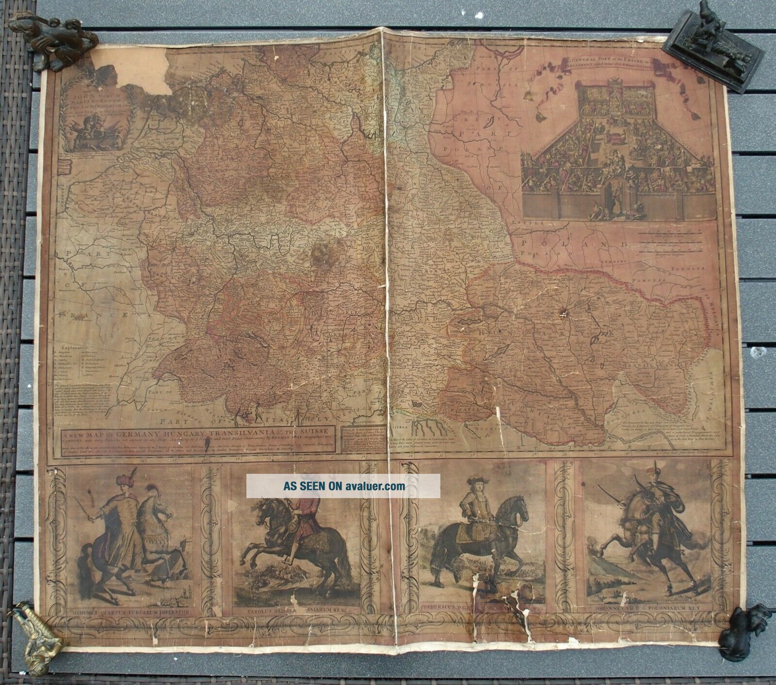
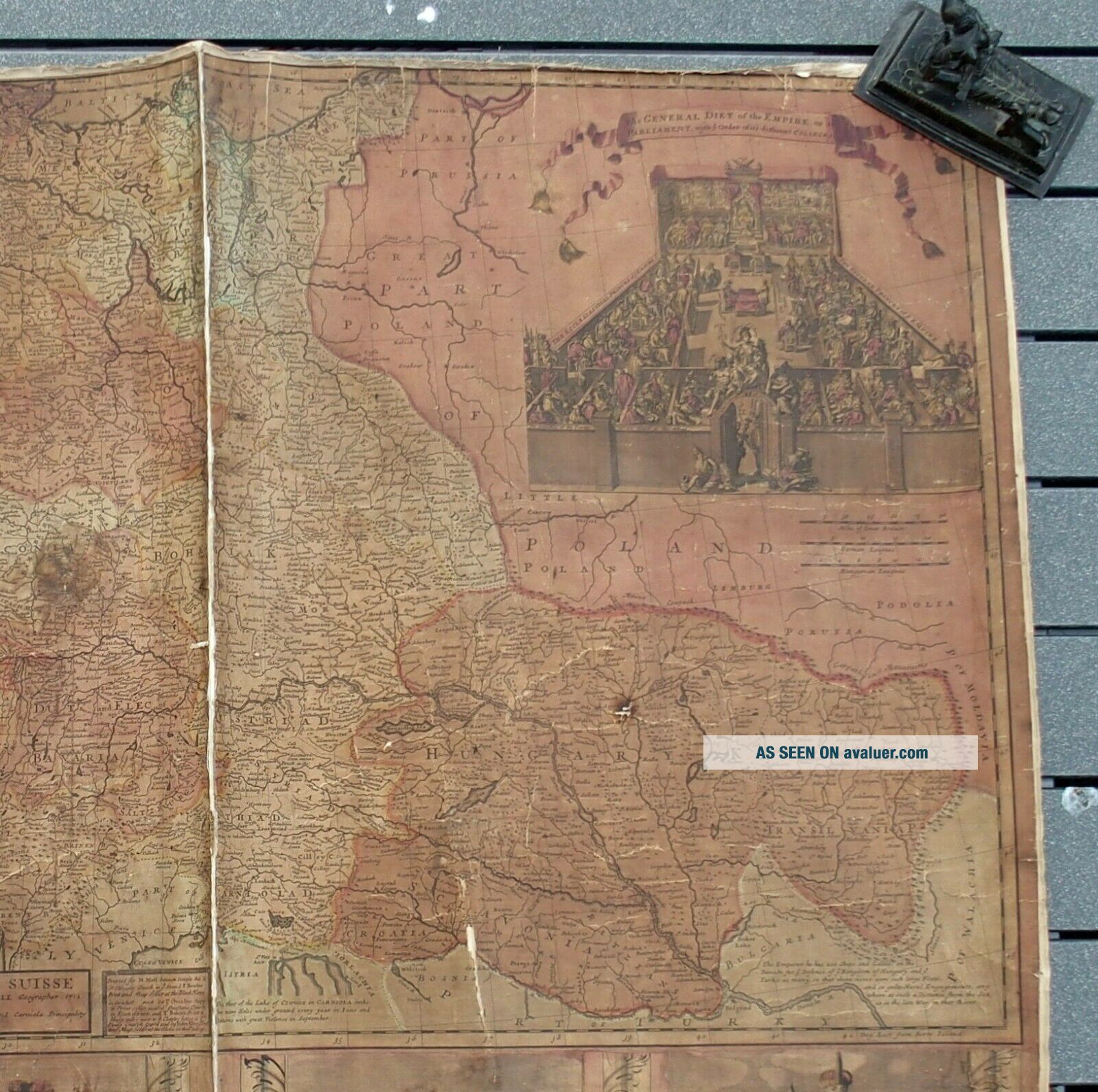
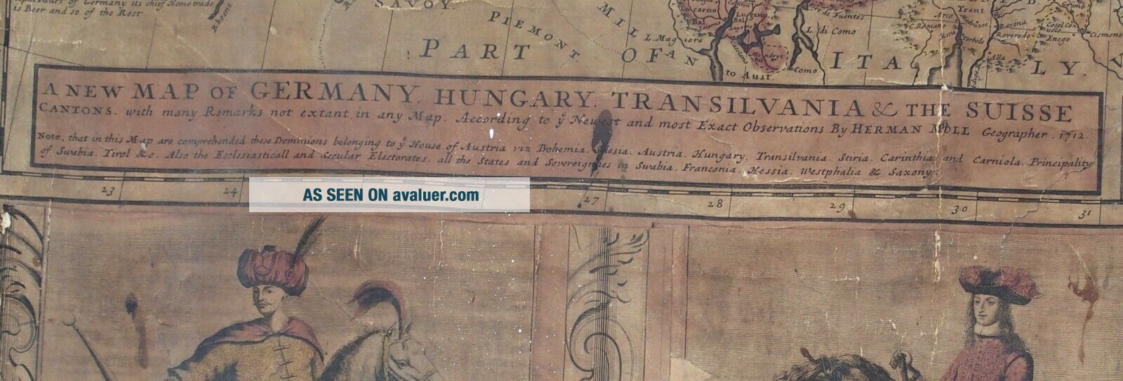
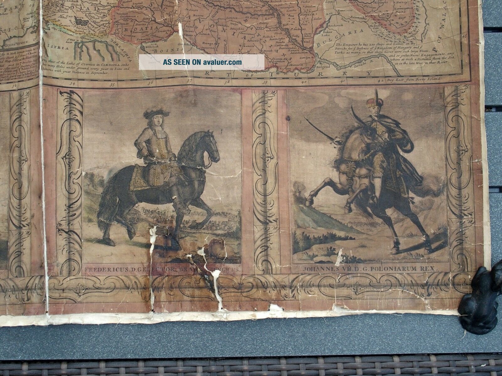
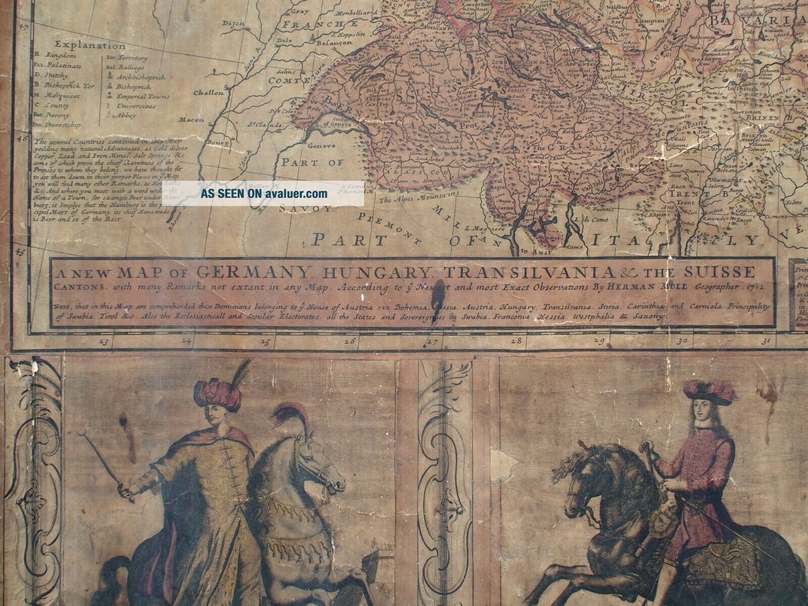
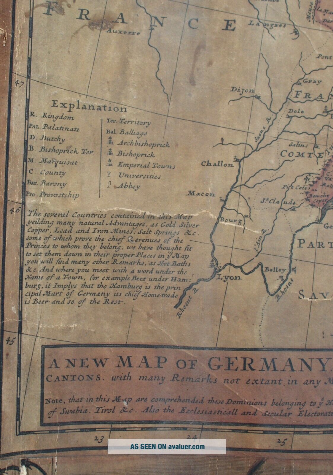
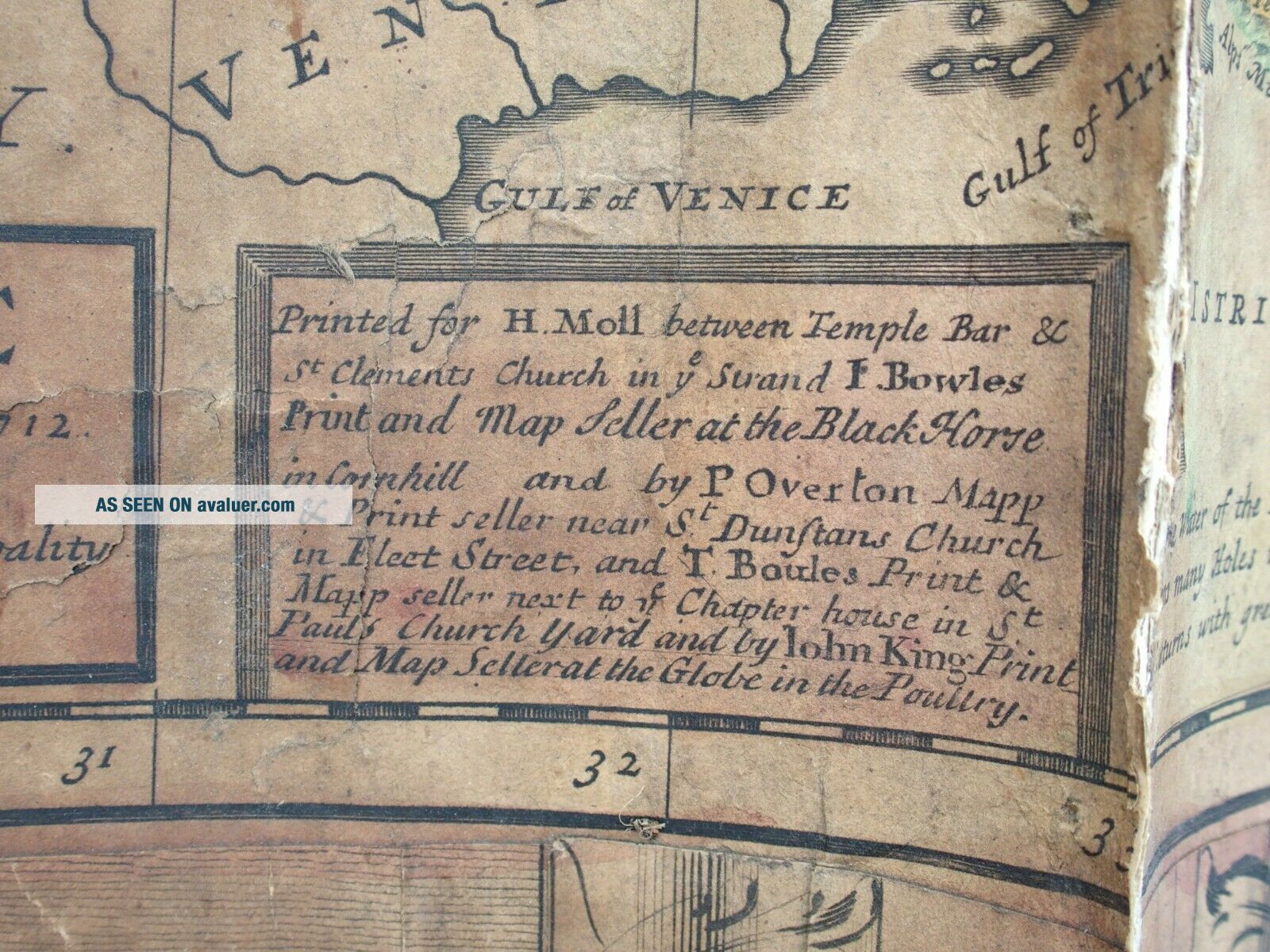
Herman Moll A Map Of Germany, Hungary, Transilvania & Swiss Cantons - Europe


Item History & Price

Information:
Reference Number: Avaluer:12844Cartographer/Publisher: Herman Moll
Country/Region: Germany
Original Description:


Herman Moll A New Map of Germany, Hungary, Transilvania & Swiss Cantons - Europe
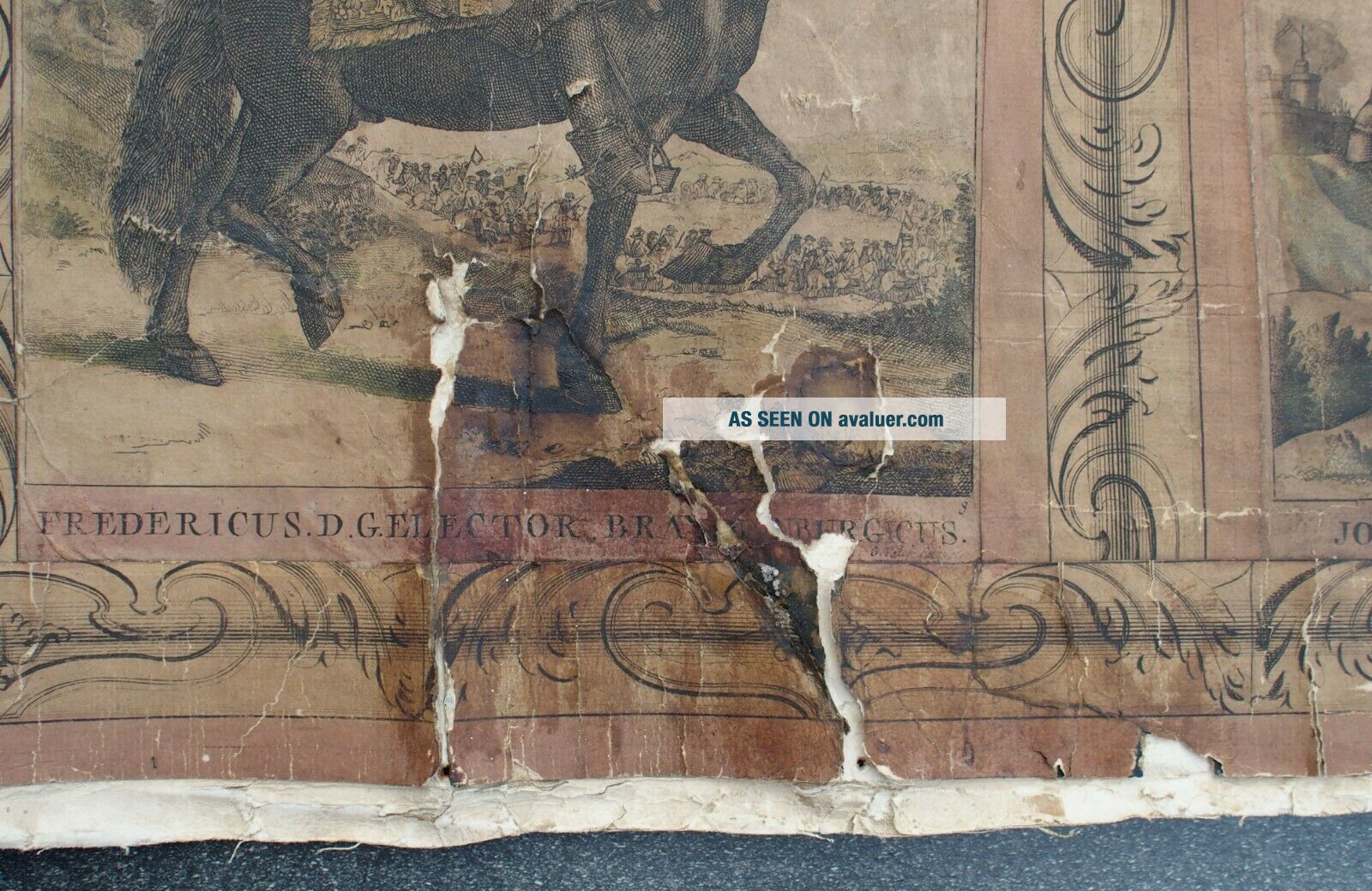
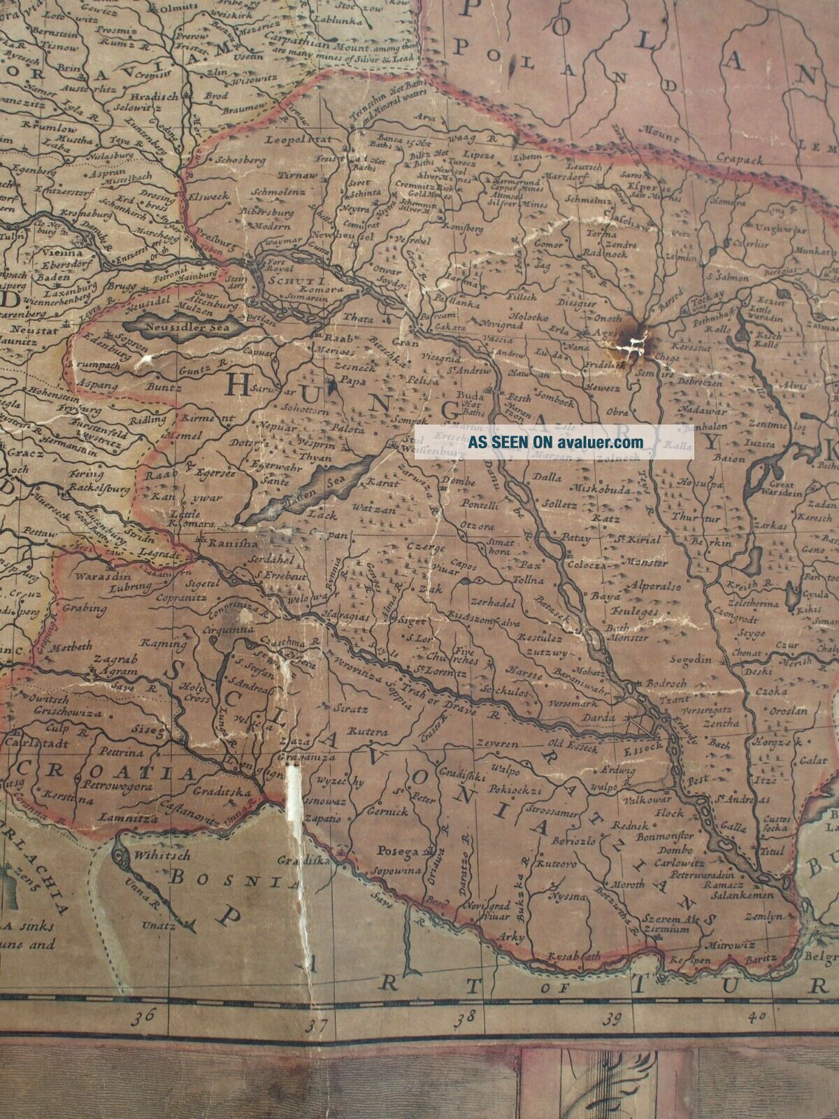
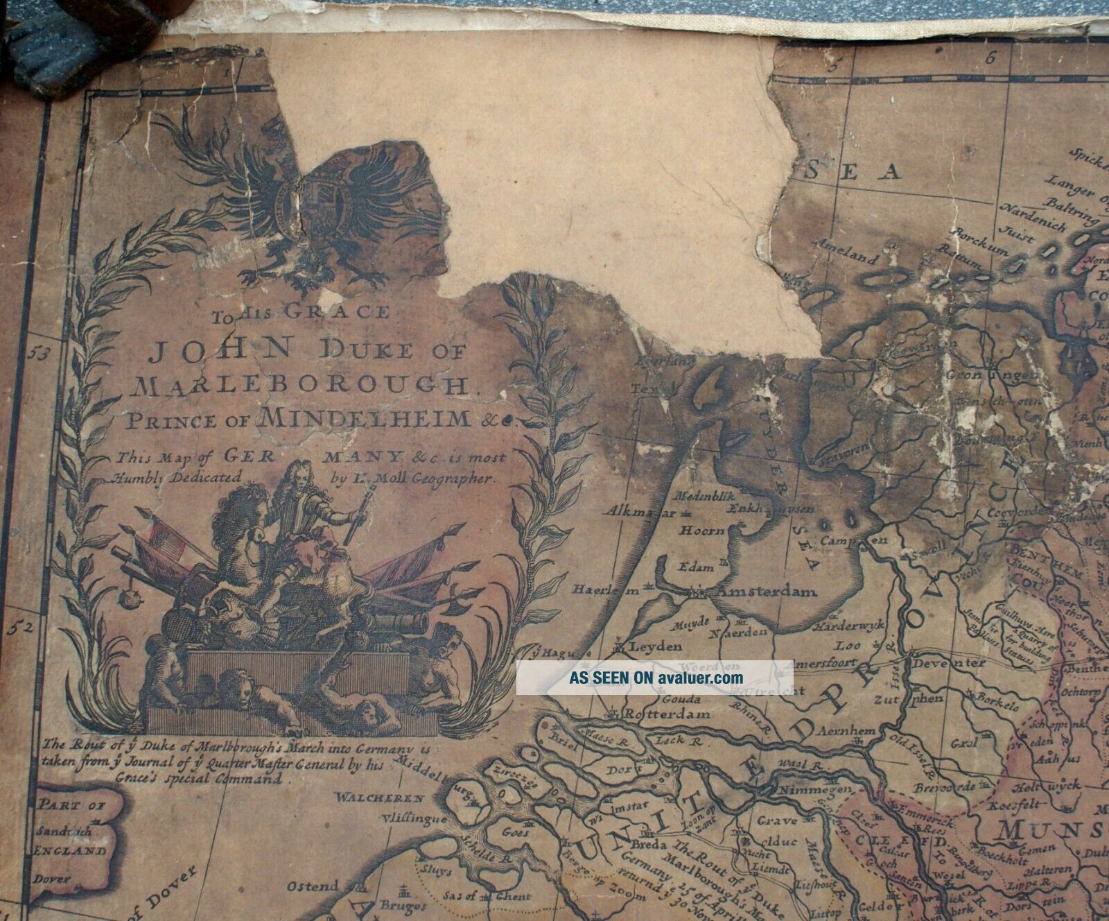
An interesting and fine old map
It is quite badly damaged - please look carefully at the images (see photos)otherwise in good antique condition
89cm high x 98cm wide
If you require more images please do not hesitate to email**PLEASE DO NOT PAY UNTIL YOU HAVE RECEIVED AN INVOICE**POSTAGE UKAll items under £50 will be sent 1st Class recorded or if over 2kgs by Courier...>All items over £50 will be sent Royal Mail Special Delivery
Overseas buyers International bidders please email for shipping costs. I am happy to ship worldwide. All items under 2 kilos will be sent Royal Mail International Signed ForIf over 2 kilos at the best priced courier servicePAYPAL only pleasePayment must be received within 7 days of close of auction.
Buyer must pay all import duties, taxes and charges
Please do not expect items to be as new, as they are antique or vintage and will of course show some signs of wear. All items are described as accurately as possible.Multiple buys usually mean cheaper packing and postage costs except when overseas purchases exceed 2 kilos.Items will be posted within 48 hours of payment received
Track Page Views With
Auctiva's FREE Counter


    Similar items


  • Antique 1736 Herman Moll Double Hemisphere Map - A Map Of The Whole World

    Antique 1736 Herman Moll Double Hemisphere Map - A Map Of The Whole World

  • A Map Of Hungary By H.  Moll 1723

    A Map Of Hungary By H. Moll 1723

  • Herman Moll Map 1729 A Map Of North Parts Of America Louisiana,  Canada Rare

    Herman Moll Map 1729 A Map Of North Parts Of America Louisiana, Canada Rare

  • C1930s Brochure Speed Along German Roads With A Road Map Of Germany

    C1930s Brochure Speed Along German Roads With A Road Map Of Germany

  • Vintage 1935 A Pictorial Map Of Germany Colortext Publications

    Vintage 1935 A Pictorial Map Of Germany Colortext Publications

  • National Geographic: A Traveler

    National Geographic: A Traveler ' S Map Of Germany 1991

  • 1722 Herman Moll Atlas Map Kingdom Of England - Great Britain - Wales

    1722 Herman Moll Atlas Map Kingdom Of England - Great Britain - Wales

  • 1722 Herman Moll Atlas Map Hungary - Hungaria - Hongrie

    1722 Herman Moll Atlas Map Hungary - Hungaria - Hongrie


    • You might also like


    • Hungary & Romania 1579 (1584) Ortelius Unusual Antique Copper Engraved Map

      Hungary & Romania 1579 (1584) Ortelius Unusual Antique Copper Engraved Map

    • Brussels Bruxelles Belfium 1777 De Ferraris & Dupuis Large Antique Map Sheet Xxi

      Brussels Bruxelles Belfium 1777 De Ferraris & Dupuis Large Antique Map Sheet Xxi

    • 1616 Atlas Map Of Iceland.

      1616 Atlas Map Of Iceland.

    • Kazan Russia 1767 Le Clerc/lespinasse Antique Copper Engraved City View

      Kazan Russia 1767 Le Clerc/lespinasse Antique Copper Engraved City View

    • 1899 Stanford,  Folding Map Of Norwich,  Norfolk,  Arthur Collins,  Jarrold & Sons,

      1899 Stanford, Folding Map Of Norwich, Norfolk, Arthur Collins, Jarrold & Sons,

    • 1948 Vintage Linen Colour Map Geological Survey Ten Mile Of Great Britain

      1948 Vintage Linen Colour Map Geological Survey Ten Mile Of Great Britain

    • 1944 Map Flying Bombs Sussex Ww2 Newspaper Military Kent Courier German V1 V2

      1944 Map Flying Bombs Sussex Ww2 Newspaper Military Kent Courier German V1 V2

    • Dated 1638 Vellum Map Of Icklesham Sussex Showing Land Uses Owners Etc

      Dated 1638 Vellum Map Of Icklesham Sussex Showing Land Uses Owners Etc

Avaluer          About Us          Privacy Policy          Contact Us          UP
© 2022, avaluer.net, Inc. or its affiliates