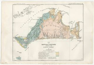
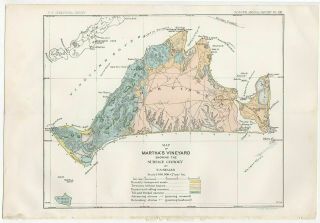
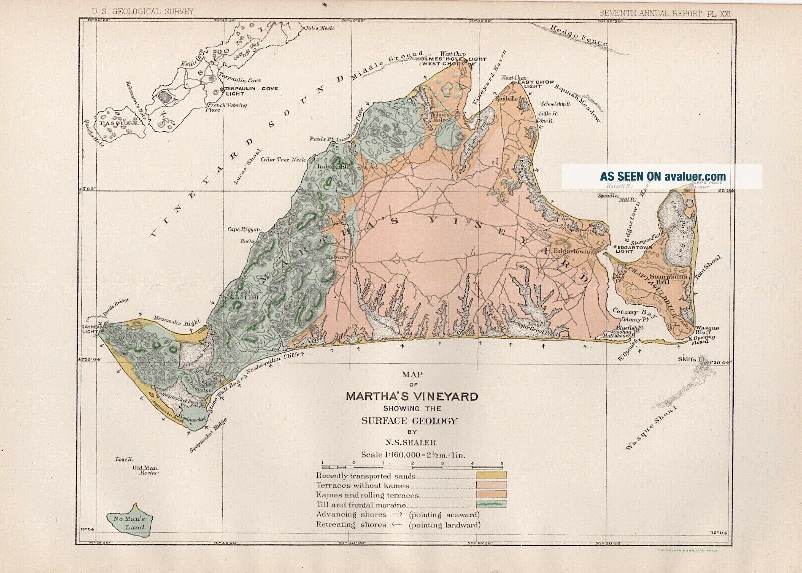
1888 Antique Geology Map Of Martha ' S Vineyard
Item History & Price
This is an original "Map of Martha's Vineyard Showing the Surface Geology" from the “Report on the Geology of Martha’s Vineyard” by Nathaniel Southgate Shaler, Government Printing Office, 1888. It is a comprehensive geologic map of Martha's Vineyard, with details on geological sub-structure, coastline and beaches, and vegetation. Shown in the map are towns, roads, harbors and lighthouses. Published by the Department of the Interior, U.S. Geological Survey, J.W. Powell, Director. ...8" x 11.5". Folded, as issued. Please see the image scan for details and condition.