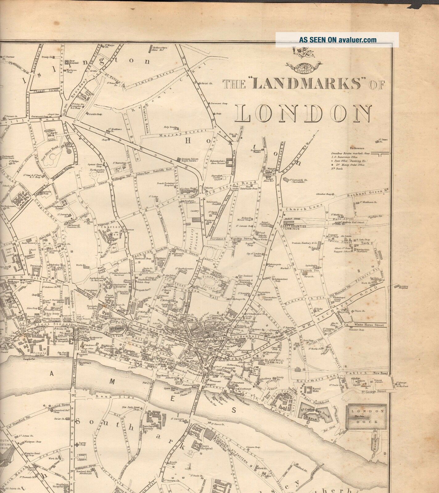
1863 LARGE ANTIQUE MAP - DISPATCH ATLAS - LANDMARKS OF LONDON
Item History & Price
1863 LARGE ANTIQUE MAP - DISPATCH ATLAS- LANDMARKS OF LONDONCouple of light spots of foxing on the image
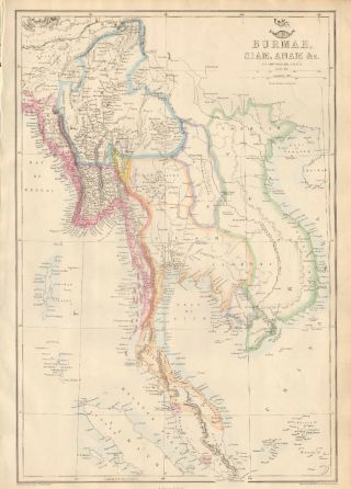
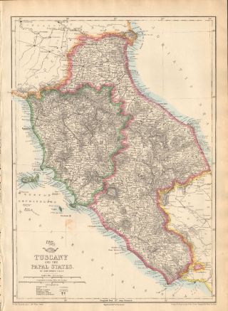
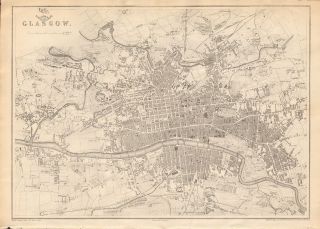
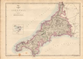
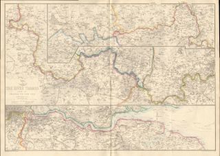
Large detailed map by Edward Weller from the Dispatch Atlas, published in 1863. The map was originally issued as two sheets. In this instance they have been joined together, presumably by the publisher or binder to include in this version of the atlas and now form the whole picture. Lithographed uncoloured map. This is an authentic old map, guaranteed t...o be over 150 years old, not a modern reproduction. Printed on light grade paper, one side only, verso is blank. This is a paper map, as issued, ie is not linen backed. It is a large map with multiple folds, again as issued . Good margins, would display well when properly mounted and framed.Free standard shipment within UK.Page Size: Large map, approx 690 x 480 mm (27 x 19 Inches) Condition:Please look at the picture provided. There may be some signs of aging and usage to margins otherwise good Provenance: The Dispatch Atlas, published at the "Weekly Dispatch" office, London, 1863The Dispatch Atlas featured detailed steel plate engraved maps of the UK and the rest of the World, showing political divisions, railways, theatres of war, town/city plans and charts, usually with single colour outline hand colouring. Maps were largely contributed by Edward Weller, John Dower and to a lesser extent, B R DaviesEdward Weller was a London-based engraver, cartographer and publisher. Having established his credentials as an engraver of finely detailed works, he sold maps to be published in a number of regular magazines and pamphlets, perhaps the best known being 'The Weekly Dispatch'. These maps were then compiled into 'The Dispatch Atlas’. Weller usually engraved the maps himself, but also worked partnership with John Dower and B R Davies, among others
GUARANTEED AUTHENTIC PRINT The picture included here is of the actual print for sale, not a stock or library picture. The vast majority of prints we sell are recovered from old, disbound books, atlases and magazines. Virtually all antiquarian maps and prints are subject to some normal aging due to use and time which is not obtrusive unless otherwise stated. We endeavour to describe any faults but please look at the picture. We offer a no questions asked return policy. GUARANTEED ORIGINAL ANTIQUE PRINT This is an authentic print, published at the date stated above. It is not a modern copy. FREE STANDARD DOMESTIC POSTAGE