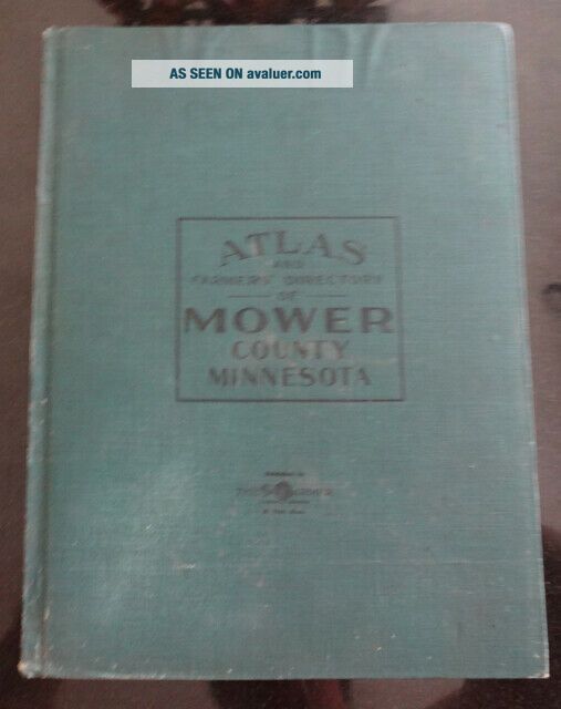
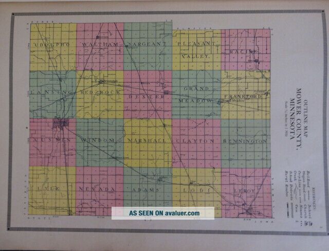
Minnesota Mower County Atlas And Farmers ' Directory 1915


Item History & Price

Information:
Reference Number: Avaluer:14111Original/Reproduction: Original
US State: Minnesota
Original Description:
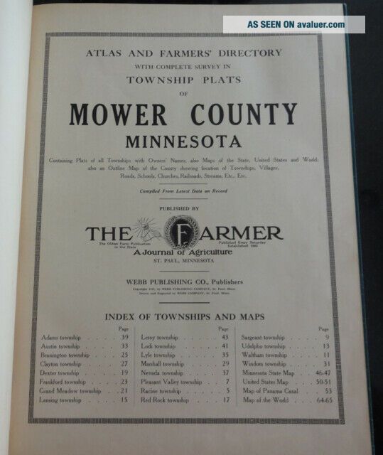
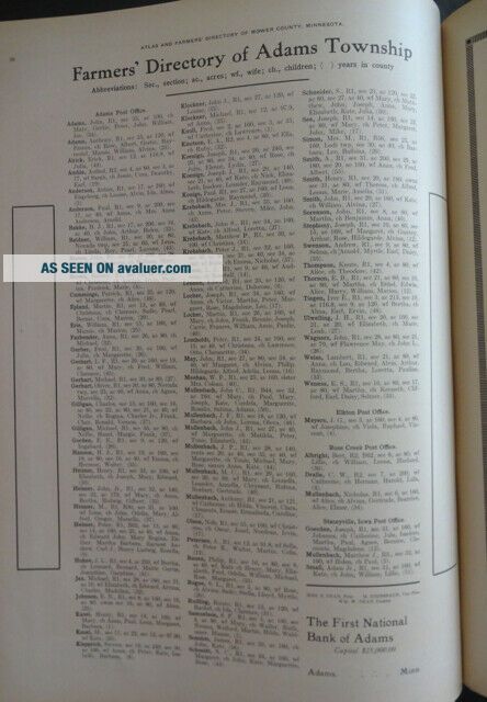
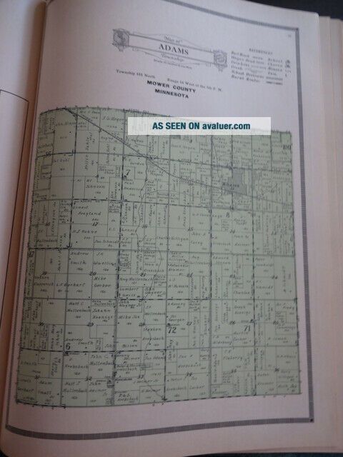
Invaluable resource for knowing who owned what and number of acres, in Mower County, over a hundred years ago. Published by "The Farmer" A Journal of Agriculture St. Paul, MN.Each of the 16 townships has a map identifying ownership and acreage. The opposing page has a listing of farmers according to a town Post Office with wife and children's name if applicable.
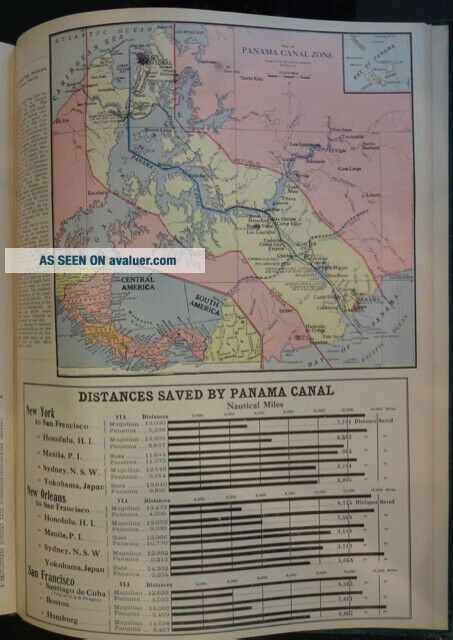
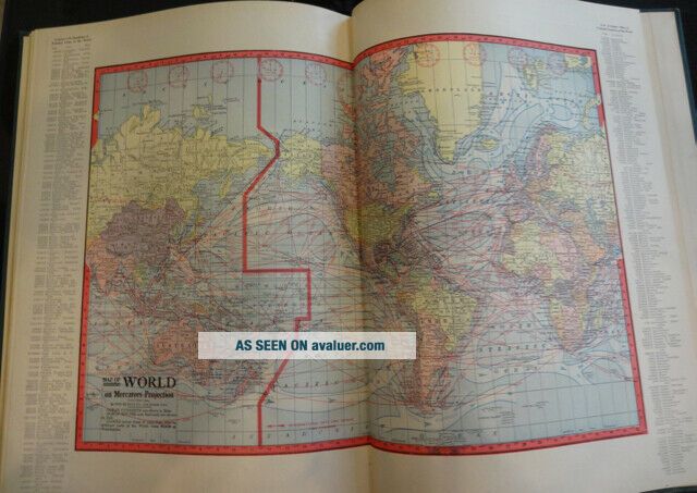
Great detailed map of Panama Canal and a World map with ocean currents.Over 65 pages.

...


    Similar items


  • Minnesota Renville County Atlas And Farmers

    Minnesota Renville County Atlas And Farmers ' Directory 1913, 1920 Minn Wallmap

  • Minnesota Dakota County Atlas And Farmers

    Minnesota Dakota County Atlas And Farmers ' Directory 1913

  • Antique Webb Publishing 1913 Atlas And Farmers Directory Meeker County Minnesota

    Antique Webb Publishing 1913 Atlas And Farmers Directory Meeker County Minnesota

  • Antique Webb Publishing 1914 Atlas And Farmers Directory Sibley County Minnesota

    Antique Webb Publishing 1914 Atlas And Farmers Directory Sibley County Minnesota

  • Antique 1914 Atlas And Farmers Directory Of Barron County Wi Townships & Maps

    Antique 1914 Atlas And Farmers Directory Of Barron County Wi Townships & Maps

  • 1930 Marathon County Wisconsin Atlas And Farmers

    1930 Marathon County Wisconsin Atlas And Farmers ' Directory

  • Atlas And Farmers

    Atlas And Farmers ' Directory, Trempealeau County, Wisconsin, 1930, Arcadia, Dodg

  • 1939 Jasper County Iowa Atlas And Farm Directory 60 Pages Neat

    1939 Jasper County Iowa Atlas And Farm Directory 60 Pages Neat


    • You might also like


    • 1860 Mitchell Hand Colored Map Colorado,  Nebraska & Kansas - Civil War Era

      1860 Mitchell Hand Colored Map Colorado, Nebraska & Kansas - Civil War Era

    • 18th Century French Map Of North America

      18th Century French Map Of North America

    • Las Vegas Nevada Vintage 1967 Us Geological Survey Quadrangle Map 4 Panels

      Las Vegas Nevada Vintage 1967 Us Geological Survey Quadrangle Map 4 Panels

    • Rare Antique 1845 Maps United States Exploring Expedition Book Antartica Hawaii

      Rare Antique 1845 Maps United States Exploring Expedition Book Antartica Hawaii

    • Vintage 1926 Map Hollywood From The Best Surveys Of The Time

      Vintage 1926 Map Hollywood From The Best Surveys Of The Time

    • American Continent (western Hemisphere) 1747 Bowen Antique Copper Engraved Map

      American Continent (western Hemisphere) 1747 Bowen Antique Copper Engraved Map

    • Gulf Coast Florida Texas United States 1705 De Fer Unusual Antique Engraved Map

      Gulf Coast Florida Texas United States 1705 De Fer Unusual Antique Engraved Map

    • California As Island United States 1700 De Fer Unusual First Edition Antique Map

      California As Island United States 1700 De Fer Unusual First Edition Antique Map

Avaluer          About Us          Privacy Policy          Contact Us          UP
© 2022, avaluer.net, Inc. or its affiliates