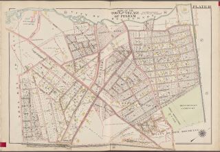
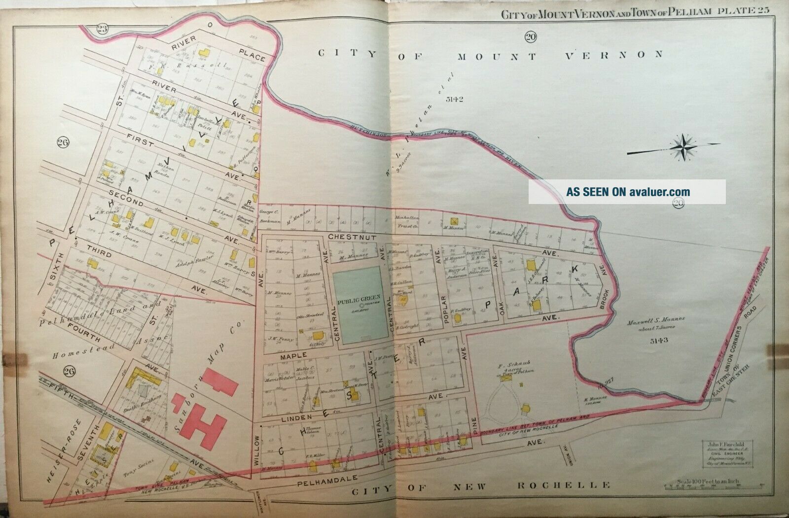
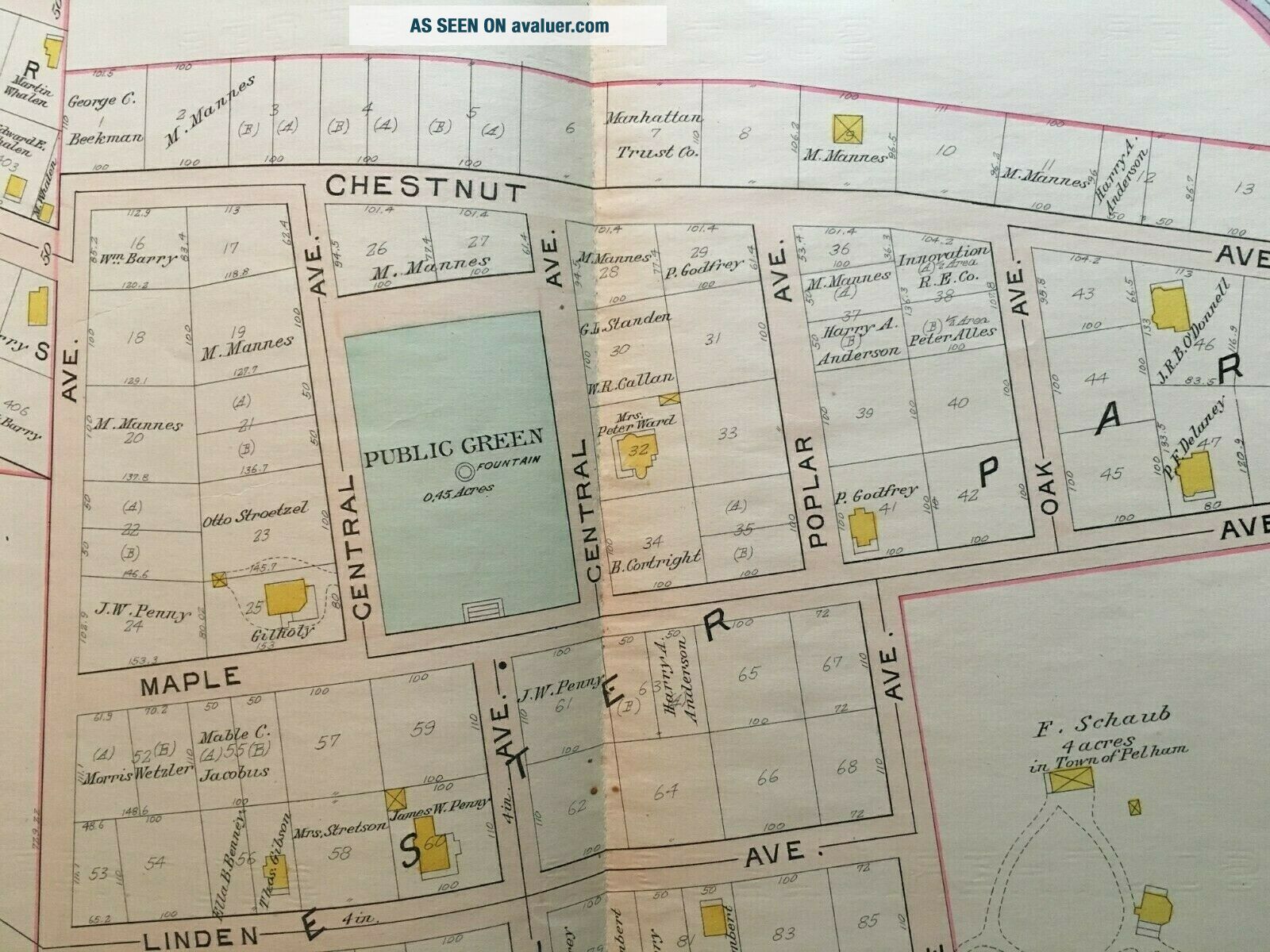
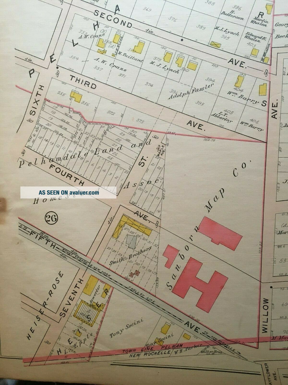
1906 PELHAM WESTCHESTER NY SANBORN MAP CO. 6TH ST - UNION COURSE RD ATLAS MAP


Item History & Price

Information:
Reference Number: Avaluer:14183
Original Description:
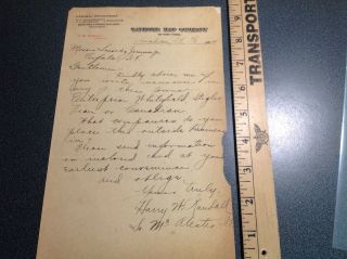
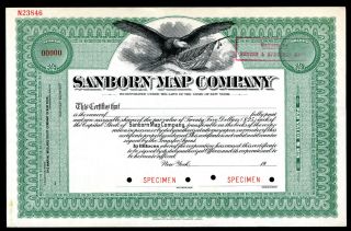
Thisis an original hand drawn on linen G.M. Hopkins 1906 Pelham, Westchester, New York, plat atlas map. It includes Sanborn Map Co., Public Green, Pelhamville and other historic buildings, parks, churches and structures. Condition: EX 23X32 ON LINEN!Plat 25 covers from: 6th Street to Union Course Road and from Pelhamdale Avenue to River Place.I am selling my collection of raremaps. If there is an area or street address of Long Island, Westchester, Brooklyn, Man...hattan, Queens, Staten Island, Bronx, Elmira, Buffalo, Rochester, Troy, Newark, Atlantic City, Essex, Berks, Montgomery, Bergen, Counties, Baltimore, New Orleans, Portland, Maine, Seattle, Cleveland, Baltimore, Toronto, Montreal, Vancouver, Denver, Portland, Maine, Philadelphia, Rochester, Toledo, Pittsburgh, Harrisburg, Wilkes-Barre, Reading, Bucks, Delaware County, Boston, South Boston, Dorchester, Roxbury, Brighton, Worcester, Brookline, Haverhill, Malden, Middlesex County, Lawrence, Quincy, Salem, Massachusetts and other cities that you might be interestedin, contact me.  I have insurance maps from 1880 to mid-1950s. Looks greatframed!    


    Similar items


  • 3558 Indian Territory Letter Sanborn Map Co Ny Canadian It 1904

    3558 Indian Territory Letter Sanborn Map Co Ny Canadian It 1904

  • Sanborn Map Co. ,  Specimen Stock.

    Sanborn Map Co. , Specimen Stock.

  • 1872 Picturesque America Antique Of Anthonys Nose,  Hudson River,  Westchester Ny

    1872 Picturesque America Antique Of Anthonys Nose, Hudson River, Westchester Ny

  • Rare Insurance Maps Of Plymouth Ma 1912 Sanborn Map Co Folio 23 Maps

    Rare Insurance Maps Of Plymouth Ma 1912 Sanborn Map Co Folio 23 Maps

  • 1954 Insurance Maps Of London Connecticut Includes Groton - Sanborn Map Co.

    1954 Insurance Maps Of London Connecticut Includes Groton - Sanborn Map Co.

  • 20x24 1910 Pelham Westchester County Ny Beechwoods Cemetery Atlas Map

    20x24 1910 Pelham Westchester County Ny Beechwoods Cemetery Atlas Map

  • 1867 Map Peekskill Cortlandt Croton Aqueduct Westchester County Ny

    1867 Map Peekskill Cortlandt Croton Aqueduct Westchester County Ny

  • Fisk & Co Ny Antique Map - Usa Acquisition Of Territory 1776 - 1884

    Fisk & Co Ny Antique Map - Usa Acquisition Of Territory 1776 - 1884


    • You might also like


    • 1860 Mitchell Hand Colored Map Colorado,  Nebraska & Kansas - Civil War Era

      1860 Mitchell Hand Colored Map Colorado, Nebraska & Kansas - Civil War Era

    • 18th Century French Map Of North America

      18th Century French Map Of North America

    • Las Vegas Nevada Vintage 1967 Us Geological Survey Quadrangle Map 4 Panels

      Las Vegas Nevada Vintage 1967 Us Geological Survey Quadrangle Map 4 Panels

    • Rare Antique 1845 Maps United States Exploring Expedition Book Antartica Hawaii

      Rare Antique 1845 Maps United States Exploring Expedition Book Antartica Hawaii

    • Vintage 1926 Map Hollywood From The Best Surveys Of The Time

      Vintage 1926 Map Hollywood From The Best Surveys Of The Time

    • American Continent (western Hemisphere) 1747 Bowen Antique Copper Engraved Map

      American Continent (western Hemisphere) 1747 Bowen Antique Copper Engraved Map

    • Gulf Coast Florida Texas United States 1705 De Fer Unusual Antique Engraved Map

      Gulf Coast Florida Texas United States 1705 De Fer Unusual Antique Engraved Map

    • California As Island United States 1700 De Fer Unusual First Edition Antique Map

      California As Island United States 1700 De Fer Unusual First Edition Antique Map

Avaluer          About Us          Privacy Policy          Contact Us          UP
© 2022, avaluer.net, Inc. or its affiliates