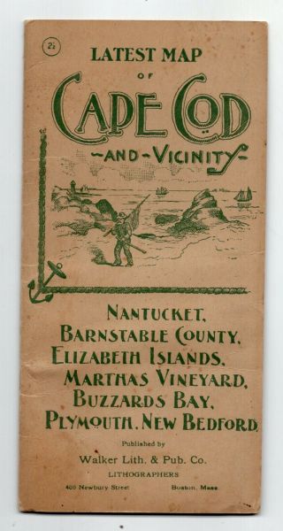
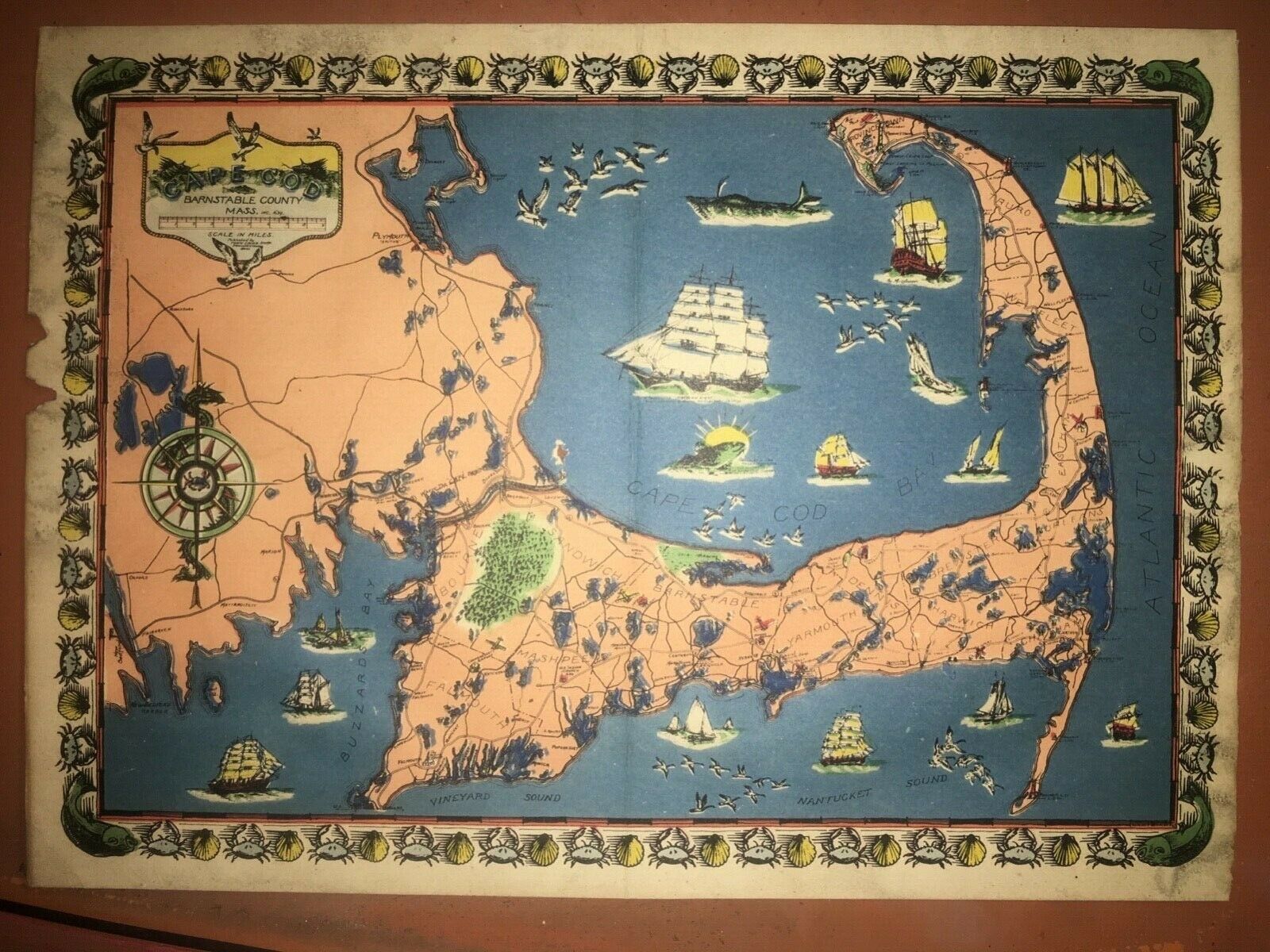
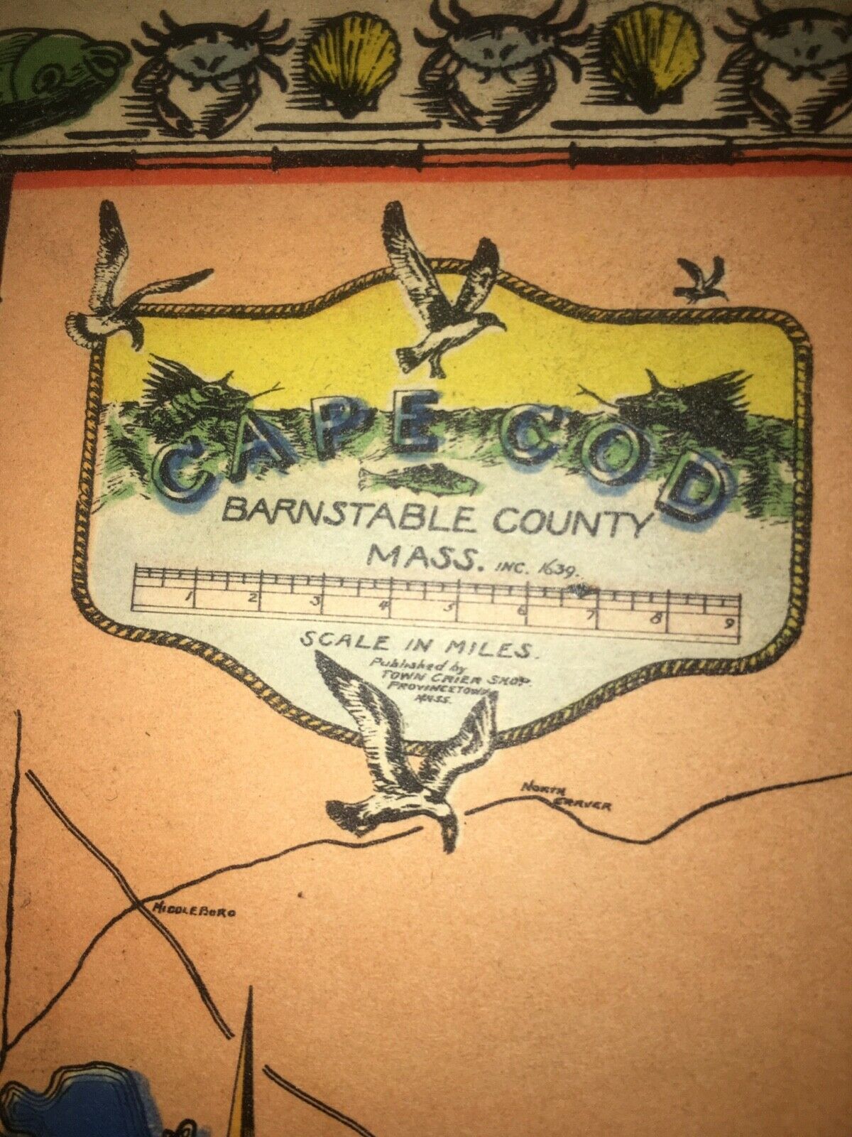
Vintage Map Of Cape Cod Circa 1930’s Printed By Town Crier Shop In Provincetown


Item History & Price

Information:
Reference Number: Avaluer:14260847Year: 1970
Date Range: 1930-1939Format: Sheet Map
Printing Technique: LithographyCartographer/Publisher: Grose Gallery
US State: MassachusettsType: Illustrated map
City: Barnstable CountyOriginal/Reproduction: Vintage Original
Country/Region: United States of America
Original Description:
Vintage Map Of Cape Cod Barnstable County Circa 1930’s printed by Town Crier Shop in Provincetown Mass. it shows it’s age with some torn edges on the left side and a crease down the middle, some discoloration around the edges and a small hole/tear in the middle. The dimensions are 12” x just under 8 3/4”. 
Please ask any questions. This is being sold AS-IS. No returns.
I only sell within the United States. No International shipping. 

...


    Similar items


  • Vintage Cook Wagon Lit Steamer Ships Brochure Map Of Far East Circa 1930

    Vintage Cook Wagon Lit Steamer Ships Brochure Map Of Far East Circa 1930 ' S

  • A Pictorial Map Of Cape Cod Circa 1970s Vtg Grose Gallery David Rose 27x21

    A Pictorial Map Of Cape Cod Circa 1970s Vtg Grose Gallery David Rose 27x21

  • Early 1900

    Early 1900 ' S Map Of Cape Cod, Nantucket, Martha ' S Vineyard

  • Rare Vintage Map Of Cairo,  Egypt.  Circa 1940’s By Orientours

    Rare Vintage Map Of Cairo, Egypt. Circa 1940’s By Orientours

  • Cafepress Vintage Map Of Cape Cod License Plate (1646464653)

    Cafepress Vintage Map Of Cape Cod License Plate (1646464653)

  • Old Boston Map Of The Usa Circa 1930

    Old Boston Map Of The Usa Circa 1930 ' S

  • Vintage Handmade Embroidered 1930’s Fabric Map Of Cape Cod Mass History Mayflowe

    Vintage Handmade Embroidered 1930’s Fabric Map Of Cape Cod Mass History Mayflowe

  • Vintage Flemming

    Vintage Flemming ' S Road And Rail Map Of South Germany Circa 1930s


    • You might also like


    • 1860 Mitchell Hand Colored Map Colorado,  Nebraska & Kansas - Civil War Era

      1860 Mitchell Hand Colored Map Colorado, Nebraska & Kansas - Civil War Era

    • 18th Century French Map Of North America

      18th Century French Map Of North America

    • Las Vegas Nevada Vintage 1967 Us Geological Survey Quadrangle Map 4 Panels

      Las Vegas Nevada Vintage 1967 Us Geological Survey Quadrangle Map 4 Panels

    • Rare Antique 1845 Maps United States Exploring Expedition Book Antartica Hawaii

      Rare Antique 1845 Maps United States Exploring Expedition Book Antartica Hawaii

    • Vintage 1926 Map Hollywood From The Best Surveys Of The Time

      Vintage 1926 Map Hollywood From The Best Surveys Of The Time

    • American Continent (western Hemisphere) 1747 Bowen Antique Copper Engraved Map

      American Continent (western Hemisphere) 1747 Bowen Antique Copper Engraved Map

    • Gulf Coast Florida Texas United States 1705 De Fer Unusual Antique Engraved Map

      Gulf Coast Florida Texas United States 1705 De Fer Unusual Antique Engraved Map

    • California As Island United States 1700 De Fer Unusual First Edition Antique Map

      California As Island United States 1700 De Fer Unusual First Edition Antique Map

Avaluer          About Us          Privacy Policy          Contact Us          UP
© 2022, avaluer.net, Inc. or its affiliates