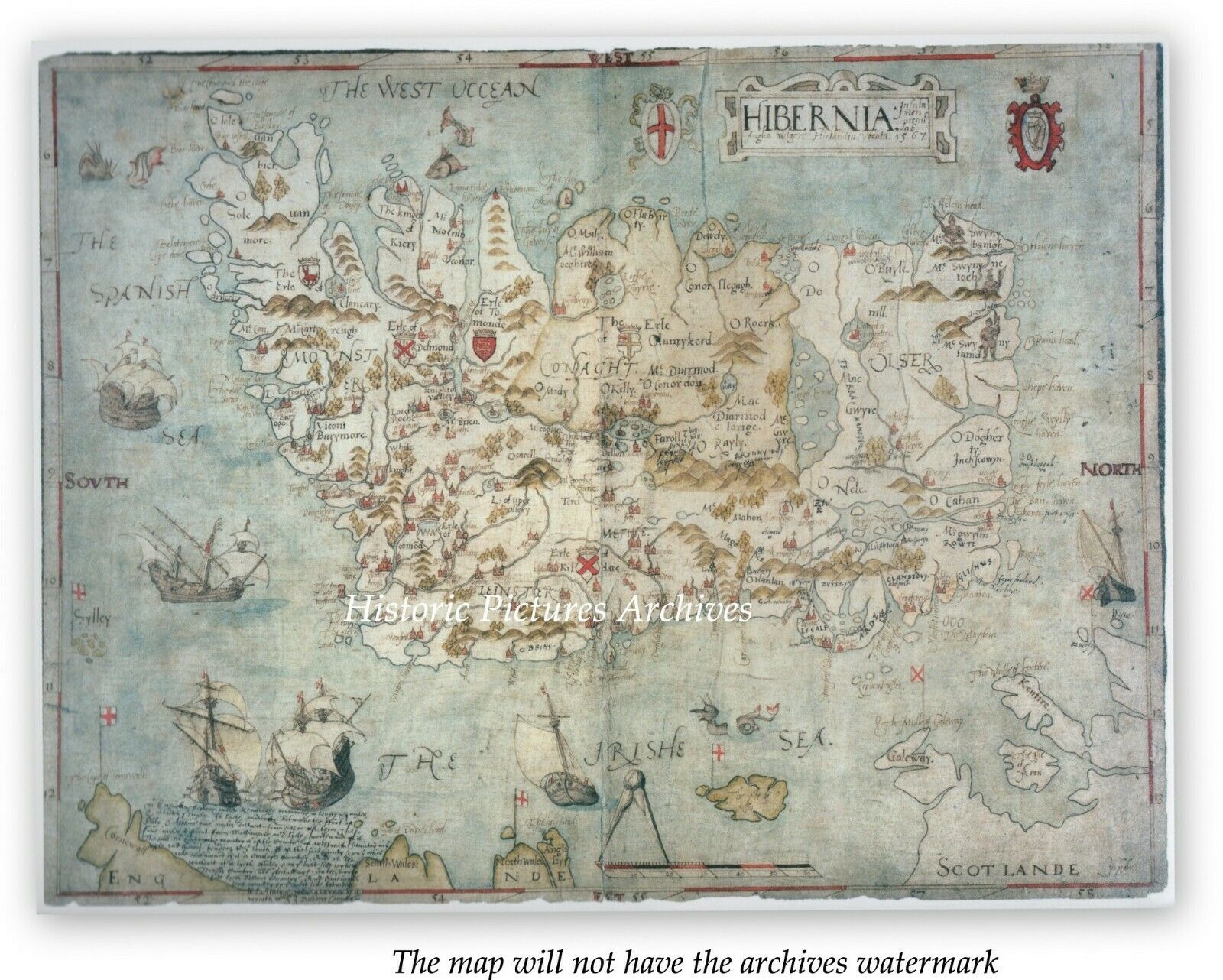
IRELAND IN 1567 HISTORIC HARDBACK PROTESTANT MAP DRAWN FOR QUEEN ELIZABETH 1
Item History & Price
| Reference Number: Avaluer:14279873 | Format: Hardback Map |
| Era: 1500s | Date Range: 1500-1599 |
SELLING HERE AN HISTORICAL LARGE MAP/PLAN HARDBACK
16th CENTURY COUNTRY MAPIRELAND IN 1567
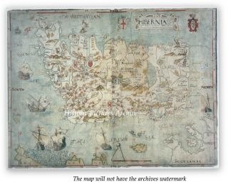
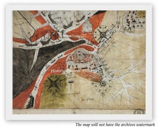
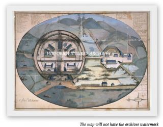
Among the earliest cartographic representations of Ireland, this map was drawn in 1567, at a time when the Protestant Elizabeth I wanted tighter control of Ireland to prevent it becoming a prize for her Catholic enemies on the continent. She colonised by supplanting the native Irish baronies with 'plantations' given to Englishmen. The very act of mapping was part of the ...appropriation of power over land. Ireland was up to that time uncharted territory from the viewpoint of its remote English rulers. However, this overview map gives the impression of a land which could be named, drawn, known — and therefore colonised. The island is set within a frame, with the west coasts of England and Scotland at the lower edge, bearing their respective flags. The title, formally given in Latin for an educated readership, can be translated as 'Hibernia, an island not far from England, in the common tongue called Ireland'. It is set in a fretwork cartouche, flanked by the cross of St George, and by a crowned harp denoting the kingdom of Ireland. All of this served to locate Ireland in the world of knowledge familiar to English government. Drawn just off the Welsh coast, a scale bar surmounted by rliviclerc indicates that the man was drawn at a scale of about I inch to 16 miles. Scale was a relatively new concept in mapping at that time, and its inclusion on this map together with degrees of latitude and longitude around the outer edge shows that the mapmaker wanted to give an impression of being familiar with the latest developments. This man was John Goghe, who signed his name in the lower right hand corner, but about whom nothing else is known. Goghe's map includes details of interest to the English: the location of castles and forts, names of settlements, difficult terrain for armies such as mountains and lakes, the holdings of Irish earls and strategic islands and river crossings. Sea was the main means of transport at that time, and there is fine drawing of the coast, harbours and rivers. The sea is decorated with ships in full sail, some with guns ablaze, while huge fish and sea monsters suggest a sense of danger. There is evidence that the map was used not just to inform those in power, but also as a working document to help form defence strategy and influence decisions at the highest levels of government. Inked additions in a sketchier hand containing information about extra places and persons of note were made by Sir William Cecil, who became Lord Burghley, one of Queen Elizabeth l's most influential ministers. Maps such as this one were one of the tools of defence and colonisation, along with the written survey and the gun.
SIZE: 10" x 8" (25 x 20 cm)
CONDITION: Excellent condition perfectly preserved in the archives.
AN HISTORIC REPLICA OF THE ORIGINAL PLAN PRODUCED WHEN THE TOPOGRAPHY OF CARTOGRAPHY WAS BEING COMPILED PROFESSIONALLY MOUNTED BUT NOT FRAMED I offer a full money back guarantee on my descriptions please bid with confidence VISIT THE ARCHIVES SHOP TO SEE OTHER HISTORIC PICTURES AND MAPS Occasionally you may see a similar item re-listed this happens when we have more than one of the item stored in the archivesWORLDWIDE POST
THANK YOU FOR VISITING