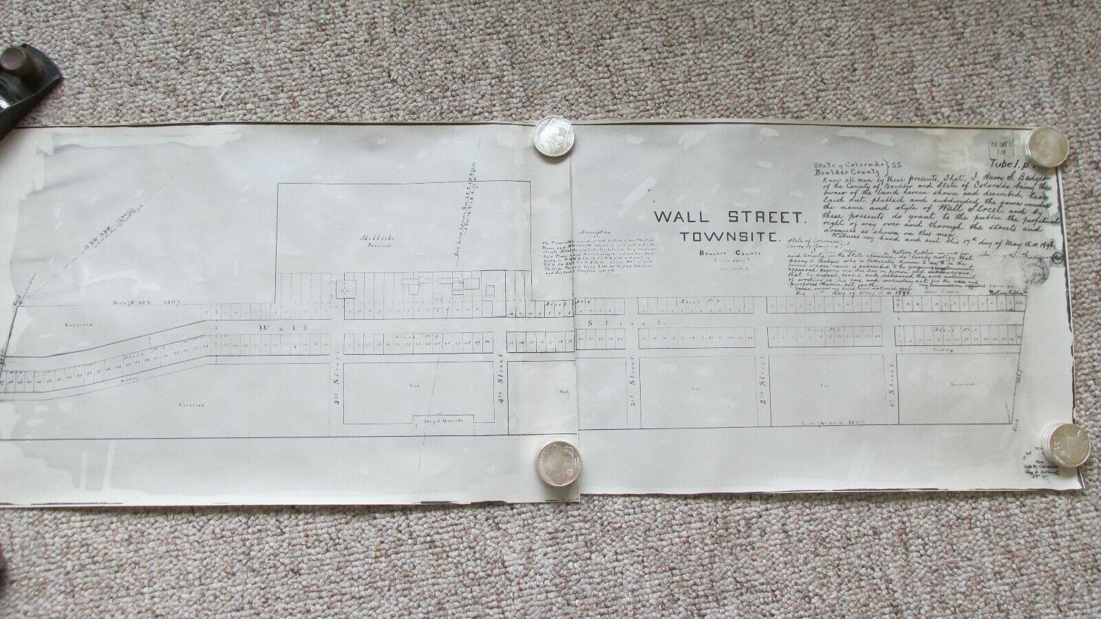
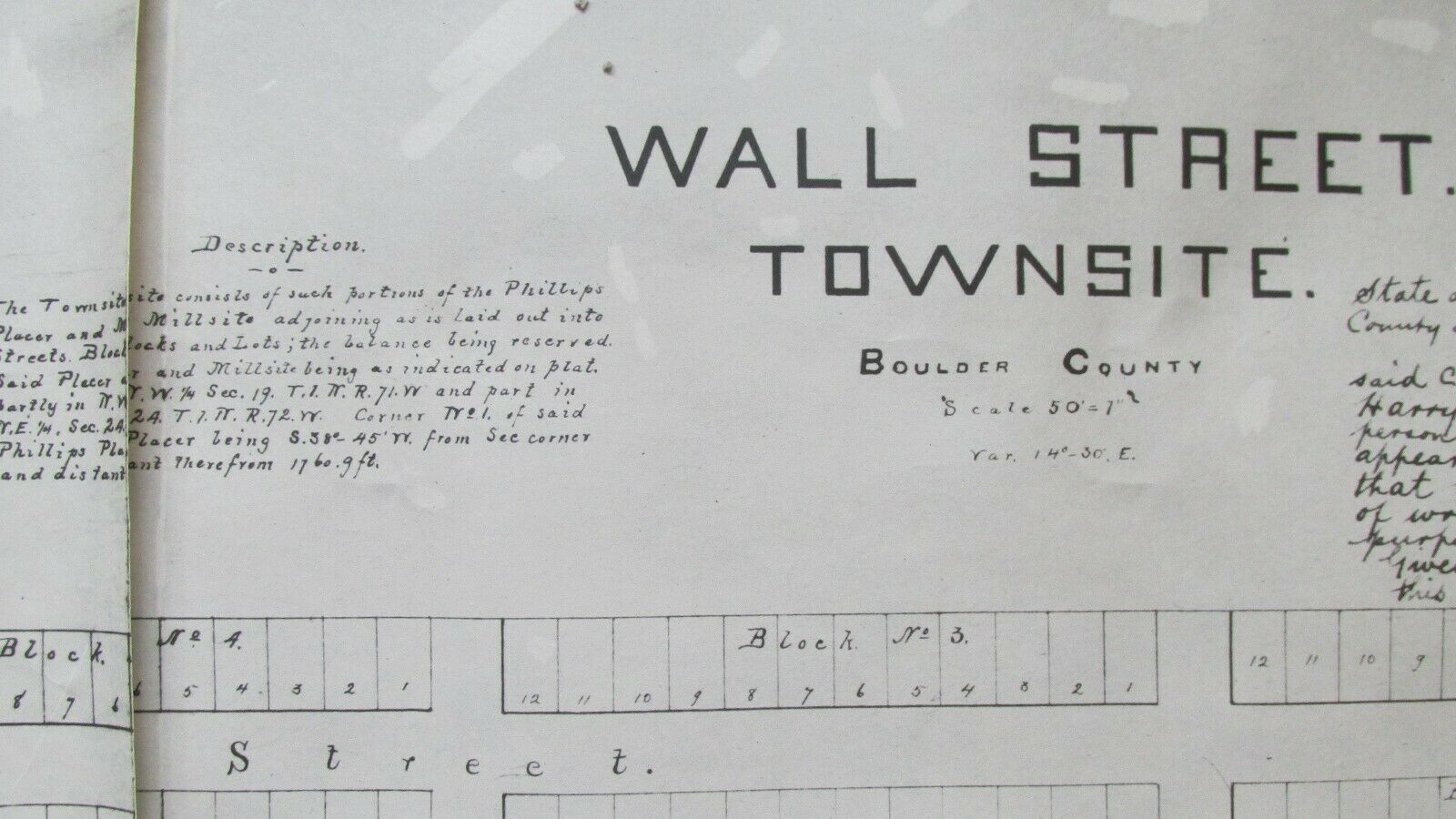
1898 Wall Street Boulder County Colorado Townsite Plat Map Reprint - Millsite


Item History & Price

Information:
Reference Number: Avaluer:14294711Original/Reproduction: Vintage Reproduction
Year: 1898Format: Wall Map
US State: ColoradoType: Town Map
Date Range: 1898
Original Description:
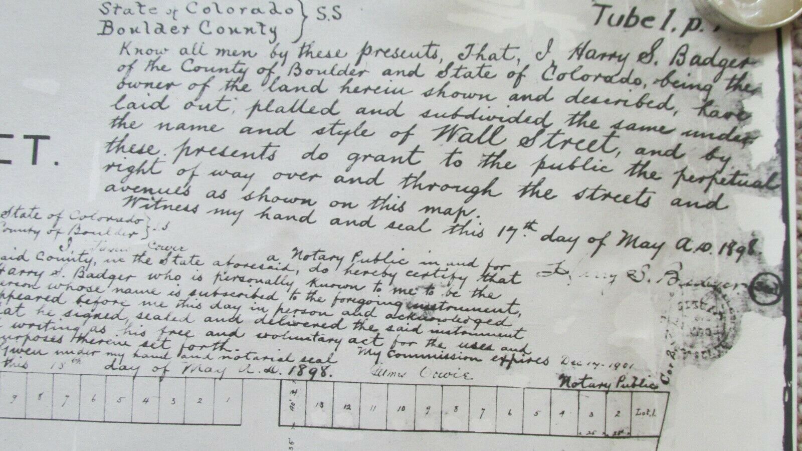
Offered here are two rolled maps of the Town Site of Wall Street in Boulder County, Colorado. Each measures 13.50 x 20.0. Very well detailed old reproduction of the original 1898 map, showing the streets and lots as well as the Phillips Mine and Mill site. Well suited for framing. Great piece of history of this early Boulder County town. Will be carefully shipped in original rolled condition. Thanks for looking!


    Similar items


  • 1902 Mining World Newspaper - Boulder County Colorado Mines - Mine Equipment Ads

    1902 Mining World Newspaper - Boulder County Colorado Mines - Mine Equipment Ads

  • Storys Baggage Express Boulder County Colorado 1910s Auto Phone 652 Postcard Co

    Storys Baggage Express Boulder County Colorado 1910s Auto Phone 652 Postcard Co

  • Lake Eldora Boulder County,  Colorado Hand - Colored - Home On The Right

    Lake Eldora Boulder County, Colorado Hand - Colored - Home On The Right

  • 1953 Boulder County Colorado License Plate

    1953 Boulder County Colorado License Plate

  • 1881 Boulder County Colorado Governor Group Gold Mine Stcck - Uncancelled - Issued

    1881 Boulder County Colorado Governor Group Gold Mine Stcck - Uncancelled - Issued

  • Salina Boulder County Colorado 4 - Bar

    Salina Boulder County Colorado 4 - Bar

  • Jalpaite Caribou Mine,  Caribou District,  Boulder County,  Colorado

    Jalpaite Caribou Mine, Caribou District, Boulder County, Colorado

  • Historic Houses Of Boulder County Colorado Architecture - History 1979

    Historic Houses Of Boulder County Colorado Architecture - History 1979


    • You might also like


    • 1860 Mitchell Hand Colored Map Colorado,  Nebraska & Kansas - Civil War Era

      1860 Mitchell Hand Colored Map Colorado, Nebraska & Kansas - Civil War Era

    • 18th Century French Map Of North America

      18th Century French Map Of North America

    • Las Vegas Nevada Vintage 1967 Us Geological Survey Quadrangle Map 4 Panels

      Las Vegas Nevada Vintage 1967 Us Geological Survey Quadrangle Map 4 Panels

    • Rare Antique 1845 Maps United States Exploring Expedition Book Antartica Hawaii

      Rare Antique 1845 Maps United States Exploring Expedition Book Antartica Hawaii

    • Vintage 1926 Map Hollywood From The Best Surveys Of The Time

      Vintage 1926 Map Hollywood From The Best Surveys Of The Time

    • American Continent (western Hemisphere) 1747 Bowen Antique Copper Engraved Map

      American Continent (western Hemisphere) 1747 Bowen Antique Copper Engraved Map

    • Gulf Coast Florida Texas United States 1705 De Fer Unusual Antique Engraved Map

      Gulf Coast Florida Texas United States 1705 De Fer Unusual Antique Engraved Map

    • California As Island United States 1700 De Fer Unusual First Edition Antique Map

      California As Island United States 1700 De Fer Unusual First Edition Antique Map

Avaluer          About Us          Privacy Policy          Contact Us          UP
© 2022, avaluer.net, Inc. or its affiliates