1872 Map F. W. Beers, Comstock & Cline Camden & Gloucester County NJ Burlington


Item History & Price

Information:
Reference Number: Avaluer:14294859
Original Description:
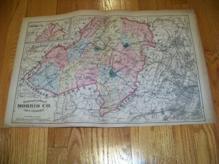
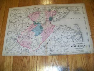
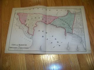
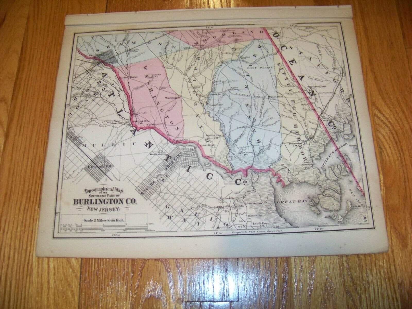
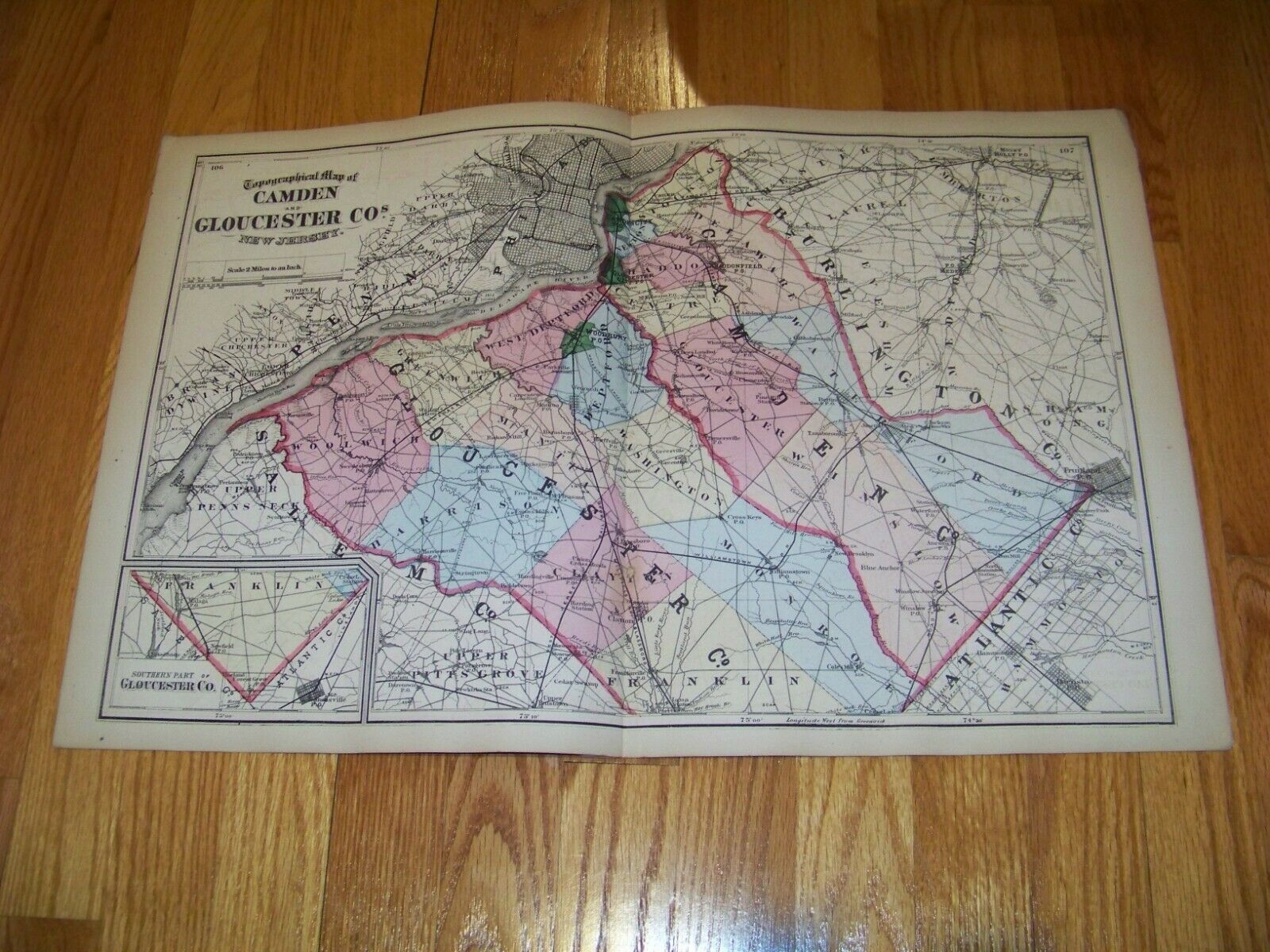
Featured here is a double sided map showing
Camden & Gloucester CountyNew Jersey with inset of Southern Part of Gloucester Countyback showsSouthern Part of Burlington County
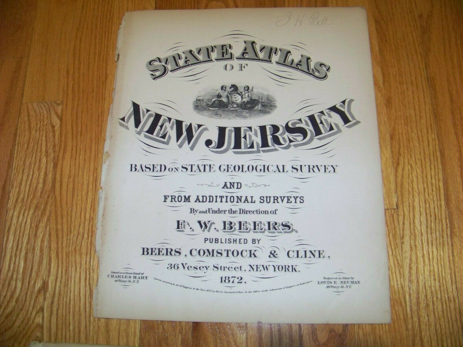
Map was taken from a partially damaged 1872 folio edition titled
State Atlas of New Jerseyunder the direction of F. W. Beerspublished byBeers, Comstock and Cline36 Vesey StreetNew York
This and other maps that I will be listing were undamagedfrom this folio
Map measures approximately 15 X 24... inches
Good Condition 
Map has been folded and will be shipped that way
  Please don't hesitate to e-mail any questions. Please check my other listings and my E-Bay Store as I will gladly combine auctions to save you on postage.   
ShipSaver

00024


    Similar items


  • 1872 Map F.  W.  Beers,  Comstock & Cline East Orange West Orange Paterson Nj

    1872 Map F. W. Beers, Comstock & Cline East Orange West Orange Paterson Nj

  • 1872 Map F.  W.  Beers,  Comstock & Cline Hoboken Jersey City Weehawken Union Nj

    1872 Map F. W. Beers, Comstock & Cline Hoboken Jersey City Weehawken Union Nj

  • 1872 Map F.  W.  Beers,  Comstock & Cline Ocean County Long Branch Jersey

    1872 Map F. W. Beers, Comstock & Cline Ocean County Long Branch Jersey

  • 1872 Map F.  W.  Beers,  Comstock & Cline Monmouth & Mercer County Jersey

    1872 Map F. W. Beers, Comstock & Cline Monmouth & Mercer County Jersey

  • 1872 Map F.  W.  Beers,  Comstock & Cline Morris County Newton Phillipsburg Nj

    1872 Map F. W. Beers, Comstock & Cline Morris County Newton Phillipsburg Nj

  • 1872 Map F.  W.  Beers,  Comstock & Cline Middlesex County Nj Perth Amboy Matawan

    1872 Map F. W. Beers, Comstock & Cline Middlesex County Nj Perth Amboy Matawan

  • 1872 Map F.  W.  Beers,  Comstock & Cline Bayonne Greenville Montclair Jersey

    1872 Map F. W. Beers, Comstock & Cline Bayonne Greenville Montclair Jersey

  • " Town Of Scarborough " Maine 1871 Map,  F W Beers Cumberland Cty Atlas

    " Town Of Scarborough " Maine 1871 Map, F W Beers Cumberland Cty Atlas


    • You might also like


    • 1860 Mitchell Hand Colored Map Colorado,  Nebraska & Kansas - Civil War Era

      1860 Mitchell Hand Colored Map Colorado, Nebraska & Kansas - Civil War Era

    • 18th Century French Map Of North America

      18th Century French Map Of North America

    • Las Vegas Nevada Vintage 1967 Us Geological Survey Quadrangle Map 4 Panels

      Las Vegas Nevada Vintage 1967 Us Geological Survey Quadrangle Map 4 Panels

    • Rare Antique 1845 Maps United States Exploring Expedition Book Antartica Hawaii

      Rare Antique 1845 Maps United States Exploring Expedition Book Antartica Hawaii

    • Vintage 1926 Map Hollywood From The Best Surveys Of The Time

      Vintage 1926 Map Hollywood From The Best Surveys Of The Time

    • American Continent (western Hemisphere) 1747 Bowen Antique Copper Engraved Map

      American Continent (western Hemisphere) 1747 Bowen Antique Copper Engraved Map

    • Gulf Coast Florida Texas United States 1705 De Fer Unusual Antique Engraved Map

      Gulf Coast Florida Texas United States 1705 De Fer Unusual Antique Engraved Map

    • California As Island United States 1700 De Fer Unusual First Edition Antique Map

      California As Island United States 1700 De Fer Unusual First Edition Antique Map

Avaluer          About Us          Privacy Policy          Contact Us          UP
© 2022, avaluer.net, Inc. or its affiliates