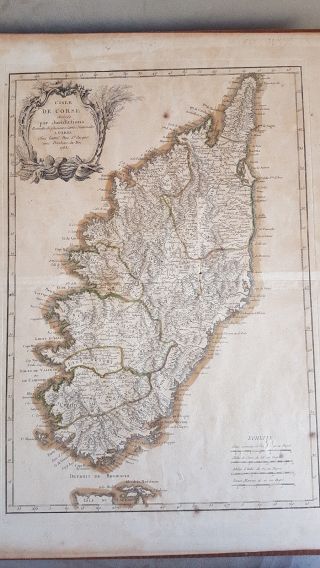
Corsica / L ' Isle De Corse From J. ELLIS Sculp. T 1768 /1780 Antique Map


Item History & Price

Information:
Reference Number: Avaluer:14334Colour: light beige
Type: County MapCartographer/Publisher: John Ellis sculp.t
Year: 1768 -1780Printing Technique: Lithography
Date Range: 1768 - 1780Original/Reproduction: Antique Original
City: CorsicaFormat: Sheet Map
Country/Region: France
Original Description:
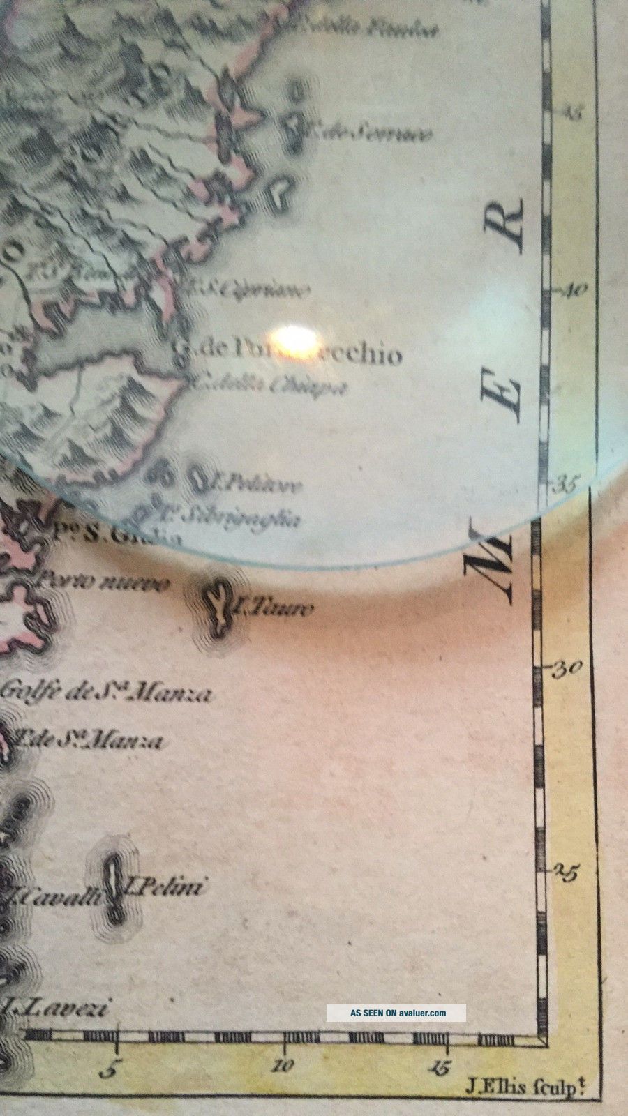
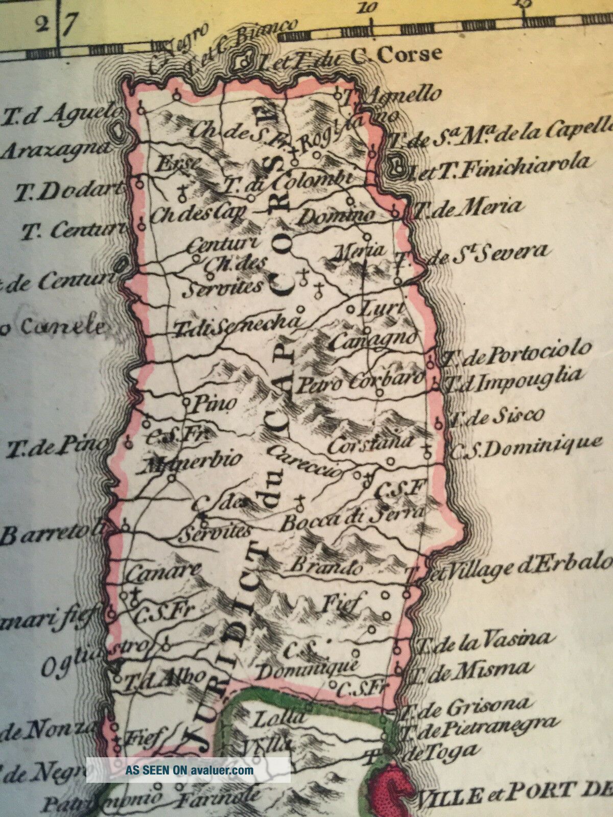
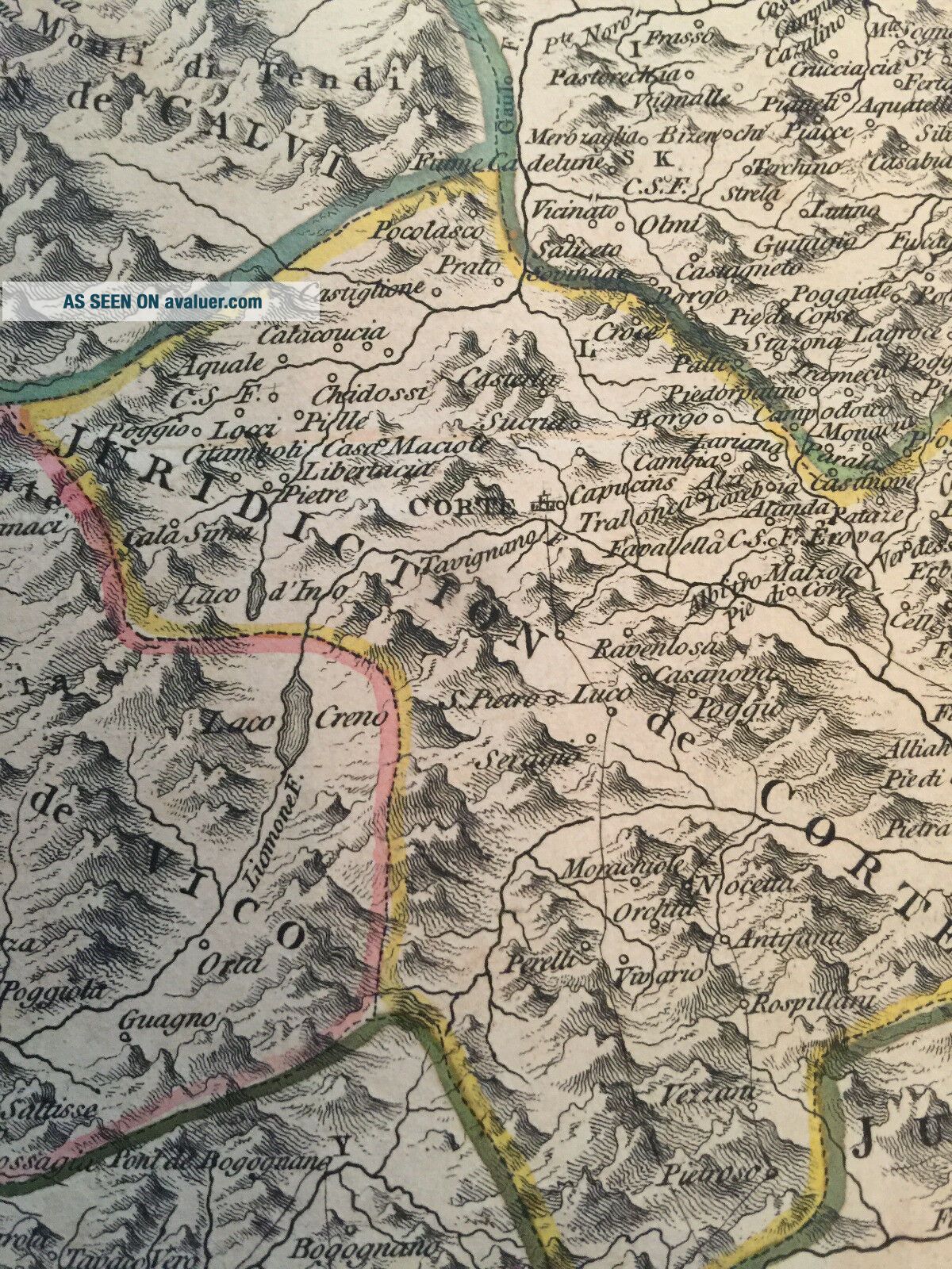
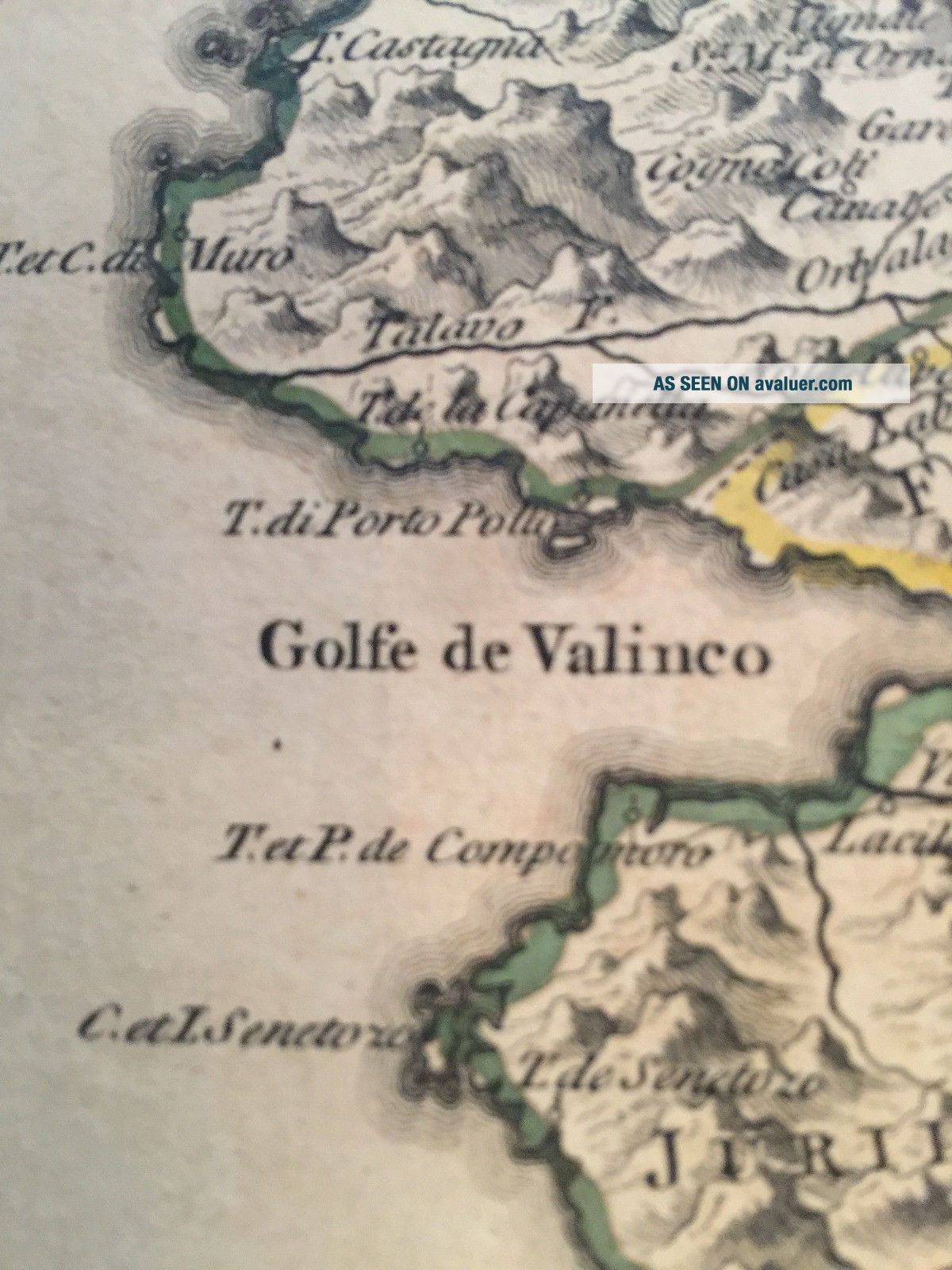
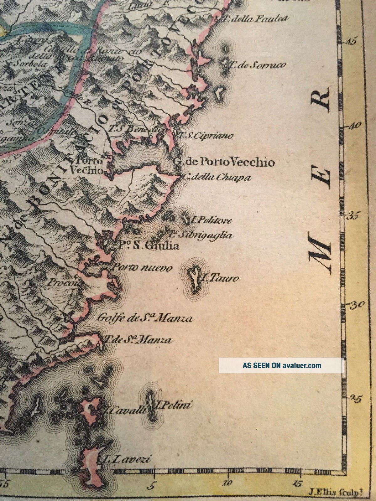
The Island of Corsica  / Original Carte de  L'ISLE de CORSE  edited from John Ellis 1768 / 1780

Marked " J. Ellis sculp.t "  who was a sculpture,   graveur et editeur 1750 - 1800.

Either in 1768 or 1780 he edited  this very detailed Antique map, colored and  showing the "Isle de Corse" in all its beauty.

Total size of the print is 555 mm high x 260 mm wide
Size of the actual map ( black printed frame ) 412 mm high x 211 mm wid...e

Map bought from antique map dealer during the Monaco Classic week in 1999
for the interior decoration of "Motor/Yacht Poseidon / Yacht Club Monaco"

Condition:  Some minor tears well documented in the photos but once behind glass it will underlines nicely the in-heritage of this centuries old map.

What better map for your Yacht you can have ?

Send in a secured mailing roll.


    Similar items


  • Rare 1783 Map Of Corsica.  L

    Rare 1783 Map Of Corsica. L ' Isle De Corse Divisee Par Juridictions

  • 1758 Bellin Atlas Map Barbados - Carte L

    1758 Bellin Atlas Map Barbados - Carte L ' Isle De La Barbade

  • " L

    " L ' Isle De Terre - Neuve, L ' Acadie " Canada Maritimes. St Lawrence. Bonne 1780 Map

  • Corals,  Litophyte Dee L

    Corals, Litophyte Dee L ' Isle De Bourbon, Buffon, Histoire Naturelle, 1765 - 83

  • 1758 Bellin Atlas Map Guadeloupe - Carte L

    1758 Bellin Atlas Map Guadeloupe - Carte L ' Isle De La Guadeloupe Marie Galante

  • 1758 Bellin Atlas Map Martinique - Carte L

    1758 Bellin Atlas Map Martinique - Carte L ' Isle De La Martinique

  • 1758 Bellin Atlas Map Grenada - Carte L

    1758 Bellin Atlas Map Grenada - Carte L ' Isle De La Grenade

  • 1758 Bellin Atlas Map Saint Lucia - Carte L

    1758 Bellin Atlas Map Saint Lucia - Carte L ' Isle De Sainte Lucie


    • You might also like


    • Hungary & Romania 1579 (1584) Ortelius Unusual Antique Copper Engraved Map

      Hungary & Romania 1579 (1584) Ortelius Unusual Antique Copper Engraved Map

    • Brussels Bruxelles Belfium 1777 De Ferraris & Dupuis Large Antique Map Sheet Xxi

      Brussels Bruxelles Belfium 1777 De Ferraris & Dupuis Large Antique Map Sheet Xxi

    • 1616 Atlas Map Of Iceland.

      1616 Atlas Map Of Iceland.

    • Kazan Russia 1767 Le Clerc/lespinasse Antique Copper Engraved City View

      Kazan Russia 1767 Le Clerc/lespinasse Antique Copper Engraved City View

    • 1899 Stanford,  Folding Map Of Norwich,  Norfolk,  Arthur Collins,  Jarrold & Sons,

      1899 Stanford, Folding Map Of Norwich, Norfolk, Arthur Collins, Jarrold & Sons,

    • 1948 Vintage Linen Colour Map Geological Survey Ten Mile Of Great Britain

      1948 Vintage Linen Colour Map Geological Survey Ten Mile Of Great Britain

    • 1944 Map Flying Bombs Sussex Ww2 Newspaper Military Kent Courier German V1 V2

      1944 Map Flying Bombs Sussex Ww2 Newspaper Military Kent Courier German V1 V2

    • Dated 1638 Vellum Map Of Icklesham Sussex Showing Land Uses Owners Etc

      Dated 1638 Vellum Map Of Icklesham Sussex Showing Land Uses Owners Etc

Avaluer          About Us          Privacy Policy          Contact Us          UP
© 2022, avaluer.net, Inc. or its affiliates