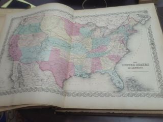
Illinois And Chicago 1856 Colton ' S Maps Early Railroad Lines


Item History & Price

Information:
Reference Number: Avaluer:14442Publication Year: 1856
Type: Railroad MapTopic: Maps
Year: 1856Cartographer/Publisher: Joseph Colton
US State: IllinoisOriginal/Reproduction: Antique Original
City: Chicago
Original Description:
Original Antique Map-Illinois with an inset - Vicinity of Chicago-shows the early railroad lines extending form the Chicago hub, including Rock Island R.R, Chicago & Miss. R.R.  Steel Plate Engraving andhand-colored on heavy paper Publisher:  J.H. Colton & Co. New YorkDate:1856    Size: 13" x 15 1/2"  (including margins 16" x18 ")  33 x 39 cm (including margins 41 x 47cm)Condition: Excellent, some aging (See Pictu...res)


    Similar items


  • Sweden And Norway 1856 Colton

    Sweden And Norway 1856 Colton ' S Maps Hand - Colored

  • Antique Map Florida 1856 Colton

    Antique Map Florida 1856 Colton ' S Maps 1st Edition

  • Vintage Sinclair Road Maps 1963 – Indiana,  Illinois And Chicago & Vicinity

    Vintage Sinclair Road Maps 1963 – Indiana, Illinois And Chicago & Vicinity

  • Antique Map Hampshire 1856 Colton

    Antique Map Hampshire 1856 Colton ' S Maps First Edition

  • 1856 Colton

    1856 Colton ' S Atlas Of The World 2 Volumes 101 Colored Maps All Very Good

  • 1855 Colton

    1855 Colton ' S Map Of Savannah And Charleston (georgia, South Carolina)

  • 1856 Colton Atlas Map Georgia Old Antique S&h

    1856 Colton Atlas Map Georgia Old Antique S&h

  • 1856 Colton Atlas Map Wisconsin - Milwaukee Old Antique S&h

    1856 Colton Atlas Map Wisconsin - Milwaukee Old Antique S&h


    • You might also like


    • 1860 Mitchell Hand Colored Map Colorado,  Nebraska & Kansas - Civil War Era

      1860 Mitchell Hand Colored Map Colorado, Nebraska & Kansas - Civil War Era

    • 18th Century French Map Of North America

      18th Century French Map Of North America

    • Las Vegas Nevada Vintage 1967 Us Geological Survey Quadrangle Map 4 Panels

      Las Vegas Nevada Vintage 1967 Us Geological Survey Quadrangle Map 4 Panels

    • Rare Antique 1845 Maps United States Exploring Expedition Book Antartica Hawaii

      Rare Antique 1845 Maps United States Exploring Expedition Book Antartica Hawaii

    • Vintage 1926 Map Hollywood From The Best Surveys Of The Time

      Vintage 1926 Map Hollywood From The Best Surveys Of The Time

    • American Continent (western Hemisphere) 1747 Bowen Antique Copper Engraved Map

      American Continent (western Hemisphere) 1747 Bowen Antique Copper Engraved Map

    • Gulf Coast Florida Texas United States 1705 De Fer Unusual Antique Engraved Map

      Gulf Coast Florida Texas United States 1705 De Fer Unusual Antique Engraved Map

    • California As Island United States 1700 De Fer Unusual First Edition Antique Map

      California As Island United States 1700 De Fer Unusual First Edition Antique Map

Avaluer          About Us          Privacy Policy          Contact Us          UP
© 2022, avaluer.net, Inc. or its affiliates