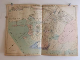
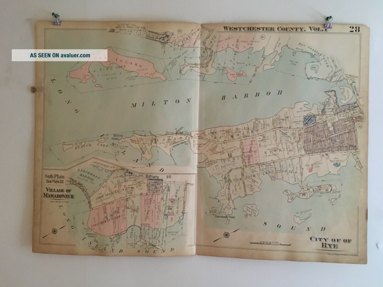
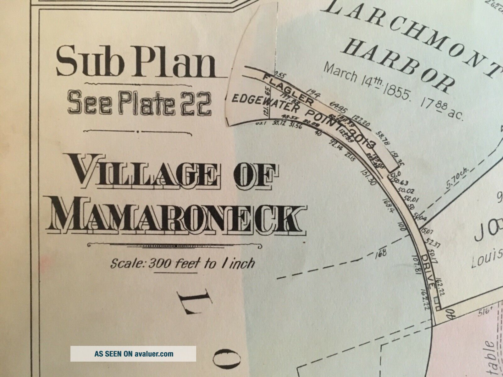
City Of Rye, Village Of Mamaroneck, Westchester County, NY 1929 Atlas Map


Item History & Price

Information:
Reference Number: Avaluer:14466Year: 1929
Date Range: 1920-1929Format: Atlas Map
Printing Technique: LithographyCartographer/Publisher: G.M. Hopkins & Co.
US State: New YorkType: City Map
City: RyeOriginal/Reproduction: Antique Original
Country/Region: United States
Original Description:
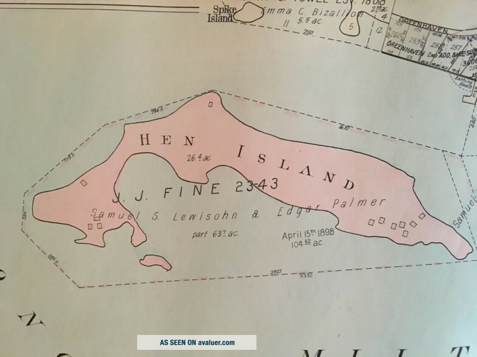
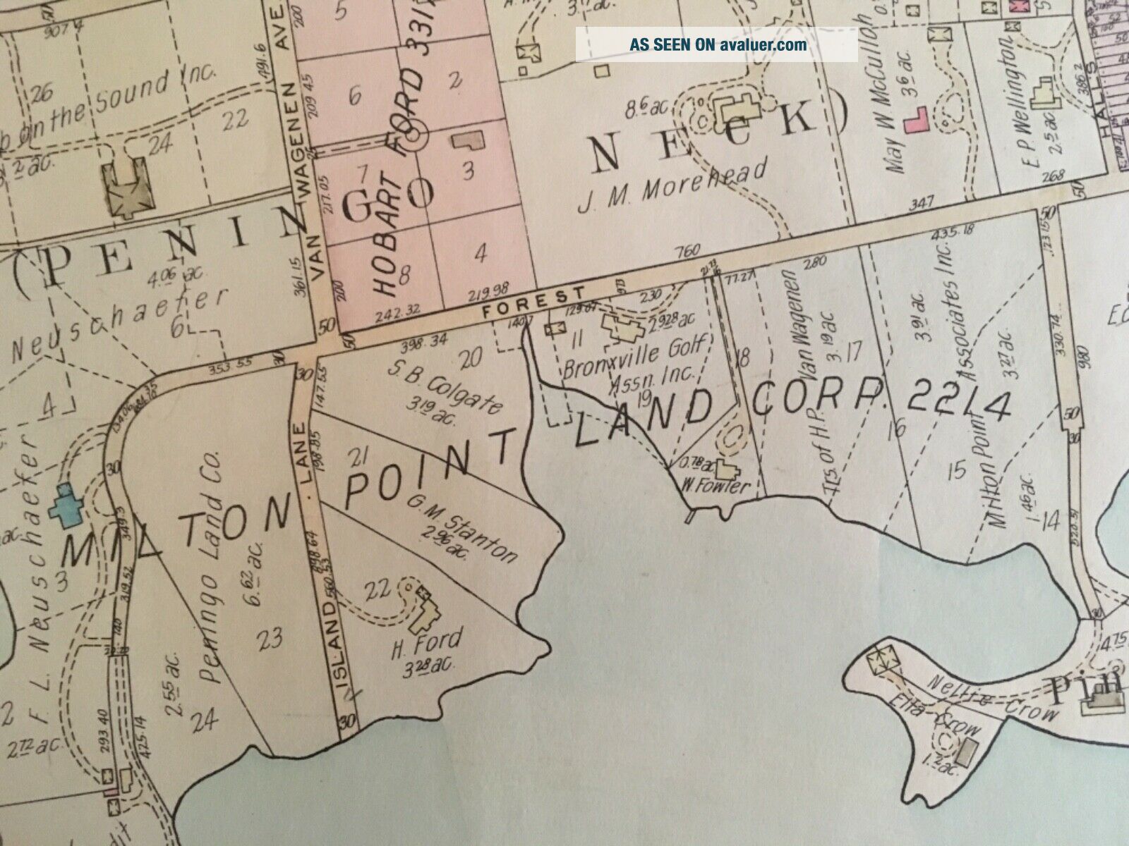
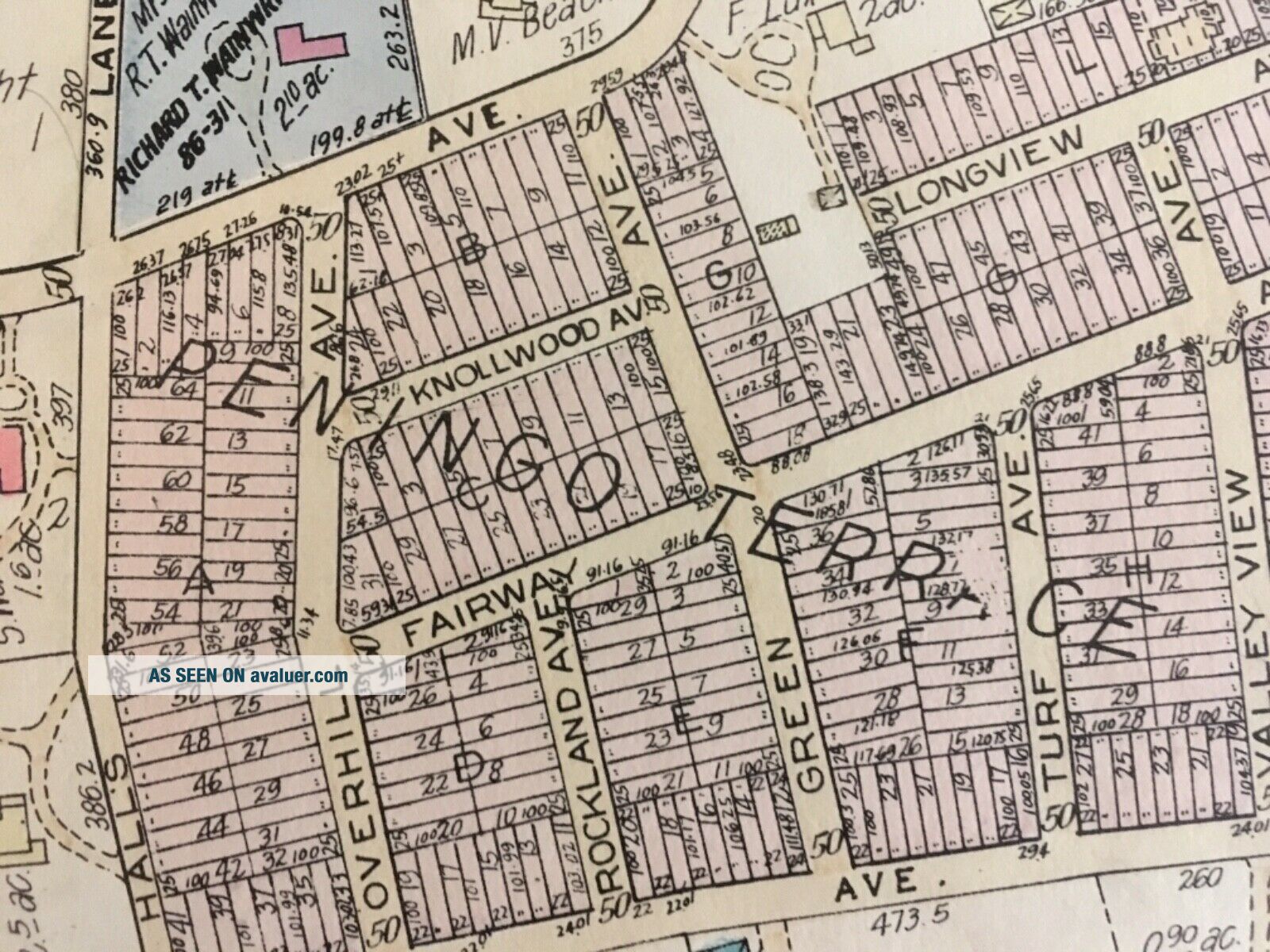
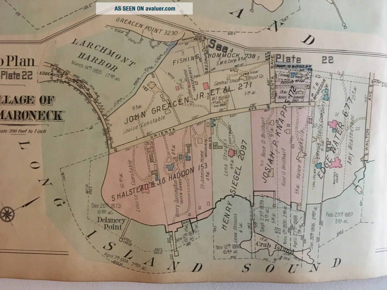
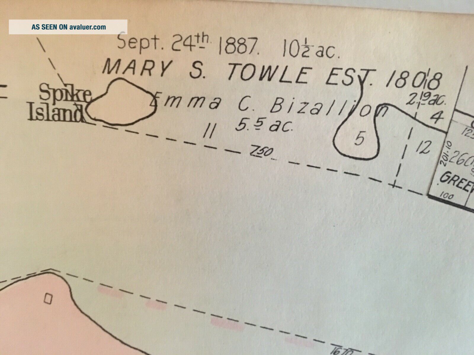
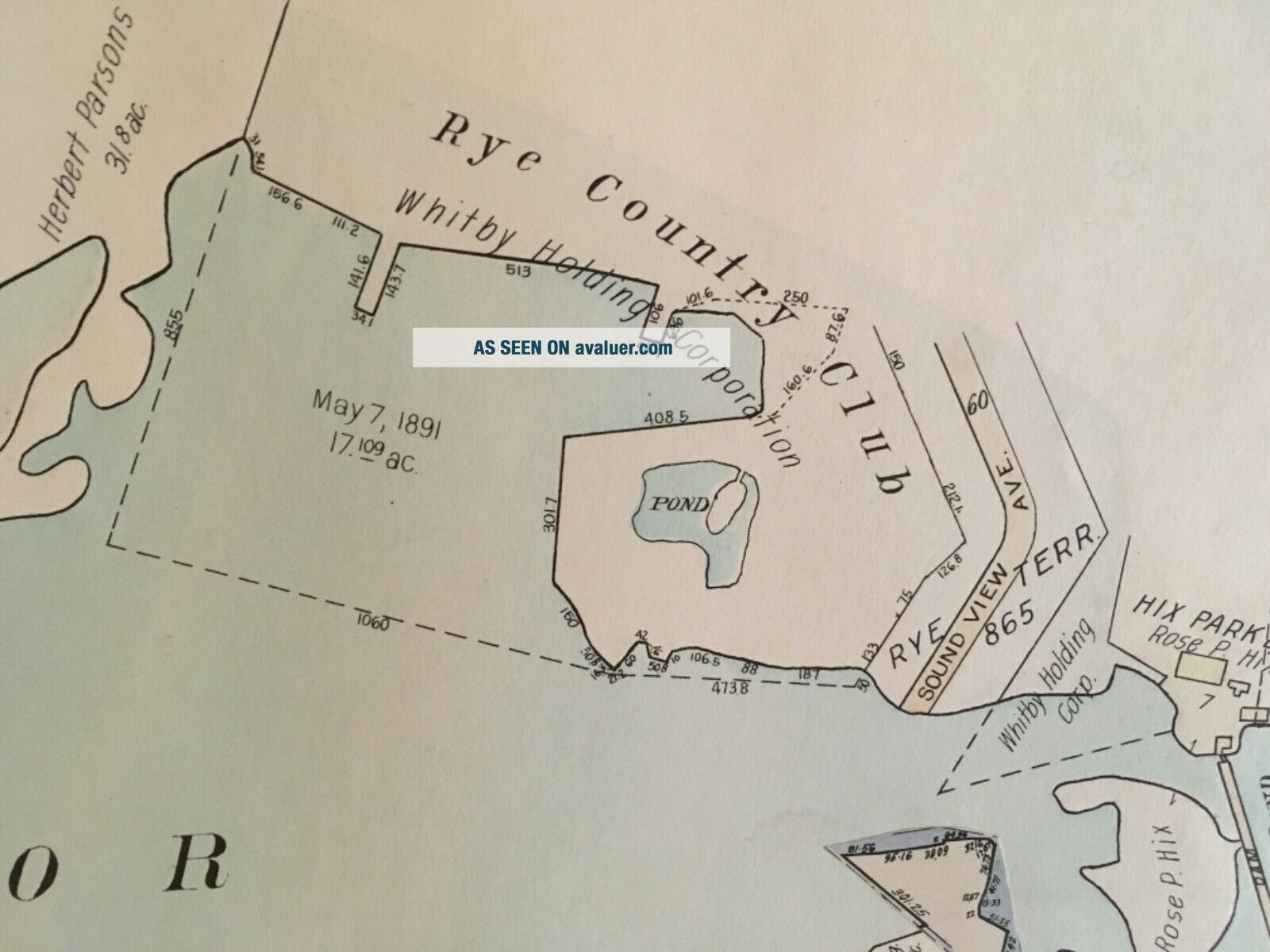
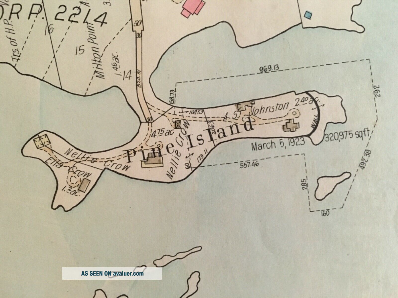
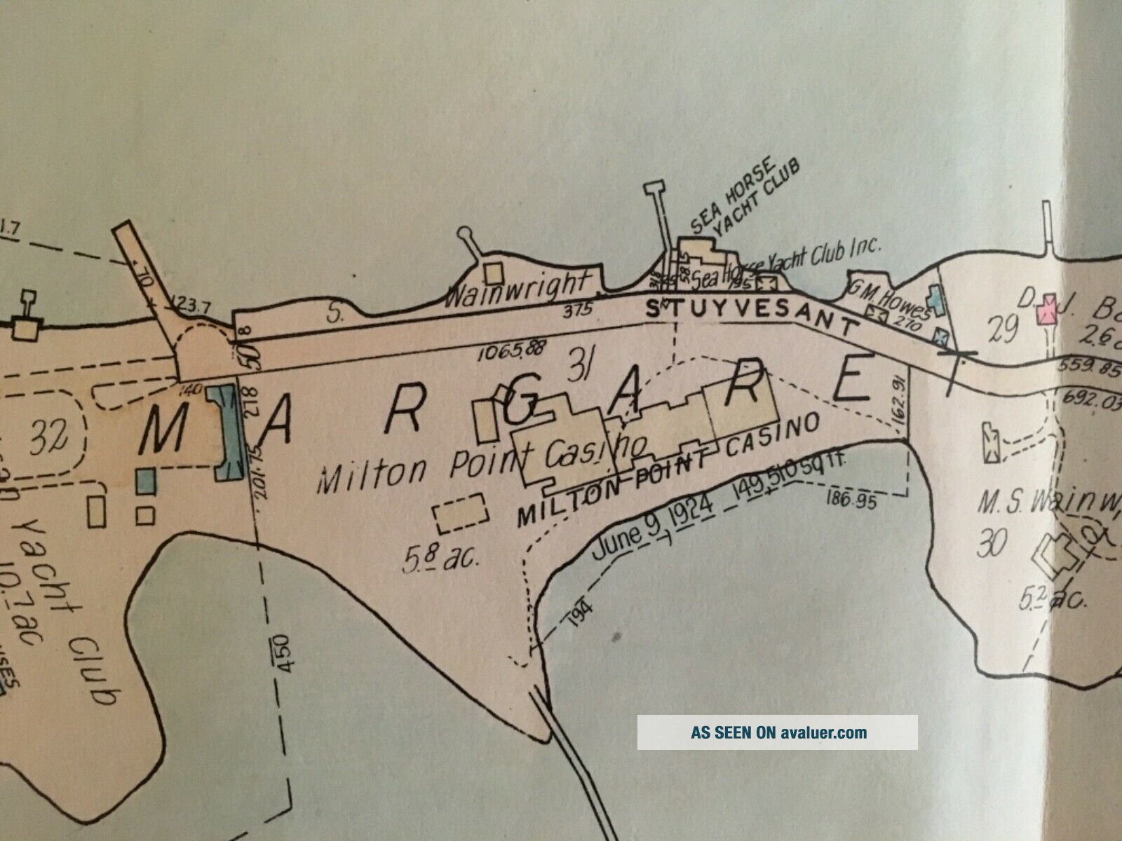
From the Atlas of Westchester County, New York Volume 1. Published by G. M. Hopkins & Co. 1929.City of Rye and Village of Mamaroneck. Shows landmarks, geographical, features, businesses and some property ownership. Linen backed on centerfold. Volume 1 (of 4) is a wonderful look back at southeastern Westchester in the early 20th century. 34” x 24”


    Similar items


  • Village Of Mamaroneck,  City Of Rye,  Westchester County,  Ny 1929 Atlas Map

    Village Of Mamaroneck, City Of Rye, Westchester County, Ny 1929 Atlas Map

  • Postcard Of Mamaroneck Ave,  Mamaroneck

    Postcard Of Mamaroneck Ave, Mamaroneck

  • Delano Village,  Harlem,  City Of York Special Patrolman Police Patch

    Delano Village, Harlem, City Of York Special Patrolman Police Patch

  • Village Of Mamaroneck Police (york) 1st Issue Traffic Shoulder Patch

    Village Of Mamaroneck Police (york) 1st Issue Traffic Shoulder Patch

  • City Of Hill Country Village Police (texas) 4th Issue Shoulder Patch

    City Of Hill Country Village Police (texas) 4th Issue Shoulder Patch

  • Currier & Ives Sunday Winter Scene Village House Museum City Of York Church

    Currier & Ives Sunday Winter Scene Village House Museum City Of York Church

  • Currier & Ives Christmas Village House Museum Of City Of York The Snow Storm

    Currier & Ives Christmas Village House Museum Of City Of York The Snow Storm

  • Currier & Ives Old Swiss Mill Village House - From The Museum Of The City Of Ny

    Currier & Ives Old Swiss Mill Village House - From The Museum Of The City Of Ny


    • You might also like


    • 1860 Mitchell Hand Colored Map Colorado,  Nebraska & Kansas - Civil War Era

      1860 Mitchell Hand Colored Map Colorado, Nebraska & Kansas - Civil War Era

    • 18th Century French Map Of North America

      18th Century French Map Of North America

    • Las Vegas Nevada Vintage 1967 Us Geological Survey Quadrangle Map 4 Panels

      Las Vegas Nevada Vintage 1967 Us Geological Survey Quadrangle Map 4 Panels

    • Rare Antique 1845 Maps United States Exploring Expedition Book Antartica Hawaii

      Rare Antique 1845 Maps United States Exploring Expedition Book Antartica Hawaii

    • Vintage 1926 Map Hollywood From The Best Surveys Of The Time

      Vintage 1926 Map Hollywood From The Best Surveys Of The Time

    • American Continent (western Hemisphere) 1747 Bowen Antique Copper Engraved Map

      American Continent (western Hemisphere) 1747 Bowen Antique Copper Engraved Map

    • Gulf Coast Florida Texas United States 1705 De Fer Unusual Antique Engraved Map

      Gulf Coast Florida Texas United States 1705 De Fer Unusual Antique Engraved Map

    • California As Island United States 1700 De Fer Unusual First Edition Antique Map

      California As Island United States 1700 De Fer Unusual First Edition Antique Map

Avaluer          About Us          Privacy Policy          Contact Us          UP
© 2022, avaluer.net, Inc. or its affiliates