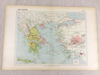
1712 Wells Map Of Ancient Greece
Item History & Price
| Reference Number: Avaluer:145869 |
1712 Wells Map of Ancient Greece
WE SELL ONLY ORIGINAL ANTIQUE MAPS - NOT REPRODUCTIONS
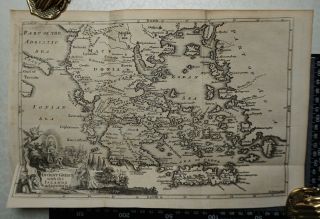
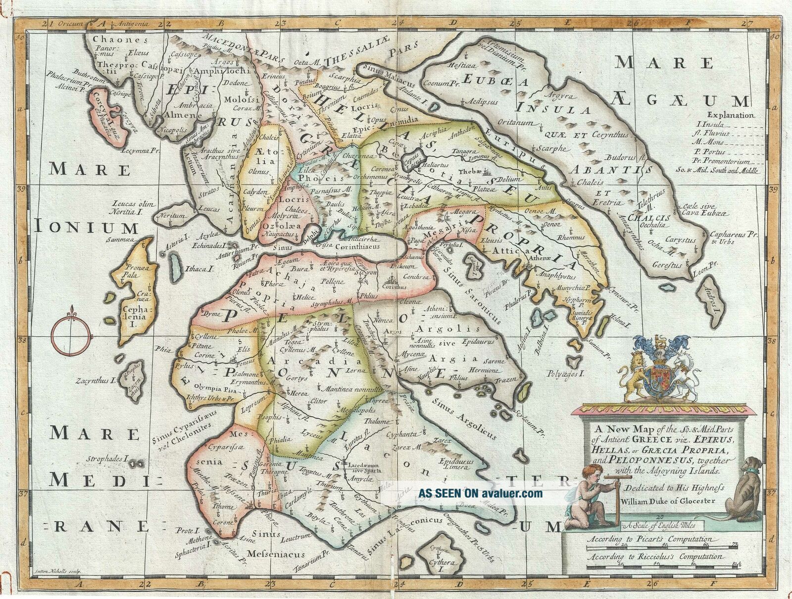
Title: A New Map of the So. and Mid. Parts of Antient Greece viz. Epirus, Hellas, or Graecia Propria, and Peloponnesus, together with the Adjoyning Islands.
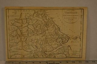
Description: This is an attractive 1712 map of Ancient Greece by Edward Wells of Oxford. It covers southern Ancient Greece including the Peloponnesus, Cythera, Euboea and several other Greek Islands. Identifies vario...us important cites from antiquity including the Athens, Thebes, Delphi, Corinth, etc. Following the Battle of Corinth in 146 BC, the Greek peninsula came under Roman rule. The period from 31 BC and AD 180 in Greek history is described as the era of the Pax Romana. This was a period of peace and security when many Greek cities flourished, leading to cultural and economic progress. The classical period in Greek history, which lasted from the 5th century B.C. through the 4th century B.C. greatly influenced the Roman Empire's politics, art, architecture, philosophy and literature. After the fall of the Western Roman Empire, Greece became the center of the eastern Roman or Byzantium Empire. A large title cartouche is included in the bottom right of the map featuring the coat of arms of the Duke of Gloucester. This, like many other Wells maps, is dedicated to Prince William, Duke of Gloucester and son of Queen Anne, who, when this map was being prepared, was a student at Oxford. Engraved by S. Nicholls and published by T. Bonwicke for the 1712 edition of Edward Wells' Atlas, A New Sett of Maps both of Ancient and Present Geography .
Size: Printed area measures 15 inches high by 20 inches wide.
Condition: Very good. Some restored splitting and toning along original centerfold. Minor spotting. Original platemark visible. Backed with archival tissue for stability.
Shipping: Shipping rates are not negotiable. Items are shipped within three business days of receiving payment. We are happy to consolidate shipping where possible. The following shipping options are available: 1. FedEx Overnight (45 USD). USA Only. Signature Required.
2. FedEx Ground or Home Delivery (15 USD). USA Only. 1 - 10 days. If your address is a P.O. Box and cannot ship FedEx we will ship USPS Priority and, while we ship promptly, recent postal personnel cutbacks mean that delivery may take time. Signature Required.
3. FedEx International or DHL International EXPRESS (45 USD).
4. We can use your FedEx Account.
Customs: International buyers are responsible for paying duty and taxes on delivery. DHL or FedEx will contact the buyer by telephone to arrange tax payment if it is levied. Duty varies by country and we cannot predict the amount you will be charged. Some countries are duty free, others are not. Typically, a customs duty and/or VAT tax will be assessed on all parcels to continental Europe. Sometimes duty or tax is due in China, but is seems very random. Hong Kong, Singapore, Korea, and Taiwan have never assessed duty on a map we shipped. Maps shipped to the UK should be duty free as educational materials, but from time to time duty of 5% is assessed incorrectly by the UK customs agents.
Insurance: All shipments are insured privately against loss and damage. All of our shipments require a signature for insurance purposes.
If you have any questions please feel free to email us through eBay.
Other ServicesConservation Framing: Geographicus recommends basic conservation framing services for any antique paper. We do not offer this service.
Antique Map Restoration: Geographicus can repair and restore your antique map. Services include deacidification cleaning flattening and backing.
BEWARE anyone attempting to contact you, from a different eBay account, claiming to represent Geographicus Antique Maps. My eBay handle is GeographicusMaps. If you are contacted by email by someone offering you my items, please call me directly to be certain you are not dealing with a con artist. My phone number is 646-320-8650. "