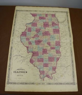
Antique Colored MAP OF ILLINOIS - Johnson ' S Family Atlas 1863
Item History & Price
| Reference Number: Avaluer:14783 | Year: 1863 |
| US State: Illinois |
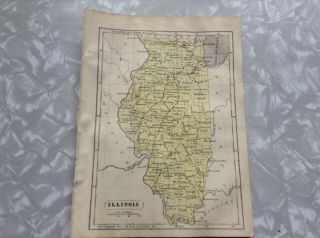
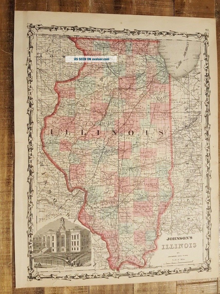
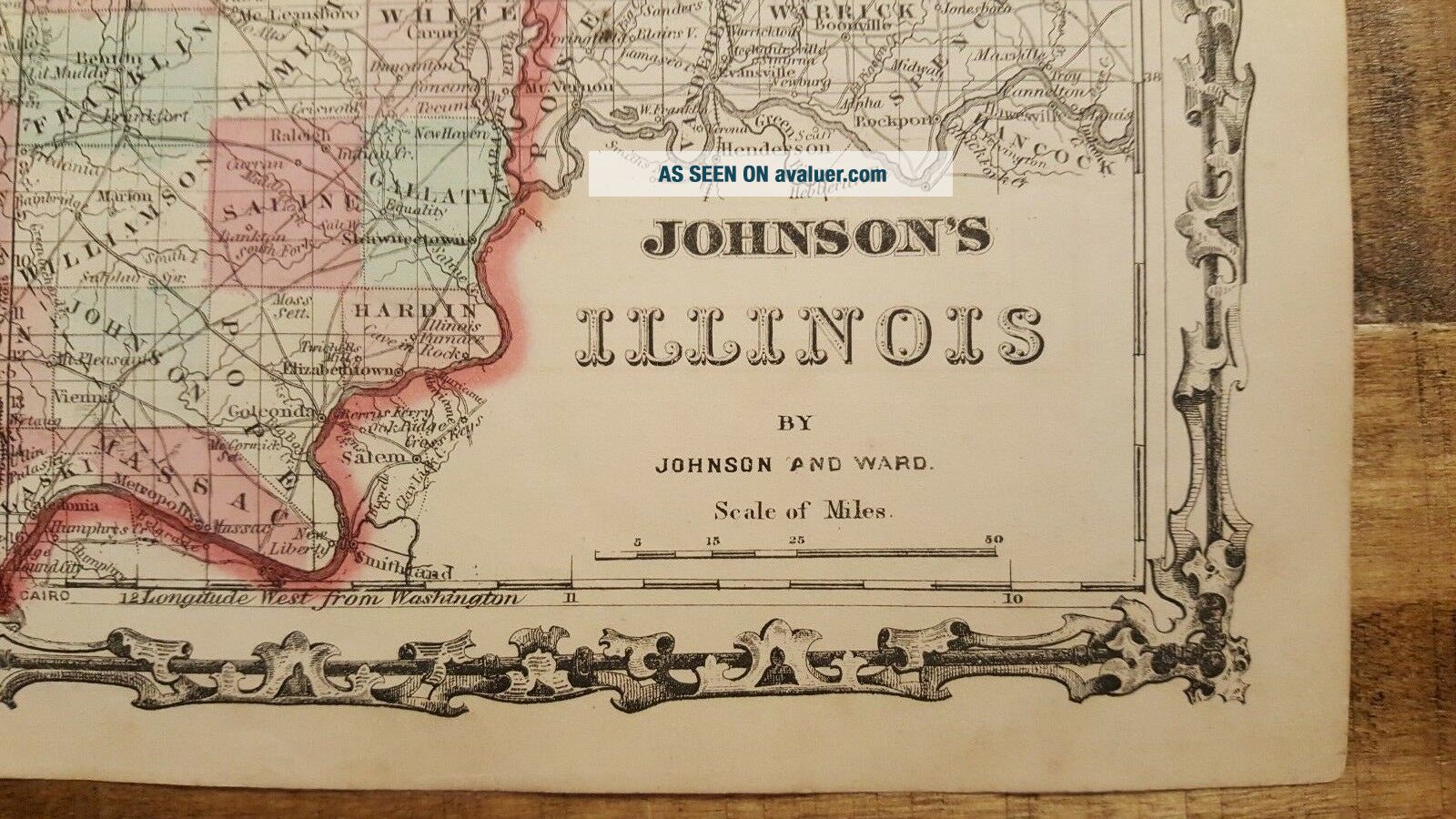
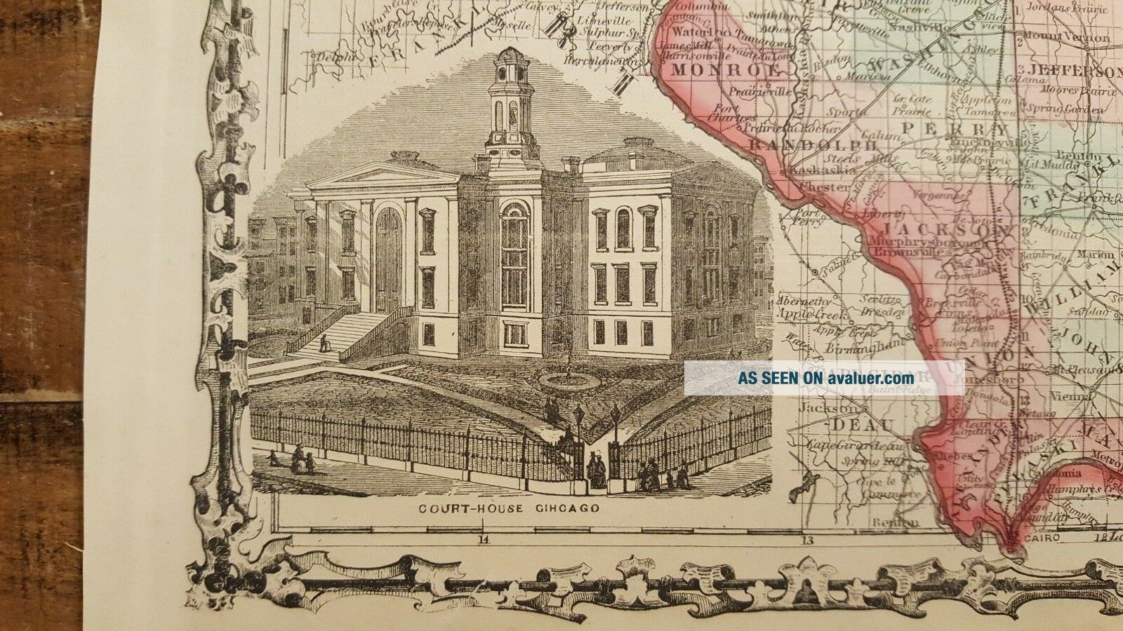
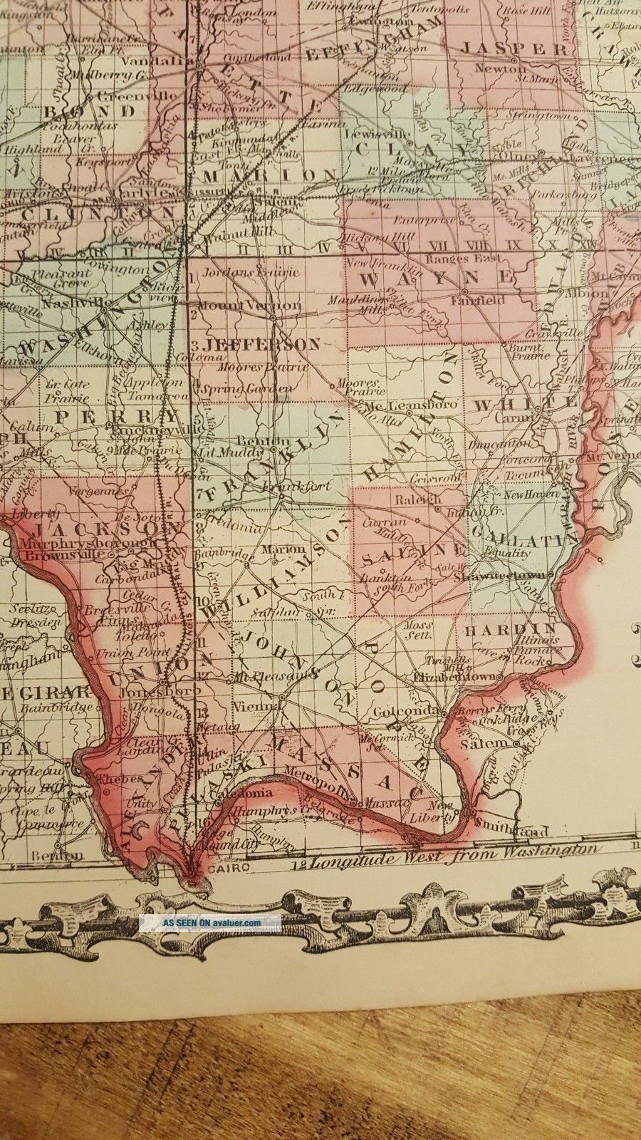
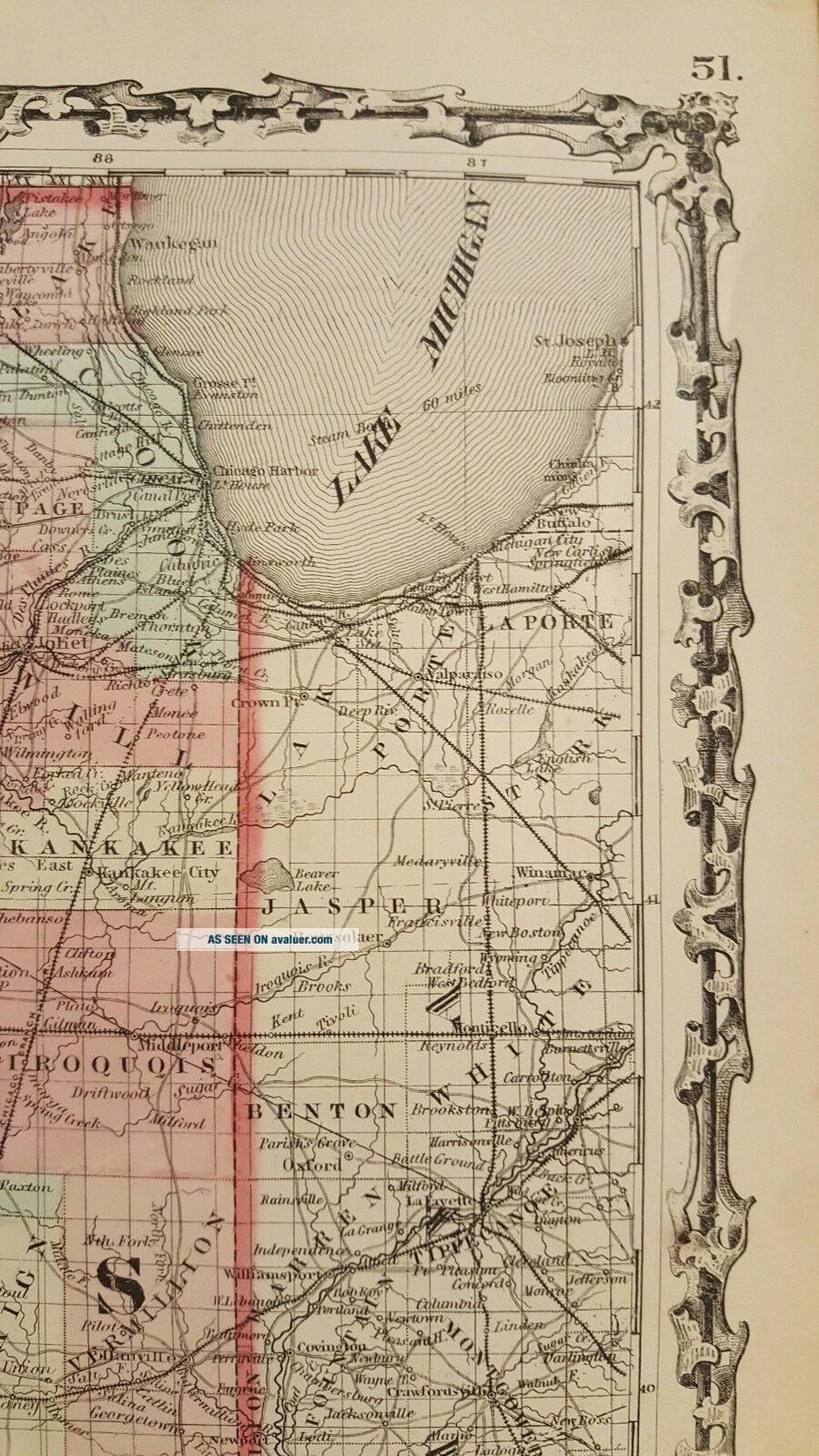
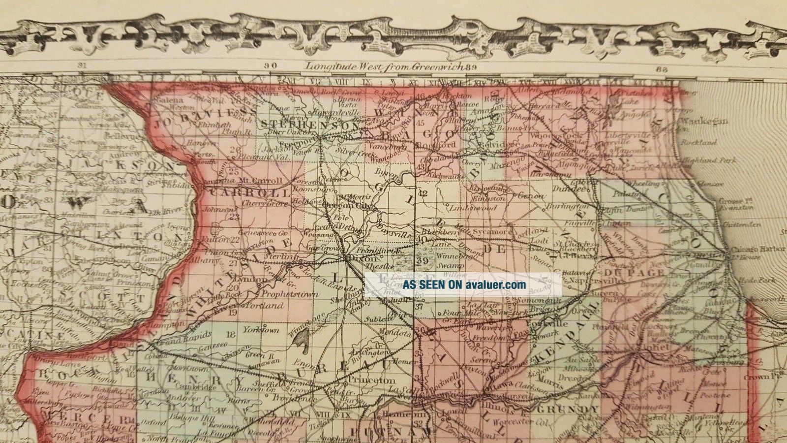
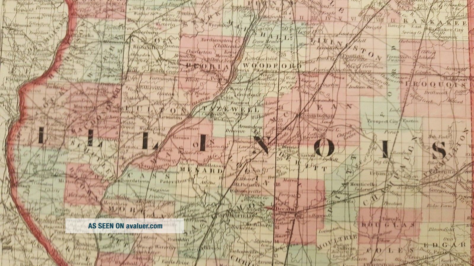
Up for sale is a great, colored antique MAP - JOHNSON'S MAP OF ILLINOIS - 1863.
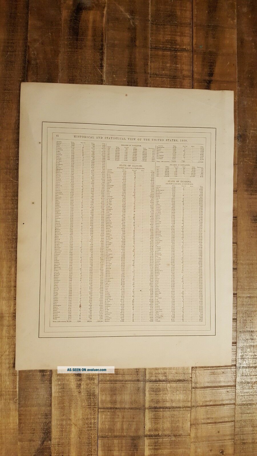
It is a very detailed map, measuring approximately 14 x 18 inches, including the border area. On the reverse side are some random historical statistics from the Atlas.
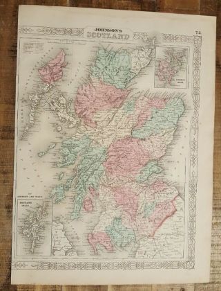
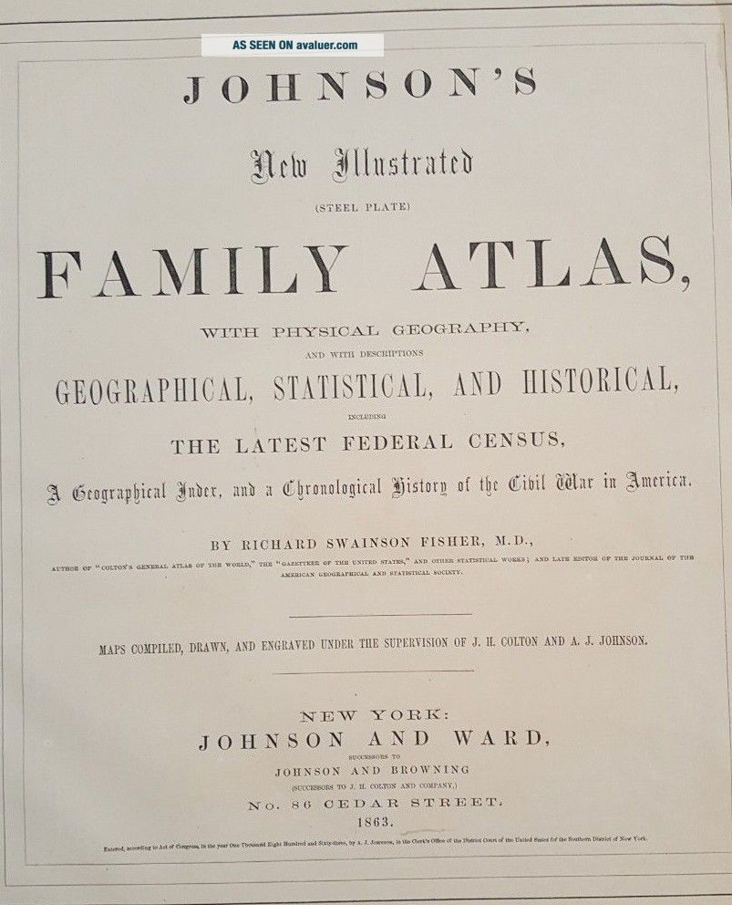
This map is from the "AMERICAN ATLAS - JOHNSON'S NEW ILLUSTRATED (STEEL PLATE) FAMILY ATLAS, WITH PHYSICAL GEOGRAPHY, AND WITH DESCRIPTIONS GEOGRAPHICAL, STATISTICAL, AND HISTORICAL, INCLUDING THE LATEST FEDERAL CENSUS, A GEOGRAPHI...CAL INDEX, AND A CHRONOLOGICAL HISTORY OF THE CIVIL WAR IN AMERICA" by Richard Swainson Fisher, M.D., - Maps Compiled, Drawn, and Engraved under the supervision of J.H. Colton and A. J. Johnson. Published by Johnson and Ward, New York - 1863.
Maps this early and showing this much detail are a great piece of history! The map has fantastic coloring to it. There is a cut down the left border from where it was originally bound. Map is generally in Good- condition. There is age related browning and toning and some spotting and stains. The map has some tears and chips around the edges, but they do not affect the map. Some other dings here and there. There are small creases or chips in the corners. Damp stains across the top border. There is a 1" tear on the bottom border that extends partly into the map. Heavier browning along the edges.
This map would be a great addition to any collection and will look very nice when framed!
Please note that while I have included a picture of the Title Page of the Atlas that this map was taken from, it is NOT included in the sale, as it is a reference piece to determine authenticity for the other maps. I would be happy to include a copy if requested.
Please see my store for other great items.
00129
It is a very detailed map, measuring approximately 14 x 18 inches, including the border area. On the reverse side are some random historical statistics from the Atlas.
This map is from the "AMERICAN ATLAS - JOHNSON'S NEW ILLUSTRATED (STEEL PLATE) FAMILY ATLAS, WITH PHYSICAL GEOGRAPHY, AND WITH DESCRIPTIONS GEOGRAPHICAL, STATISTICAL, AND HISTORICAL, INCLUDING THE LATEST FEDERAL CENSUS, A GEOGRAPHI...CAL INDEX, AND A CHRONOLOGICAL HISTORY OF THE CIVIL WAR IN AMERICA" by Richard Swainson Fisher, M.D., - Maps Compiled, Drawn, and Engraved under the supervision of J.H. Colton and A. J. Johnson. Published by Johnson and Ward, New York - 1863.
Maps this early and showing this much detail are a great piece of history! The map has fantastic coloring to it. There is a cut down the left border from where it was originally bound. Map is generally in Good- condition. There is age related browning and toning and some spotting and stains. The map has some tears and chips around the edges, but they do not affect the map. Some other dings here and there. There are small creases or chips in the corners. Damp stains across the top border. There is a 1" tear on the bottom border that extends partly into the map. Heavier browning along the edges.
This map would be a great addition to any collection and will look very nice when framed!
Please note that while I have included a picture of the Title Page of the Atlas that this map was taken from, it is NOT included in the sale, as it is a reference piece to determine authenticity for the other maps. I would be happy to include a copy if requested.
Please see my store for other great items.
00129