1757 Large Bellin Map Of Gulf Of Mexico, Florida, West Indies
Item History & Price
| Reference Number: Avaluer:15068 |
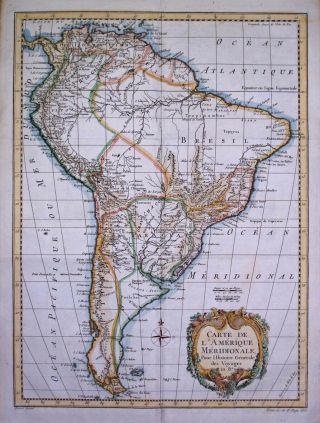
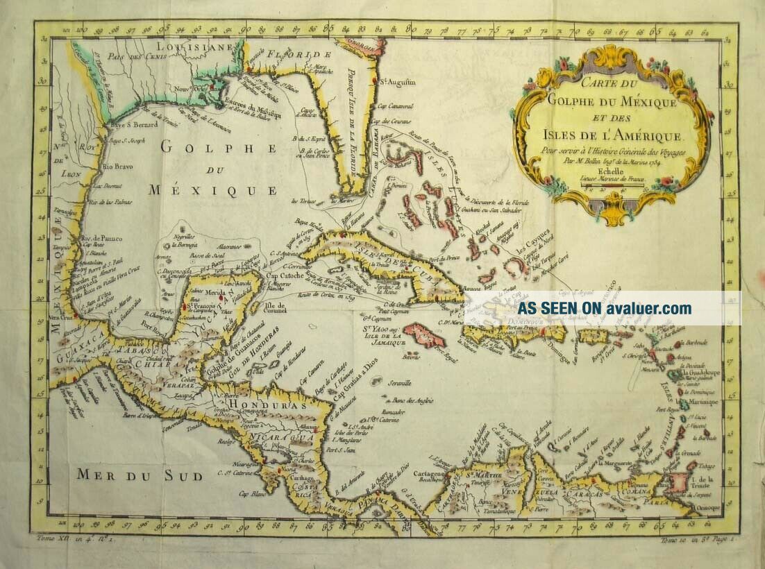
1757 Bellin Map - Carte du Golphe du Mexique et des Isles de L'AmeriqueJ.N. Bellin provided a huge number of maps for L'Abbe Prevost's 'Histoire Generale des Voyages', a 25 volume plus work describing the discoveries, journeys and settlements of seventeenth and early eighteenth century European powers. Many of these maps were issued in Dutch and German as well as French. This outstanding, large map of the Gulf of Mexico and Caribbean is from a 1757 French editi...on of "Histoire.... In the north it shows the whole of Florida in an elongated manner, goes west through Louisiana into Mexico and then south through central America to Panama. In the centre of the map is the Caribbean with Cuba, Jamaica, Santo Domingo , Puerto Rico and the smaller islands of the West Indies. There is a splendid, large cartouche title in the top right. The map measures 11" by 15" , has outline hand colouring, several folds (as issued) and is in fairly good condition with a repair to the top right. The map is guaranteed to be over 250 years old. ShippingUnited States - Regular airmail $5.00US. Tracked airmail (optional) is an additional US$12.00 for a total of US$17.00. Canada - $3.00US for regular mail, $9.00US for registered mail. Canadian customers please add GST or HST where applicable.Rest of the world - Regular air mail $8.00US. Registered/insured airmail (optional) is is an additional US$15.00 for a total of US$23.00.Terms and ConditionsPlease note - We can only take responsibility for delivery if the optional registration/insurance is added. Regular airmail is usually very safe and reliable, but items sent by regular airmail are at the buyers risk - regular airmail provides no tracking number, no proof of shipping or delivery, and no insurance in case of loss or damage.Please note - Mailing from Canada to the United States and all other international destinations can sometimes take over three weeks for delivery. We will combine shipment of multiple purchases - several items can be shipped together for one shipping cost. Payment OptionsWe accept Paypal. Beach Antique Maps & Prints International antique map and print dealers for over 35 years Please check our other map & print auctions on ebay. To learn more about Antique Maps please click on 'me' on this page and visit our webpage 'About Antique Maps'.