1844 NORTH AMERICA TEXAS REPUBLIC ANTIQUE MAP FROM JOHNSTON ' S NATIONAL ATLAS


Item History & Price

Information:
Reference Number: Avaluer:15247Year: 1844
Date Range: 1800-1899Format: Atlas Map
Printing Technique: Copper PlateCartographer/Publisher: Alexander K. Johnston
US State: TexasType: Political Map
Country/Region: United States of AmericaOriginal/Reproduction: Antique Original
Original Description:
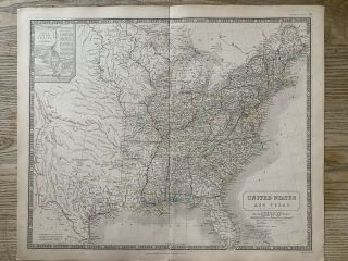
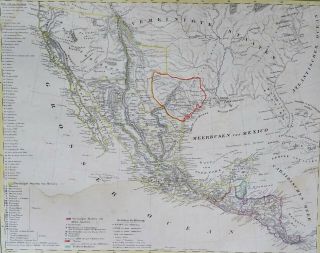
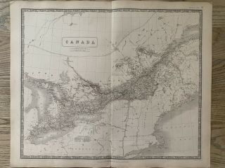
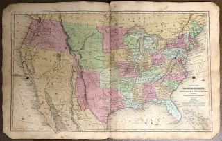
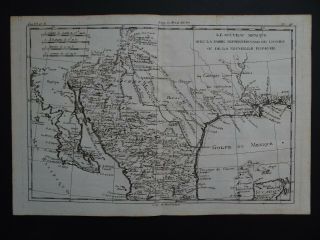
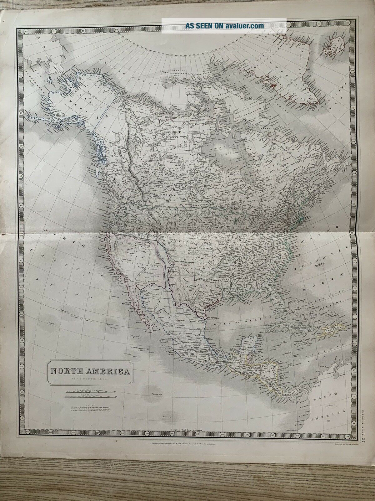
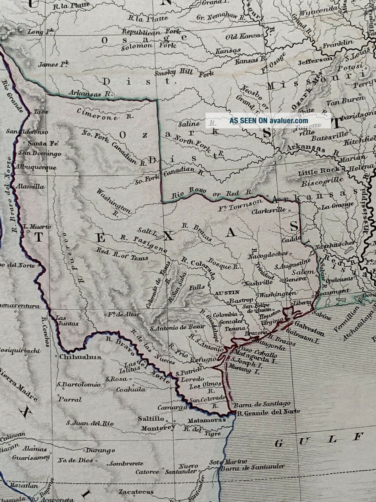
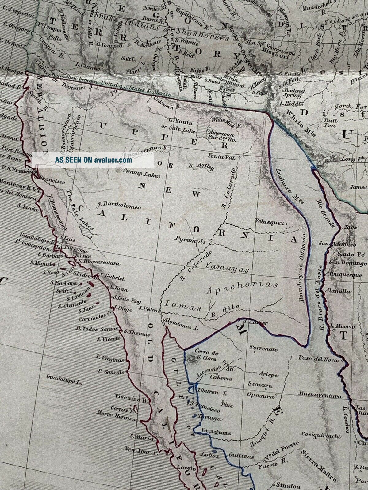
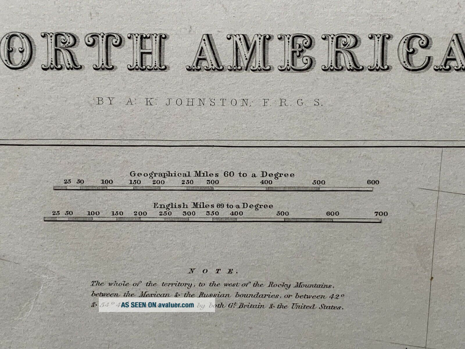
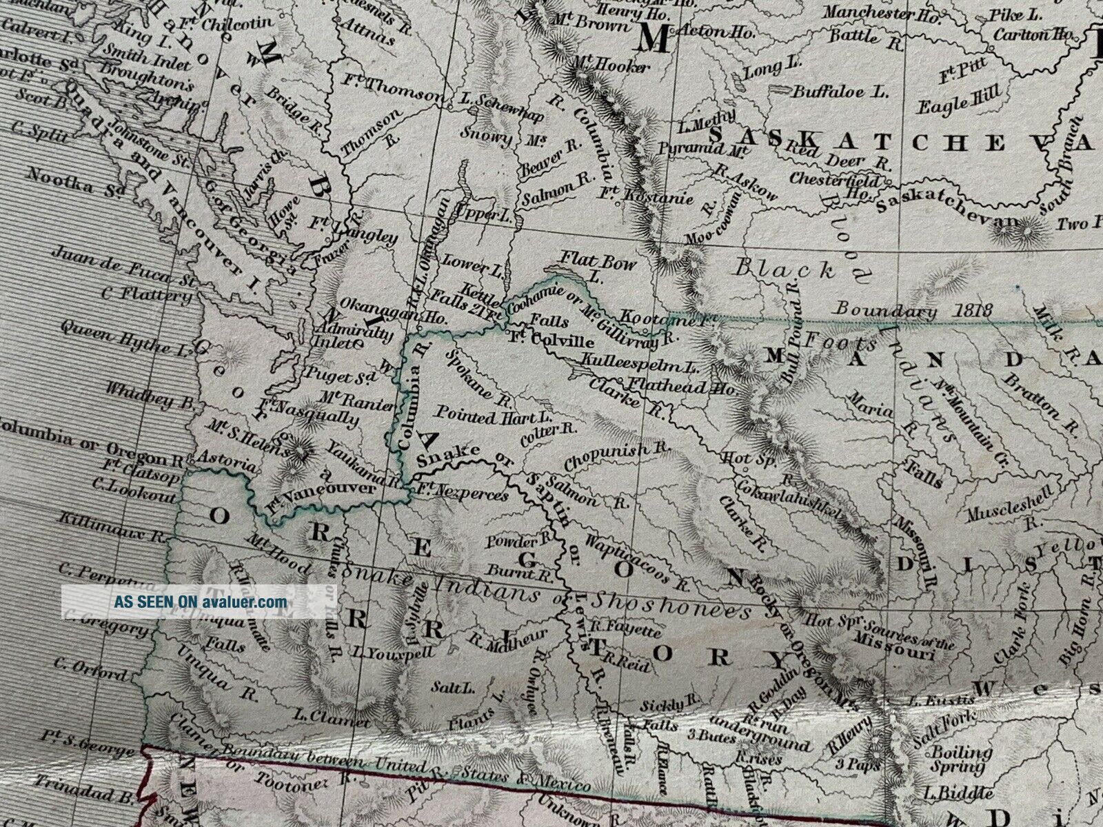
This beautiful map is from "The National Atlas of Historical, Commercial and Political Geography constructed from the most recent and authentic sources by Alexander Keith Johnston, F.R.G.S., published by John Johnstone and W. & A.K. Johnston, Edinburgh, 1844The maps shows an independent Texas Republic. The large California Territory belongs to Mexico and New Mexico is a narrow strip between California and Texas. Alaska is called Russian America. The small note mentions the dis...puted Oregon Territory. It says "The whole of the territory to the West of the Rocky Mountains between the Mexican & The Russian boundaries or between 42° & 54° 40' N.Lat. is claimed by both Gt. Britain & the United States".  The map measures approximately 67 cm x 55 cm or 26" x 21". It is printed on one side only and is perfect for framing.  The quality of the paper is exceptional quality and very thick. This is an original antique, 175 years old. The map is hand coloured in outline.Alexander Keith Johnston was born at Kirkhill near Penicuik, south of Edinburgh. He was the son of Andrew Johnston and Isabel Keith. His brother was Thomas Brumby Johnston FRSE.After an education at the High School and the University of Edinburgh he was apprenticed to the Edinburgh engraver and mapmaker, James Kirkwood. In 1826, he joined his brother William (who would become Sir William Johnston, Lord Provost of Edinburgh) in a printing and engraving business, forming the well-known cartographical firm of W. and A. K. Johnston with offices based at 4 St Andrew Square in Edinburgh's New Town and their printworks based at Edina Works, off Easter Road. The firm used the clan motto of "Ready Aye Ready" as their logo. Early hikes in the West Highlands had led Johnston to despair at the accuracy of maps, and inspired a desire to rectify this. The rest of Johnston's life was devoted to geography, his later years to its educational aspects especially. His services were recognised by the leading scientific societies of Europe and America.In October 1849, he was elected a Fellow of the Royal Society of Edinburgh, his proposer being Robert Chambers. In 1862 he was a founding member of the Meteorological Society of Scotland. He was awarded an honorary doctorate (LLD) in 1865.His Edinburgh address in later years was 16 Grosvenor Crescent in the affluent West End.[6]He died at Ben Rhydding, Yorkshire, in 1871. He is buried in the north-west section of Grange Cemetery in Edinburgh.Shipping can be combined for multiple items. Please look at my other listings for more maps, atlases, books and engravings.


    Similar items


  • 1844 United States & Texas Republic Antique Map From Johnston

    1844 United States & Texas Republic Antique Map From Johnston ' S National Atlas

  • Us,  Republic Of Texas,  Mexico Flemming,  1844,  Mexico,  Mittel America,  Texas Rare

    Us, Republic Of Texas, Mexico Flemming, 1844, Mexico, Mittel America, Texas Rare

  • Antique 1844 Smith

    Antique 1844 Smith ' S Geography Atlas Hand Colored Maps Texas Republic

  • 1854 Smith

    1854 Smith ' S Geography Atlas 20 Hand Colored Maps Texas Republic

  • 1844 Canada Large Hand Coloured Antique Map From Johnston

    1844 Canada Large Hand Coloured Antique Map From Johnston ' S National Atlas

  • 1844 North America.  Texas,  Upper California,  Old California.  Hand - Colored

    1844 North America. Texas, Upper California, Old California. Hand - Colored

  • John Randolph 1948 Official Texas Brags Map Of North America W/ Mailer

    John Randolph 1948 Official Texas Brags Map Of North America W/ Mailer

  • 1780 Bonne Atlas Map California - Mexico - Spain - America Texas Mexico

    1780 Bonne Atlas Map California - Mexico - Spain - America Texas Mexico


    • You might also like


    • 1860 Mitchell Hand Colored Map Colorado,  Nebraska & Kansas - Civil War Era

      1860 Mitchell Hand Colored Map Colorado, Nebraska & Kansas - Civil War Era

    • 18th Century French Map Of North America

      18th Century French Map Of North America

    • Las Vegas Nevada Vintage 1967 Us Geological Survey Quadrangle Map 4 Panels

      Las Vegas Nevada Vintage 1967 Us Geological Survey Quadrangle Map 4 Panels

    • Rare Antique 1845 Maps United States Exploring Expedition Book Antartica Hawaii

      Rare Antique 1845 Maps United States Exploring Expedition Book Antartica Hawaii

    • Vintage 1926 Map Hollywood From The Best Surveys Of The Time

      Vintage 1926 Map Hollywood From The Best Surveys Of The Time

    • American Continent (western Hemisphere) 1747 Bowen Antique Copper Engraved Map

      American Continent (western Hemisphere) 1747 Bowen Antique Copper Engraved Map

    • Gulf Coast Florida Texas United States 1705 De Fer Unusual Antique Engraved Map

      Gulf Coast Florida Texas United States 1705 De Fer Unusual Antique Engraved Map

    • California As Island United States 1700 De Fer Unusual First Edition Antique Map

      California As Island United States 1700 De Fer Unusual First Edition Antique Map

Avaluer          About Us          Privacy Policy          Contact Us          UP
© 2022, avaluer.net, Inc. or its affiliates