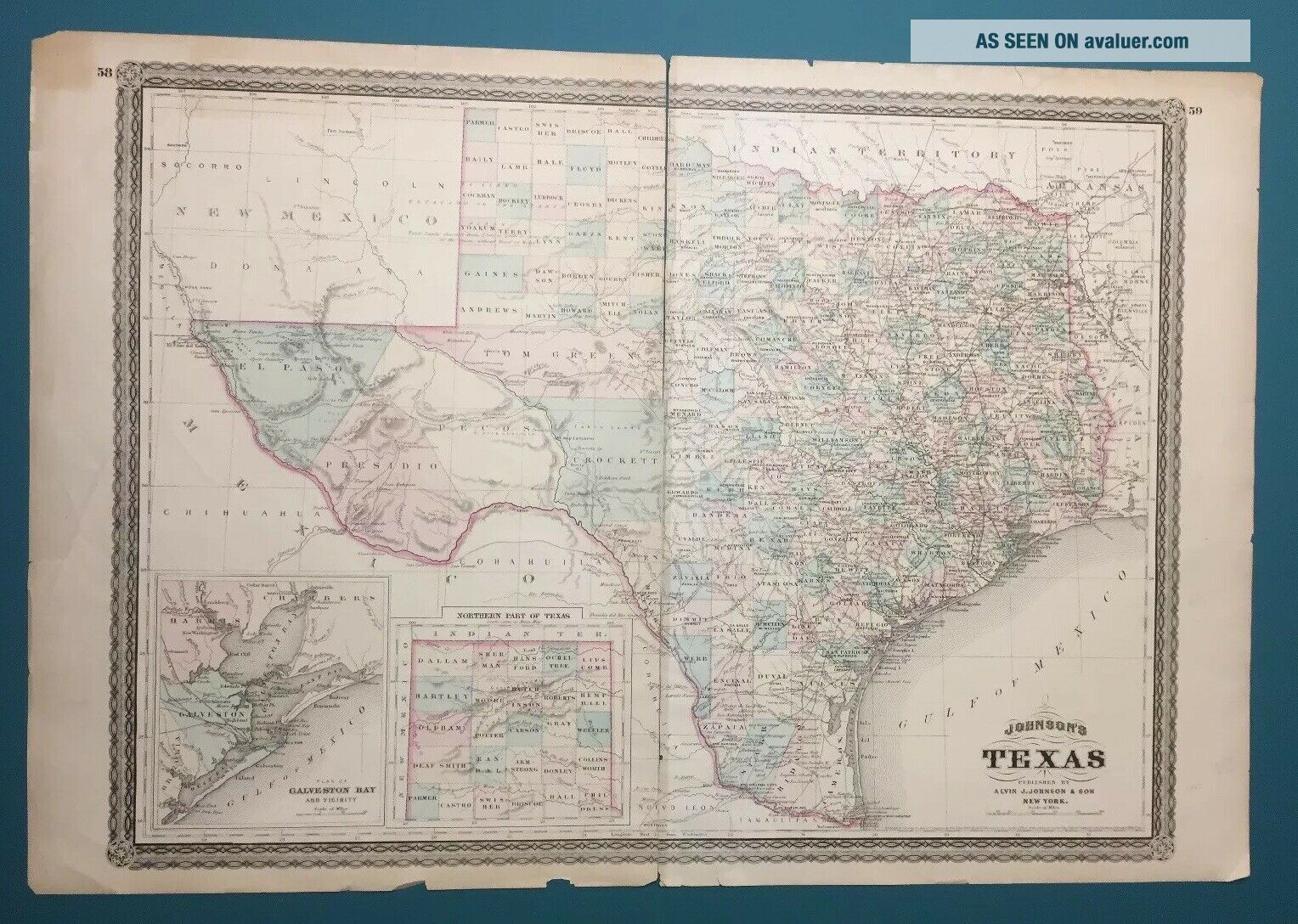
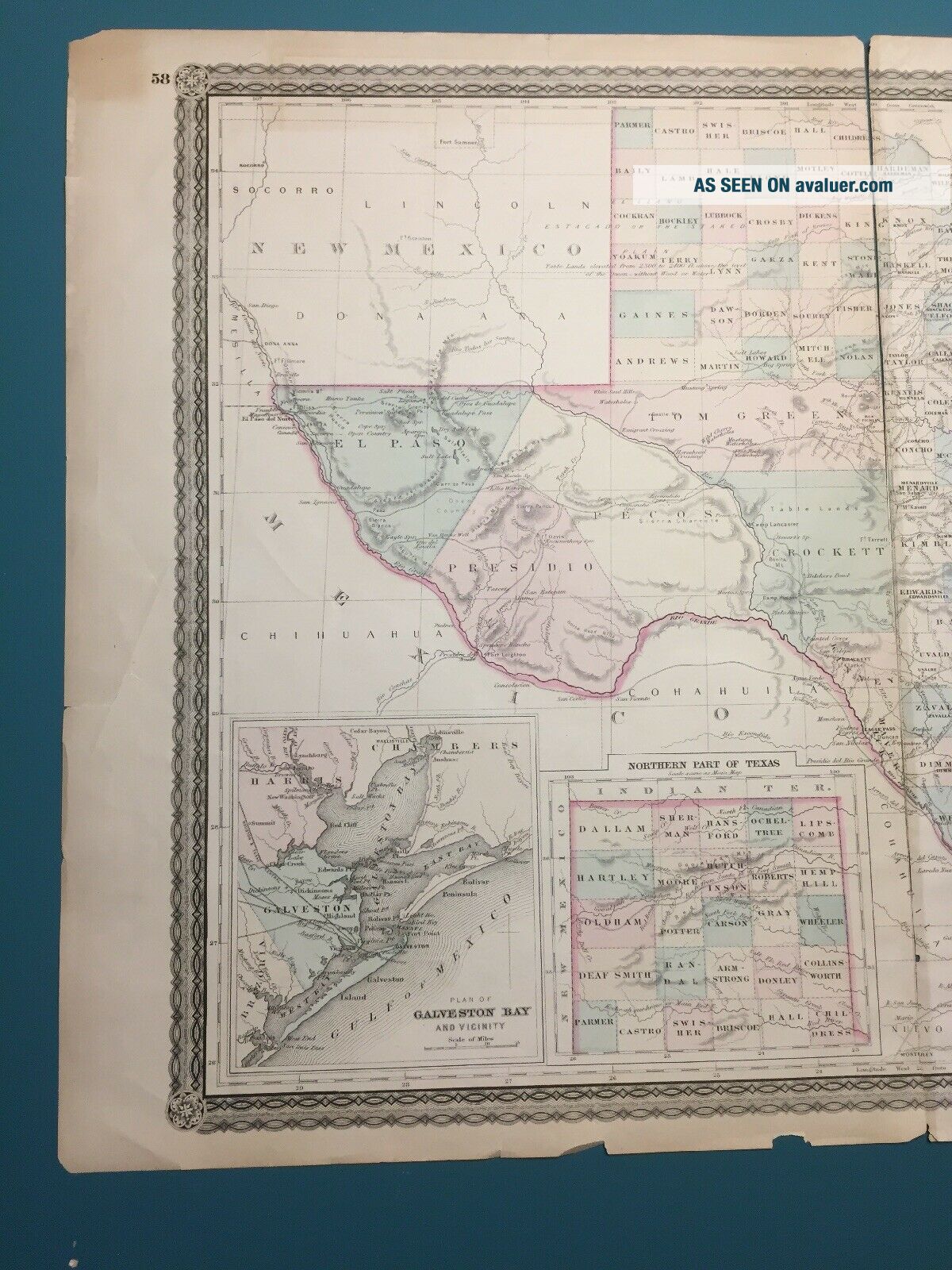
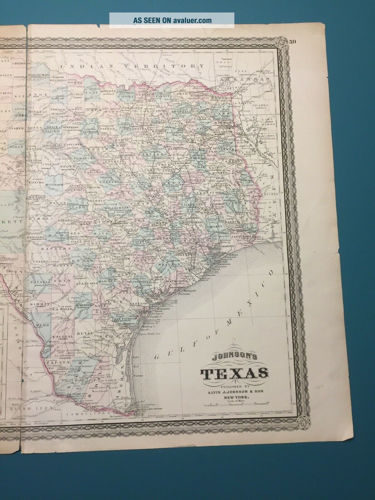
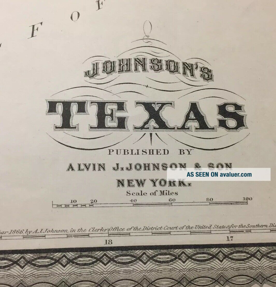
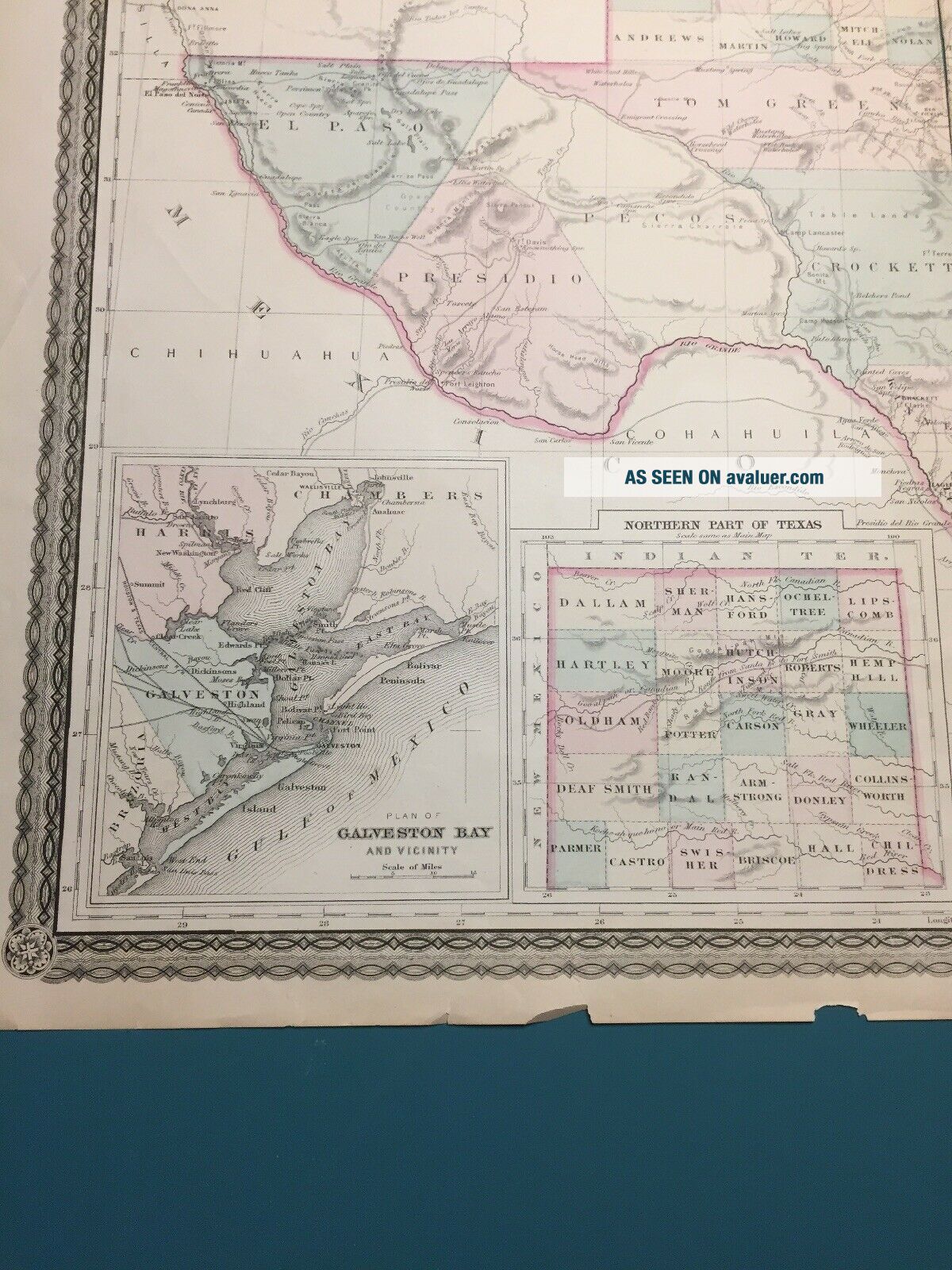
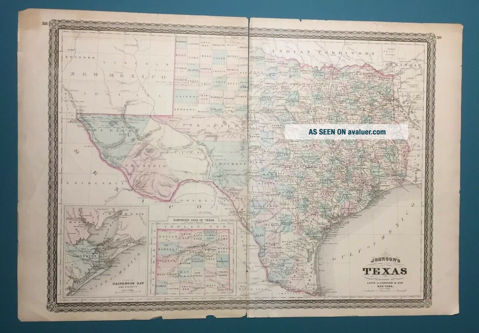
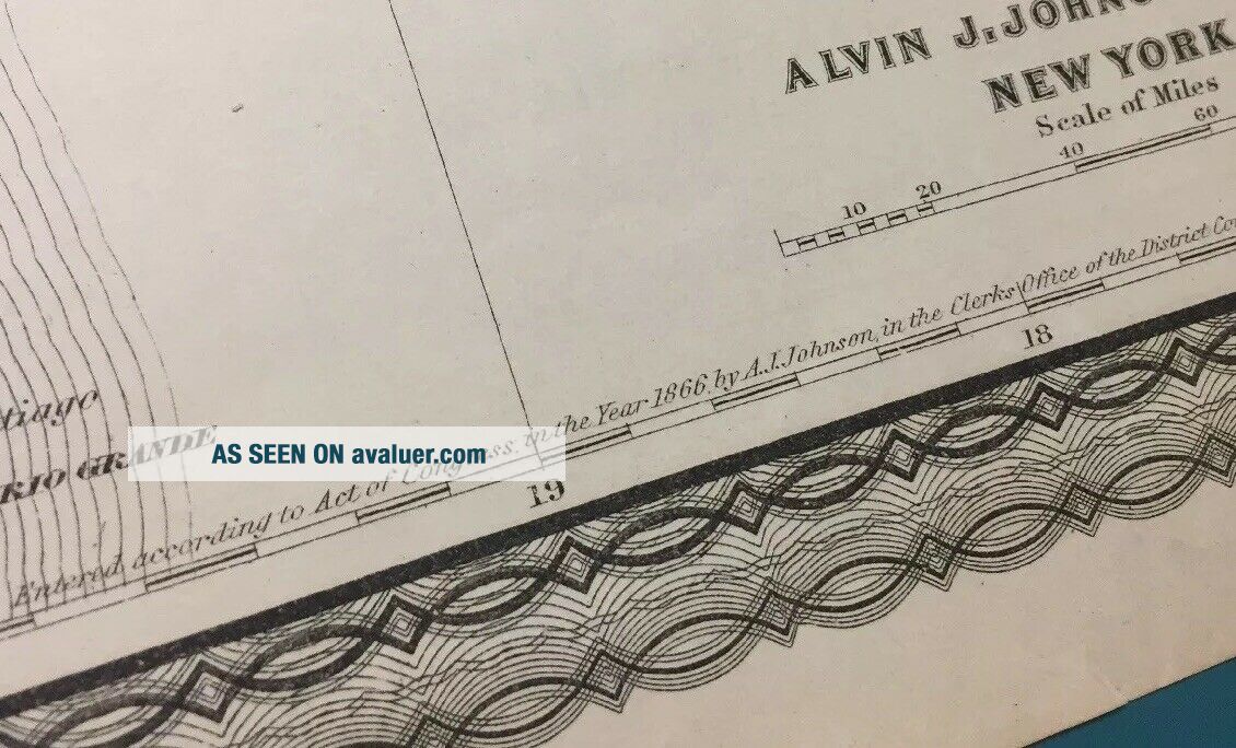
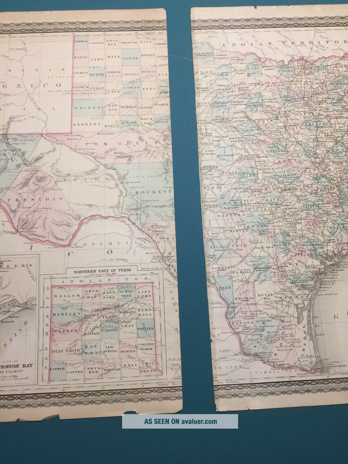
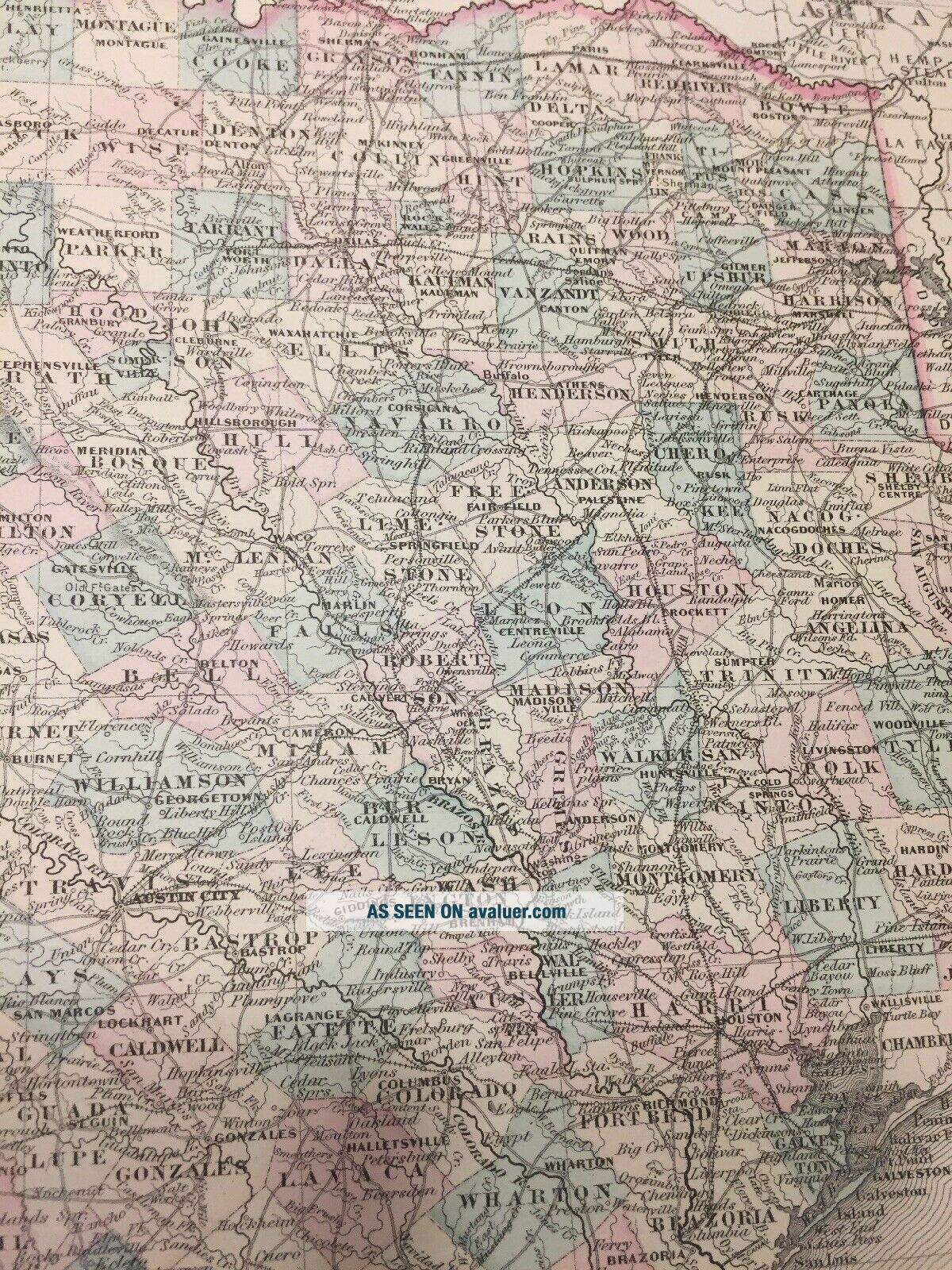
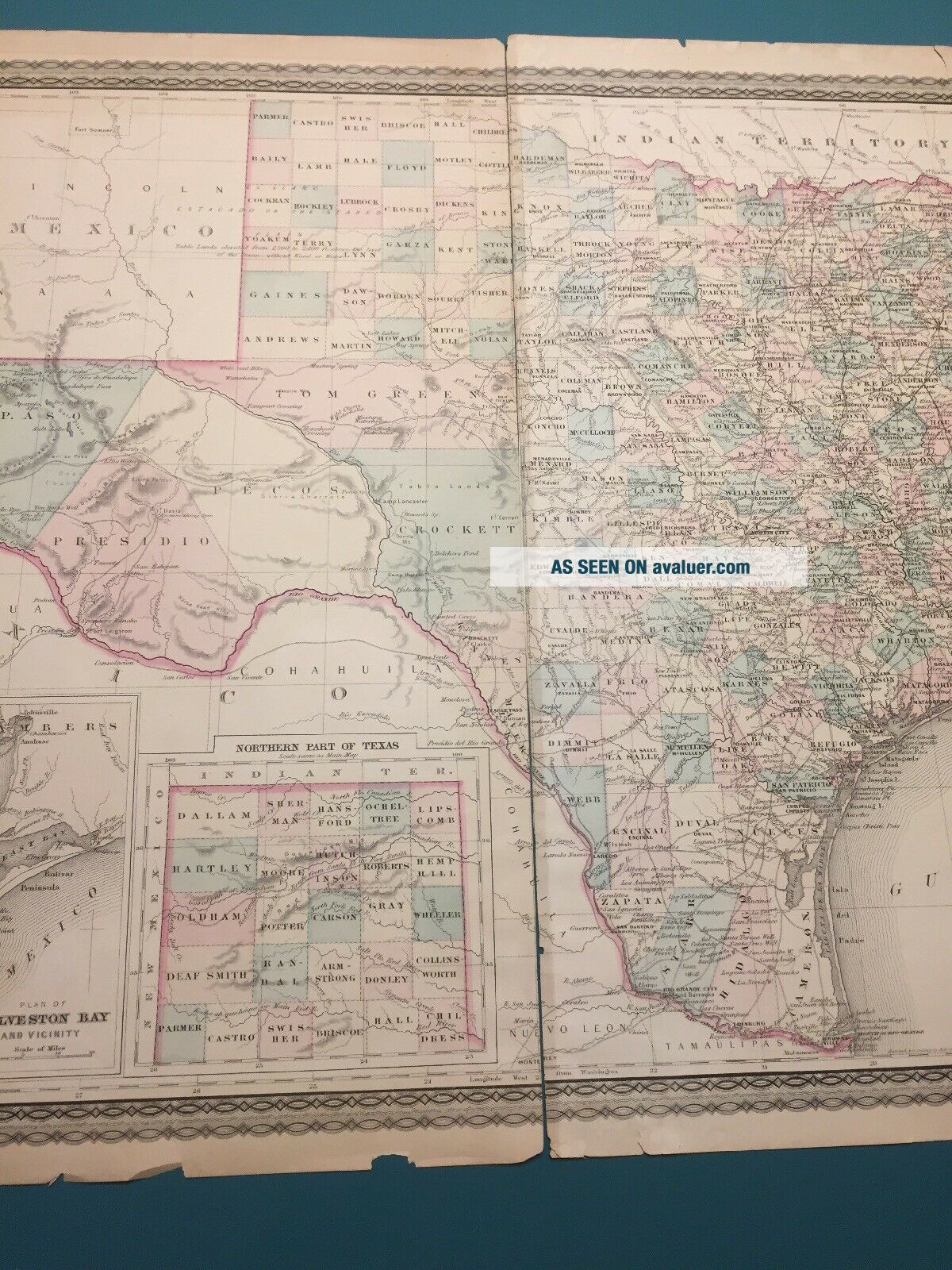
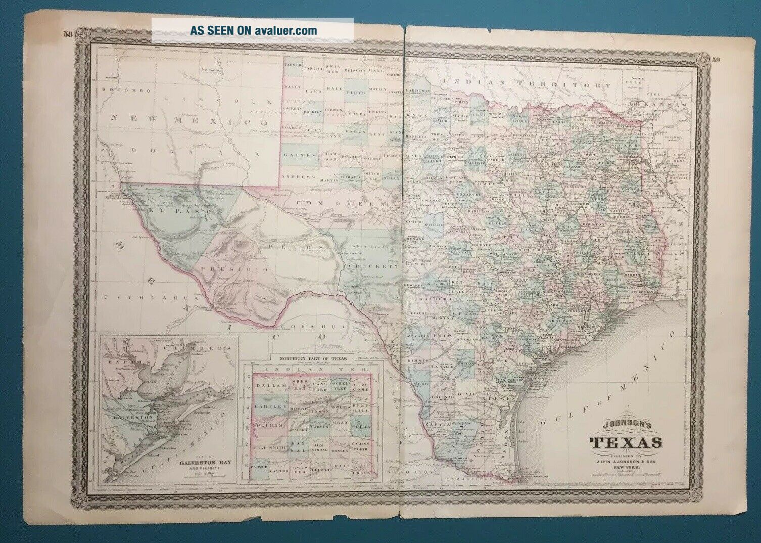
Antique 1877 Edition Johnson’s 1866 Map Of The State Of Texas


Item History & Price

Information:
Reference Number: Avaluer:15334Year: 1866
US State: Texas
Original Description:
Antique 1877 Edition of Johnson’s 1866 Map Of The State Of Texas in used condition. Measures 26.5”x18”. I have been told by an expert on Johnson Maps this edition is rare. This item has been packed in a box for years. Shows signs of age and use. See all photos for condition.


    Similar items


  • Rare,  Johnson

    Rare, Johnson ' S Military Map Of The United States 1861

  • Antique Pre - 1920s Cram

    Antique Pre - 1920s Cram ' S Radio Map Of The Us Canada

  • 1864 Johnson

    1864 Johnson ' S Military Map Of The U. S 26 X 18

  • Antique Linen Scroll Johnston

    Antique Linen Scroll Johnston ' S Clan Map Of The Scottish Highlands. 33e.

  • 1954 Howard Johnson

    1954 Howard Johnson ' S Restaurants - Map Of The Usa - Travel - Blue - Vintage Ad

  • Antique 1912 Edition - People

    Antique 1912 Edition - People ' S Handy Atlas Of The World - 1910 Census Edition

  • 1866 Johnson

    1866 Johnson ' S Family Atlas Of The World (1865 Loc). Civil War Era

  • 1862 Johnson

    1862 Johnson ' S Family Atlas Of The World


    • You might also like


    • 1860 Mitchell Hand Colored Map Colorado,  Nebraska & Kansas - Civil War Era

      1860 Mitchell Hand Colored Map Colorado, Nebraska & Kansas - Civil War Era

    • 18th Century French Map Of North America

      18th Century French Map Of North America

    • Las Vegas Nevada Vintage 1967 Us Geological Survey Quadrangle Map 4 Panels

      Las Vegas Nevada Vintage 1967 Us Geological Survey Quadrangle Map 4 Panels

    • Rare Antique 1845 Maps United States Exploring Expedition Book Antartica Hawaii

      Rare Antique 1845 Maps United States Exploring Expedition Book Antartica Hawaii

    • Vintage 1926 Map Hollywood From The Best Surveys Of The Time

      Vintage 1926 Map Hollywood From The Best Surveys Of The Time

    • American Continent (western Hemisphere) 1747 Bowen Antique Copper Engraved Map

      American Continent (western Hemisphere) 1747 Bowen Antique Copper Engraved Map

    • Gulf Coast Florida Texas United States 1705 De Fer Unusual Antique Engraved Map

      Gulf Coast Florida Texas United States 1705 De Fer Unusual Antique Engraved Map

    • California As Island United States 1700 De Fer Unusual First Edition Antique Map

      California As Island United States 1700 De Fer Unusual First Edition Antique Map

Avaluer          About Us          Privacy Policy          Contact Us          UP
© 2022, avaluer.net, Inc. or its affiliates