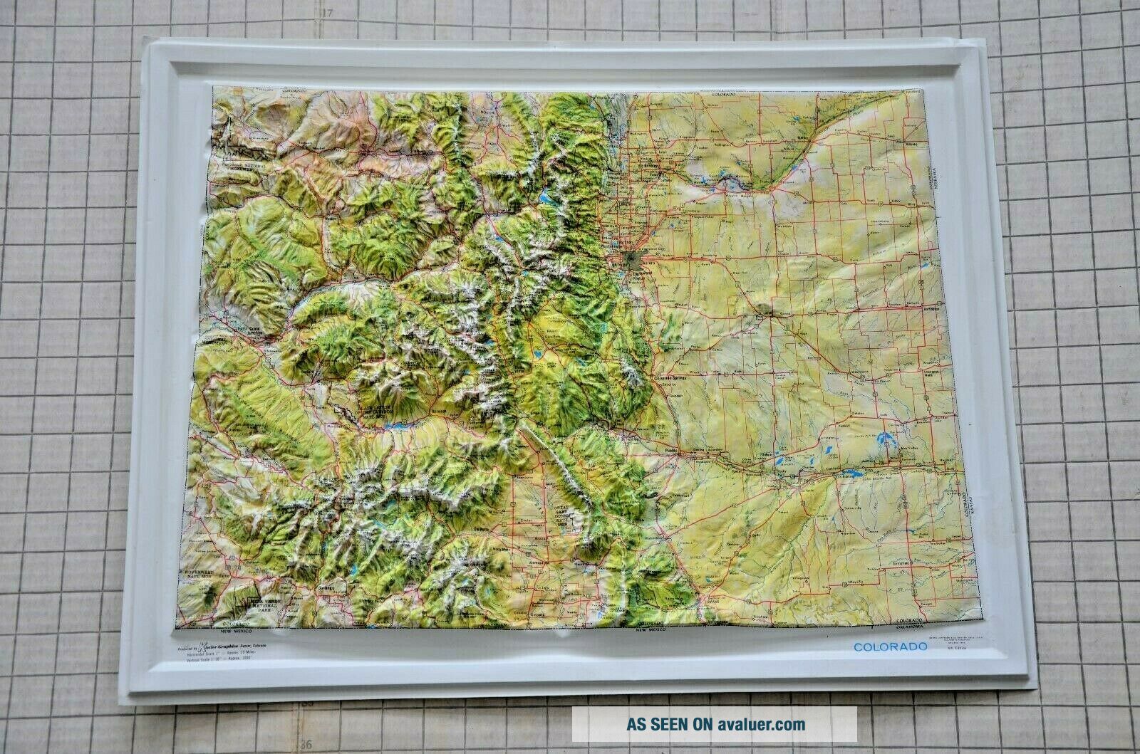
RARE Jeppesen Raised Relief Map COLORADO Kintler Graphics 3 - D Topographic Map
Item History & Price
| Reference Number: Avaluer:15353 | Type: Topographical Map |
| Date Range: 1960-1969 | Year: 1967 |
| Topic: Maps | US State: Colorado |
| Features: Raised Relief |
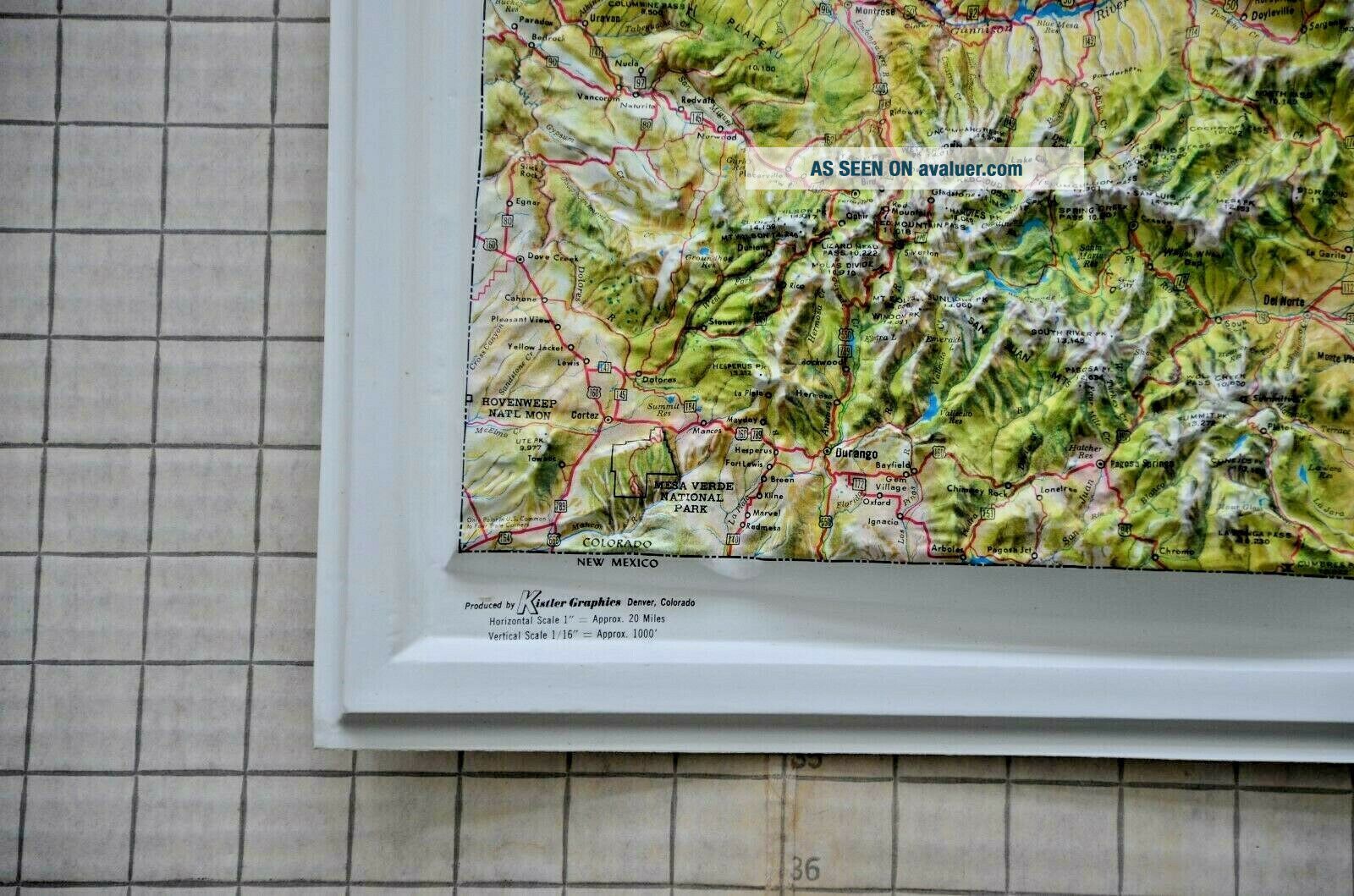
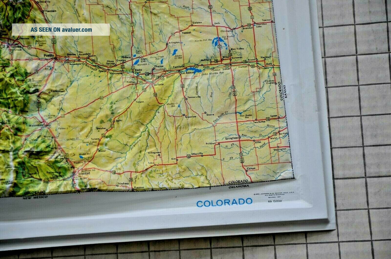
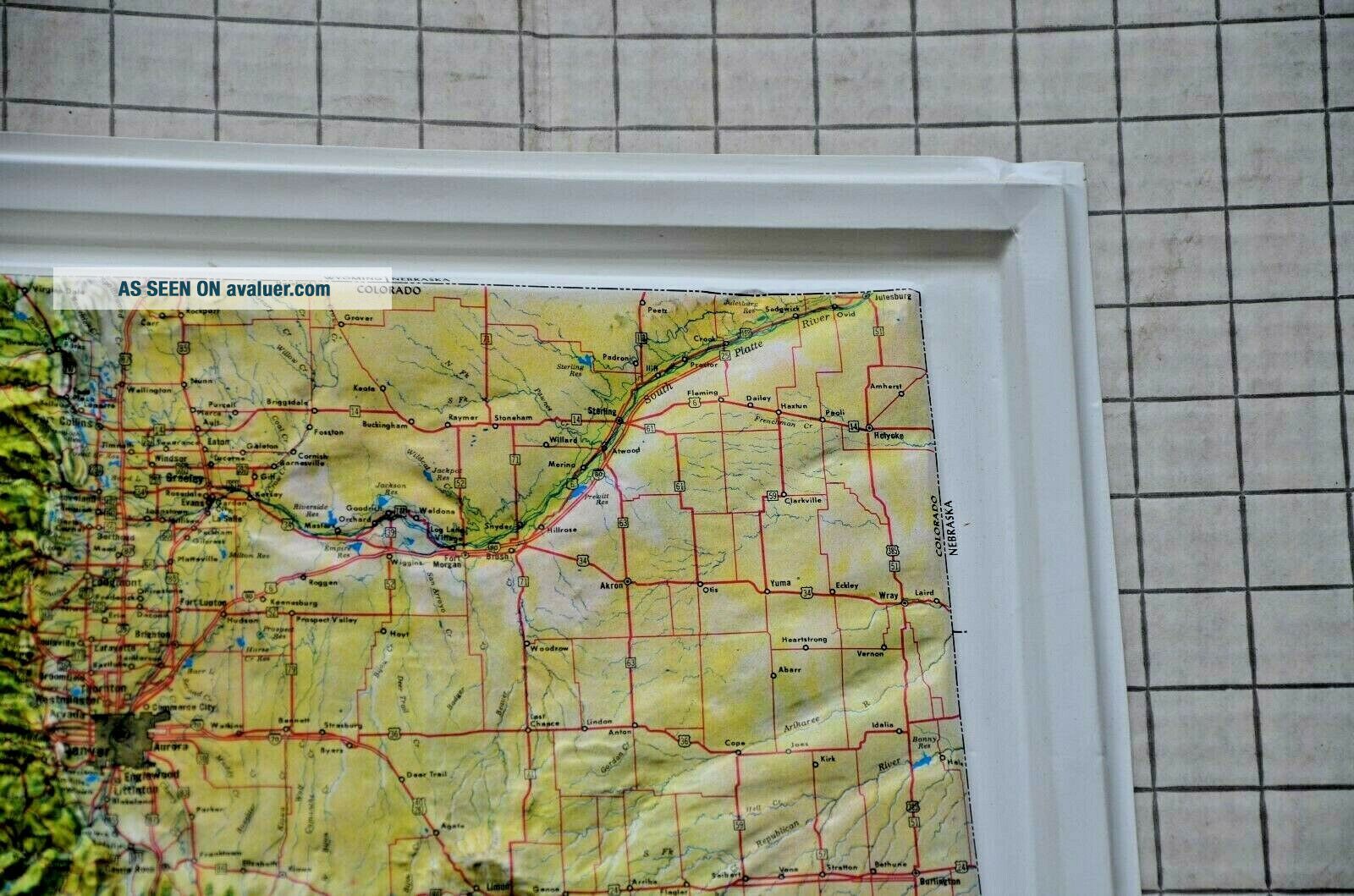
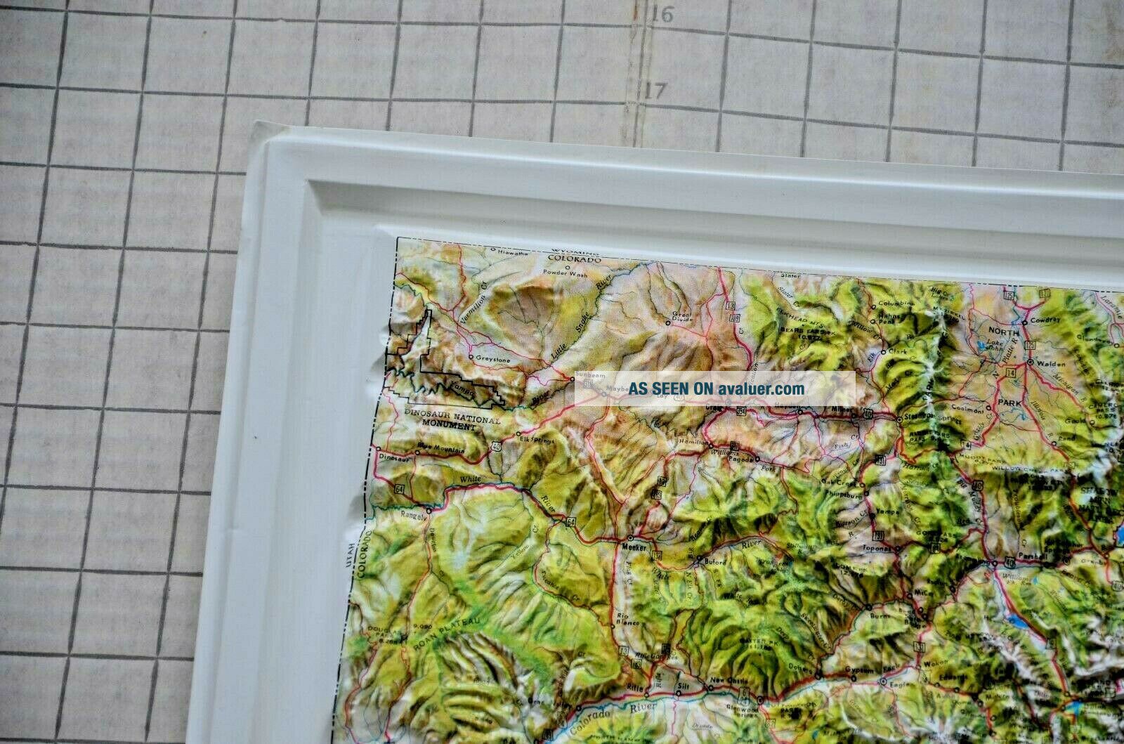
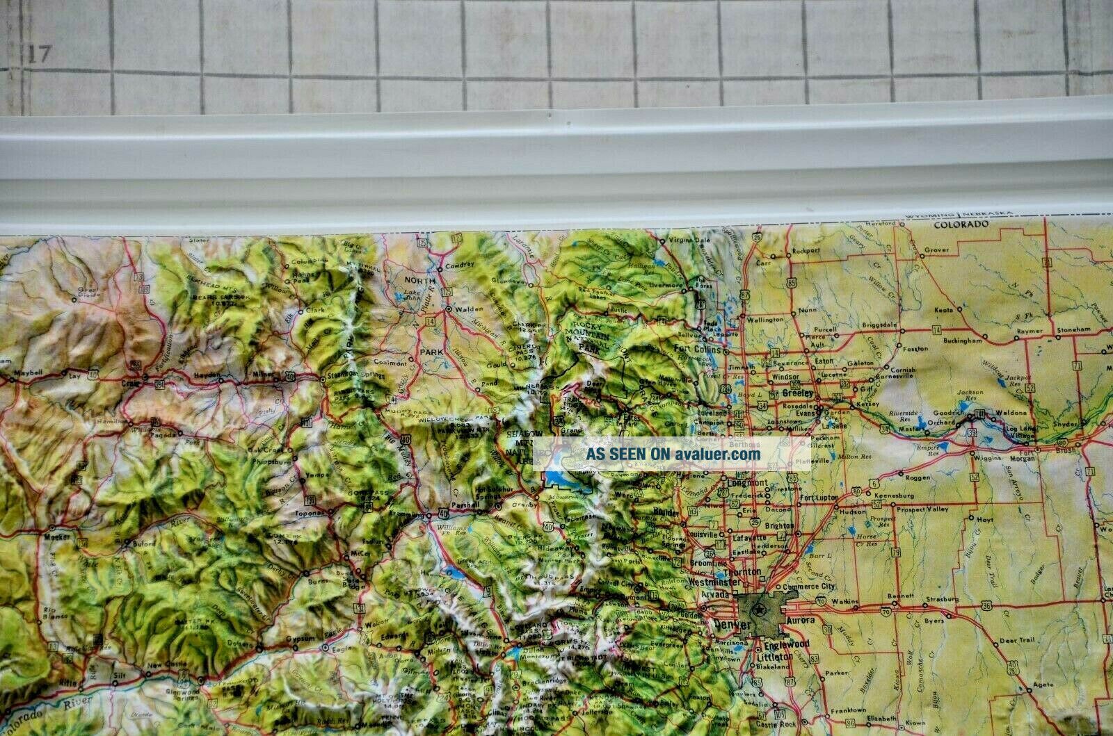
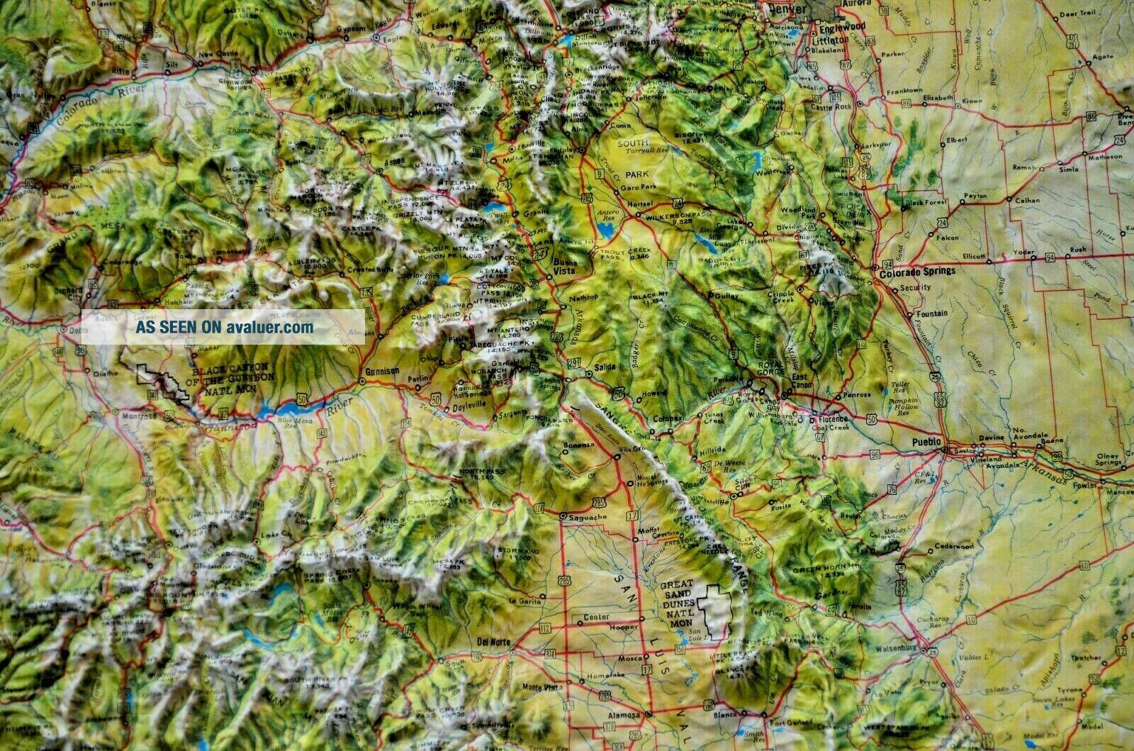
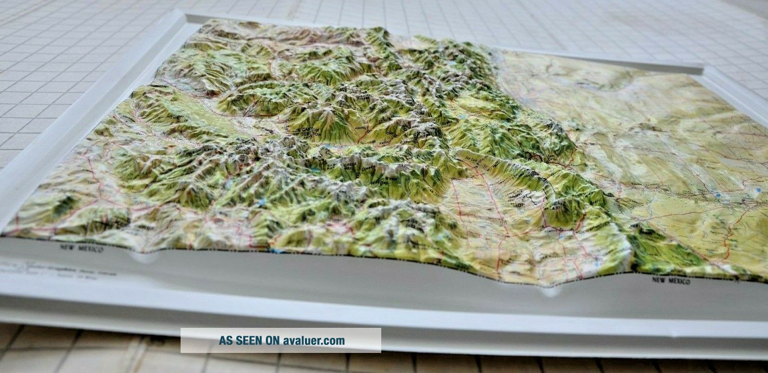
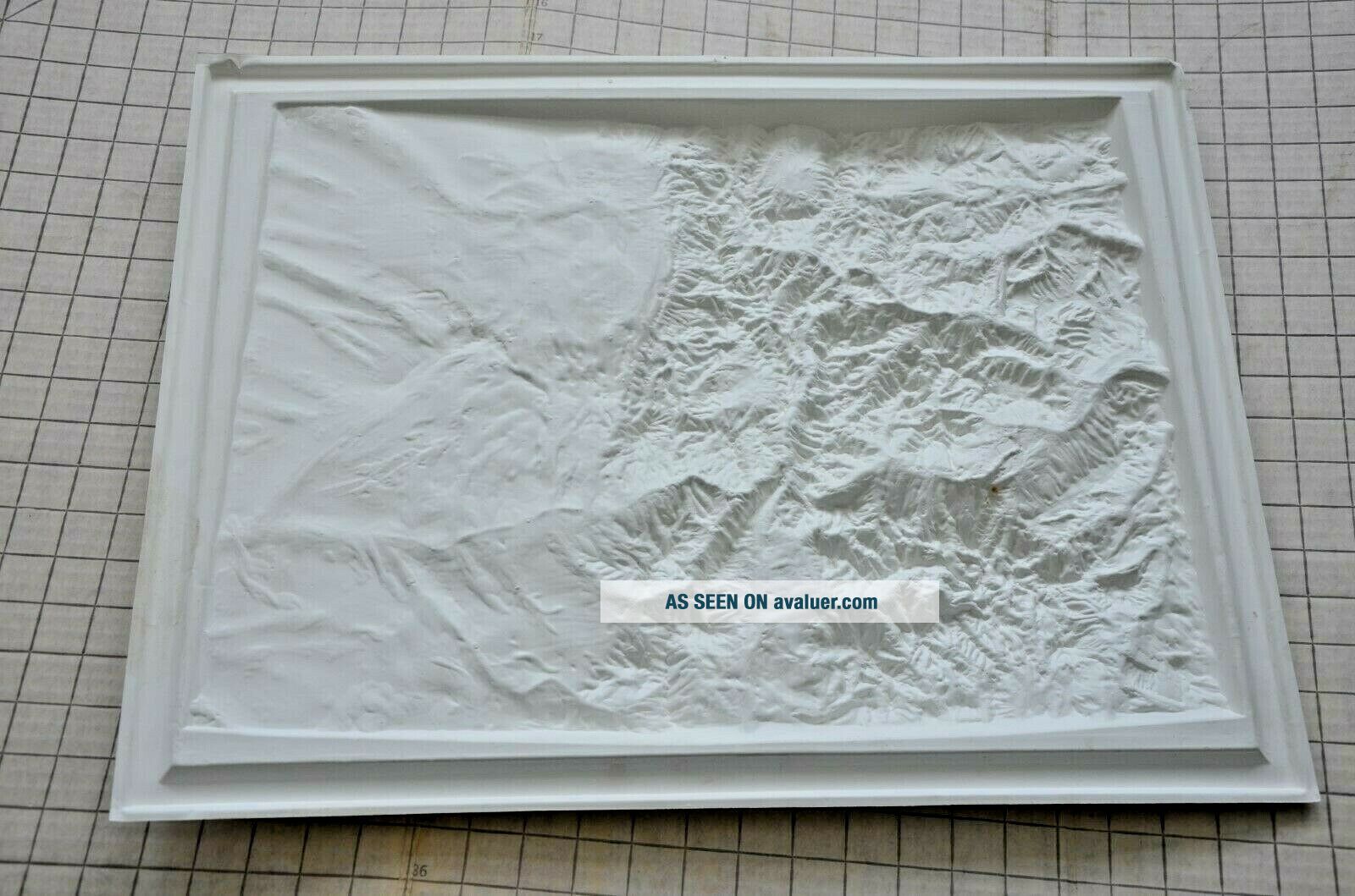
3D Topo map by Jeppesen, printed by Kintler Graphics of Denver, Colorado. State of Colorado, featured in brightly colored three dimensions! These show an accurate representation of the natural terrain of each state, and since Colorado has more terrain above 12, 000 feet than any other state, this map is indeed impressive! The colors are narual pigments meant to assist in describing the landscape. This map is not framed, but has a raised edge. There are some very minor bumps to the corn...ers, but no cracks or creasing in the map itself. There are two pinholes at the top center (in the white, not on the map itself, and outside the raised edge so invisible if framed). No peeling paint, or other flaws.
Map measures 22" long by 17" tall. Horizontal scale: 1" = 20 miles. Vertical scale: 1/16" = 1000 feet. Thanks for supporting our small Montana business!
Map measures 22" long by 17" tall. Horizontal scale: 1" = 20 miles. Vertical scale: 1/16" = 1000 feet. Thanks for supporting our small Montana business!