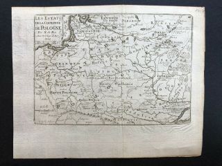
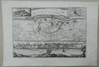
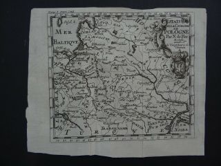
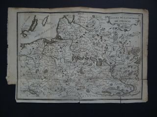
POLAND DATED 1717 By NICOLAS DE FER 18e CENTURY UNUSUAL ANTIQUE ENGRAVED MAP


Item History & Price

Information:
Reference Number: Avaluer:15448Printing Technique: Copper Plate
Year: 1717Original/Reproduction: Antique Original
Country/Region: Poland
Original Description:

Title of the map:
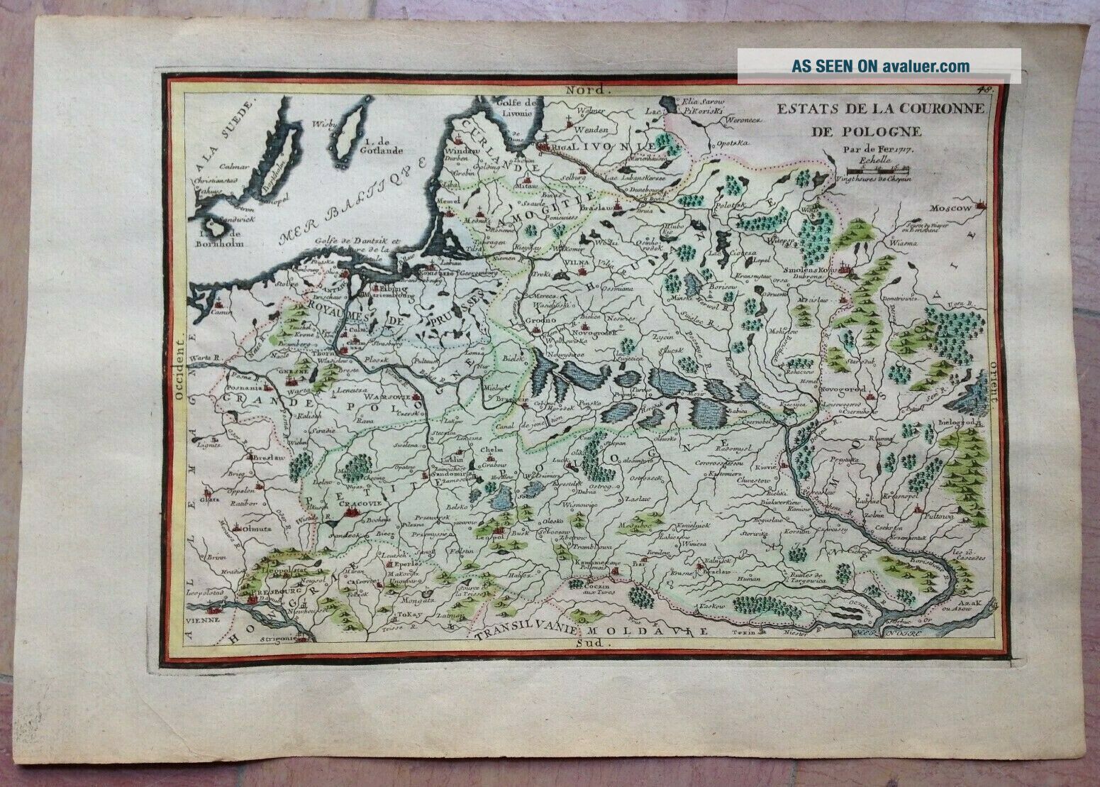
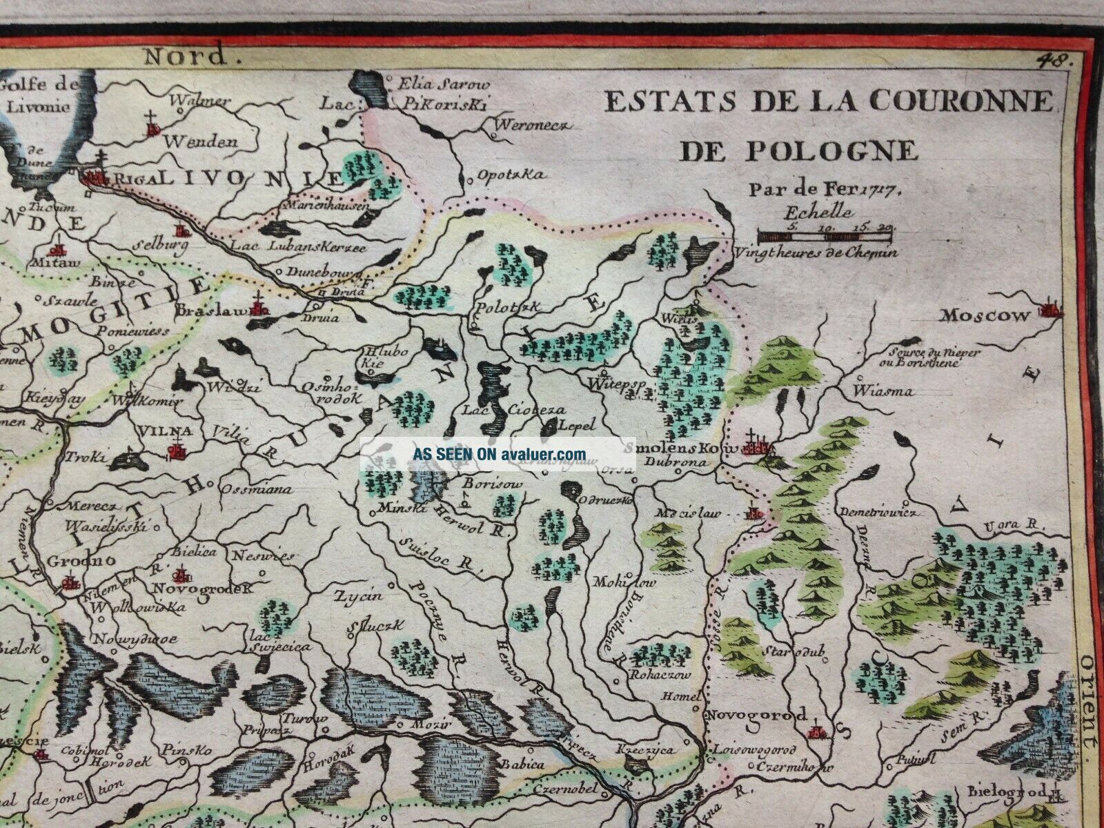
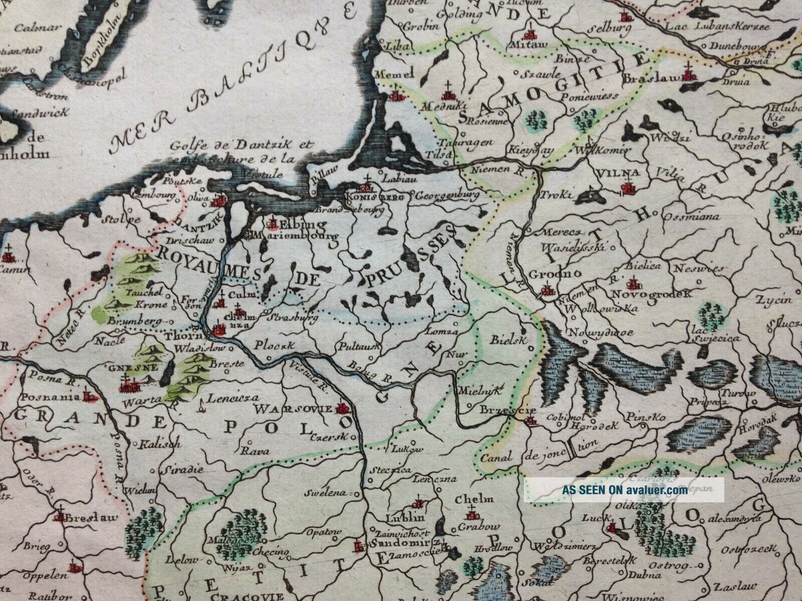
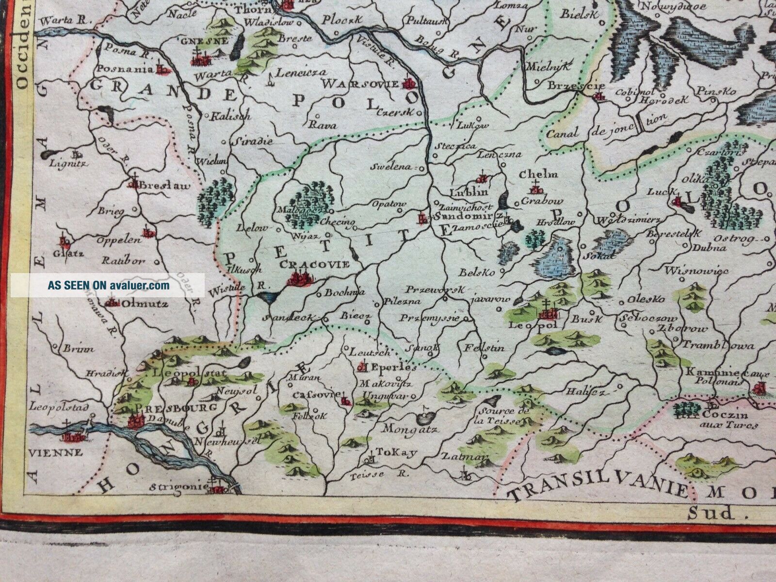
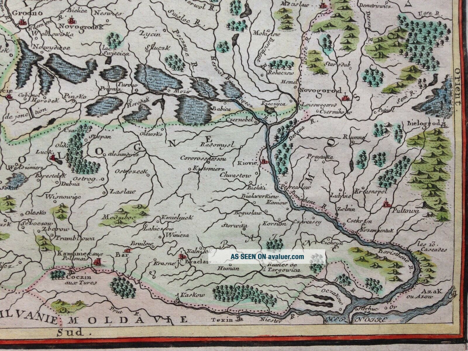
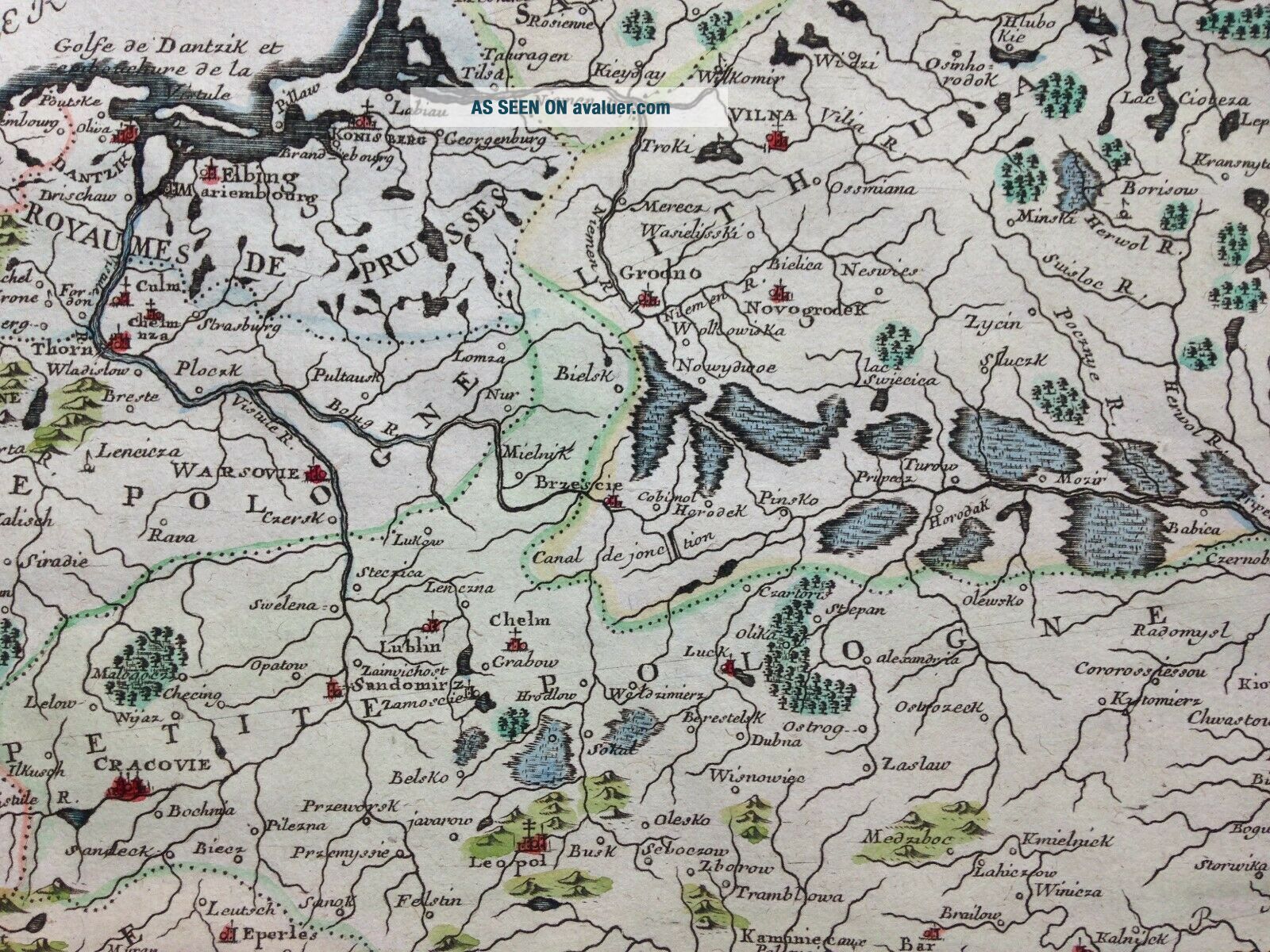
"ESTATS DE LA COURONNE DE POLOGNE Par de Fer 1717"
Unusual antique copper engraved map of POLAND, by Nicolas DE FER, XVIIIe century.

Nicolas De FER (1646-1720) is one of the famous geographe of XVIIIe century. His earliest wellknown map of the canal de Languedoc, realised in 1669. In 1697, he published his first world atlas.

Size with margins : 27, 3 x 39, 2 cm / 10, 6 x 15, 3 inches
Condition : good condition.
Edition : Paris, ...dated 1717, XVIIIe Century.

If you buy more than one item, you have to pay just one only shipping cost.All shipments are insured.

WE DON'T SELL LASER AND COPIES MAPS, ALL WE SELL IS ORIGINAL AND ANTIQUEDue to the age an type of paper, some imperfections are to be expected. Please examine the images provided carefully, and if you have any questions please ask and we will be happy to help you


    Similar items


  • 018 Antique 1717 Map Of Poland,  Ukraine And Lithuania Nicolas De Fer

    018 Antique 1717 Map Of Poland, Ukraine And Lithuania Nicolas De Fer

  • United States Canada 1702 Nicolas De Fer 18e Century Unusual Antique Map

    United States Canada 1702 Nicolas De Fer 18e Century Unusual Antique Map

  • Texas Mississipi 1701 Nicolas De Fer 18e Century Unusual Antique Map

    Texas Mississipi 1701 Nicolas De Fer 18e Century Unusual Antique Map

  • 1724 Map Of Isles Britanniques By Nicolas De Fer Angleterre Ecosse Irlande

    1724 Map Of Isles Britanniques By Nicolas De Fer Angleterre Ecosse Irlande

  • Warsaw,  Warschau,  Warszawa,  Varsovia,  Poland,  Polonia,  Polen.  Nicolas De Fer 1705.  Map

    Warsaw, Warschau, Warszawa, Varsovia, Poland, Polonia, Polen. Nicolas De Fer 1705. Map

  • 1721 Nicolas De Fer Atlas Map Poland - Estats De La Couronne De Pologne

    1721 Nicolas De Fer Atlas Map Poland - Estats De La Couronne De Pologne

  • 1754 Nicolas De Fer Atlas Map Poland - Pologne - Lithuania - Lithuanie

    1754 Nicolas De Fer Atlas Map Poland - Pologne - Lithuania - Lithuanie

  • 1721 Robbe Atlas Methode A La Geographie 2 Vols,  Nicolas De Fer Maps

    1721 Robbe Atlas Methode A La Geographie 2 Vols, Nicolas De Fer Maps


    • You might also like


    • Hungary & Romania 1579 (1584) Ortelius Unusual Antique Copper Engraved Map

      Hungary & Romania 1579 (1584) Ortelius Unusual Antique Copper Engraved Map

    • Brussels Bruxelles Belfium 1777 De Ferraris & Dupuis Large Antique Map Sheet Xxi

      Brussels Bruxelles Belfium 1777 De Ferraris & Dupuis Large Antique Map Sheet Xxi

    • 1616 Atlas Map Of Iceland.

      1616 Atlas Map Of Iceland.

    • Kazan Russia 1767 Le Clerc/lespinasse Antique Copper Engraved City View

      Kazan Russia 1767 Le Clerc/lespinasse Antique Copper Engraved City View

    • 1899 Stanford,  Folding Map Of Norwich,  Norfolk,  Arthur Collins,  Jarrold & Sons,

      1899 Stanford, Folding Map Of Norwich, Norfolk, Arthur Collins, Jarrold & Sons,

    • 1948 Vintage Linen Colour Map Geological Survey Ten Mile Of Great Britain

      1948 Vintage Linen Colour Map Geological Survey Ten Mile Of Great Britain

    • 1944 Map Flying Bombs Sussex Ww2 Newspaper Military Kent Courier German V1 V2

      1944 Map Flying Bombs Sussex Ww2 Newspaper Military Kent Courier German V1 V2

    • Dated 1638 Vellum Map Of Icklesham Sussex Showing Land Uses Owners Etc

      Dated 1638 Vellum Map Of Icklesham Sussex Showing Land Uses Owners Etc

Avaluer          About Us          Privacy Policy          Contact Us          UP
© 2022, avaluer.net, Inc. or its affiliates