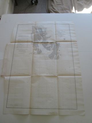
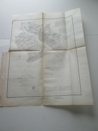
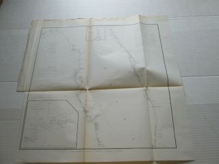
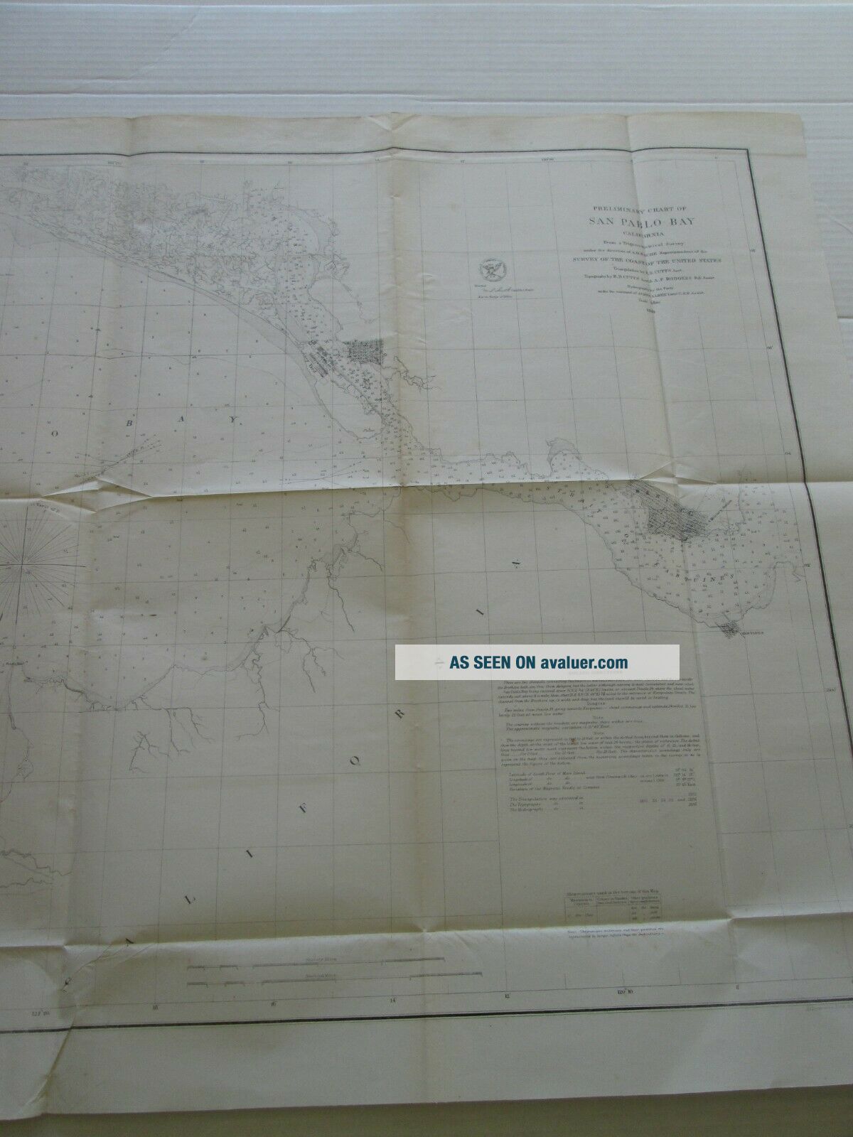
(1) 1856 U. S. COAST SURVEY CHART: " SAN PABLO BAY, CALIFORNIA "


Item History & Price

Information:
Reference Number: Avaluer:15595Year: 1853
Country Of Manufacture: United StatesSpecial Attributes: 1st Edition
Original Description:
THE BEST OFFER FUNCTION IS ON FOR THIS LISTING.  I WILL CONSIDER ANY AND ALL OFFERS, SO IF YOU ARE INTERESTED PLEASE USE EBAY'S BEST OFFER FUNCTION TO MAKE THAT OFFER.


    Similar items


  • (1) 1856 U.  S.  Coast Survey Chart: " Stillwater Bay,  Washington "

    (1) 1856 U. S. Coast Survey Chart: " Stillwater Bay, Washington "

  • (1) 1856 U.  S.  Coast Survey Chart: " Seacoast Of Texas In Vicinity Of Galveston "

    (1) 1856 U. S. Coast Survey Chart: " Seacoast Of Texas In Vicinity Of Galveston "

  • (1) 1856 U.  S.  Coast Survey Chart : " Galveston Entrance,  Texas "

    (1) 1856 U. S. Coast Survey Chart : " Galveston Entrance, Texas "

  • (1) 1856 U.  S.  Coast Survey Chart: " St.  John

    (1) 1856 U. S. Coast Survey Chart: " St. John ' S River, Florida " Entrance - Brown ' S

  • (1) 1856 U.  S.  Coast Survey Chart: " St.  Mark

    (1) 1856 U. S. Coast Survey Chart: " St. Mark ' S River, Florida " Preliminary Chart

  • (1) 1856 U.  S.  Coast Survey Chart: " North Edisto River,  South Carolina "

    (1) 1856 U. S. Coast Survey Chart: " North Edisto River, South Carolina "

  • One (1) 1856 U.  S.  Coast Survey Chart: Sketch F,  Number Vi,  Coast Of Florida

    One (1) 1856 U. S. Coast Survey Chart: Sketch F, Number Vi, Coast Of Florida


    • You might also like


    • 1860 Mitchell Hand Colored Map Colorado,  Nebraska & Kansas - Civil War Era

      1860 Mitchell Hand Colored Map Colorado, Nebraska & Kansas - Civil War Era

    • 18th Century French Map Of North America

      18th Century French Map Of North America

    • Las Vegas Nevada Vintage 1967 Us Geological Survey Quadrangle Map 4 Panels

      Las Vegas Nevada Vintage 1967 Us Geological Survey Quadrangle Map 4 Panels

    • Rare Antique 1845 Maps United States Exploring Expedition Book Antartica Hawaii

      Rare Antique 1845 Maps United States Exploring Expedition Book Antartica Hawaii

    • Vintage 1926 Map Hollywood From The Best Surveys Of The Time

      Vintage 1926 Map Hollywood From The Best Surveys Of The Time

    • American Continent (western Hemisphere) 1747 Bowen Antique Copper Engraved Map

      American Continent (western Hemisphere) 1747 Bowen Antique Copper Engraved Map

    • Gulf Coast Florida Texas United States 1705 De Fer Unusual Antique Engraved Map

      Gulf Coast Florida Texas United States 1705 De Fer Unusual Antique Engraved Map

    • California As Island United States 1700 De Fer Unusual First Edition Antique Map

      California As Island United States 1700 De Fer Unusual First Edition Antique Map

Avaluer          About Us          Privacy Policy          Contact Us          UP
© 2022, avaluer.net, Inc. or its affiliates