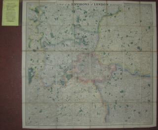
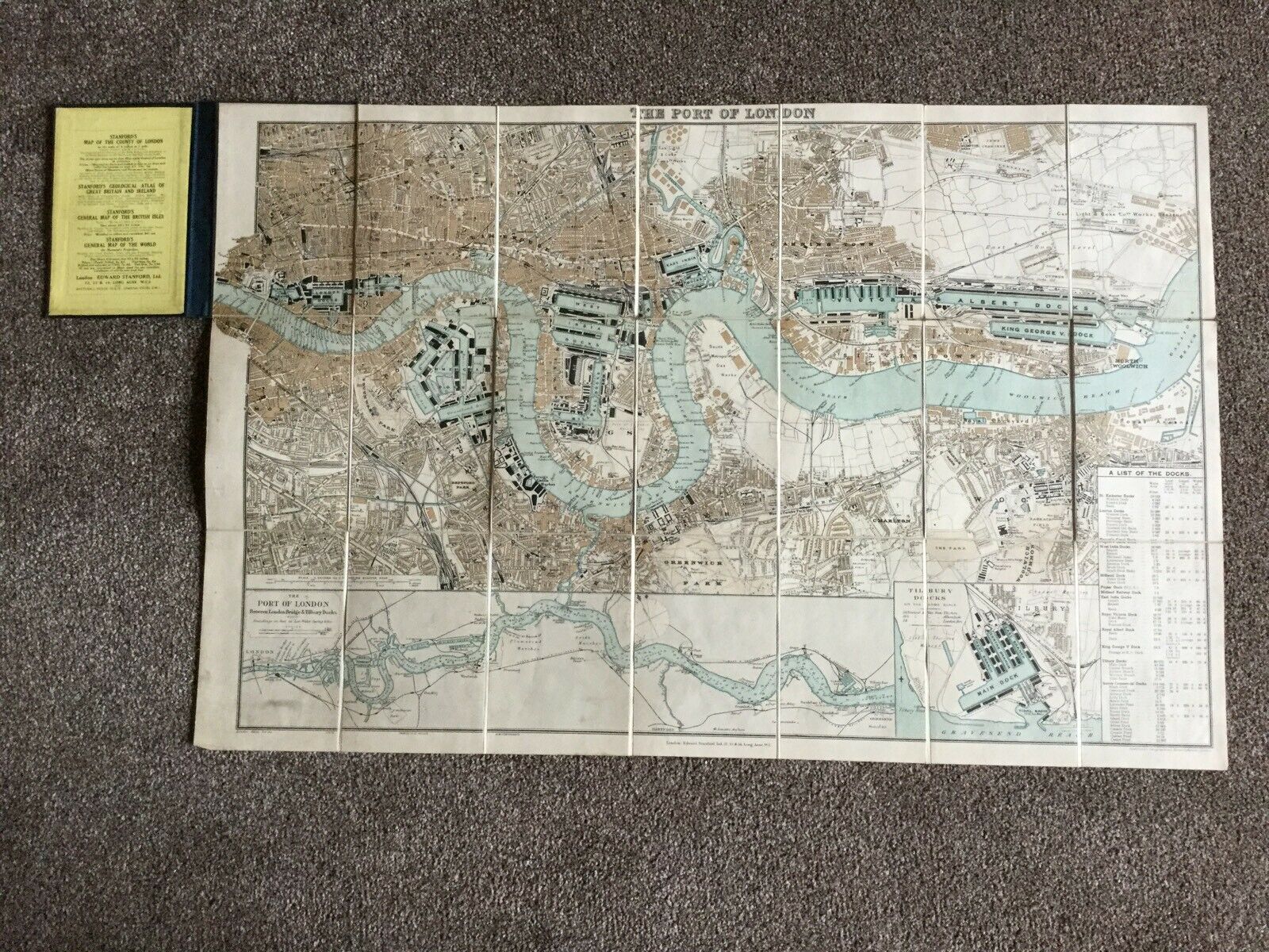
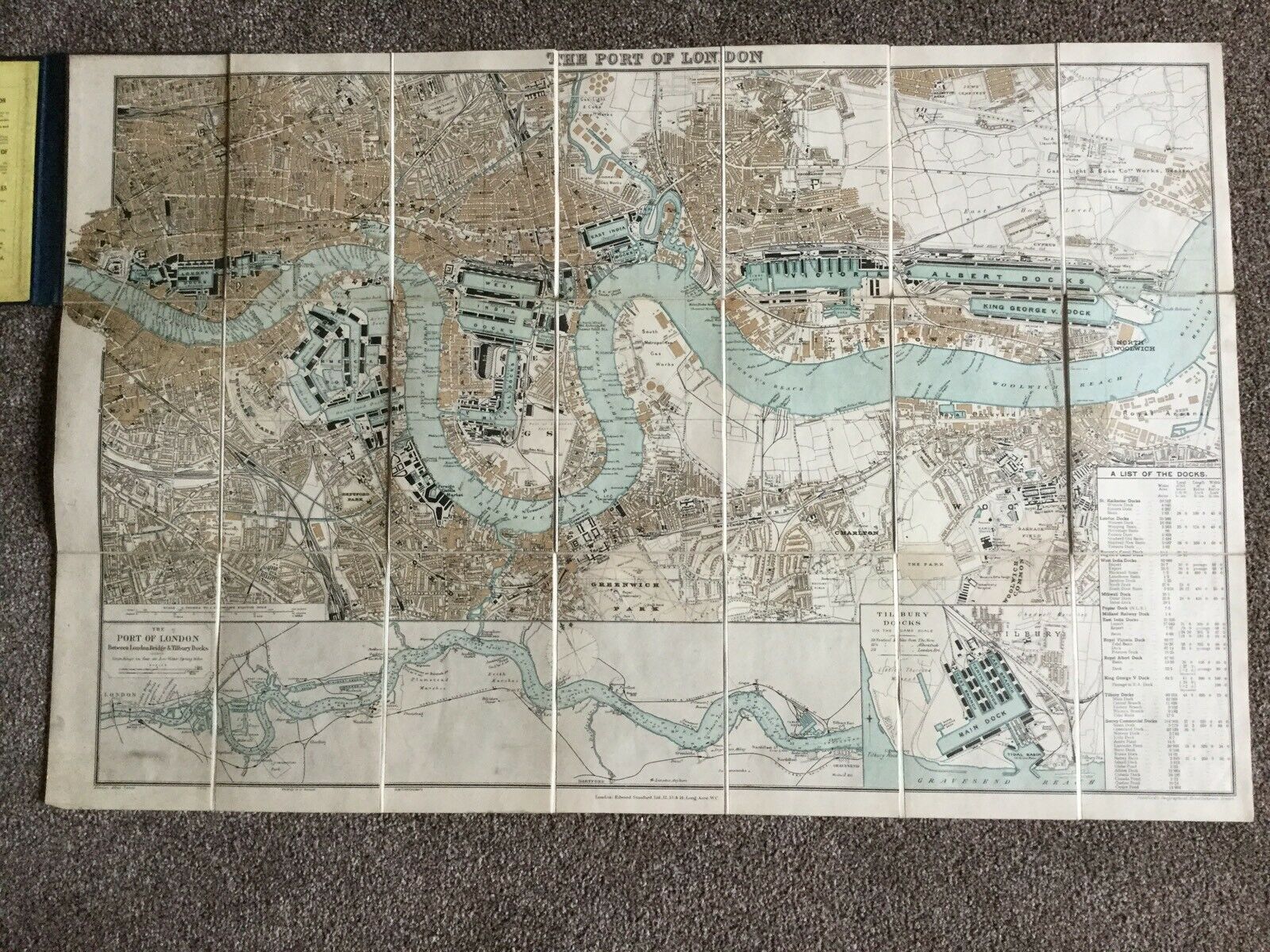
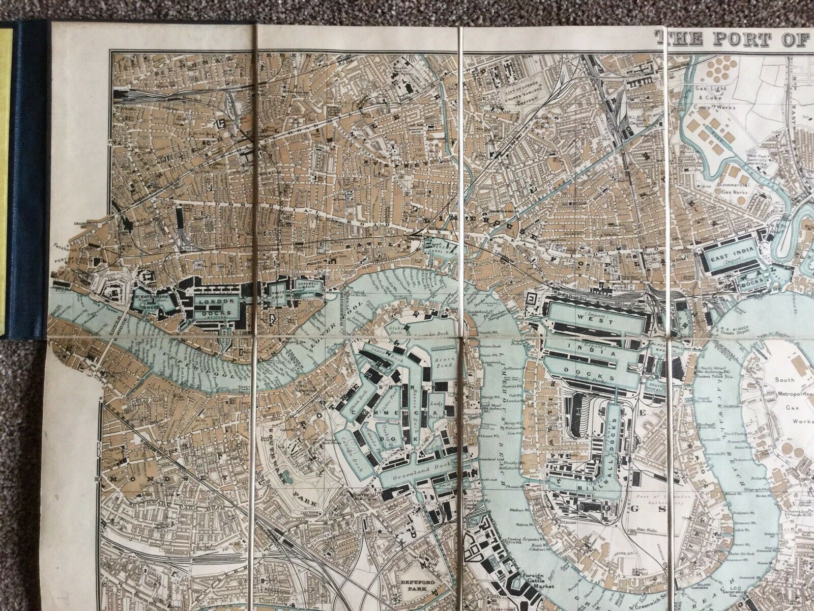
Edward Stanford London Atlas Map Port Of London Linen Hardback Map 1904


Item History & Price

Information:
Reference Number: Avaluer:15677456Format: Atlas Map
Type: City MapOriginal/Reproduction: Antique Original
Country/Region: EnglandDate Range: 1900-1909
City: LondonYear: 1904
Original Description:
An excellent Edward Stanford original map of then Port Of London 1904. Very good condition with no tears. Covers intact just some marks. Map 77cm x 50cm when opened. Please see photographs. We will combine postage. Part of a large and varied collection- please see our other items.


    Similar items


  • 1702 De La Feuille Atlas Map Port Of Vigo - Spain - Port De Vigos - Battle Vigo

    1702 De La Feuille Atlas Map Port Of Vigo - Spain - Port De Vigos - Battle Vigo

  • Edward Stanford London Atlas Map Of The Nile Valley Rare

    Edward Stanford London Atlas Map Of The Nile Valley Rare

  • Environs Of London 25 Miles Around Edward Stanford Undated Vintage Map

    Environs Of London 25 Miles Around Edward Stanford Undated Vintage Map

  • Antique Map Of Durham.  1900.  Edward Stanford.  London

    Antique Map Of Durham. 1900. Edward Stanford. London

  • South America - London Atlas Map - Edward Stanford Folding Linen Map C 1930

    South America - London Atlas Map - Edward Stanford Folding Linen Map C 1930

  • Switzerland C1884 Antique Fold Out Map By Edward Stanford London

    Switzerland C1884 Antique Fold Out Map By Edward Stanford London

  • 1719 Manesson Mallet Atlas Map Tower Of London - Tour De Londres Thurn Zu Londen

    1719 Manesson Mallet Atlas Map Tower Of London - Tour De Londres Thurn Zu Londen

  • Bartholomews Segmented Map On Cloth,  1910s,  Of Devon,  Pub By Edward Stanford Ltd

    Bartholomews Segmented Map On Cloth, 1910s, Of Devon, Pub By Edward Stanford Ltd


    • You might also like


    • Hungary & Romania 1579 (1584) Ortelius Unusual Antique Copper Engraved Map

      Hungary & Romania 1579 (1584) Ortelius Unusual Antique Copper Engraved Map

    • Brussels Bruxelles Belfium 1777 De Ferraris & Dupuis Large Antique Map Sheet Xxi

      Brussels Bruxelles Belfium 1777 De Ferraris & Dupuis Large Antique Map Sheet Xxi

    • 1616 Atlas Map Of Iceland.

      1616 Atlas Map Of Iceland.

    • Kazan Russia 1767 Le Clerc/lespinasse Antique Copper Engraved City View

      Kazan Russia 1767 Le Clerc/lespinasse Antique Copper Engraved City View

    • 1899 Stanford,  Folding Map Of Norwich,  Norfolk,  Arthur Collins,  Jarrold & Sons,

      1899 Stanford, Folding Map Of Norwich, Norfolk, Arthur Collins, Jarrold & Sons,

    • 1948 Vintage Linen Colour Map Geological Survey Ten Mile Of Great Britain

      1948 Vintage Linen Colour Map Geological Survey Ten Mile Of Great Britain

    • 1944 Map Flying Bombs Sussex Ww2 Newspaper Military Kent Courier German V1 V2

      1944 Map Flying Bombs Sussex Ww2 Newspaper Military Kent Courier German V1 V2

    • Dated 1638 Vellum Map Of Icklesham Sussex Showing Land Uses Owners Etc

      Dated 1638 Vellum Map Of Icklesham Sussex Showing Land Uses Owners Etc

Avaluer          About Us          Privacy Policy          Contact Us          UP
© 2022, avaluer.net, Inc. or its affiliates