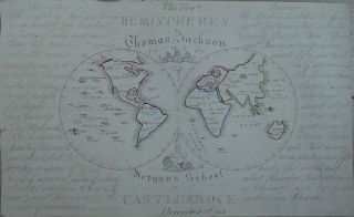
ITALY 1574 HAND DRAWN MAP ITALIA SICILIA SARDINIA AFTER SEBASTIAN MUNSTER


Item History & Price

Information:
Reference Number: Avaluer:15677915Cartographer/Publisher: Sebastian Munster
Year: 1574Printing Technique: Manuscript/Hand drawn
Date Range: 1500-1599Original/Reproduction: Antique Original
Country/Region: Italy
Original Description:
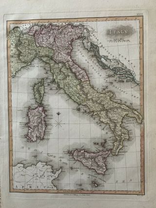
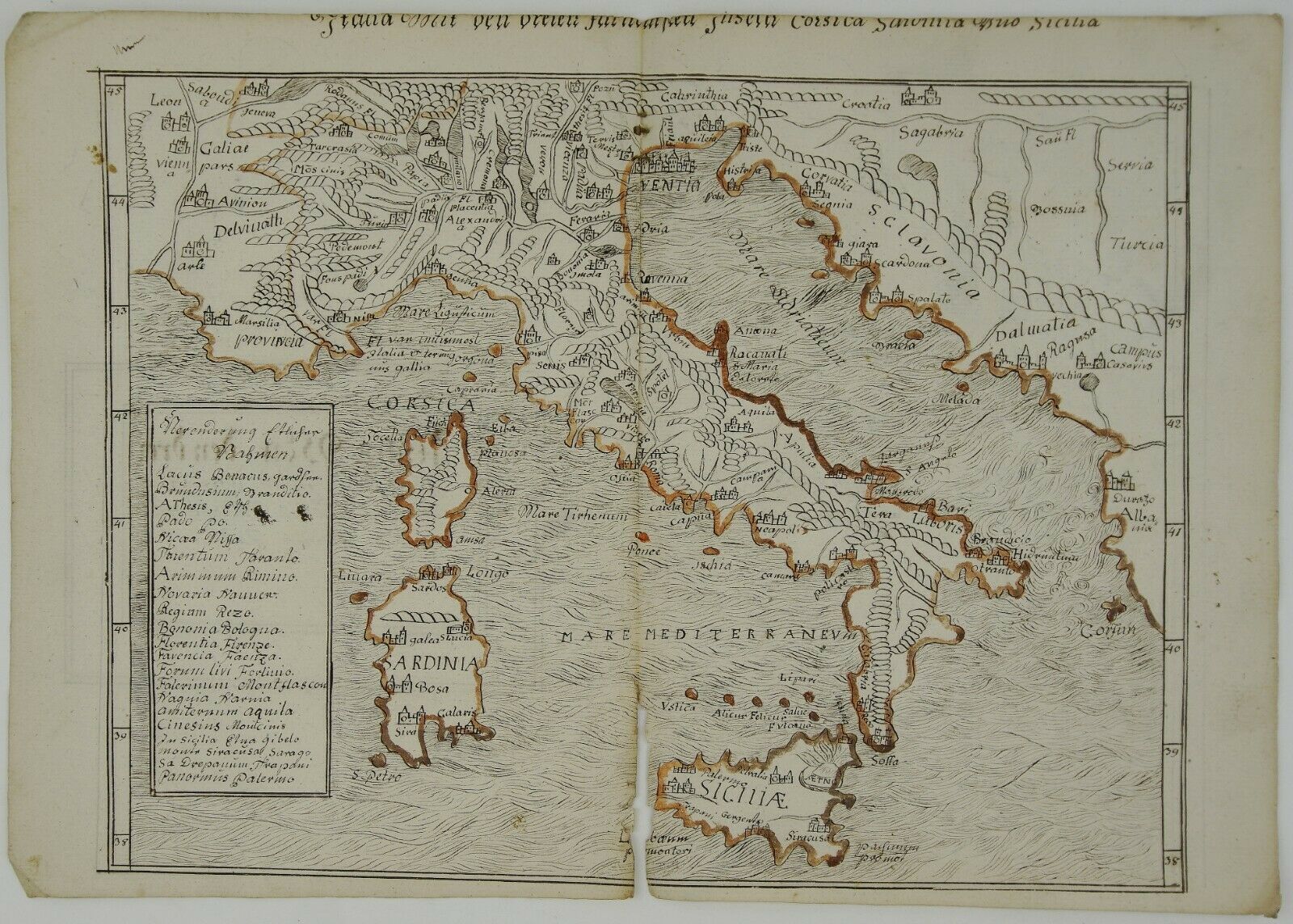
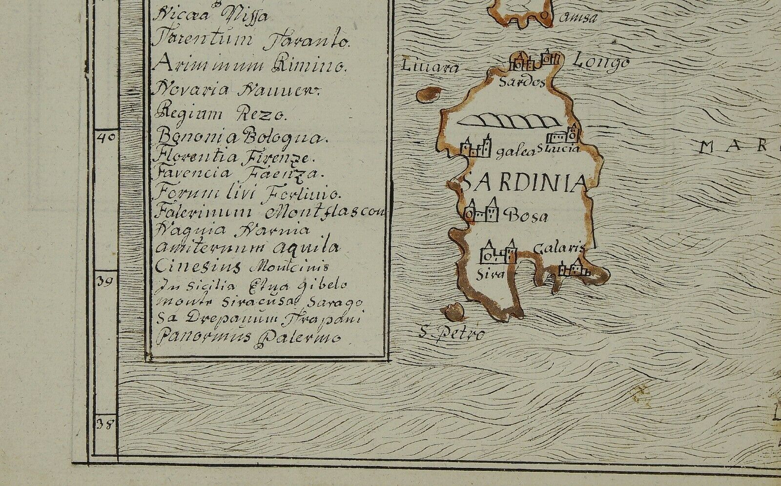
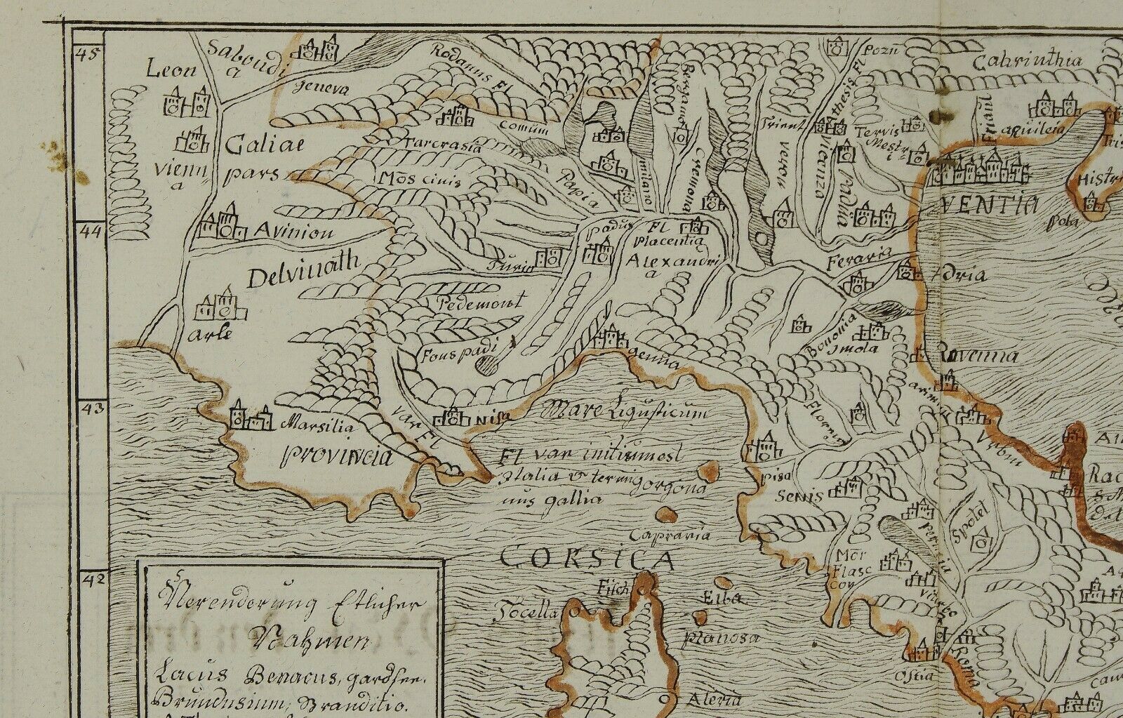
Title:          “Italia mit Dreien furnemsten Inseln, Corsica, Sardinia und Sicilia.”​
​Description:Nice hand drawn map of Italy. Map made after Sebastian Münster’s map from “Cosmographey oder beschreibung aller Länder” published in 1574. It was the only one hand made map in whole book, probably this page was missing and was replaced with hand drawn map instead.
Cartographer:     Sebastian Munster​ (148...8 – 1552)Sheet size:          39, 8 x 28, 0 cmTechnique:          hand drawn Condition:Good condition. Heavy hand made paper with original watermarks. Narrow upper margin. Recto and verso with contemporary handwritten annotations. Lower middle fold 7cm separation.​This is a genuine antique map and NOT a modern copy or reprint! ​Due to the ageof this map some imperfections to be expected! ​​Do not hesitate to ask for moreinformation! Combine shippingis possible!


    Similar items


  • 1852 Sir Thomas Jackson Hsbc Bank - Hand Drawn Map Of The World - Dublin School

    1852 Sir Thomas Jackson Hsbc Bank - Hand Drawn Map Of The World - Dublin School

  • Antique Hand Drawn Map Woodland Of Abraham De Bevoise In The Hills In Town

    Antique Hand Drawn Map Woodland Of Abraham De Bevoise In The Hills In Town

  • 1872 Hand Drawn Map,  Rockland,  Maine; Snow Farwell & Co. ,  Knox & Lincoln R.  R.

    1872 Hand Drawn Map, Rockland, Maine; Snow Farwell & Co. , Knox & Lincoln R. R.

  • 1840 Cuba Hand Drawn Map Jurisdictional Division Artemisa & Guira Colored Detail

    1840 Cuba Hand Drawn Map Jurisdictional Division Artemisa & Guira Colored Detail

  • Civil War 1862 Report W/ Hand Drawn Map Contraband Cavalry Fairfax Virginia

    Civil War 1862 Report W/ Hand Drawn Map Contraband Cavalry Fairfax Virginia

  • Japanese Hand Drawn Maps Land Survey Maps Miyagi Fukushima Set 17 Meiji

    Japanese Hand Drawn Maps Land Survey Maps Miyagi Fukushima Set 17 Meiji

  • 1852 Sir Thomas Jackson Hsbc Bank - Hand Drawn Map Of North & South Africa,  Cape

    1852 Sir Thomas Jackson Hsbc Bank - Hand Drawn Map Of North & South Africa, Cape

  • 1813 Italy Antique Hand Coloured Map By Samuel Neele

    1813 Italy Antique Hand Coloured Map By Samuel Neele


    • You might also like


    • Hungary & Romania 1579 (1584) Ortelius Unusual Antique Copper Engraved Map

      Hungary & Romania 1579 (1584) Ortelius Unusual Antique Copper Engraved Map

    • Brussels Bruxelles Belfium 1777 De Ferraris & Dupuis Large Antique Map Sheet Xxi

      Brussels Bruxelles Belfium 1777 De Ferraris & Dupuis Large Antique Map Sheet Xxi

    • 1616 Atlas Map Of Iceland.

      1616 Atlas Map Of Iceland.

    • Kazan Russia 1767 Le Clerc/lespinasse Antique Copper Engraved City View

      Kazan Russia 1767 Le Clerc/lespinasse Antique Copper Engraved City View

    • 1899 Stanford,  Folding Map Of Norwich,  Norfolk,  Arthur Collins,  Jarrold & Sons,

      1899 Stanford, Folding Map Of Norwich, Norfolk, Arthur Collins, Jarrold & Sons,

    • 1948 Vintage Linen Colour Map Geological Survey Ten Mile Of Great Britain

      1948 Vintage Linen Colour Map Geological Survey Ten Mile Of Great Britain

    • 1944 Map Flying Bombs Sussex Ww2 Newspaper Military Kent Courier German V1 V2

      1944 Map Flying Bombs Sussex Ww2 Newspaper Military Kent Courier German V1 V2

    • Dated 1638 Vellum Map Of Icklesham Sussex Showing Land Uses Owners Etc

      Dated 1638 Vellum Map Of Icklesham Sussex Showing Land Uses Owners Etc

Avaluer          About Us          Privacy Policy          Contact Us          UP
© 2022, avaluer.net, Inc. or its affiliates