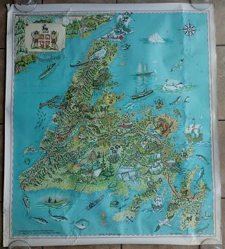
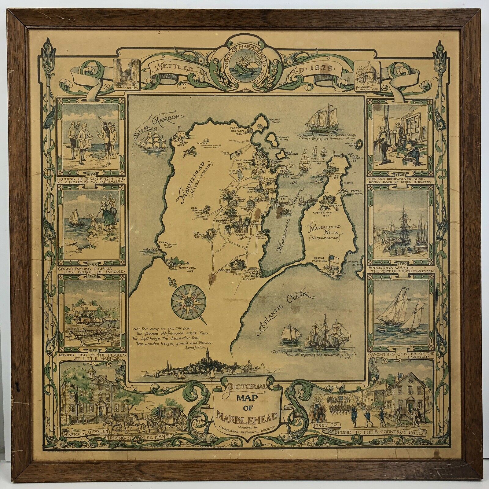
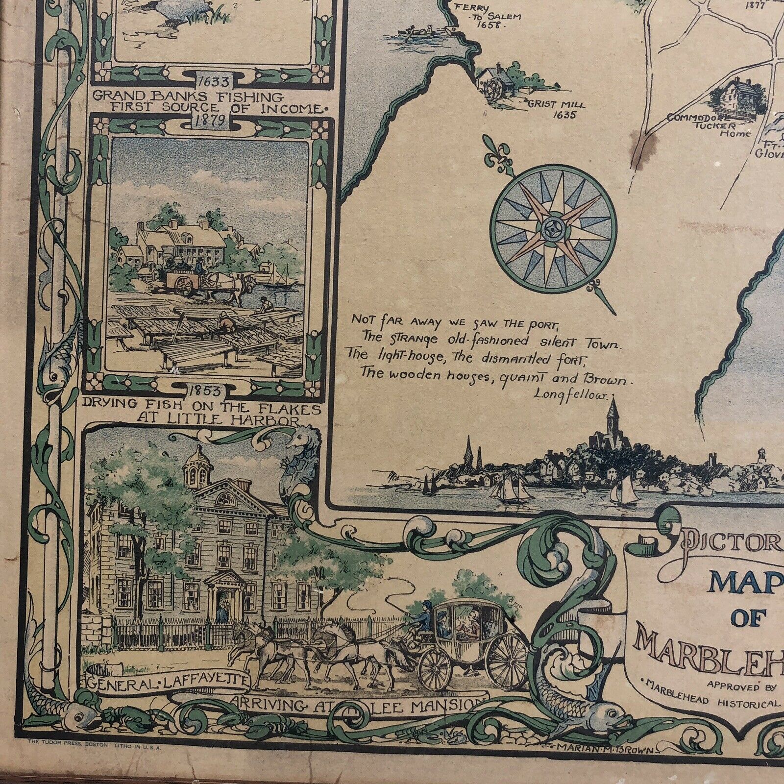
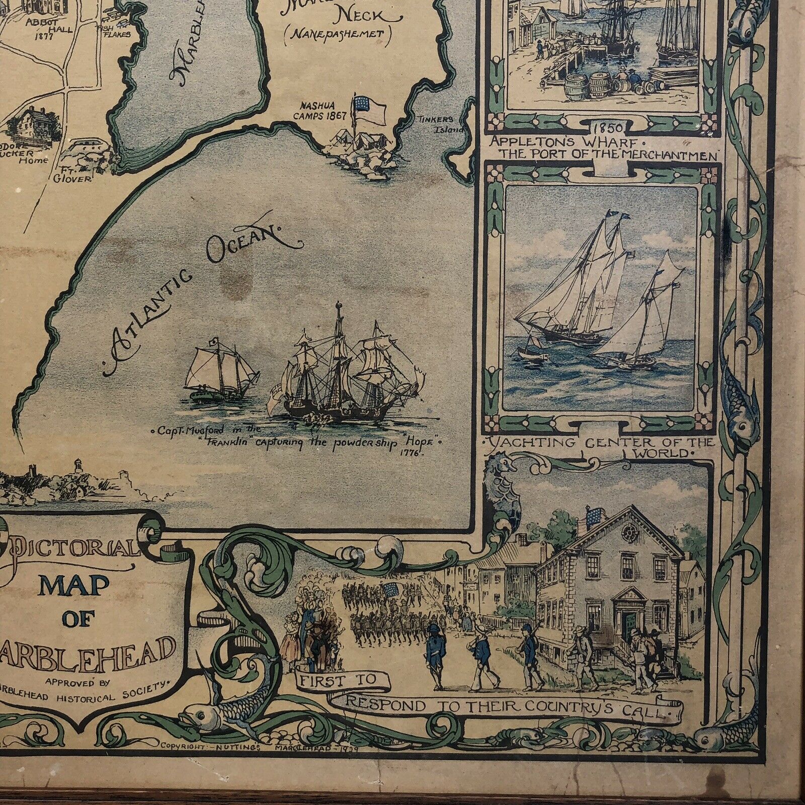
1929 Pictorial Map Of Marblehead Antique


Item History & Price

Information:
Reference Number: Avaluer:15689161Year: 1929
Original Description:
1929 Pictorial Map Of Marblehead. Shipped with USPS First Class Package. 20" x 20", Approved by Marblehead Historical Society. Ready to hang (no glass)


    Similar items


  • 1929 Pictorial Map Of Old Boston By Charles R Capon The Five Cents Savings Bank

    1929 Pictorial Map Of Old Boston By Charles R Capon The Five Cents Savings Bank

  • 1929 Vintage Map Of Hungary

    1929 Vintage Map Of Hungary

  • Vintage 1960

    Vintage 1960 ' S Sheriff Danny Arnold ' Old Wild West Pictorial ' Map Of America

  • Iconic 1936 Pictorial Map Of Beijing.

    Iconic 1936 Pictorial Map Of Beijing.

  • 1944 Persian Gulf Command Pictorial Map Of Iran

    1944 Persian Gulf Command Pictorial Map Of Iran

  • Old Art Map Of England The Pictorial Map Of London

    Old Art Map Of England The Pictorial Map Of London

  • Vintage 1965 Paul Parsons Pictorial Map Of Newfoundland

    Vintage 1965 Paul Parsons Pictorial Map Of Newfoundland


    • You might also like


    • 1860 Mitchell Hand Colored Map Colorado,  Nebraska & Kansas - Civil War Era

      1860 Mitchell Hand Colored Map Colorado, Nebraska & Kansas - Civil War Era

    • 18th Century French Map Of North America

      18th Century French Map Of North America

    • Las Vegas Nevada Vintage 1967 Us Geological Survey Quadrangle Map 4 Panels

      Las Vegas Nevada Vintage 1967 Us Geological Survey Quadrangle Map 4 Panels

    • Rare Antique 1845 Maps United States Exploring Expedition Book Antartica Hawaii

      Rare Antique 1845 Maps United States Exploring Expedition Book Antartica Hawaii

    • Vintage 1926 Map Hollywood From The Best Surveys Of The Time

      Vintage 1926 Map Hollywood From The Best Surveys Of The Time

    • American Continent (western Hemisphere) 1747 Bowen Antique Copper Engraved Map

      American Continent (western Hemisphere) 1747 Bowen Antique Copper Engraved Map

    • Gulf Coast Florida Texas United States 1705 De Fer Unusual Antique Engraved Map

      Gulf Coast Florida Texas United States 1705 De Fer Unusual Antique Engraved Map

    • California As Island United States 1700 De Fer Unusual First Edition Antique Map

      California As Island United States 1700 De Fer Unusual First Edition Antique Map

Avaluer          About Us          Privacy Policy          Contact Us          UP
© 2022, avaluer.net, Inc. or its affiliates