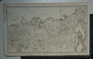
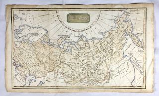
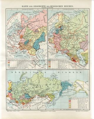
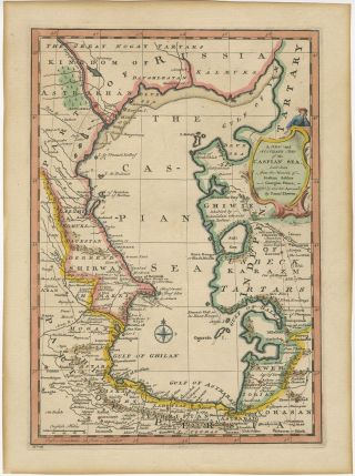
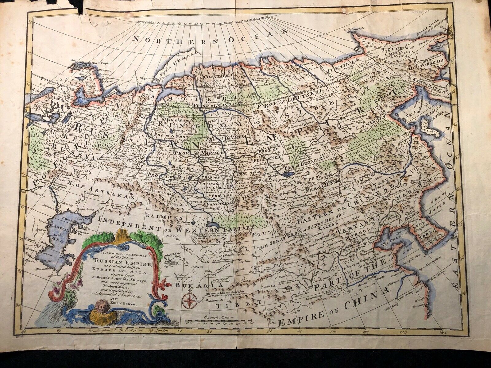
Map Of Russian Empire 1747 Emanuel Bowen Copper Engraving Hand - Colored


Item History & Price

Information:
Reference Number: Avaluer:15703679Cartographer/Publisher: Emanuel Bowen
Country/Region: United KingdomYear: 1747
Original Description:
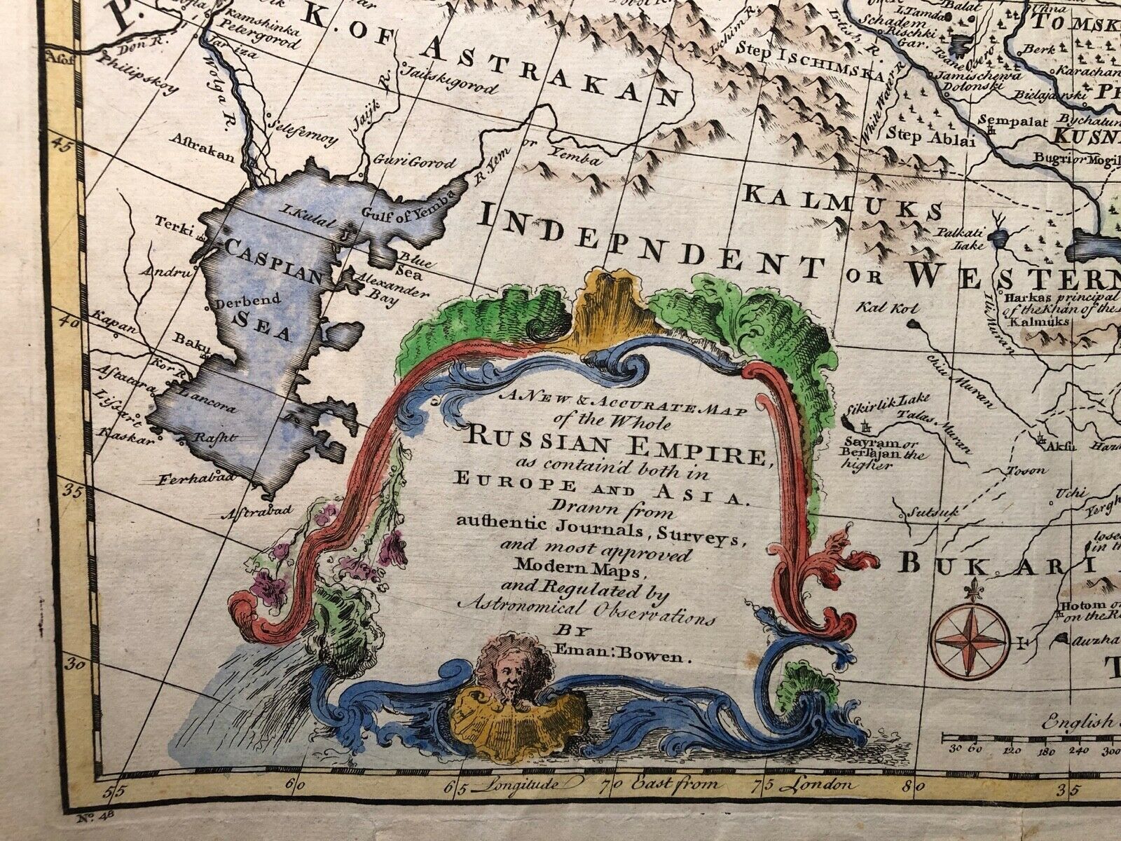
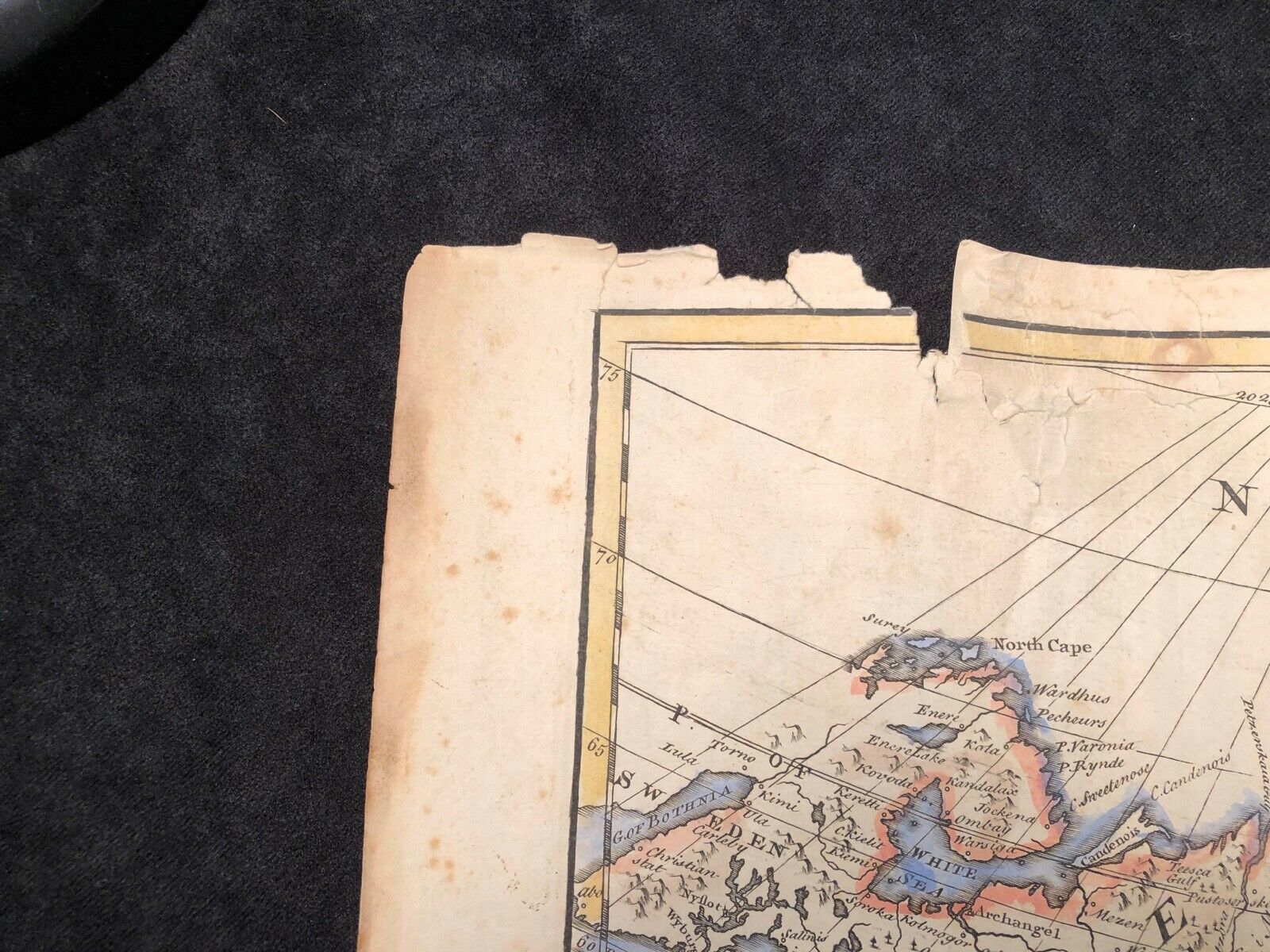
Authentic copper engraving with hand coloring from the mid 1700s"A New and Accurate Map of the Whole Russian Empire as contain'd both in Europe and Asia. Drawn from authentic Journals, Surveys, and most approved Modern Maps, and Regulated by Astronomical observations"  By Emanuel BowenIn good condition with some damage to the edges.Image measures 18.5" x 13.75"Sheet measures 21" x 14.75"


    Similar items


  • 1799 History Of Catherine The Great The Empress Russia (w/map Of Russian Empire)

    1799 History Of Catherine The Great The Empress Russia (w/map Of Russian Empire)

  • 1808 - Map Of Russian Empire - J Russell For William Guthrie

    1808 - Map Of Russian Empire - J Russell For William Guthrie

  • Antique Hand Coloured Engraved Map Of Russian Empire,  C1818 Kelly

    Antique Hand Coloured Engraved Map Of Russian Empire, C1818 Kelly

  • North America.  Hand Coloured Map Dated 1747.  Emanuel Bowen.

    North America. Hand Coloured Map Dated 1747. Emanuel Bowen.

  • 1895 Russia History Of Russian Empire Poland Ukraine Crimea Baltic Siberia Map

    1895 Russia History Of Russian Empire Poland Ukraine Crimea Baltic Siberia Map

  • Antique Framed 1747 Map Of Sweden By Cartographer Eman Bowen

    Antique Framed 1747 Map Of Sweden By Cartographer Eman Bowen

  • Russia Russian Empire 1 Kopeck 1854 Copper Coin Defect Of Coinage Inkuziya 8063

    Russia Russian Empire 1 Kopeck 1854 Copper Coin Defect Of Coinage Inkuziya 8063

  • Antique Map Of The Caspian Sea By Bowen (1747)

    Antique Map Of The Caspian Sea By Bowen (1747)


    • You might also like


    • Hungary & Romania 1579 (1584) Ortelius Unusual Antique Copper Engraved Map

      Hungary & Romania 1579 (1584) Ortelius Unusual Antique Copper Engraved Map

    • Brussels Bruxelles Belfium 1777 De Ferraris & Dupuis Large Antique Map Sheet Xxi

      Brussels Bruxelles Belfium 1777 De Ferraris & Dupuis Large Antique Map Sheet Xxi

    • 1616 Atlas Map Of Iceland.

      1616 Atlas Map Of Iceland.

    • Kazan Russia 1767 Le Clerc/lespinasse Antique Copper Engraved City View

      Kazan Russia 1767 Le Clerc/lespinasse Antique Copper Engraved City View

    • 1899 Stanford,  Folding Map Of Norwich,  Norfolk,  Arthur Collins,  Jarrold & Sons,

      1899 Stanford, Folding Map Of Norwich, Norfolk, Arthur Collins, Jarrold & Sons,

    • 1948 Vintage Linen Colour Map Geological Survey Ten Mile Of Great Britain

      1948 Vintage Linen Colour Map Geological Survey Ten Mile Of Great Britain

    • 1944 Map Flying Bombs Sussex Ww2 Newspaper Military Kent Courier German V1 V2

      1944 Map Flying Bombs Sussex Ww2 Newspaper Military Kent Courier German V1 V2

    • Dated 1638 Vellum Map Of Icklesham Sussex Showing Land Uses Owners Etc

      Dated 1638 Vellum Map Of Icklesham Sussex Showing Land Uses Owners Etc

Avaluer          About Us          Privacy Policy          Contact Us          UP
© 2022, avaluer.net, Inc. or its affiliates