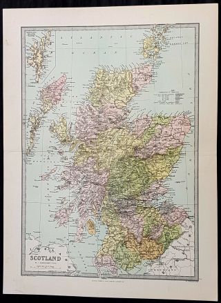
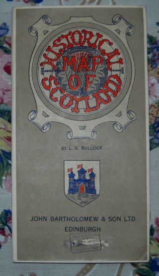
1720 JB Homann Large Antique Map Of Scotland


Item History & Price
| Reference Number: Avaluer:15709087 |
contact us ebay profile ebay storeMagnae Britannia Pars Septentrionalis Regnum Scotiae....Johan. Bapt. HomannoCartographer : - Homann, Johann Baptist 1663-1724. Date: - 1720 Size: - 24in x 20in (610mm x 515mm) Ref#: - 33663 Condition: - (A) Very Good ConditionDescription:
This large original hand coloured copper plate engraved antique map of Scotalnd by JB Homann firm was published in 1720.General Definitions:
Paper thickness and quality: - Heavy and stable
Paper color : - off w...hite
Age of map color: - Original
Colors used: - Blue, red, yellow
General color appearance: - Authentic
Paper size: - 24in x 20in (610mm x 515mm)
Plate size: - 23in x 19in (585mm x 485mm)
Margins: - Min 1/2in (12mm)Imperfections:
Margins: - Light soiling
Plate area: - Light soiling and dis-colouration in 4 small areas of image
Verso: - Backed onto contemporary paperBackground:
The Treaty of Perpetual Peace was signed in 1502 by James IV of Scotland and Henry VII of England. James married Henrys daughter, Margaret Tudor. James invaded England in support of France under the terms of the Auld Alliance and became the last British monarch to die in battle, at Flodden in 1513. In 1560, the Treaty of Edinburgh brought an end to the Anglo-French conflict and recognized the Protestant Elizabeth I as Queen of England. The Parliament of Scotland met and immediately adopted the Scots Confession, which signaled the Scottish Reformations sharp break from papal authority and Catholic teaching. The Catholic Mary, Queen of Scots was forced to abdicate in 1567.
In 1603, James VI, King of Scots inherited the thrones of the Kingdom of England and the Kingdom of Ireland in the Union of the Crowns, and moved to London. The military was strengthened, allowing the imposition of royal authority on the western Highland clans. The 1609 Statutes of Iona compelled the cultural integration of Hebridean clan leaders. With the exception of a short period under the Protectorate, Scotland remained a separate state, but there was considerable conflict between the crown and the Covenanters over the form of church government. The Glorious Revolution of 1688–89 saw the overthrow of King James VII of Scotland and II of England by the English Parliament in favour of William III and Mary II In common with countries such as France, Norway, Sweden and Finland, Scotland experienced famines during the 1690s. Mortality, reduced childbirths and increased emigration reduced the population of parts of the country about 10-15%.
In 1698, the Company of Scotland attempted a project to secure a trading colony on the Isthmus of Panama. Although it received a huge investment, the Darien scheme failed, partially due to English hostility. Along with the threat of an English invasion, the resulting bankruptcies played a leading role in convincing the Scots elite to back a union with England. On 22 July 1706, the Treaty of Union was agreed between representatives of the Scots Parliament and the Parliament of England. The following year twin Acts of Union were passed by both parliaments to create the united Kingdom of Great Britain with effect from 1 May 1707 with popular opposition and anti-union riots in Edinburgh, Glasgow, and elsewhere.
With trade tariffs with England now abolished, trade blossomed, especially with Colonial America. The clippers belonging to the Glasgow Tobacco Lords were the fastest ships on the route to Virginia. Until the American War of Independence in 1776, Glasgow was the worlds premier tobacco port, dominating world trade. The deposed Jacobite Stuart claimants had remained popular in the Highlands and north-east, particularly amongst non-Presbyterians, including Roman Catholics and Episcopalian Protestants. However, two major Jacobite risings launched in 1715 and 1745 failed to remove the House of Hanover from the British throne. The threat of the Jacobite movement to the United Kingdom and its monarchs effectively ended at the Battle of Culloden, Great Britains last pitched battle.
The Scottish Enlightenment and the Industrial Revolution turned Scotland into an intellectual, commercial and industrial powerhouse so much so Voltaire said We look to Scotland for all our ideas of civilisation. With the demise of Jacobitism and the advent of the Union, thousands of Scots, mainly Lowlanders, took up numerous positions of power in politics, civil service, the army and navy, trade, economics, colonial enterprises and other areas across the nascent British Empire. Historian Neil Davidson notes after 1746 there was an entirely new level of participation by Scots in political life, particularly outside Scotland. Davidson also states far from being peripheral to the British economy, Scotland – or more precisely, the Lowlands – lay at its core. In the Highlands, clan chiefs gradually started to think of themselves more as commercial landlords than leaders of their people. These social and economic changes included the first phase of the Highland Clearances and, ultimately, the demise of the clan system. In the last third of the 18th century, Highlanders began to migrate seasonally to Lowland cities for work, and emigration to the New World from both the Highlands and Lowlands became commonplace, even as the population increasedHomann, Johann Baptist 1663-1724.
Homann Heirs 1700-1780.
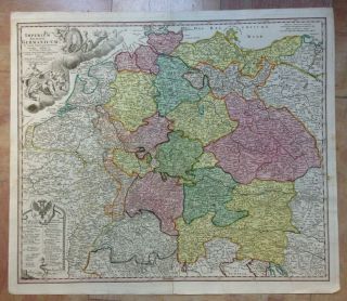
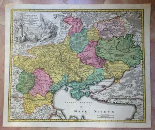
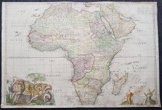
Following the long period of Dutch domination, the Homann family became the most important map publishers in Germany in the eighteenth century, the business being founded by J.B. Homann in Nuremberg about the year 1702. Soon after publishing his first atlas in 1707 he became a member of the Berlin academy of Sciences and in 1715 he was appointed Geographer to the Emperor. After the founder\'s death in 1724, the firm was continued under the direction of his son until 1730 and was then bequeathed to his heirs on the condition that it trades under the name of Homann Heirs. The firm remained in being until the next century and had a wide influence on map publishing in Germany. Apart from the atlases the firm published a very large number of individual maps.
The Homman\'s produced a Neuer Atlas in 1714, a Grosser Atlas in 1737, and an Atlas Maior with about 300 maps in 1780. They also issued a special Atlas of Germany with full sized plans of principal cities, school atlases and an Atlas of Silesia in 1750 with 20 maps.
What is an Antique MapThe word Antique in the traditional sense refers to an item that is more than a hundred years old. In the past maps were sold in two forms, as a single sheet (broadsheet) or bound in an atlas or book. The majority of antique maps for sale today come from books or atlases and have survived due to the protection offered by the hardback covers.When considering a purchase The first thing to determine when staring a collection or purchasing an item, is what is important to you. Most collectors prefer to build their collections around a theme. You may decide to collect maps from one region or country, charting its development through time. Similarly you could collect maps of one particular period in time, by type (i.e. sea or celestial charts) or by cartographer. The collector might also want to consider the theme of cartographical misconceptions such as California as an island or Australia as Terra Australis or the Great Southern Land.
The subject is so wide that any would-be-collector has almost endless possibilities to find his own little niche within the field, and thereby build a rewarding collection.Starting a collection & pricingPricing is based on a number of different factors, the most important of which is regional. In any series of maps the most valuable are usually the World Map and the America/North America. The World because it is usually the most decorative and America because it has the strongest regional market. Other factors that come into play re: price is rarity, age, size, historical importance, decorative value (colour) and overall condition and quality of paper it is printed on.
As specialised dealers, we frequently work with first time map buyers who are just starting their collection. Guiding new collectors on their first antique map purchase and helping new collectors to focus their interests is one of the most rewarding aspects of being an rare map dealer. So please do not hesitate to contact us and we will be happy to help with any questions you may have.Payment, Shipping & Return OptionsPlease click on the \"Shipping and Payments\" Tab above for shipping, payment and return detailsAbout USClassical Images was founded 1998 and has built an excellent reputation for supplying high quality original antiquarian maps, historical atlases, antique books and prints. We carry an extensive inventory of antiquarian collectibles from the 15th to 19th century. Our collection typically includes rare books and decorative antique maps and prints by renowned cartographers, authors and engravers. Specific items not listed may be sourced on request.
Classical Images adheres to the Codes of Ethics outlined by the Antiquarian Booksellers Association of America (ABAA).
We are a primarily an online based enterprise, however our inventory may be viewed by appointment. Please call or email to arrange a viewing.
This large original hand coloured copper plate engraved antique map of Scotalnd by JB Homann firm was published in 1720.General Definitions:
Paper thickness and quality: - Heavy and stable
Paper color : - off w...hite
Age of map color: - Original
Colors used: - Blue, red, yellow
General color appearance: - Authentic
Paper size: - 24in x 20in (610mm x 515mm)
Plate size: - 23in x 19in (585mm x 485mm)
Margins: - Min 1/2in (12mm)Imperfections:
Margins: - Light soiling
Plate area: - Light soiling and dis-colouration in 4 small areas of image
Verso: - Backed onto contemporary paperBackground:
The Treaty of Perpetual Peace was signed in 1502 by James IV of Scotland and Henry VII of England. James married Henrys daughter, Margaret Tudor. James invaded England in support of France under the terms of the Auld Alliance and became the last British monarch to die in battle, at Flodden in 1513. In 1560, the Treaty of Edinburgh brought an end to the Anglo-French conflict and recognized the Protestant Elizabeth I as Queen of England. The Parliament of Scotland met and immediately adopted the Scots Confession, which signaled the Scottish Reformations sharp break from papal authority and Catholic teaching. The Catholic Mary, Queen of Scots was forced to abdicate in 1567.
In 1603, James VI, King of Scots inherited the thrones of the Kingdom of England and the Kingdom of Ireland in the Union of the Crowns, and moved to London. The military was strengthened, allowing the imposition of royal authority on the western Highland clans. The 1609 Statutes of Iona compelled the cultural integration of Hebridean clan leaders. With the exception of a short period under the Protectorate, Scotland remained a separate state, but there was considerable conflict between the crown and the Covenanters over the form of church government. The Glorious Revolution of 1688–89 saw the overthrow of King James VII of Scotland and II of England by the English Parliament in favour of William III and Mary II In common with countries such as France, Norway, Sweden and Finland, Scotland experienced famines during the 1690s. Mortality, reduced childbirths and increased emigration reduced the population of parts of the country about 10-15%.
In 1698, the Company of Scotland attempted a project to secure a trading colony on the Isthmus of Panama. Although it received a huge investment, the Darien scheme failed, partially due to English hostility. Along with the threat of an English invasion, the resulting bankruptcies played a leading role in convincing the Scots elite to back a union with England. On 22 July 1706, the Treaty of Union was agreed between representatives of the Scots Parliament and the Parliament of England. The following year twin Acts of Union were passed by both parliaments to create the united Kingdom of Great Britain with effect from 1 May 1707 with popular opposition and anti-union riots in Edinburgh, Glasgow, and elsewhere.
With trade tariffs with England now abolished, trade blossomed, especially with Colonial America. The clippers belonging to the Glasgow Tobacco Lords were the fastest ships on the route to Virginia. Until the American War of Independence in 1776, Glasgow was the worlds premier tobacco port, dominating world trade. The deposed Jacobite Stuart claimants had remained popular in the Highlands and north-east, particularly amongst non-Presbyterians, including Roman Catholics and Episcopalian Protestants. However, two major Jacobite risings launched in 1715 and 1745 failed to remove the House of Hanover from the British throne. The threat of the Jacobite movement to the United Kingdom and its monarchs effectively ended at the Battle of Culloden, Great Britains last pitched battle.
The Scottish Enlightenment and the Industrial Revolution turned Scotland into an intellectual, commercial and industrial powerhouse so much so Voltaire said We look to Scotland for all our ideas of civilisation. With the demise of Jacobitism and the advent of the Union, thousands of Scots, mainly Lowlanders, took up numerous positions of power in politics, civil service, the army and navy, trade, economics, colonial enterprises and other areas across the nascent British Empire. Historian Neil Davidson notes after 1746 there was an entirely new level of participation by Scots in political life, particularly outside Scotland. Davidson also states far from being peripheral to the British economy, Scotland – or more precisely, the Lowlands – lay at its core. In the Highlands, clan chiefs gradually started to think of themselves more as commercial landlords than leaders of their people. These social and economic changes included the first phase of the Highland Clearances and, ultimately, the demise of the clan system. In the last third of the 18th century, Highlanders began to migrate seasonally to Lowland cities for work, and emigration to the New World from both the Highlands and Lowlands became commonplace, even as the population increasedHomann, Johann Baptist 1663-1724.
Homann Heirs 1700-1780.
Following the long period of Dutch domination, the Homann family became the most important map publishers in Germany in the eighteenth century, the business being founded by J.B. Homann in Nuremberg about the year 1702. Soon after publishing his first atlas in 1707 he became a member of the Berlin academy of Sciences and in 1715 he was appointed Geographer to the Emperor. After the founder\'s death in 1724, the firm was continued under the direction of his son until 1730 and was then bequeathed to his heirs on the condition that it trades under the name of Homann Heirs. The firm remained in being until the next century and had a wide influence on map publishing in Germany. Apart from the atlases the firm published a very large number of individual maps.
The Homman\'s produced a Neuer Atlas in 1714, a Grosser Atlas in 1737, and an Atlas Maior with about 300 maps in 1780. They also issued a special Atlas of Germany with full sized plans of principal cities, school atlases and an Atlas of Silesia in 1750 with 20 maps.
What is an Antique MapThe word Antique in the traditional sense refers to an item that is more than a hundred years old. In the past maps were sold in two forms, as a single sheet (broadsheet) or bound in an atlas or book. The majority of antique maps for sale today come from books or atlases and have survived due to the protection offered by the hardback covers.When considering a purchase The first thing to determine when staring a collection or purchasing an item, is what is important to you. Most collectors prefer to build their collections around a theme. You may decide to collect maps from one region or country, charting its development through time. Similarly you could collect maps of one particular period in time, by type (i.e. sea or celestial charts) or by cartographer. The collector might also want to consider the theme of cartographical misconceptions such as California as an island or Australia as Terra Australis or the Great Southern Land.
The subject is so wide that any would-be-collector has almost endless possibilities to find his own little niche within the field, and thereby build a rewarding collection.Starting a collection & pricingPricing is based on a number of different factors, the most important of which is regional. In any series of maps the most valuable are usually the World Map and the America/North America. The World because it is usually the most decorative and America because it has the strongest regional market. Other factors that come into play re: price is rarity, age, size, historical importance, decorative value (colour) and overall condition and quality of paper it is printed on.
As specialised dealers, we frequently work with first time map buyers who are just starting their collection. Guiding new collectors on their first antique map purchase and helping new collectors to focus their interests is one of the most rewarding aspects of being an rare map dealer. So please do not hesitate to contact us and we will be happy to help with any questions you may have.Payment, Shipping & Return OptionsPlease click on the \"Shipping and Payments\" Tab above for shipping, payment and return detailsAbout USClassical Images was founded 1998 and has built an excellent reputation for supplying high quality original antiquarian maps, historical atlases, antique books and prints. We carry an extensive inventory of antiquarian collectibles from the 15th to 19th century. Our collection typically includes rare books and decorative antique maps and prints by renowned cartographers, authors and engravers. Specific items not listed may be sourced on request.
Classical Images adheres to the Codes of Ethics outlined by the Antiquarian Booksellers Association of America (ABAA).
We are a primarily an online based enterprise, however our inventory may be viewed by appointment. Please call or email to arrange a viewing.