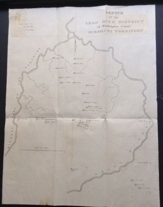
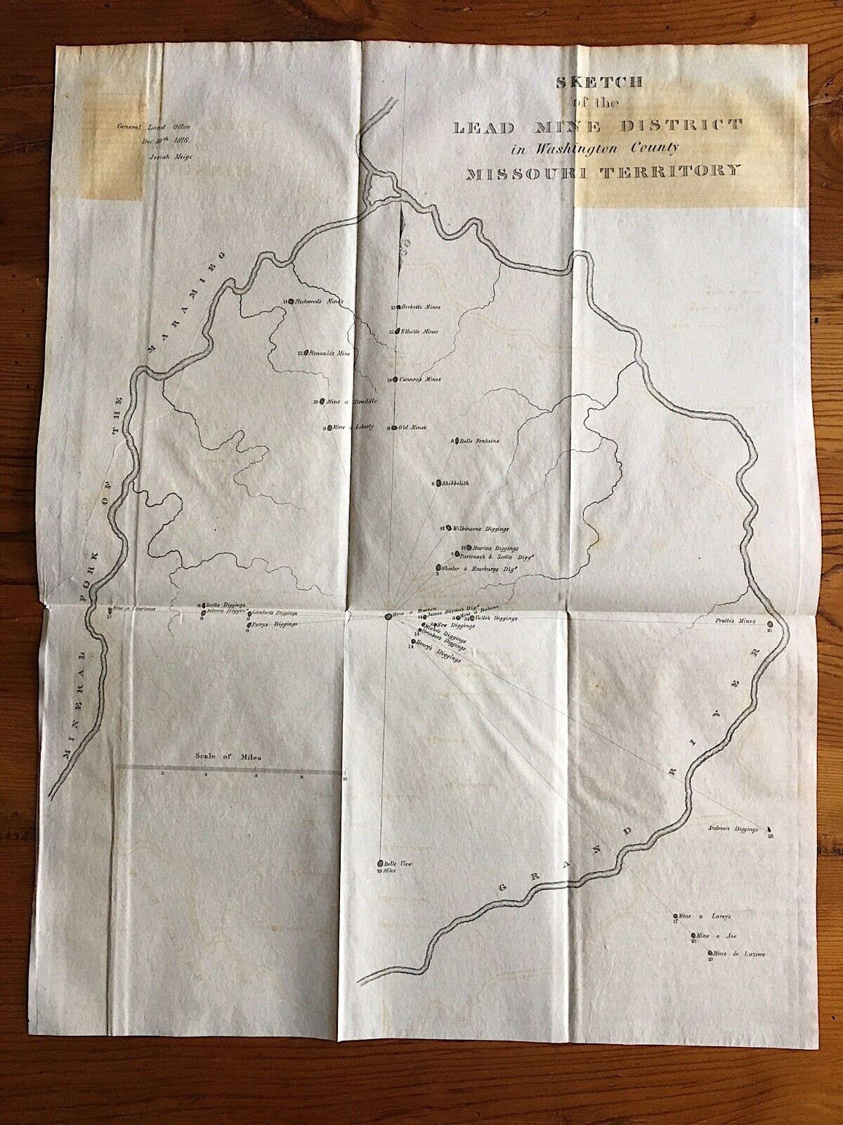
Sketch Of Lead Mine District Washington County Missouri Territory 1816 Meigs Map
Item History & Price
| Reference Number: Avaluer:15710687 | Original/Reproduction: Antique Original |
| US State: Missouri | Type: Mining Map |
| Original/Reprint: Original Print | Year: 1816 |
"Sketch of the Lead Mine District in Washington County Missouri Territory." Information at upper left reads, "General Land Office, Dec 10th 1816, Josiah Meigs." i believe this map was published in the American State Papers, circa 1834 out of Washington, D. C. Map will be mailed carefully refolded.* CONDITION: Good- with cross-folds, browning (not unusual for this map), and a 7 inch repaired tear from behind near the left center edge. Barely noticeable from the front.
* SIZE: Measure...s approximately 15 1/2 x 20 1/8 inches.
* SIZE: Measure...s approximately 15 1/2 x 20 1/8 inches.