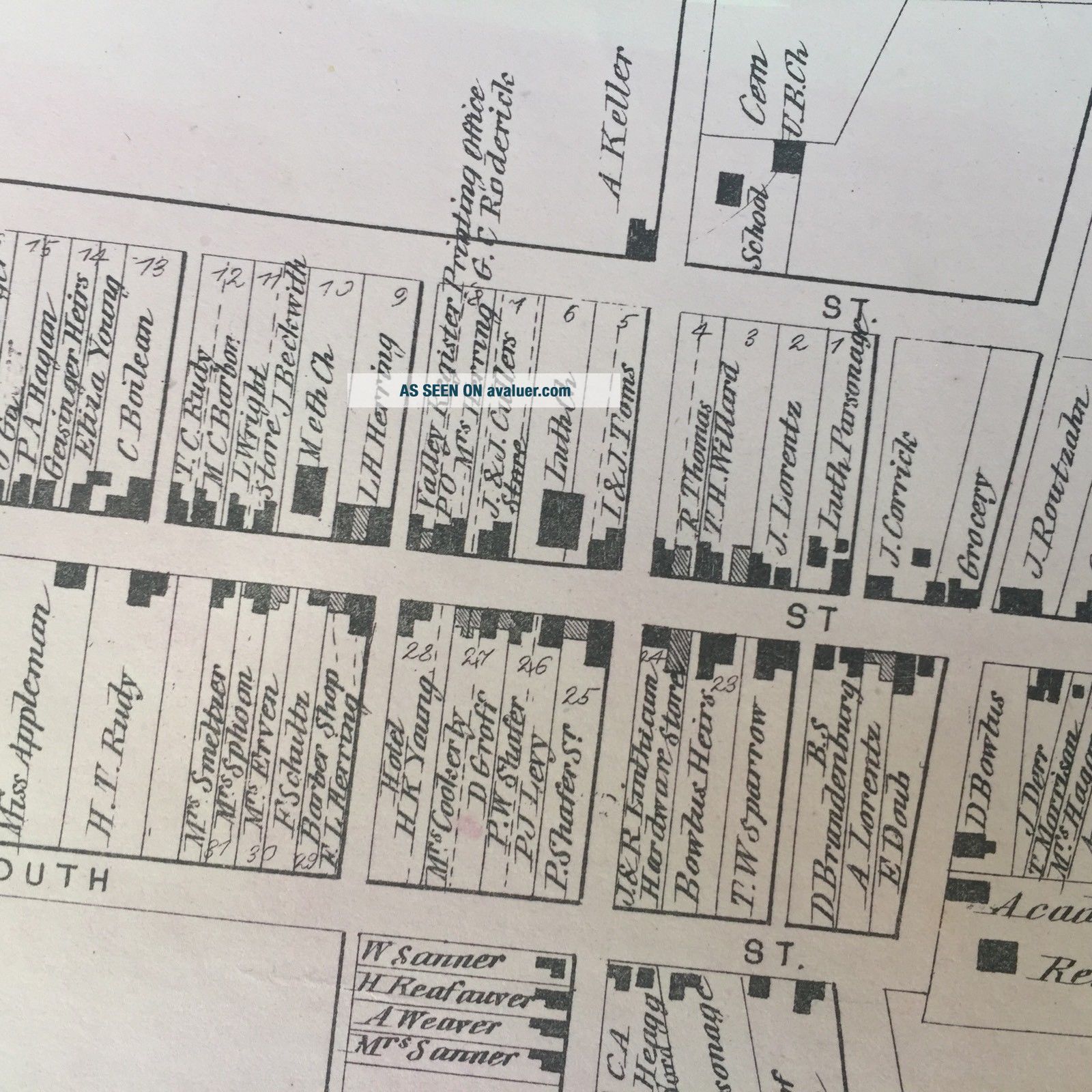
1873 RARE HAND COLORED Poster STREET MAP Of MIDDLETOWN Maryland FREDERICK COUNTY
Item History & Price
| Reference Number: Avaluer:16111 |
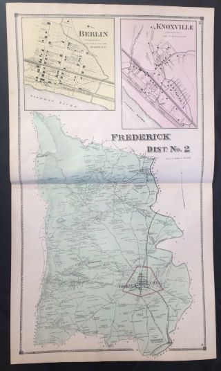
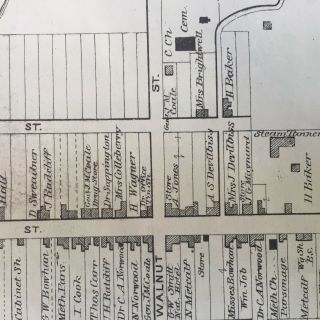
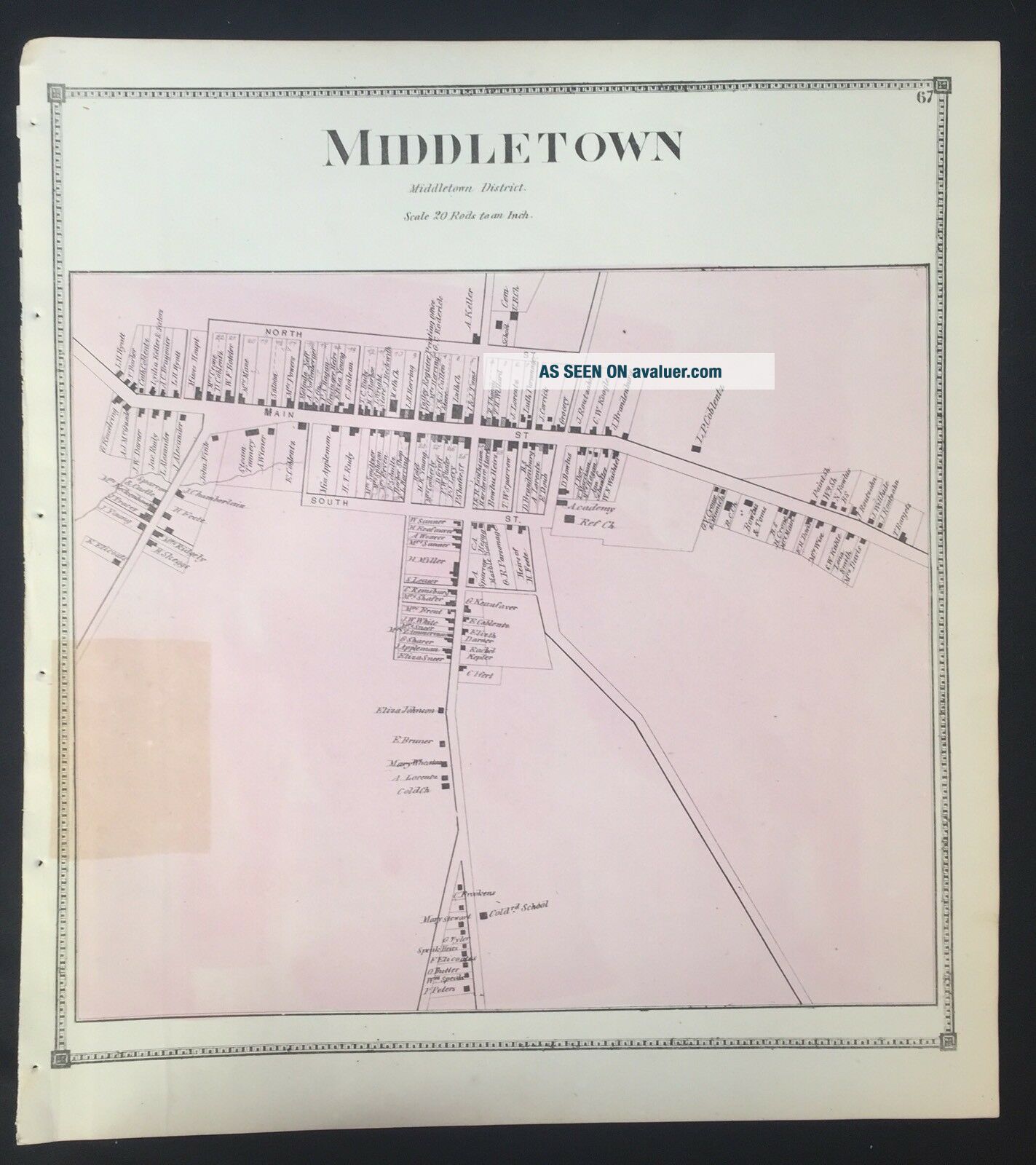
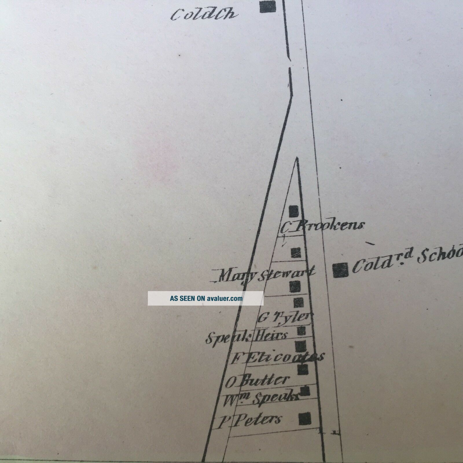
RARE 1873 full-color STREET MAP of the FREDERICK COUNTY, MARYLAND MIDDLETOWN, including property owner and street names. This POSTER-LIKE piece is from the exceedingly scarce 1873 TITAS ATLAS of Frederick County. #MB019Please visit our ebay store for printed on the front page other FANTASTIC Americana, Antiquarian Books and Ephemera.SEE PHOTO-----COMPLETE, ORIGINAL , map of Frederick County towns of MIDDLETOWN, Maryland. This map, (publish...ed in Philadelphia), is fantastic Frederick County, Maryland history! This FULL-PAGE MAP measures 15" X 14".This map would make an excellent addition to any fine FREDERICK COUNTY or Middletown collection. Perfect for framing and display.A young Lieutenant George Washington, while surveying the South Mountain area, reported that the valley to the east was one of the most beautiful places he had ever seen. Later, as a Colonel in 1755, he was to accompany General Braddock on the old Indian Trail that ran through the valley on his way to Fort Cumberland.The early German and English settlers started to arrive in the valley in the 1730s. Among them was Michael Jesserong, who paid £66 for 50 acres. He named his property Middletown and sold the first lots there in 1767, the date officially marked as that of the town’s founding.The history of Middletown is a mirror on the nation’s development. Main Street spread to the west with construction of the National Pike through the town in 1806; the telegraph lines from Frederick to Hagerstown were routed through Middletown in 1854; and in 1896, car 11 of the Frederick Middletown Railway made its first run to Middletown. During the Civil War, both armies passed through the town to the battles of South Mountain and Antietam. In the aftermath of those battles, Middletown opened its churches and homes to care for the wounded.Middletown preserves many historic structures indicative of its various periods of development and prosperity. The core of the old town, comprising the several blocks along West Main Street (US Route 40 Alt) and South Church Street (MD Route 17) contains several examples of Federal and Greek Revival architecture, including the Zion Evangelical Lutheran Church (1859-1860) and Christ Reformed Church United Church of Christ (1818). With the coming of the Hagerstown and Frederick Railway in the 1890s, the town expanded to the east, where several examples of various Victorian-era styles can be seen, including Queen Anne, Gothic Revival, and later examples of Colonial Revival styles. The economic prosperity experienced in the town during the first quarter of the twentieth century led to the alteration of older commercial structures and the construction of new ones in the first few blocks of Main Street, including the Beaux-Arts styled Valley Savings Bank (today the Middletown Valley Bank). Many of these structures are registered in the Middletown Historic District.Very Good condition, with a small rectangular offset where a newspaper clipping had been laid on the map. This listing includes the complete entire original map. VINTAGE BOOKS AND FINE ART stands behind all of the items that we sell with a no questions asked, money back guarantee. Every item we sell is original printed on the date indicated at the beginning of its description, unless clearly stated as a reproduction in the header AND text body. U.S. buyers pay calculated priority postage which includes waterproof plastic and a heavy cardboard flat to protect your purchase from damage in the mail. International postage is quoted when we are informed as to where the package is to be sent. We do combine postage (to reduce postage costs) for multiple purchases sent in the same package. We accept payment by PAYPAL. We ship packages daily. This is truly a piece OF HISTORY that YOU CAN OWN!