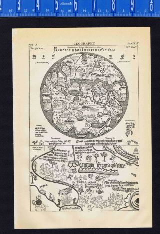
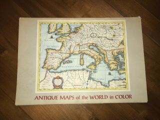
1683 Mallet MAP Of The WORLD In ARMILLARY SPHERES - California As An ISLAND - RARE
Item History & Price
An outstanding copper plate hand colored map of
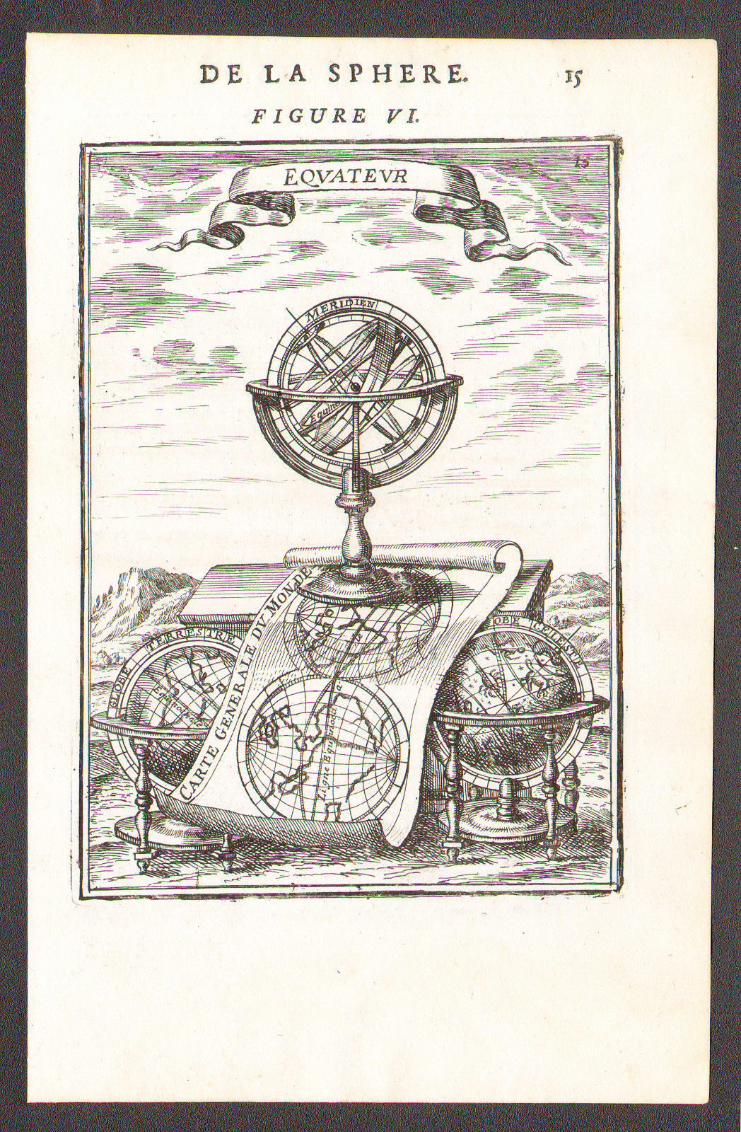
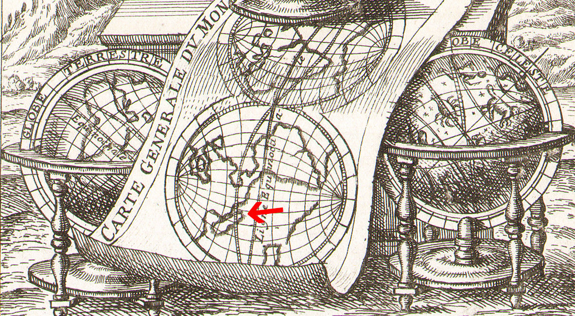
ARMILLARY SPHERES - EQUATOROne sphere showsCalifornia as an Island
A Allain Manesson Mallet work of art
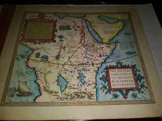
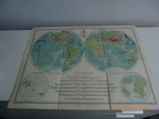
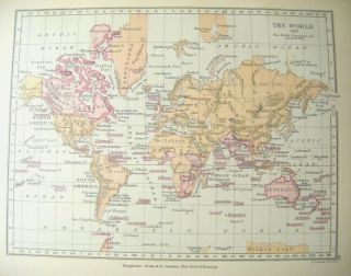
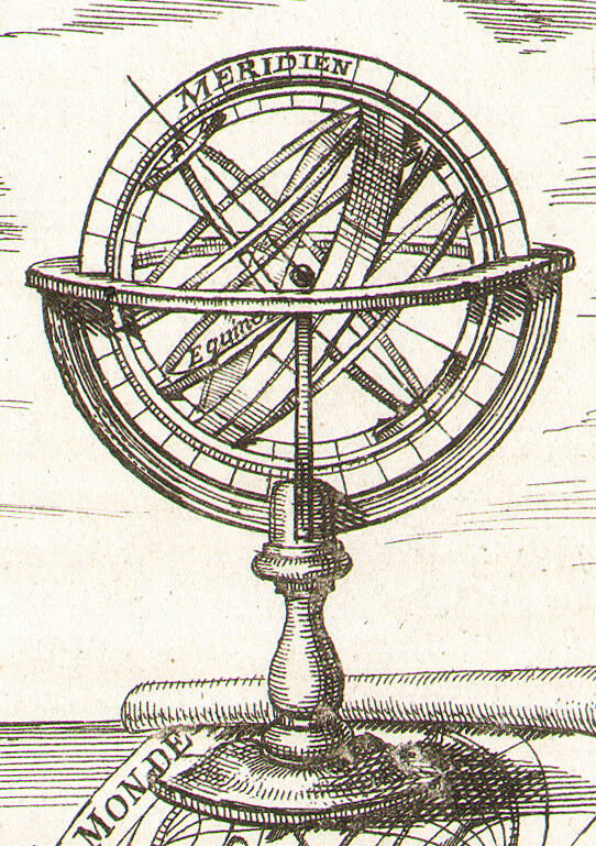
TITLE OF THE PRINT:ARMILLARY SPHERE.'Equateur'. Carte Generale du Monde. Astrolabe.DATE PRINTED: 1683IMAGE SIZE: Overall page size 13 x 21cm approximately (5 x 8inches); image size 10.5 x 14.5cm approximately (4 x 5.5 inches)TYPE: Original 17th century copperplate printVERSO: There is text in French printed on the revers...e sideARTIST/CARTOGRAPHER/ENGRAVER: Allain Manesson MalletPROVENANCE: "Description de l'Univers, contenant lesdifferents systemes du Monde, les Cartes generales & particulieres de laGeographie Ancienne & Moderne: Les Plans & les Profils des principalesVilles & des autres lieux considerables de la Terre; avec les portraits deSouverains qui y commandent, leurs Blasons, Titres & Livrees: Et lesMoeurs, Religions, Gouvernements & divers habillemens de chaqueNation", dedie'e au Roy, par Allain Manesson Mallet. Paris, Chez DenysThierry, Rue S. Jacques, MDCLXXXIII [First edition, Paris, 1683]In the center is a rolled map showing the Western Hemisphere including California as an Island and the other showing Europe and Africa.
The image is about 4" by 5.5", with ample borders. Printed on quality laid paper.
Condition
In pristine condition, shows no wear for its 335 year age. . This is a must see/buy.
Shipping, packing and handling charges are a flat $2.66 in the UnitedStates, international is $12.83.
This item is unconditionallyguaranteed to be original and as described. We do not sellreproductions or copies. PLEASE CLICK HERE TO VISIT OUR STORE
for other fantastic items for sale
We are proud of our outstanding feedback rating. Thankyou for bidding.
Westside Antiques Norman Riggs
3/3/18
00416
ARMILLARY SPHERES - EQUATOROne sphere showsCalifornia as an Island
A Allain Manesson Mallet work of art
TITLE OF THE PRINT:ARMILLARY SPHERE.'Equateur'. Carte Generale du Monde. Astrolabe.DATE PRINTED: 1683IMAGE SIZE: Overall page size 13 x 21cm approximately (5 x 8inches); image size 10.5 x 14.5cm approximately (4 x 5.5 inches)TYPE: Original 17th century copperplate printVERSO: There is text in French printed on the revers...e sideARTIST/CARTOGRAPHER/ENGRAVER: Allain Manesson MalletPROVENANCE: "Description de l'Univers, contenant lesdifferents systemes du Monde, les Cartes generales & particulieres de laGeographie Ancienne & Moderne: Les Plans & les Profils des principalesVilles & des autres lieux considerables de la Terre; avec les portraits deSouverains qui y commandent, leurs Blasons, Titres & Livrees: Et lesMoeurs, Religions, Gouvernements & divers habillemens de chaqueNation", dedie'e au Roy, par Allain Manesson Mallet. Paris, Chez DenysThierry, Rue S. Jacques, MDCLXXXIII [First edition, Paris, 1683]In the center is a rolled map showing the Western Hemisphere including California as an Island and the other showing Europe and Africa.
The image is about 4" by 5.5", with ample borders. Printed on quality laid paper.
Condition
In pristine condition, shows no wear for its 335 year age. . This is a must see/buy.
Shipping, packing and handling charges are a flat $2.66 in the UnitedStates, international is $12.83.
This item is unconditionallyguaranteed to be original and as described. We do not sellreproductions or copies. PLEASE CLICK HERE TO VISIT OUR STORE
for other fantastic items for sale
We are proud of our outstanding feedback rating. Thankyou for bidding.
Westside Antiques Norman Riggs
3/3/18
00416