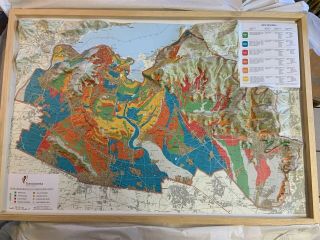
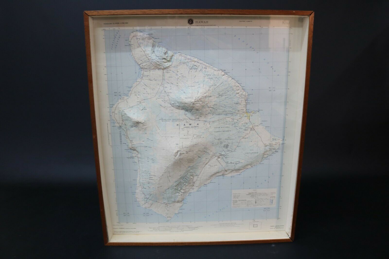
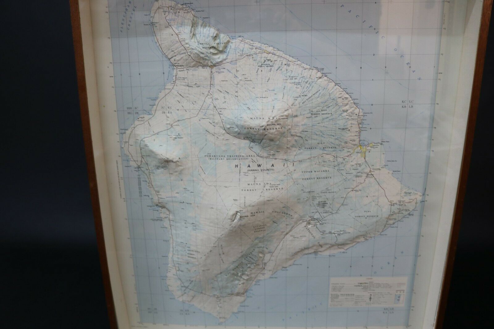
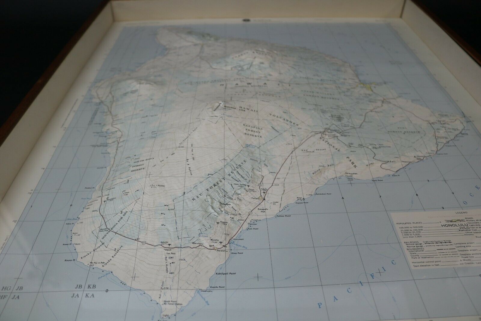
Raised Relief Map Of Hilo Hawaii Island Box Frame Vintage Map


Item History & Price

Information:
Reference Number: Avaluer:18661365Printing Technique: Copper Plate
Year: UnknownOriginal/Reproduction: Antique Original
Date Range: 1990-1999
Original Description:
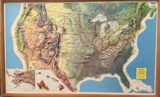
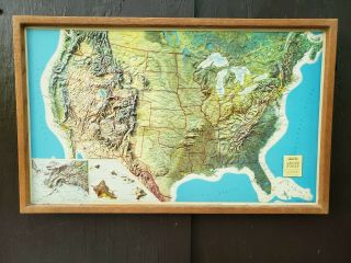
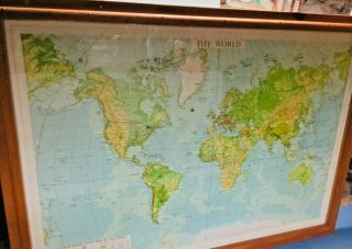
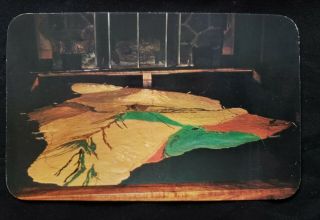
Stunning raised releif map of hawaii in a wooden box frame with glazed front. Measures 28 inches high x 24 inches wide, two corner joints have opened a bit, a fantastic map, please see the images............We specialise in packing rare and delicate items, will be expertly packed and shipped to your door anywhere in the world.  
All offers considered but please remember ebay allow me 2 days to consider offers and the item can still sell to another buyer duri...ng this time; please either make a close offer or to avoid disappointment hit the buy now button. Will be very well packed, padded and boxed for World shipping with tracking.      


    Similar items


  • Framed 3d Topographical Italy Raised Relief Map Of Franciacorta Wine Region

    Framed 3d Topographical Italy Raised Relief Map Of Franciacorta Wine Region

  • For Jaychris69 Nystrom Raised Relief Map Of Africa Rare Mid Century 50 49” X 39”

    For Jaychris69 Nystrom Raised Relief Map Of Africa Rare Mid Century 50 49” X 39”

  • Nystrom Raised Relief Map Of The United States

    Nystrom Raised Relief Map Of The United States

  • Raised Relief Map Of Oahu,  Army Map Service,  Corps Of Engineers,  U.  S.  Army

    Raised Relief Map Of Oahu, Army Map Service, Corps Of Engineers, U. S. Army

  • Rand Mcnally Raised Relief Map Of United States In Color W Wooden Frame 21”x 34”

    Rand Mcnally Raised Relief Map Of United States In Color W Wooden Frame 21”x 34”

  • Old Rand Mcnally Hubbard Scientific Raised Relief Map Of The Usa With Frame

    Old Rand Mcnally Hubbard Scientific Raised Relief Map Of The Usa With Frame

  • Nystrom Raised Relief Map Of The World No 98 Circa 1969 Large 5

    Nystrom Raised Relief Map Of The World No 98 Circa 1969 Large 5 ' Frame & Glass

  • Vintage Hawaii Photo Post Card Relief Map Of Hawaii Island

    Vintage Hawaii Photo Post Card Relief Map Of Hawaii Island


    • You might also like


    • 1860 Mitchell Hand Colored Map Colorado,  Nebraska & Kansas - Civil War Era

      1860 Mitchell Hand Colored Map Colorado, Nebraska & Kansas - Civil War Era

    • 18th Century French Map Of North America

      18th Century French Map Of North America

    • Las Vegas Nevada Vintage 1967 Us Geological Survey Quadrangle Map 4 Panels

      Las Vegas Nevada Vintage 1967 Us Geological Survey Quadrangle Map 4 Panels

    • Rare Antique 1845 Maps United States Exploring Expedition Book Antartica Hawaii

      Rare Antique 1845 Maps United States Exploring Expedition Book Antartica Hawaii

    • Vintage 1926 Map Hollywood From The Best Surveys Of The Time

      Vintage 1926 Map Hollywood From The Best Surveys Of The Time

    • American Continent (western Hemisphere) 1747 Bowen Antique Copper Engraved Map

      American Continent (western Hemisphere) 1747 Bowen Antique Copper Engraved Map

    • Gulf Coast Florida Texas United States 1705 De Fer Unusual Antique Engraved Map

      Gulf Coast Florida Texas United States 1705 De Fer Unusual Antique Engraved Map

    • California As Island United States 1700 De Fer Unusual First Edition Antique Map

      California As Island United States 1700 De Fer Unusual First Edition Antique Map

Avaluer          About Us          Privacy Policy          Contact Us          UP
© 2022, avaluer.net, Inc. or its affiliates