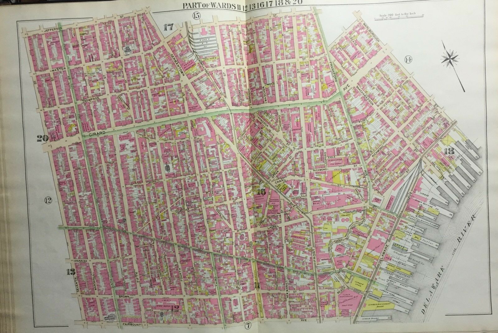
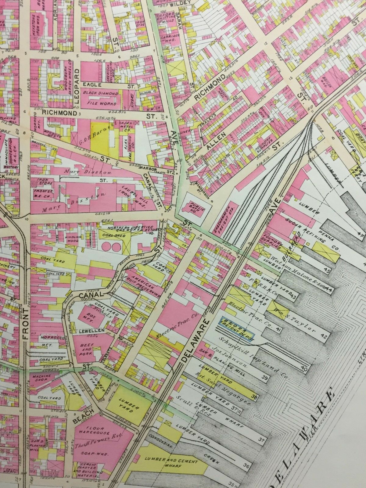
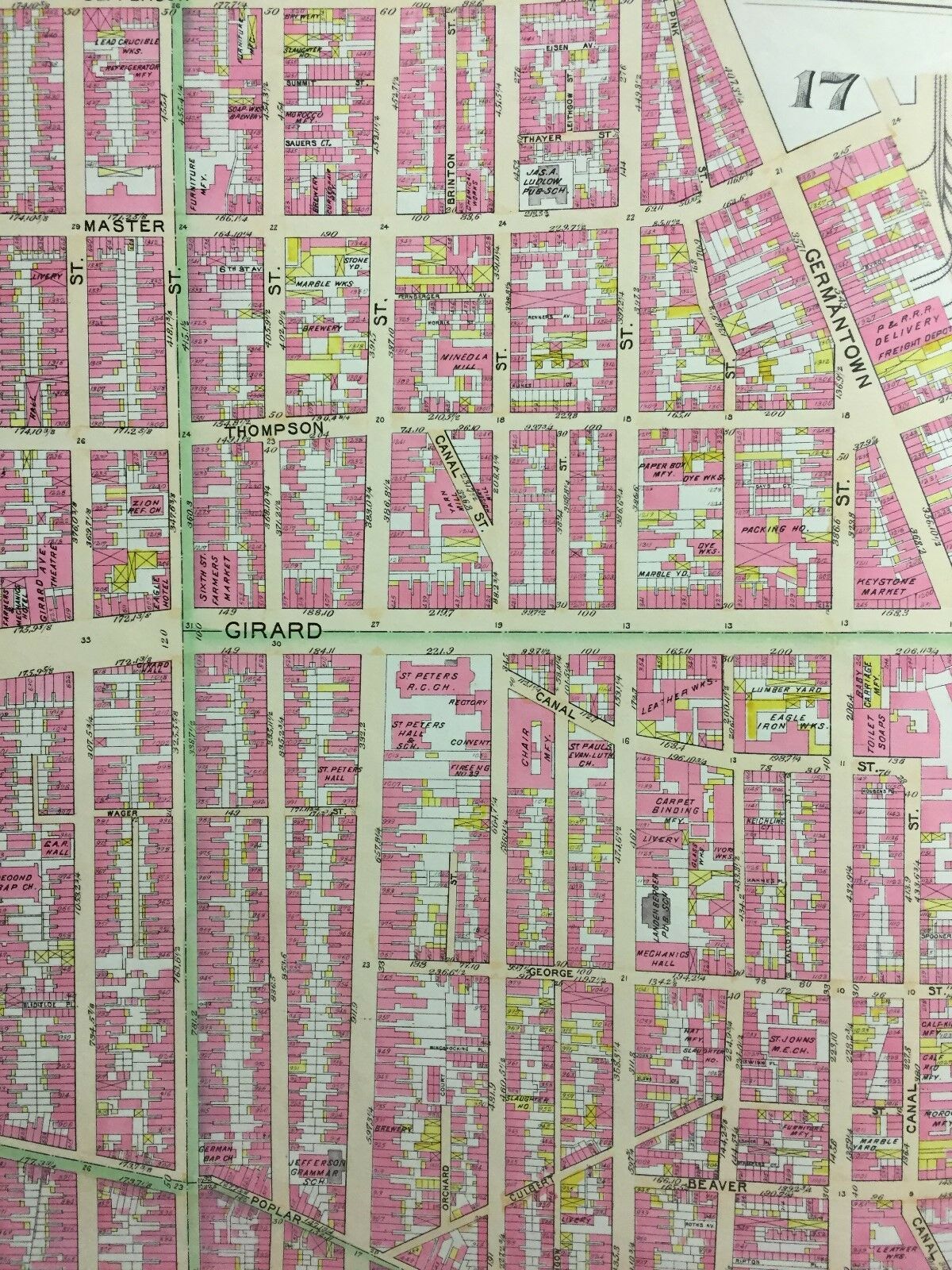
1895 NORTHERN LIBERTIES PHILADELPHIA PA PENN TREATY PARK ST. PETER ' S ATLAS MAP
Item History & Price
| Reference Number: Avaluer:19779683 |
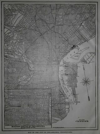
This is a 24x36 high quality high resolution reproduction on 70 lb. thick stock paper (see my feedback) G.W. Bromley plat atlas map of the Northern Liberties section of Philadelphia, Pennsylvania. This map features Bulls Head Hotel, Rising Sun Hotel, Labor Lyceum Association, St. Peter's R.C. Church, the future home of Penn Treaty Park as well as other noteworthy buildings and structures. It is dated 1895.PLAT 13 covers from Seventh Street to Marlborough Street and from Jeff...erson Street to Fairmouth Avenue.
OTHER SIZES AVAILABLE UPON REQUEST: 11X14, $19.95; 16X20, $24.95;36X48, $79.95; 24X36 ON CANVAS $89.95.I am selling my collection of rare maps. If there is an area or street address of Long Island, Westchester, Brooklyn, Manhattan, Queens, StatenIsland, Bronx, Elmira, Buffalo, Rochester, Troy, Newark, Atlantic City, Essex, Berks, Montgomery, Bergen, Counties, Baltimore, Washington, D.C., Los Angeles, NewOrleans, Portland, Maine, Seattle, Cleveland, Baltimore, Toronto, Montreal, Vancouver, Denver, Portland, Maine, Kansas City, New Haven, Philadelphia, Rochester, Toledo, Pittsburgh, Harrisburg, Wilkes-Barre, Reading, Bucks, Delaware County, Boston, South Boston, Dorchester, Roxbury, Brighton, Worcester, Brookline, Newton, Haverhill, Malden, Middlesex County, Lawrence, Quincy, Salem, Massachusetts, Newport, Rhode Island and other cities that you might be interested in, check my other listings orcontact me. I have insurance maps from 1880 to mid-1950s. Looks greatframed! Check out my otheritems!
OTHER SIZES AVAILABLE UPON REQUEST: 11X14, $19.95; 16X20, $24.95;36X48, $79.95; 24X36 ON CANVAS $89.95.I am selling my collection of rare maps. If there is an area or street address of Long Island, Westchester, Brooklyn, Manhattan, Queens, StatenIsland, Bronx, Elmira, Buffalo, Rochester, Troy, Newark, Atlantic City, Essex, Berks, Montgomery, Bergen, Counties, Baltimore, Washington, D.C., Los Angeles, NewOrleans, Portland, Maine, Seattle, Cleveland, Baltimore, Toronto, Montreal, Vancouver, Denver, Portland, Maine, Kansas City, New Haven, Philadelphia, Rochester, Toledo, Pittsburgh, Harrisburg, Wilkes-Barre, Reading, Bucks, Delaware County, Boston, South Boston, Dorchester, Roxbury, Brighton, Worcester, Brookline, Newton, Haverhill, Malden, Middlesex County, Lawrence, Quincy, Salem, Massachusetts, Newport, Rhode Island and other cities that you might be interested in, check my other listings orcontact me. I have insurance maps from 1880 to mid-1950s. Looks greatframed! Check out my otheritems!